Improved Land for Sale in Ashland, Oregon
100 Belle Fiore Ln, Ashland, OR 97520
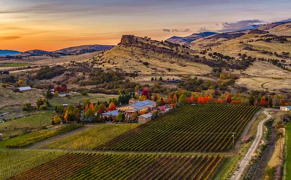
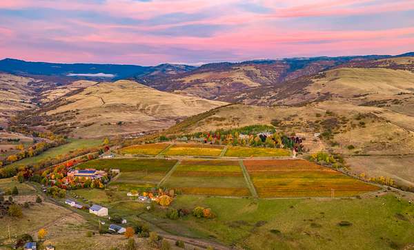
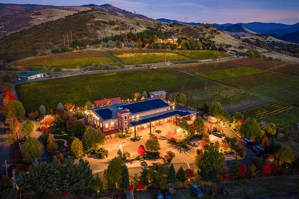
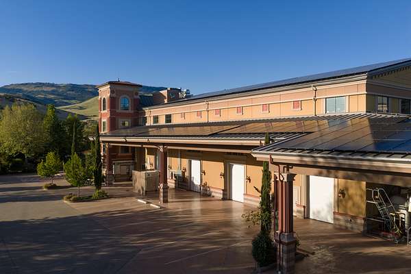
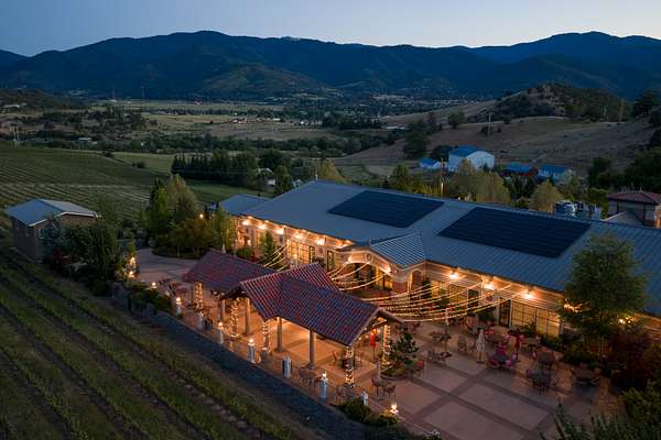
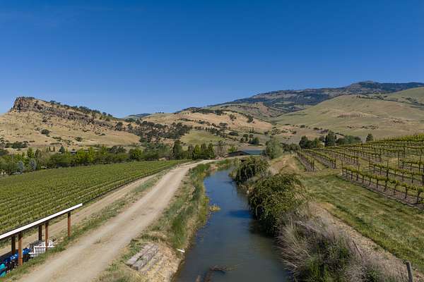
Offered for sale for the first time ever, Belle Fiore Estate Winery is one of Oregon's most significant vineyard estates and event destinations--a premier 27,136-square-foot, two-story estate winery, tasting room, restaurant, production facility, and event pavilion situated on 51.82 acres in the heart of Ashland's wine country. With more than 37 irrigated acres of Oregon water rights, and an established vineyard planted with 14 grape varieties, Belle Fiore represents an extraordinary union of European architectural grandeur, commercial winemaking capability, hospitality, and wine-country beauty.
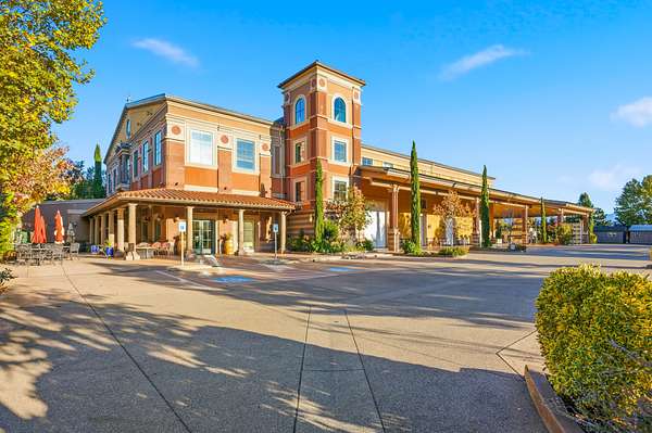
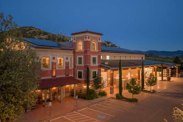
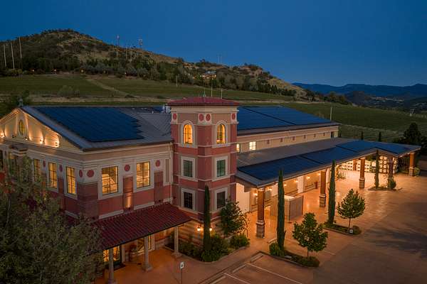
Completed in 2013 by Batzer Construction and designed by architect John Kvapil of DKA Architecture, the winery was conceived in the style of an Italian basilica, crowned by a commanding four-story bell tower that complements the nearby Belle Fiore Château. Built to endure for generations, the exterior features multicolored decorative stucco accented by full-height brick pilasters, rustic split-block detailing, and elegant stonework throughout.
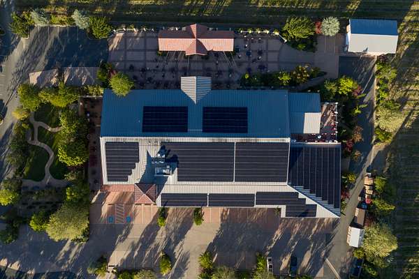
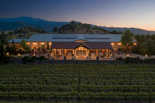
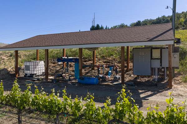
The winery's power system is grid-tied but also boasts an elaborate 500 solar power array and a 200 KWH backup battery system, which offsets the commercial power bill dramatically and assures a constant power source at a fraction of the commercial grid tied rate. Additionally, the winery features a 5 hydron unit ground source heating and cooling system, powered by miles of buried copper piping trenched in the earth, a constant efficient source of heating and cooling energy.
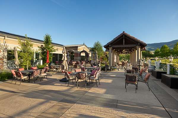
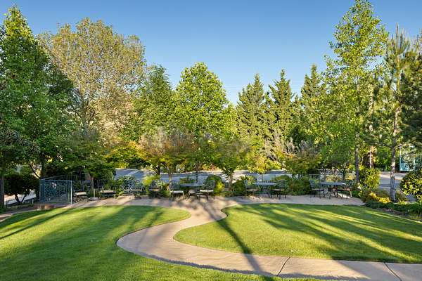
Surrounding the Wine Pavilion, manicured lawns and extensive perennial landscaping provide year-round beauty, while a fountain patio creates an elegant setting for outdoor tastings. A secluded private grotto and beautifully landscaped grounds further enhance the sense of arrival and establish Belle Fiore as a destination of remarkable character and distinction.
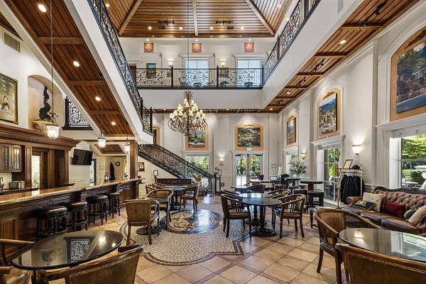
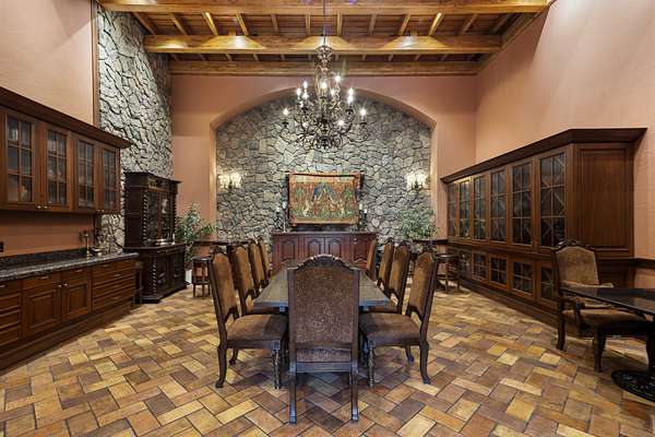
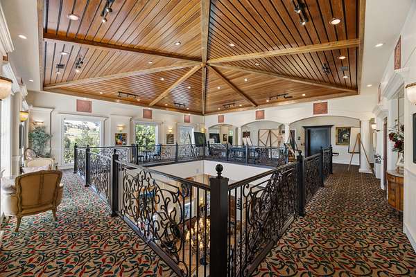
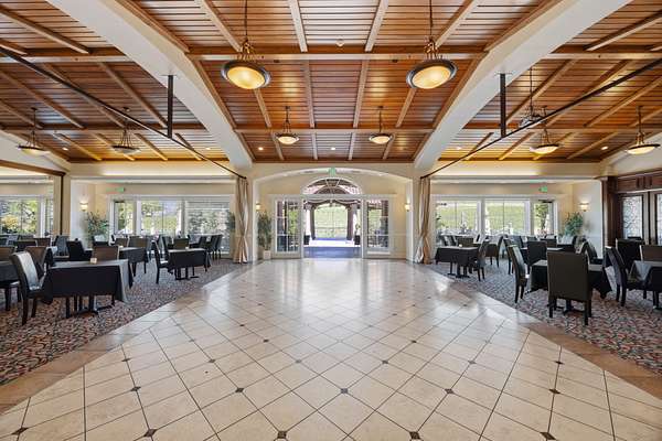
Inside, soaring 40-foot cathedral ceilings create an immediate sense of grandeur. A magnificent staircase, ornate railings, and custom chandeliers introduce interiors designed on an impressive scale for wine tasting, dining, entertainment, and special events. Multiple tasting spaces are found throughout the winery, while the main tasting room connects to an intimate ceremonial barrel room created for private dinners and exclusive gatherings.
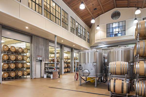
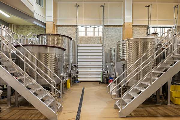
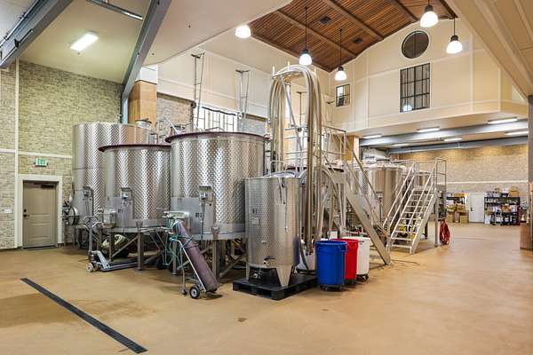
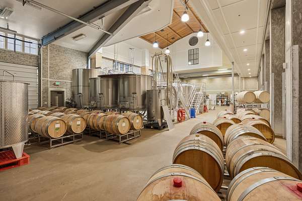
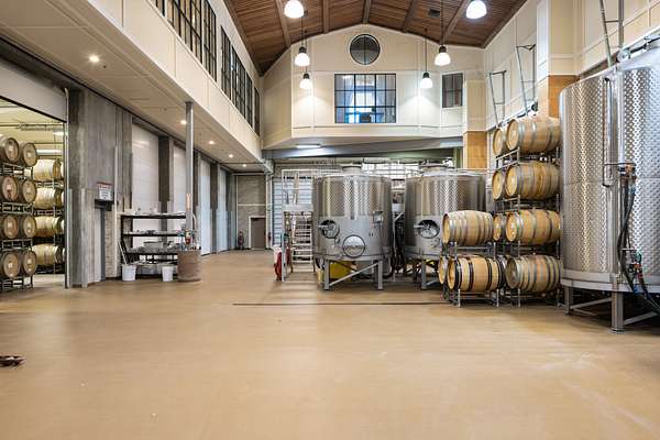
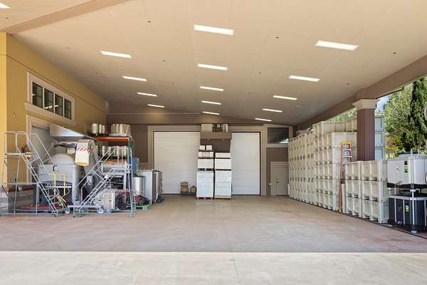
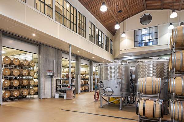
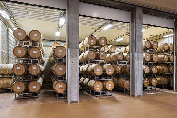
The winery's commercial production wing offers substantial infrastructure for large-scale operations. A 10,000-square-foot tank room provides capacity to produce up to 20,000 cases annually, complemented by eight barrel-storage bays and two 22-foot-high refrigerated barrel rooms capable of storing approximately 600 barrels. Extensive refrigerated wine and case-storage areas provide capacity for as many as 20,000+ cases of bottled wine. Supporting production spaces include a laboratory, winemaker offices, soaring ceilings, extensive operational infrastructure, and an expansive 10,000-square-foot covered crush pad. A private winemaker's apartment is also incorporated within the facility.
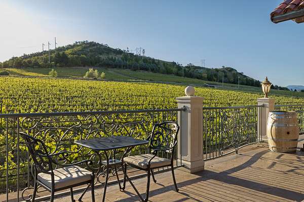
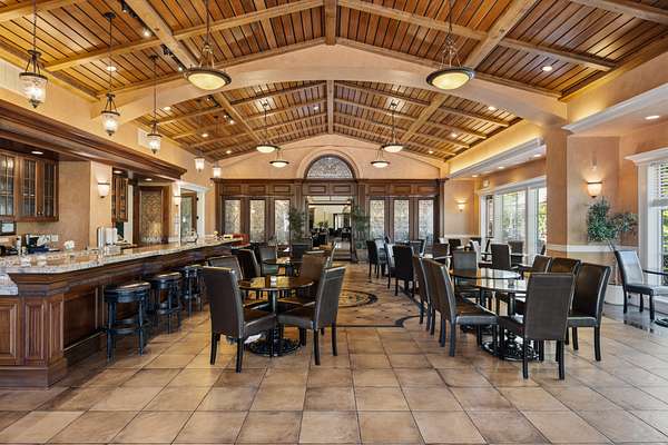
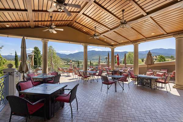
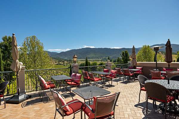
The upper level encompasses the winery's principal hospitality spaces and is accessible by two grand staircases or elevator. A central corridor overlooking the production floor leads to an Italian-style wine bar and adjoining outdoor terrace. The wine bar accommodates approximately 40 guests and features live music several nights a week, while the terrace seats approximately 50 and commands panoramic views across the vineyards, valley, and surrounding mountains. Fire pits and umbrellas create an inviting environment for year-round enjoyment.
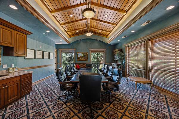
The adjoining Numinos Room serves as an elegant ballroom and flexible event venue accommodating up to 140 guests, with partition options allowing the space to be tailored for smaller and more intimate gatherings. The adjacent Calypso Room offers additional versatility as a private boardroom or bridal suite.
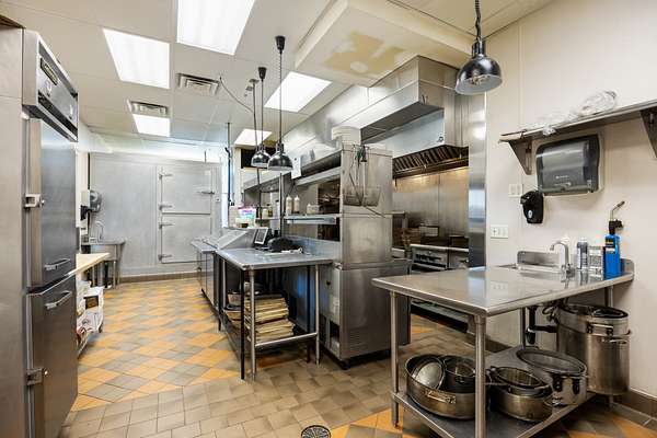
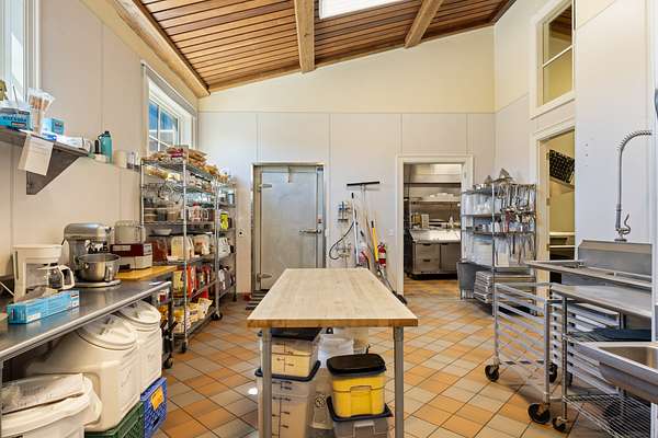
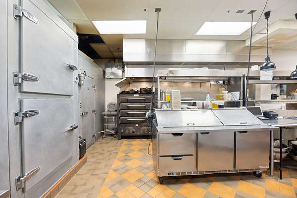
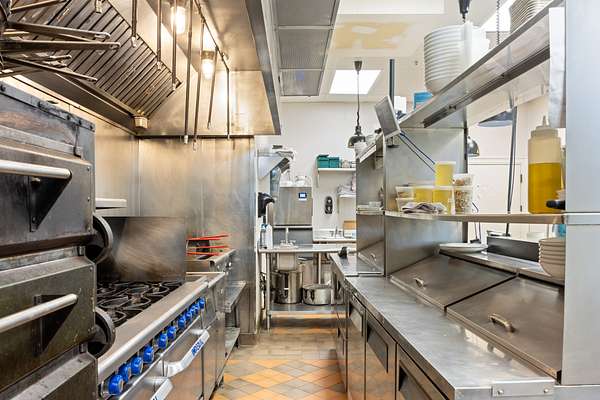
A full-service restaurant is supported by an approximately 1,500-square-foot commercial kitchen equipped with ovens, grills, preparation stations, walk-in refrigeration, and ample storage. Together with the winery's expansive terraces and outdoor dining areas overlooking the vineyard and valley, these facilities create an exceptional setting for dining, hospitality, weddings, corporate retreats, and private celebrations.
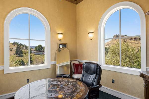
Offices dedicated to winery operations, event management, and wine club administration are located within the four-story bell tower. At its highest level, a private viewing room offers sweeping vistas encompassing Ashland's mountains, Pompadour Butte, Pilot Rock, and the surrounding wine-country landscape.
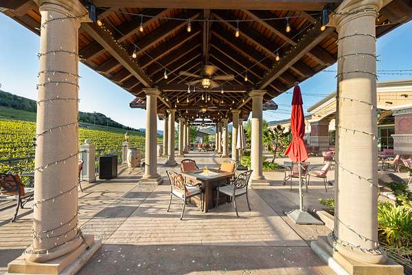
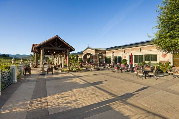
To the east, an extraordinary 15,000-square-foot outdoor plaza further expands the estate's hospitality and event capabilities. A red clay tile-roofed pergola anchors this open-air venue, which accommodates up to 150 guests for dining, live entertainment, weddings, and special events while overlooking the estate vineyards.
Welcoming more than 50,000 visitors annually, Belle Fiore has become a recognized destination for wine tourism, dining, weddings, corporate retreats, private events, and live entertainment. Its established vineyard, significant irrigated acreage, sophisticated hospitality infrastructure, extensive commercial production capabilities, and substantial potential for continued growth distinguish it as a rare offering within the Pacific Northwest wine industry.
Belle Fiore Estate Winery represents a remarkable opportunity to acquire one of Southern Oregon's most distinctive and celebrated winery estates--a property where Italian-inspired architectural elegance, established viticulture, modern winemaking capabilities, destination hospitality, and panoramic natural beauty converge on an extraordinary scale.
Business assets and inventory are available, subject to applicable licensing and regulatory requirements. Approximately 16,000 cases and 400 barrels of wine inventory associated with the business. Any transfer of wine inventory will be handled separately from the real estate escrow and facilitated by the parties' legal and licensing advisors, subject to all applicable OLCC/TTB requirements.
Location
- Street address
- 100 Belle Fiore Ln
- County
- Jackson County
- Zip code
- 97520
- Community
- South East Ashland Hills
- School district
- Check with district
- Elevation
- 2,000 feet
Directions
Take Dead Indian Memorial Rd to 100 Belle Fiore Lane. No drive-bys. Access is gated.
Property details
- Acreage
- 51.82 acres
- Zoning
- EFU / RR-5
- Access
- Private road
- Builder
- Batzer Construction
- Showing
- Appointment only
- Posted
Property taxes
- 2025
- $50,663
Parcels
- 10631602
Legal description
BEGINNING AT a point on the southerly right of way of Dead Indian Memorial Road, said point also being the Northwest corner of that tract described in Instrument Number 2007-036970 of the Official Record of Jackson County, Oregon; located in the northeast quarter of Section 12, Township 39 South, Range 1 East of the Willamette Meridian, said County and State; thence South 11°21’34” West, along the west line of said tract, a distance of 243.61 feet; thence leaving said line through the following courses, South 40°07’45” East, a distance of 59.45 feet; thence South 25°36’36” East, a distance of 87.81 feet; thence South 15°15’15” East, a distance of 51.82 feet; thence South 47°55’01” East, a distance of 53.04 feet; thence South 77°10’26” East, a distance of 61.08 feet; thence along the arc of a curve to the left, having a radius of 264.64 feet, a central angle of 21°57’06”, a length of 101.39 feet and a long chord bearing and distance of North 87°11’43” East, 100.77 feet; thence North 75°19’18” East, a distance of 151.25 feet; thence North 80°09’01” East, a distance of 72.57 feet; thence South 83°44’16” East, a distance of 50.45 feet; thence South 64°51’42” East, a distance of 87.29 feet; thence North 71°02’52” East, a distance of 59.19 feet, to a point 27.50 feet westerly of when measured perpendicular to the easterly line of that tract described in Instrument Number 03-26176 of said Official Records; thence 27.50 feet westerly of and parallel with said easterly line through the following courses, South 59°16’00” East, a distance of 345.61 feet; thence South 28°14’31” East, a distance of 207.75 feet; thence South 77°55’34” West, leaving said offset line, a distance of 79.77 feet; thence South 35°43’37” West, a distance of 250.98 feet; thence South 0°31’44” East, a distance of 137.71 feet; thence South 8°54’49” East, a distance of 82.02 feet; thence South 14°46’36” East, 223.24 feet; thence South 12°12’05” East, a distance of 272.61 feet; thence South 22°01’40” East, a distance of 260.68 feet; thence South 28°48’22” East, a distance of 181.35 feet; thence North 76°10’07” East, a distance of 137.14 feet; thence South 30°25’46” East, a distance of 112.73 feet; thence North 59°02’01” East, a distance of 114.01 feet; thence South 72°37’52” East, a distance of 38.13 feet; thence North 78°35’59” East, a distance of 172.26 feet; thence North 14°58’37” East, 174.34 feet; thence North 47°42’58” East, a distance of 82.27 feet, to a point on the east line of said tract; thence along the boundary of said tract through the following courses, North 16°31’50” West, a distance of 128.22 feet to a 5/8 inch iron pin; thence North 50°34’28” West, a distance of 248.48 feet to a 5/8 inch iron pin; thence North 37°57’04” West a distance of 322.89 feet to a 5/8 inch iron pin; thence North 27°56’29” West, a distance of 316.36 feet to a 5/8 inch iron pin; thence North 26°39’05” West, a distance of 142.58 feet to a 5/8 inch iron pin; thence North 8°23’33” West, a distance of 147.42 feet to a 5/8 inch iron pin; thence North 28°14’31” West, a distance of 222.53 feet; thence North 59°16’ West, a distance of 370.93 feet to a point on the West line of Section 7, Township 39 South, Range 2 East of the Willamette Meridian said County and State; thence North 0°09’00” East, along said West line, a distance of 97.40 feet; thence North 64°50’ West, leaving said line, a distance of 73.72 feet; thence South 79°02’15” West, a distance of 186.60 feet; thence South 87°40’35” West, a distance of 132.83 feet; thence North 74°20’20” West, a distance of 132.57 feet; thence North 37°33’15” West, a distance of 119.45 feet; thence North 3°03’30” East, a distance of 122.64 feet; thence North 9°10’ West, a distance of 67.92 feet, to a point on the southerly right of way of Dead Indian Memorial Road; thence along the arc of a curve to the left, having a radius of 924.93 feet, a central angle of 3°32’22”, an arc length of 57.14 feet and a long chord bearing and distance of South 79°37’16” West, 57.13 feet, to the POINT OF BEGINNING.
Details and features
Lot
- View
- City, Farm, Mountain, Scenic
- Features
- Crops, Garden, Gate, Lawn, Sprinkler System
Exterior
- Parking Spaces
- 80
- Parking
- Driveway, Garage, Parking Lot, RV Parking
- Features
- Balcony, Barn, Deck, Farm Equipment, Outbuilding, Patio, Porch, RV/Boat Storage, Shed, Workshop
Structure
- Style
- Mediterranean
- Heating
- Electric, Forced Air, Geothermal
- Cooling
- Central Air, Geothermal
- Materials
- Block, Masonry, Stone, Stucco
- Roof
- Metal, Tile
Interior
- Flooring
- Carpet, Concrete, Granite, Stone, Tile
- Features
- Elevator, Furnished, Security System, Vaulted Ceiling, Wired for Data
Listing history
| Date | Event | Price | Change | Source |
|---|---|---|---|---|
| Sept 14, 2026 | New listing | $14,000,000 | — | Listing agent |