Land for Sale in Archer, Nebraska
11th Rd, Archer, NE 68816
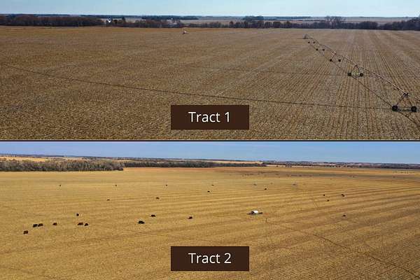
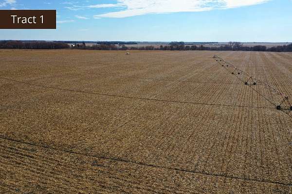
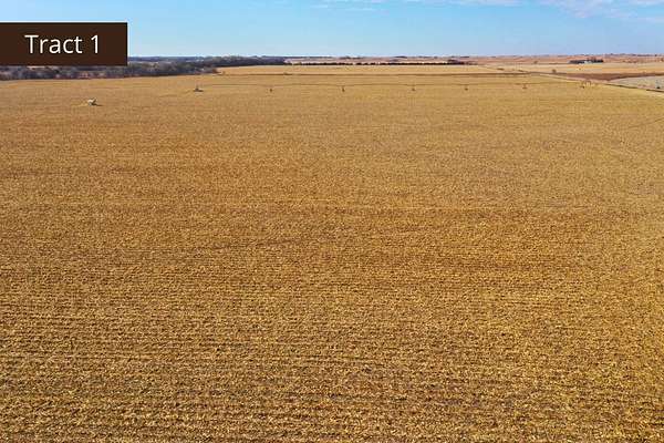
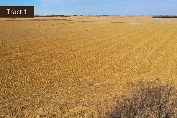
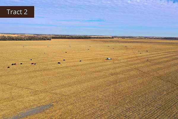
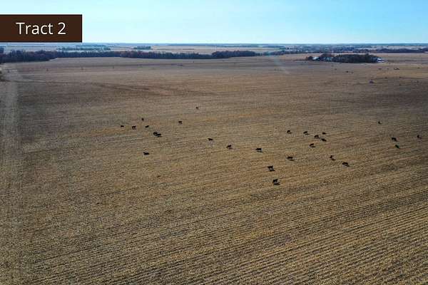
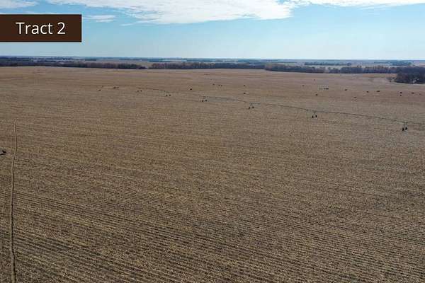
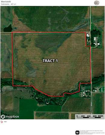
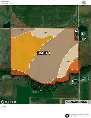
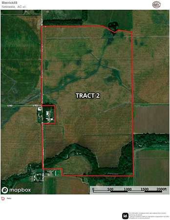
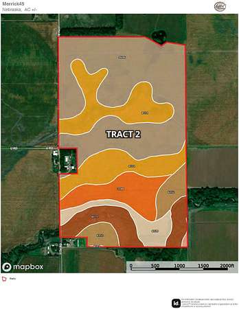
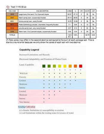
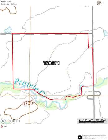
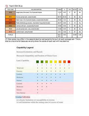
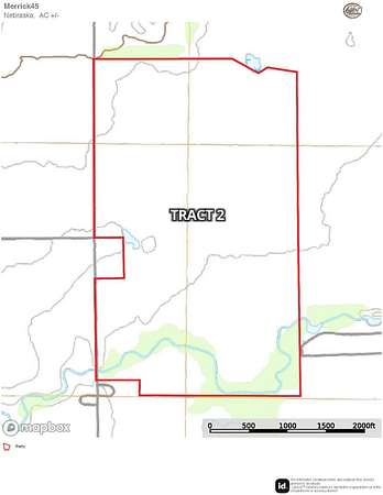
Whether you are seeking to expand your agricultural operation or invest in a versatile, well-maintained farm, these properties warrant your consideration. Tract 1 features a corner-arm center pivot and a reliable water supply. Tract 2 features primarily center-pivot irrigated cropland, complemented by a small portion of gravity-irrigated ground. Much of the irrigation equipment has been updated, ensuring reliable performance throughout the growing season. Several irrigation wells have been serviced-some pulled and repaired-and an additional well was installed in recent years. Underground piping has also been added to enhance efficiency and streamline irrigation operations. For outdoor enthusiasts, Prairie Creek borders the south end of Tract 2, offering excellent habitat and strong potential for trophy whitetail hunting. Tract 1 and Tract 2 are adjacent and can be paired, creating a seamless expansion opportunity for a larger, more efficient operation. Both properties are turn-key farms equipped with newer irrigation systems designed to support optimal productivity and long-term performance. These are quality offerings you won't want to miss! Tract 1 - 119.75+/- Acres - $886,150 Legal Description: Part of NE 1/4 of Section 3, Township 14 North, Range 7 West, Merrick County, NE Property Taxes: $4,445.98 Total Acres (per assessor): 119.75+/- Irrigated Acres: 110.48+/- Grassland Acres: 6.41+/- Other Acres: 2.86+/- Irrigation Information: 5 Irrigation Wells Well G-106167: Drilled in 1983, 400 GPM Well G-172737: Drilled in 2014, 150 GPM, 38' Pumping Level, 40' Well Depth Well G-106168: Drilled in 1983, 400 GPM Well G-013403: Drilled in 1951, 400 GPM, 41' Well Depth Well G-111017: Drilled in 2001, 475 GPM, 35' Pumping Level, 41' Well Depth 2017 6-Tower Valley center pivot with corner arm Located in the Central Platte NRD 111.32 Certified Irrigated Acres FSA Information: Total Cropland Acres: 343.58 Corn: 292.53 Base Acres - 117 PLC Yield Soybeans: 31.41 Base Acres - 42 PLC Yield Total Base Acres: 323.94 Tract 2 - 255.14+/- Acres - $1,837,000 Legal Description: Part of SW1/4 of Section 35, Township 15 North, Range 7 West and Part of N1/2 of NW1/4 and N1/2 of SW1/4 less 2.5 acres of Section 2, Township 14 North, Range 7 West, Merrick County, NE Property Taxes: $9,089 Total Acres (per assessor): 255.14+/- Irrigated Acres: 206.04+/- Dryland Acres: 10.08+/- Grassland Acres: 36.27+/- Other Acres: 2.75+/- Irrigation Information: 7 Irrigation Wells Well G-076499A: Drilled in 1993, 75 GPM Well G-102181: Drilled in 1999, 400 GPM, 29' Pumping Level, 39' Well Depth Well G-104122: Drilled in 1999, 450 GPM, 35' Pumping Level, 41' Well Depth Well G-0764991: Drilled in 1993, 75 GPM Well G-101999: Drilled in 1999, 450 GPM, 35' Pumping Level, 41' Well Depth Well G-195527: Drilled in 1922, 400 GPM, 33' Pumping Level, 40' Well Depth Well G-102182: Drilled in 1999, 400 GPM, 28' Pumping Level, 35' Well Depth 7-Tower Valley center pivot with corner arm, set up for 1,000 GPM, put up 4 years ago 2013 6-Tower Valley center pivot set up for 425 GPM Located in the Central Platte NRD 218.50 Certified Irrigated Acres FSA Information: Total Cropland Acres: 343.58 Corn: 292.53 Base Acres - 117 PLC Yield Soybeans: 31.41 Base Acres - 42 PLC Yield Total Base Acres: 323.94 All mineral rights owned by the seller, if any, convey to the buyer.
Location
- Street address
- 11th Rd
- County
- Merrick County
- Zip code
- 68816
- Elevation
- 1,716 feet
Directions
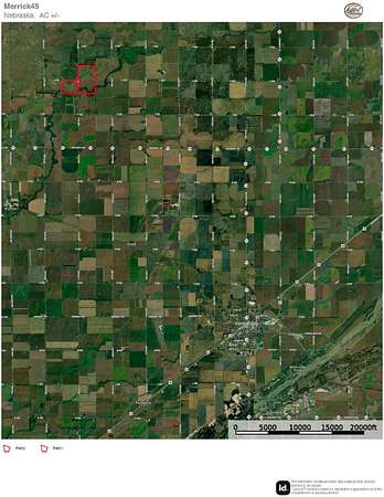
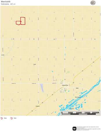
Take Highway 14 north out of Central City for roughly 5 miles to Highway 92. Turn and go west approximately 5 miles to 11th road. Turn and go north for 2 miles. Tract 1 is located on the west side of the road. Tract 2 is located on the east side of the road.
Property details
- Acreage
- 375 acres
- Zoning
- Agricultural
- MLS #
- MyStateMLS 11613009
- Posted
Property taxes
- Recent
- $14,069
Listing history
| Date | Event | Price | Change | Source |
|---|---|---|---|---|
| June 5, 2026 | Relisted | $2,723,150 | — | MyStateMLS |
| May 11, 2026 | Listing removed | $2,723,150 | — | Listing agent |
| Jan 9, 2026 | Price drop | $2,723,150 | $151,850 -5.3% | MyStateMLS |
| Dec 2, 2025 | New listing | $2,875,000 | — | MyStateMLS |