Residential Land for Sale in Livermore, Colorado
1222 Meadow Mountain Dr, Livermore, CO 80536
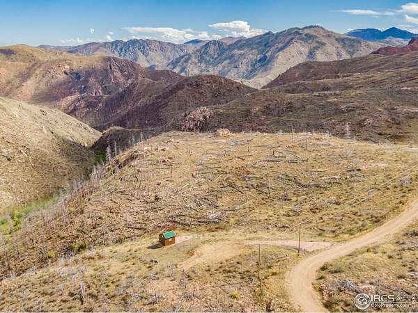
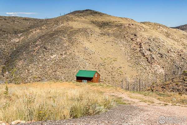
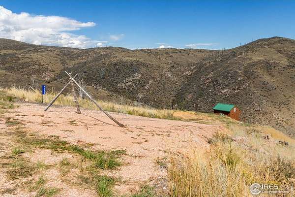
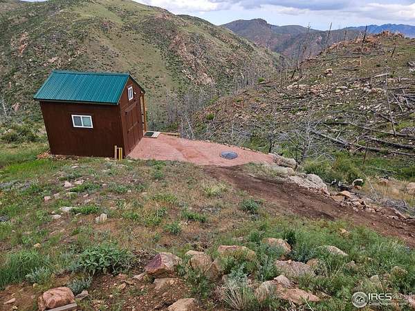
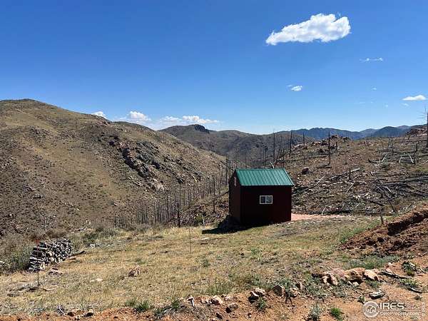
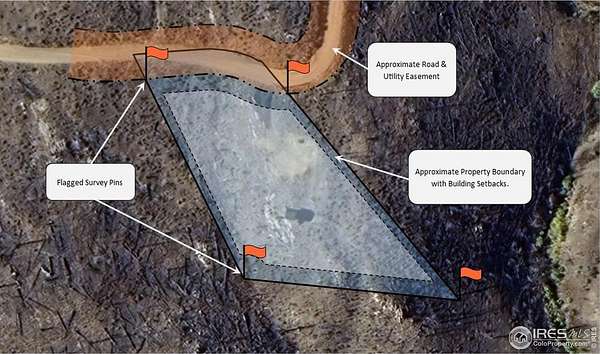
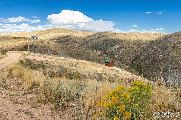
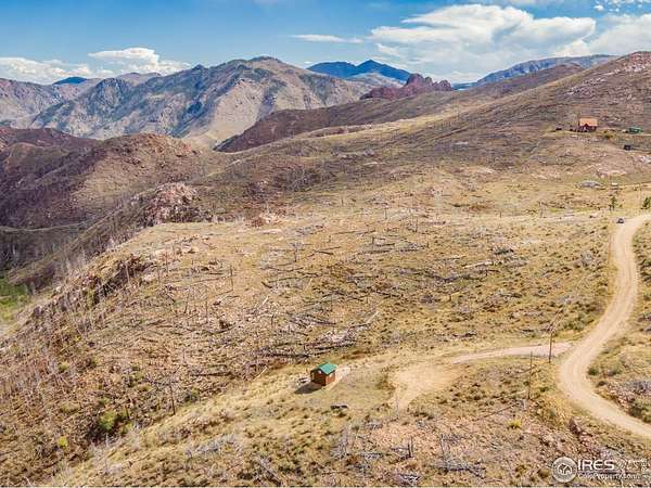
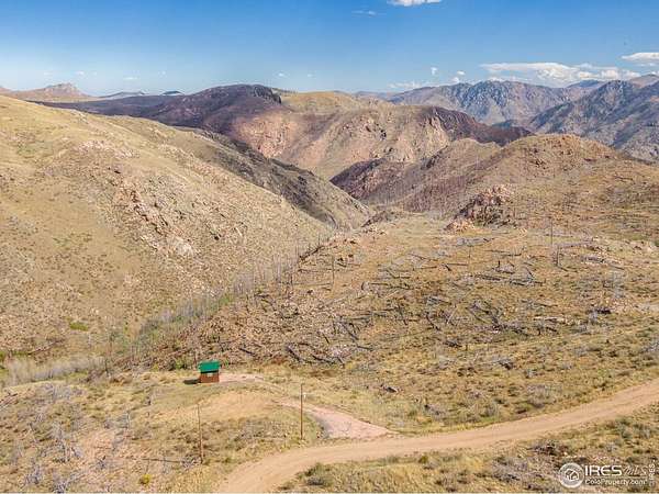
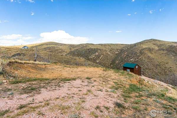
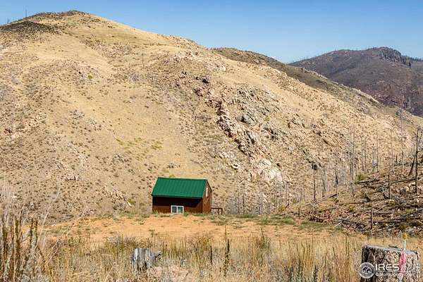
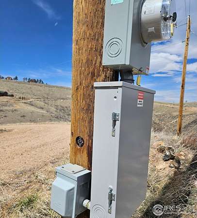
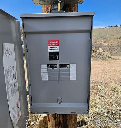
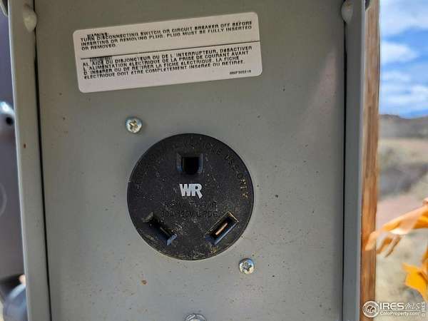
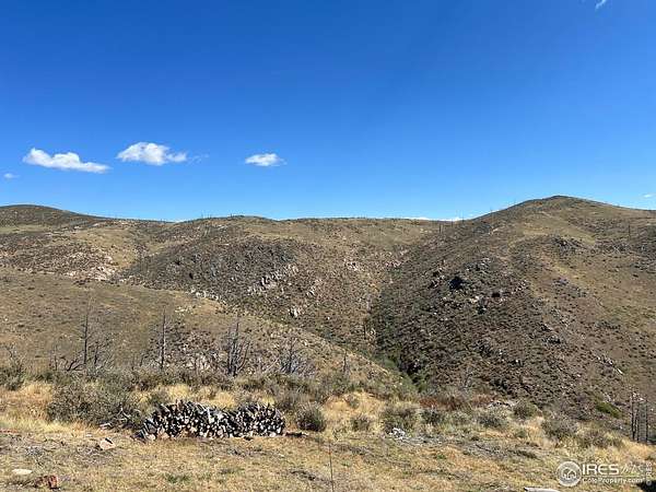
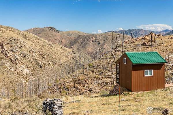
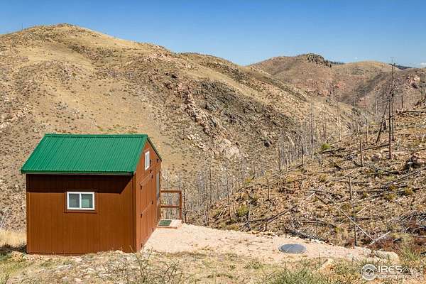
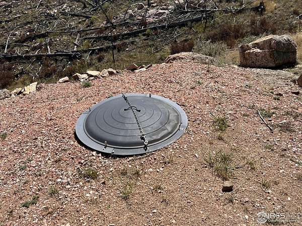
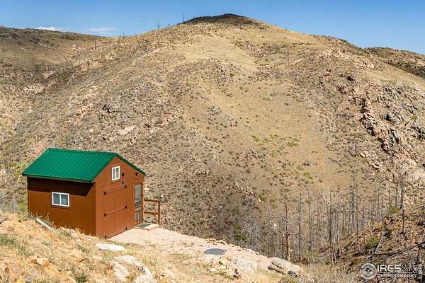
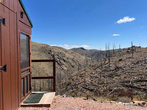
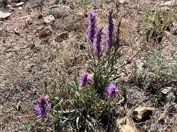
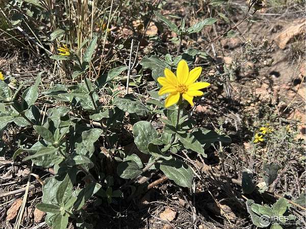
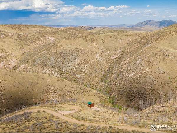
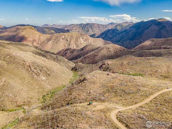
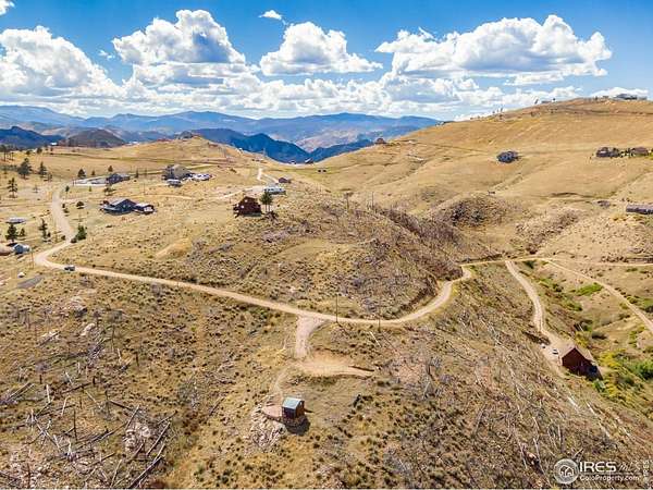
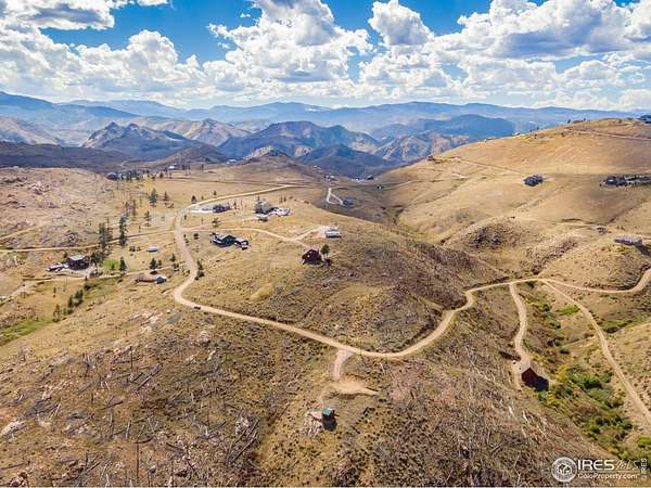
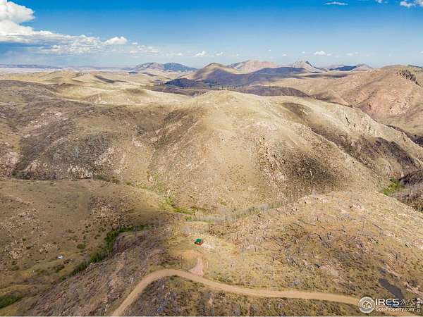
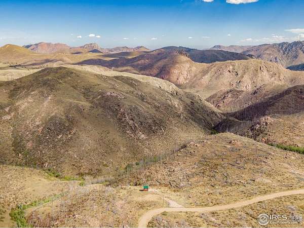
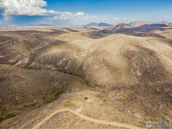
Discover the perfect blend of rugged beauty and modern convenience with this land bordering National Forest to the east -- a haven for outdoor enthusiasts. The property features a cut-in driveway and building pad, plus a 10x12 shed, ideal for gear storage. Enjoy 200 Amp electrical service at the road, including two 30A outlets -- perfect for RVs or future development (approx $6k improvement). An HOA-approved firepit is already in place and can be recertified by new owners. Most of the fire-damaged timber has been cleared, opening up the land for fresh possibilities and panoramic views. A builder and architect have both confirmed the soil should support a conventional septic system, and the seller has verified with the HOA and County that a standard perc test should suffice. Water access is flexible: owners can fill up at no cost from designated stations or opt for delivery to a cistern for a fee. Whether you're parking your camper for up to six months or planning a permanent retreat, you'll enjoy fishing ponds, miles of scenic trails, and year-round access via plowed roads w/HOA-maintained grading. Additional amenities include RV dump stations, water fill-up points, and trash drop-off, making off-grid living refreshingly convenient. This isn't just land -- it's your launchpad for adventure, tranquility, and the Colorado lifestyle.
Location
- Street address
- 1222 Meadow Mountain Dr
- County
- Larimer County
- Community
- Glacier View Meadows
- School district
- Poudre
- Elevation
- 7,144 feet
Directions
HWY 287 North to The Forks. West on W County Rd 74e/Red Feather Lakes Rd. Take the Glacier View Meadows entrance to Rigby's Roadhouse (Gate 1) on Eiger Rd. Stay on Eiger Rd (it becomes Many Thunder Mountain Dr.- Don't turn Rt on Eiger). At the fork, chooseMeadow Mountain Dr. Immediate hairpin, stay on Meadow Mountain Dr. Turn right on Horse Mtn Dr. Stay left as it turns back into Meadow Mtn Dr. Keep following it after GPS says you have arrived. You'll see The Group sign on the right before the road turns left again. Grays Peak Ct is too far. 1222 on blue marker by power pole.sign on the right before the road turns left again. Grays Peak Ct is too far.1222 on blue marker by power pole.
Property details
- Acreage
- 1.29 acres
- Zoning
- E
- MLS #
- IRES 1045049
- Posted
Property taxes
- 2024
- $1,123
Expenses
- Home Owner Assessments Fee
- $500 annually
- Home Owner Assessments Fee
- $130 annually
Parcels
- R1084402
Details and features
Listing
- Type
- Land
Lot
- View
- Hills
- Features
- Abuts National Forest, Deciduous Trees, Evergreen Trees, Mountains, Native Grass, Outbuildings, Rolling Lot, Sloping Lot, Steep Lot, Wooded
Property utilities
| Category | Type | Status |
|---|---|---|
| Gas | Propane | Available |
Nearby schools
| Name | Type | District |
|---|---|---|
| Livermore | Elementary | Poudre |
| Cache la Poudre | Middle | Poudre |
| Poudre | High | Poudre |
Listing history
| Date | Event | Price | Change | Source |
|---|---|---|---|---|
| Feb 19, 2026 | Under contract | $50,000 | — | IRES |
| Jan 27, 2026 | Price drop | $50,000 | $2,000 -3.8% | IRES |
| Oct 4, 2025 | New listing | $52,000 | — | IRES |