Improved Mixed-Use Land for Sale in Fort McCoy, Florida
15260 NE 152nd Pl, Fort McCoy, FL 32134
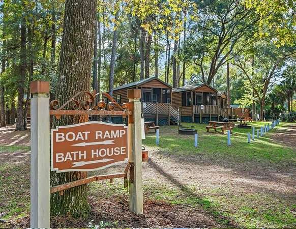
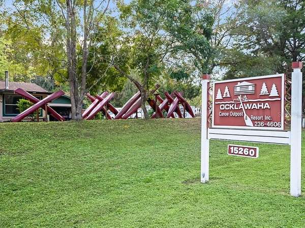
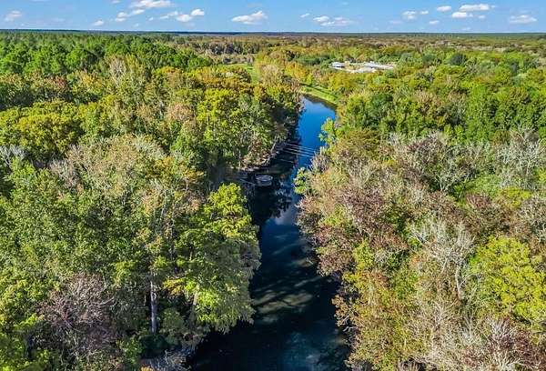
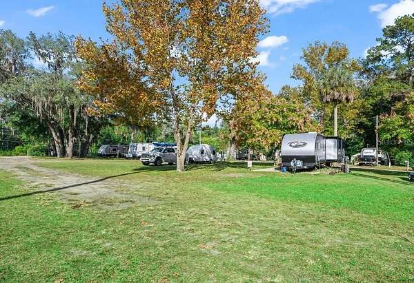
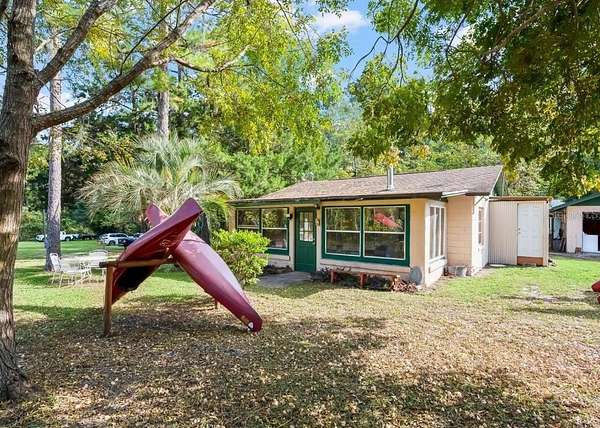
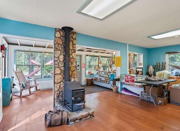
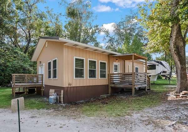
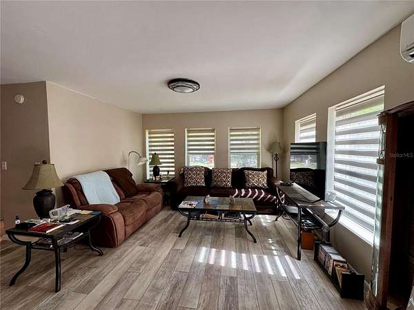
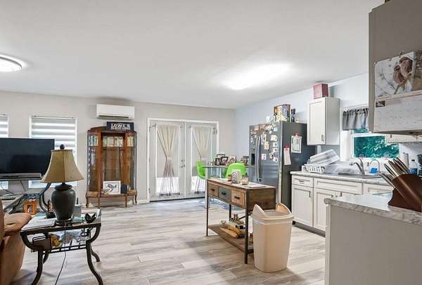
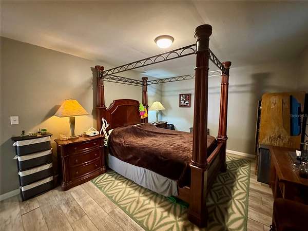
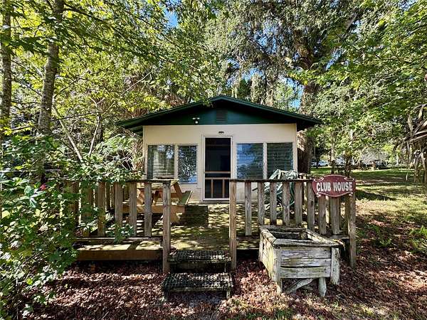
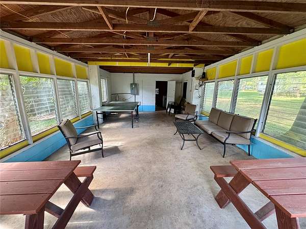
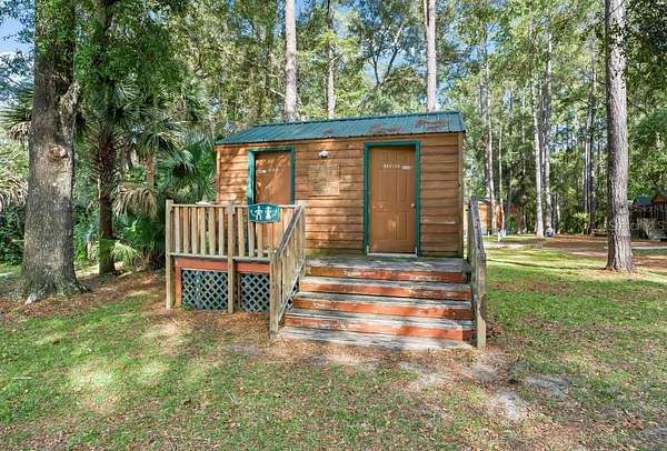
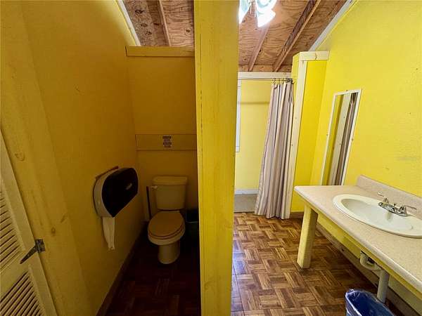
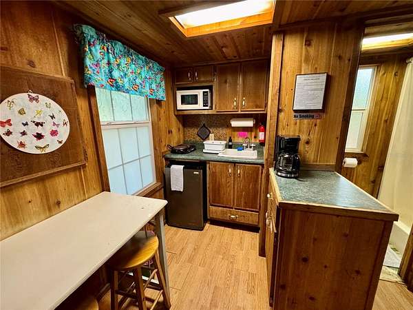
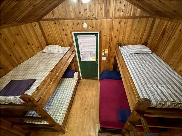
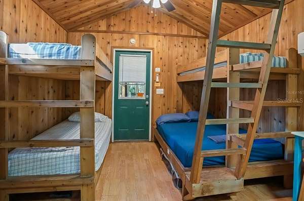
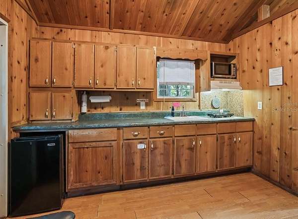
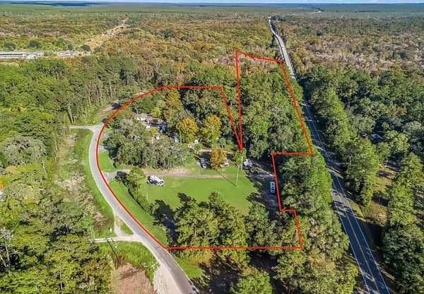
Rare riverfront investment opportunity in Fort McCoy! Situated on approximately 6.91 acres, this established recreational rental property offers multiple income streams with room for future expansion. The property includes 6 rental cabins, 11 existing RV sites with 20/30/50 AMP service, tent camping sites, a 2-bedroom/1-bath main residence, clubhouse, bathhouse, and check-in building with gift shop. Direct river access and an on-site fishing pond add to the property's recreational appeal. The RV sites are individually metered and currently accommodate a mix of long-term tenants and short-term/weekend guests. A large vacant area offers potential for approximately 10 additional RV sites, providing an opportunity to expand operations and increase future revenue. The offering includes the real estate, existing recreational rental business, and equipment/FF&E, creating an opportunity for an investor, owner-operator, hospitality buyer, or outdoor recreation business. Zoned B-4. Business financials available with signed NDA
Location
- Street address
- 15260 NE 152nd Pl
- County
- Marion County
- Zip code
- 32134
- Community
- Ocklawaha Outpost
- Elevation
- 46 feet
Directions
Coming from the NORTH on I-75, traveling SOUTH 1. Take I-75 South to Exit 368 - CR 318. 2. Turn left/east onto CR 318. 3. Continue to US-441/US-301 and turn right/south. 4. Follow US-441/301 to CR 316 East. 5. Follow CR 316 East toward Fort McCoy. There is a short jog where CR 316 uses Hwy 200A before continuing east again. 6. Continue on CR 316 East for approximately 13 miles. 7. As you approach the Ocklawaha River bridge, watch carefully for NE 152nd Place on the LEFT. 8. Turn left onto NE 152nd Place. The Outpost is at 15260 NE 152nd Place.
Property details
- Acreage
- 7.21 acres
- Zoning
- B4
- MLS #
- MFRMLS GC543988
- Posted
Property taxes
- 2025
- $6,710
Parcels
- 10146-000-00
Legal description
SEC 09 TWP 13 RGE 24 N 60 FT OF S 260 FT OF GOVT LT 10 W OF EUREKA CREEK KNOWN AS OCKLAWAHA RIVER & COM 260 FT N FROM SW COR OF GOVT LT 10 N ALG W BDY TO S ROW OF PUBLIC HWY ELY ALG ROW 250 FT S 250 FT SWLY TO POB & COM 250 FT E OF INTER OF SLY ROW O F FT MCCOY-EUREKA-LAKE KERR HWY WITH W LINE OF GOVT LT 10 ELY 250 FT S 200 FT W 50 FT SWLY TO PT THAT IS 250 FT S OF POB N TO POB & COM 260 FT N OF SW COR OF GOVT LT 10 E TO OLD RIVER NORTH ALG RIVER TO PUBLIC HWY TH W ALG HWY TO W BDY OF GOVT LT 10 TH S TO POB EX COM 260 FT N OF SW COR OF GOVT LT 10 TH N TO S ROW OF PUBLIC RD NELY ALG RD ROW 500 FT TH S 200 FT SWLY TO POB EX THAT PORTION OF LAND TAKEN BY CANAL AUTHORITY AKA THAT PORTION E OF W TAKING LINE & S 260 FT OF GOV L 10 EX N 60 FT
Details and features
Listing
- Type
- Commercial Sale
Lot
- View
- River
- Waterfront
- River Front
Exterior
- Structures
- Outbuilding
Structure
- Stories
- 1
- Materials
- Wood Siding
Listing history
| Date | Event | Price | Change | Source |
|---|---|---|---|---|
| Oct 23, 2026 | New listing | $1,200,000 | — | MFRMLS |