160 Acres of Agricultural Land for Sale in Montezuma, Kansas
17th Rd & X Rd, Montezuma, KS 67867
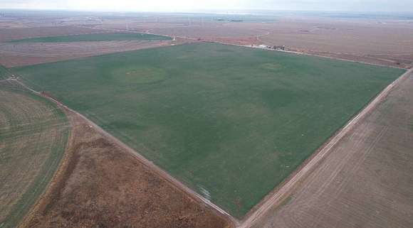
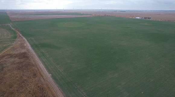

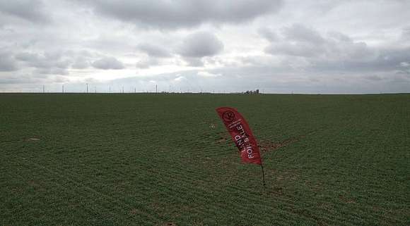
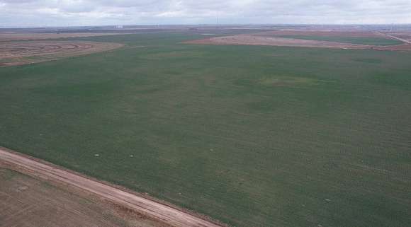


Our company is proud to present this dryland quarter located between Montezuma and Cimarron, Kansas that features a high-percentage of tillable acreage and is located just 1/2 mile from the pavement of Highway 23. This tract is all-business for the ag operator due to lack of non-tillable portions. You'll like what you see! This tract totals 160 acres more or less with 155.36 acres of cropland according to FSA records. The majority soil type on the property is Class 2 Satanta loam (0-1% slopes) coming in at 100.1 acres according to the soil map. Class 2 Uly silt loam (1-3% slopes)totals 16.02 acres and more Satanta silt loam (1-3% slopes) at 14.7 acres with the balance made up of Ness, Uly and Manter varieties. Please refer to the soil map contained in the "Related Documents". FSA records indicate: DCP Cropland- 155.36 Acres Wheat BA- 47.57 with PLC Yield of 41 Corn BA- 34.83 with PLC Yield of 204 Sorghum BA- 44.11 of PLC Yield of 88 Proximity to pavement makes this offering all the more attractive as it's just a 1/2 mile to the asphalt of Highway 23 with convenient access to Montezuma, Cimarron, Garden City and Dodge City with multiple grain marketing options including the Haggard elevator just to the southeast. For more information, please contact the Broker. Brief Legal Description: The NW 1/4 of Section 35, Township 27 South, Range 28 West of the 6th P.M., Gray County, Kansas. 160 acres, more or less. Driving Directions from Montezuma: Take Highway 56 east for 5 1/2 miles to Highway 23 and turn north. Proceed 2 1/2 miles to Road X and turn east. Proceed 1/2 mile and the property begins on the south side. Possession: Possession shall be after the 2024 harvest of the currently growing wheat crop. Minerals: The Sellers mineral interests shall transfer to the Buyer.
Directions
Driving Directions from Montezuma: Take Highway 56 east for 5 1/2 miles to Highway 23 and turn north. Proceed 2 1/2 miles to Road X and turn east. Proceed 1/2 mile and the property begins on the south side.
Property details
- County
- Gray County
- Elevation
- 2,789 feet
- MLS Number
- MyStateMLS 11231910
- Date Listed
Parcels
- 0351573500000002000
Resources
Detailed attributes
Listing
- Type
- Vacant Land
Lot
- Views
- Farm, Scenic
Listing history
| Date | Event | Price | Change | Source |
|---|---|---|---|---|
| Jan 12, 2024 | Under contract | $592,000 | — | MyStateMLS |
| Jan 4, 2024 | Price decrease | $592,000 | $32,000 -5.1% | MyStateMLS |
| Dec 22, 2023 | New listing | $624,000 | — | MyStateMLS |