Images
Map
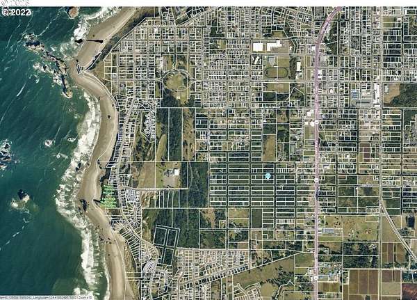
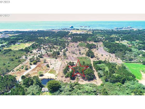
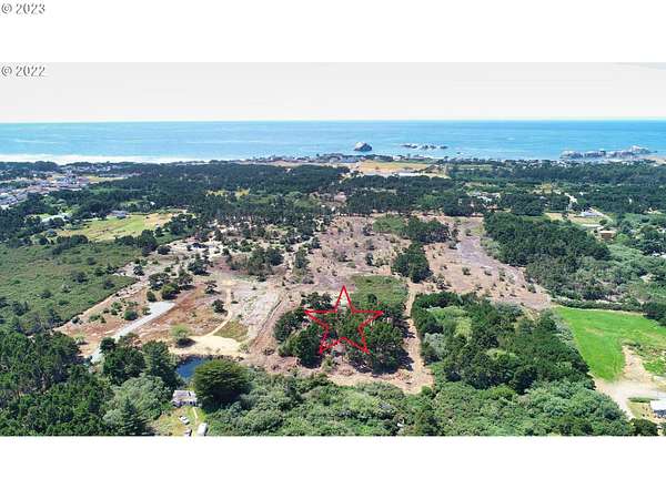
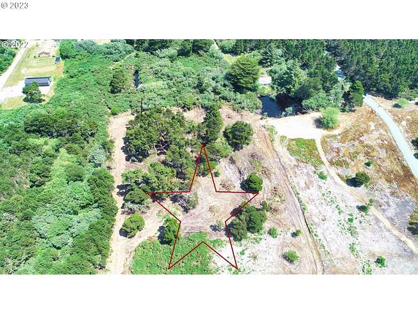
Residential Land for Sale in Bandon, Oregon
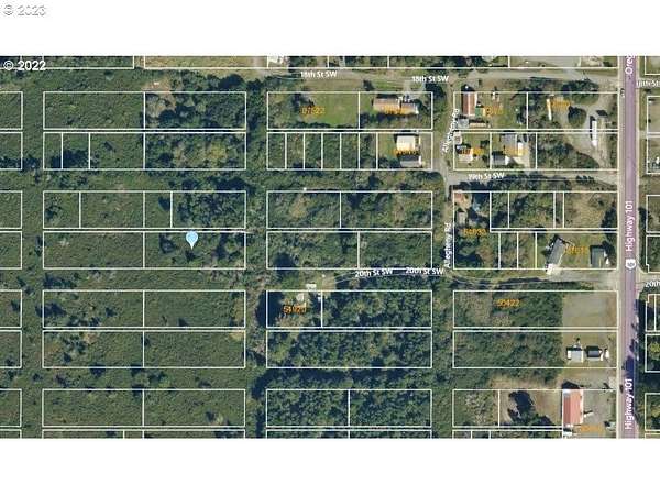
20 St SW, Bandon, OR 97411
$89,900
0.63 acres
Active sale
$9.1k drop
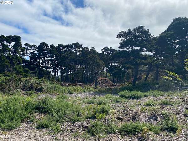
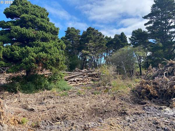
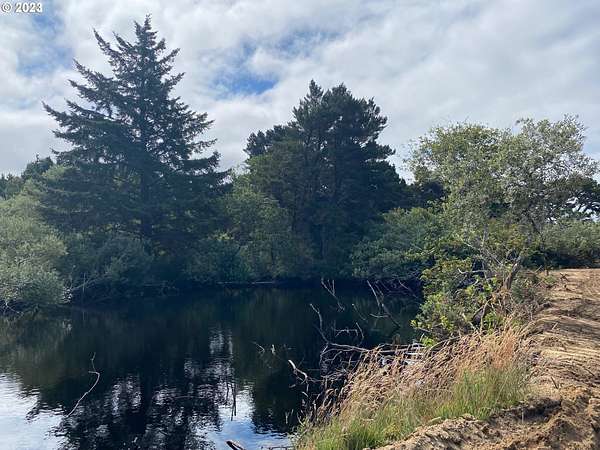
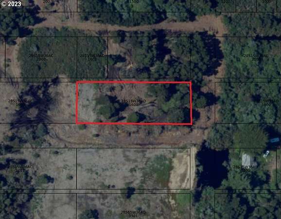
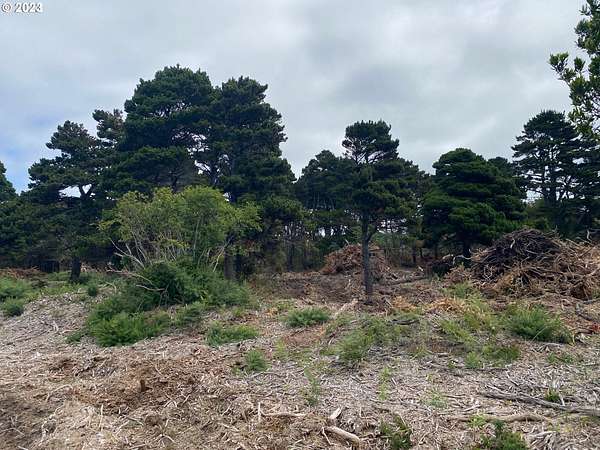
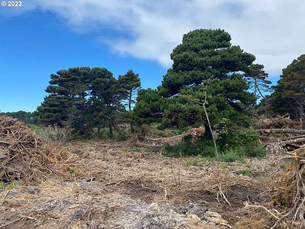
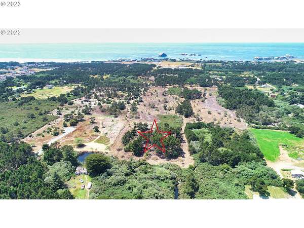
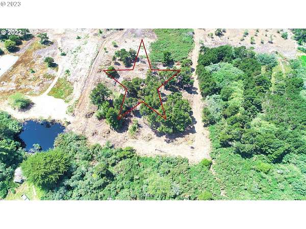
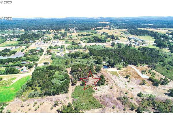
Est $627/moNICE BIG CHUNK OF LAND! ON Bandon's west side in Face Rock Heights formerly known as the Donut Hole but now rapidly being developed due to its proximity to world class beaches, golf, seafood, all kinds of food, fishing & coastal fun(10 minute walk to beach). .63 acre, 100 by 275 feet, mostly cleared but left the pine trees. View of nearby pond! Needs well, septic & City of Bandon Electric extended as well as the last part of the road improved. OWNER MAY CARRY!
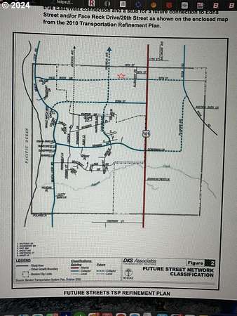
Location
- Street address
- 20 St SW
- County
- Coos County
- Elevation
- 82 feet
Directions
Call first. Hwy 101 heading south turn west on 21st St. then walk north at sign to 20th.
Property details
- Lot size
- 0.63 acres27,443 sq ft
- Zoning
- UR-2
- MLS #
- RMLS 23247046
- Posted
Property taxes
- Recent
- $247
Parcels
- 99921255
Legal description
TRS 28S-15W-36AD TL 1602, Block 4, Lots 12-22
Details and features
Listing
- Type
- Land
- Subtype
- Single Family Residence
Nearby schools
| Name | Type |
|---|---|
| Ocean Crest | Elementary |
| Harbor Lights | Middle |
| Bandon | High |
Listing history
| Date | Event | Price | Change | Source |
|---|---|---|---|---|
| Dec 3, 2025 | Price added | $89,900 | — | RMLS |
| Nov 21, 2025 | Price removed | $— | — | RMLS |
| Feb 28, 2025 | Relisted | $89,900 | — | RMLS |
| Feb 23, 2024 | Listing removed | $89,900 | — | Listing agent |
| Feb 20, 2024 | Price drop | $89,900 | $9,100 -9.2% | RMLS |
| Oct 23, 2023 | New listing | $99,000 | — | RMLS |
Payment calculator

Contact listing agent
By submitting, I agree to the terms of use and to be contacted by . Message and data rates may apply.