Residential Land for Sale in Alton, Illinois
2027 Brown St, Alton, IL 62002
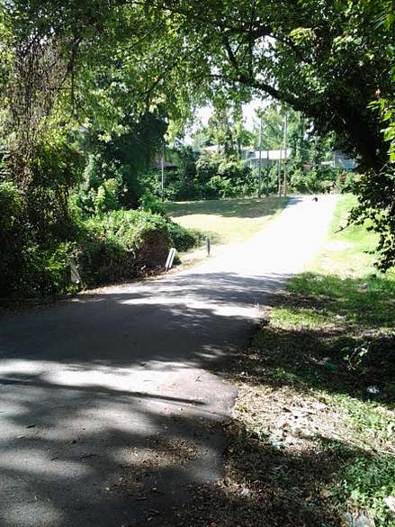
Vacant, residential lot that was cleared of a demolished house. Corner lot, located at the intersection of Wilkinson Avenue and Brown Street. 44 x 135 corner lot, that slopes down to a creek (part of Black Creek, called Shield's Branch on maps), away from Brown Street. The lower area is adjacent to the creek. A steep hill rises past the creek, and leads to Mills Avenue, which joins Washington Avenue. Wilkinson Avenue continues on and joins Washington Avenue, also. Rock Springs Drive is further down off of Brown Street, and, construction road work, along and following Shield's Branch, near the Alton Memorial Hospital, has just been done. Halliburton Street and Arthur Street are located off of Wilkinson Avenue, nearby.
Location
- Street address
- 2027 Brown St
- County
- Madison County
- Elevation
- 535 feet
Directions
Madison County is across the Clark Bridge, from St. Louis County. Hwy. I-270 runs around St. Louis, MO. From I-270, in north St. Louis County, Hwy. 367 runs north to the Mississippi River. The Clark Bridge crosses the Mississippi River, near the confluence of the Missouri and Mississippi Rivers, and, brings the traveler to Madison County, Illinois. Madison County, Illinois is accessed by Hwy. I-255, which intersects Hwy. I-270. Route 3, or the Great River Road, runs north from Hwy. I-270 into Alton, on Broadway Avenue. Alton is a river town, and Route 140 (Washington Avenue) goes north.
Near the Fast Eddie's Bon Air Restaurant, turn onto Route 140, or Washington Avenue, at the Phillips 66 Gas Station, which is across from the Alton Police Station. Brown Street intersects Washington Avenue at the Calvary Baptist Church, 1422 Washington Avenue. The Upper Alton Branch of the US Bank is located at the other corner, at 1520 Washington Avenue. Turn left, and, drive past these two businesses.
2027 Brown Street is located, about 2 blocks, down a sloping hill, on the left, past Funke Street, and Signal Drive.
Property details
- Lot size
- 0.14 acres6,098 sq ft
- Zoning
- R-2 Residential
- Access
- Public road
- Showing
- Go on your own
- Posted
Property taxes
- 2022
- $132
Expenses
- Closing costs paid by buyer.
- $600 one-time
Parcels
- 23-2-08-07-13-302-001
Legal description
Mills Subd Lot 1 44x135
Details and features
Lot
- Features
- Partially Wooded
Exterior
- Parking
- Driveway
Property utilities
| Category | Type | Status | Description |
|---|---|---|---|
| Power | Grid | Available | Available |
Nearby schools
| Name | Type | District | Description |
|---|---|---|---|
| East Elementary School | Elementary, Public | Alton | 1035 Washington Avenue, Alton, Illinois 62002 |
| Alton Middle School | Middle, Public | Alton | 2200 College Avenue, Alton, Illinois 62002 |
| Alton High School | High, Public | Alton Community Unit School District 11 | 4200 Humbert Road, Alton, Illinois 62002 |
| Marquette Catholic High School | High, Private | Roman Catholic Diocese of Springfield, Illinois | 219 E. 4th Street, Alton, Illinois 62002 |
Listing history
| Date | Event | Price | Change | Source |
|---|---|---|---|---|
| May 13, 2025 | Price increase | $5,520 | $1,520 38% | Property seller |
| Aug 10, 2023 | New listing | $4,000 | — | Property seller |