Residential Land for Sale in Creede, Colorado
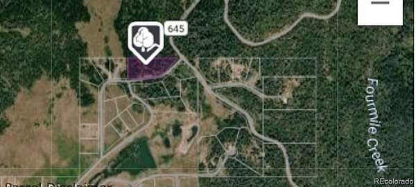
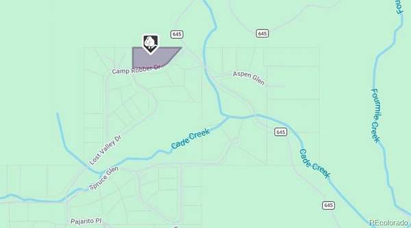
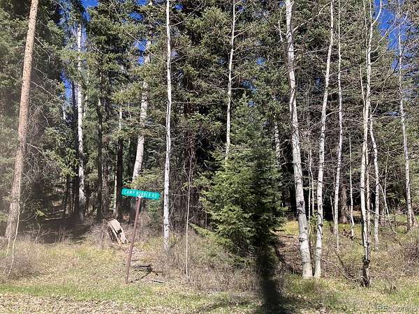
207 Camp Robber Dr, Creede, CO 81130
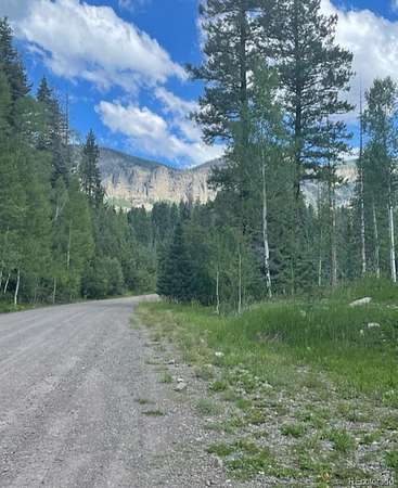
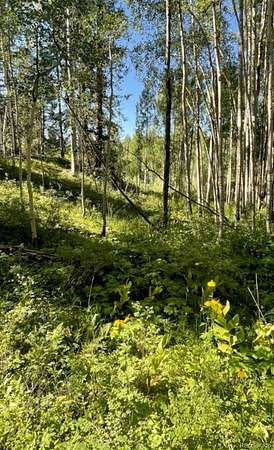
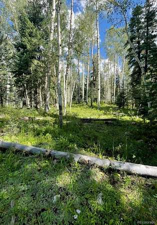
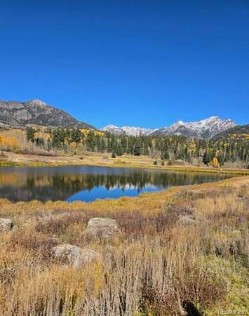
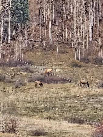
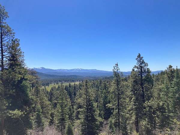
Backing to the National Forest, this lot is secluded, quiet, and ready for your dream mountain home. Imagine making this your basecamp for some of the best hunting in the world. Elk, mountain lion, bear, deer, Rocky Mountain Bighorn Sheep, and so much more are part of this hunting unit. Water tap for the neighborhood water is paid in full. You would need to install a septic system, and pull power off one of the nearby poles.
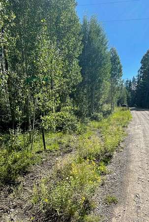
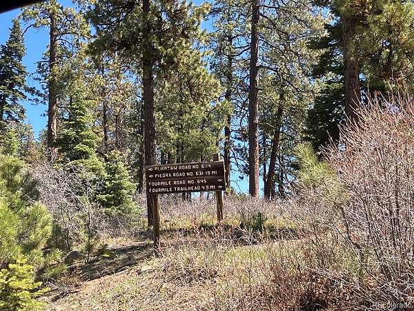
Discover the magic of life above in the Lost Valley of the San Juans on 2.39 acres. A tight knit community, tucked away in the San Juan National Forest. Bring your RV or camp for short periods of time, per the HOA. Private gated trail access for ATVing and Side-by-side trail riding that ends up at Plumtaw Road No 634.
Enjoy community lakes, and hundreds of thousands of acres just outside the neighborhood for world class ATVing, hunting, hiking, biking, horseback riding, and fishing. One of the last remaining wild places, at 9,000 feet elevation, you can get lost in nature and peace and quiet. HOA dues cover water access to the lot and lakes.
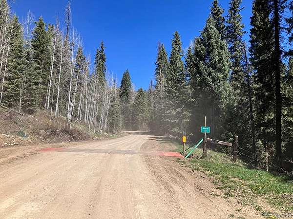
Private access for property owners once the gate at 4 Mile Road is closed. Access in winter via Snowmobile/Trak Side-by-Side and park your car at gate parking lot. Gate is controlled by the U.S. Forest service, and just opened on April 14th, and usually closes once permanent snow is on the ground in December.
Make sure you download maps before driving by because there is no cell service in the area.
Why pay and wait for campground reservations when you can build your dream home in paradise?
Seller is also selling .81 acres in the same community. MLS#3103405
- Listed by Kristin Walter, (970) 368-2124, Mountain Dream Real Estate
Location
- Street address
- 207 Camp Robber Dr
- County
- Mineral County
- Zip code
- 81130
- Community
- Lost Valley of The San Juans
- School district
- Archuleta County 50 JT
- Elevation
- 8,850 feet
Directions
Directions From Pagosa Springs, 4-MILE RD to Lost Valley Dr./Camp Robber Dr. Left on Lost Valley Dr. Property is on the right.
GPS Coordinates 37.399155
- 107.058615
Property details
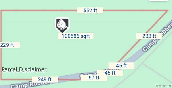
- Acreage
- 2.39 acres
- Zoning
- Residential
- MLS #
- REcolorado 5306659
- Posted
Property taxes
- 2026
- $2,201
Expenses
- Homeowner Association Fee
- $40 monthly
Parcels
- 538934402012
Legal description
LTS 10 & 11 BLK 5 UNIT 2 LOST VALLEY OF THE SAN JUAN
Resources
Details and features
Listing
- Type
- Land
- Subtype
- Improved Land
- Terms
- 1031 Exchange, Cash, Conventional, USDA Loan, VA Loan
- Conditions
- None
- Possession
- Closing/DOD, Immediate, Negotiable
Location
- Incorporated
- No
Community
- Association
- Lost Valley of The San Juans
- Amenities
- Pond Seasonal
- Fee Includes
- Road Maintenance, Water
Lot
- Road Surface
- Dirt
- Road Responsibility
- Private Maintained Road
- View
- Meadow, Mountain(s)
- Well Type
- Community
- Well Usage
- Household Inside Only
- Well Permits
- 32953-F-R
- Features
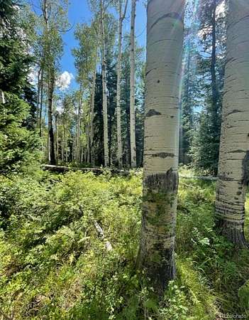
- Borders National Forest, Foothills, Level, Many Trees, Mountainous, Rolling Slope, Secluded
Exterior
- Fencing
- Partial
Structure
- Water
- Shared Well
- Sewer
- Community Sewer
Property utilities
| Category | Type | Status |
|---|---|---|
| Power | Grid | Available |
| Water | Shared Well | Available |
Listing history
| Date | Event | Price | Change | Source |
|---|---|---|---|---|
| Apr 30, 2026 | New listing | $135,000 | — | REcolorado |
Payment calculator
Based on information submitted to the MLS GRID as of June 20, 2026 3:00 pm MT. All data is obtained from various sources and may not have been verified by broker or MLS GRID. Supplied Open House Information is subject to change without notice. All information should be independently reviewed and verified for accuracy. Properties may or may not be listed by the office/agent presenting the information. Some IDX listings have been excluded from this website. View more