Land for Auction in Trenton, Missouri
20th Ne St Trenton, MO 64683
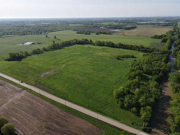


Grundy County Missouri 40 m/l Acres
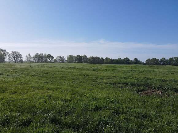
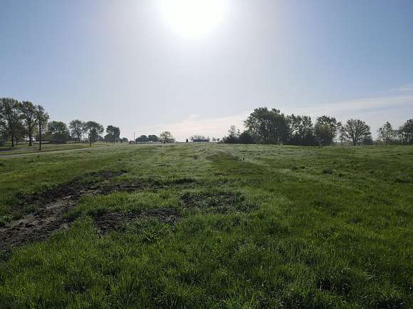
This property is 40 acres located miles northeast of Trenton Missouri in Grundy County. This property was previously a landfill and has been closed since 1992. The property can never be built on or tilled for farming but can be hayed and hunted on.
Land Fill Disclosure
Site Name: Trenton Landfill
Classification: Class 4
Date of Registry Placement: June 10, 1992
Site Address: Northeast of Trenton, east of Highway 65 in Grundy County, Missouri, NE 1/4, NW 1/4, Sec. 10, T61N, R24W, Trenton Quadrangle
Present Property Owner: Connie S. Gwinnup and Anthony Clifford Droz
Lead Aqency: Missouri Department of Natural Resources (MoDNR)
Waste Type: Heavy metals, paint waste, and herbicides
Quantity: Not determined
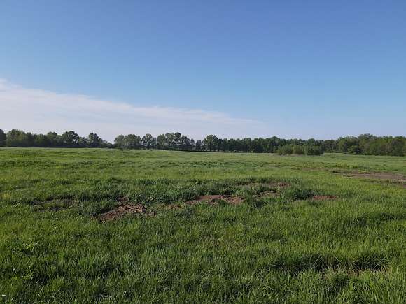
Site Description and Environmental Concern: The Trenton Landfill site is an inactive 40-acre sanitary landfill with heavy metal, paint waste, and herbicide contamination. The privately owned site is located 2 miles northeast of the city of Trenton, Grundy County, Missouri. Currently, the property appears to be an open field, but the waste mass remains buried on site. The owner planted native grasses, trees, and forbes as part of the site's stabilization. The property is located in a predominantly rural agricultural area. The site is fenced along the east and south sides, but is open along Muddy Creek to the west, and along the road to the north. The owner posted "No Trespass" signs. The nearest residence is located 270 feet north of the site. The city of Trenton used this site as a pre-law landfill from 1959 until 1975, when it received a Solid Waste Sanitary Landfill Permit (#107901). In 1979, the landfill ceased accepting waste. In 1980, the city of Trenton graded and seeded the area to prevent erosion off-site. In 1985, samples of Muddy Creek showed elevated levels of heavy metals downstream from the landfill. This discovery prompted MoDNR to investigate the landfill as a potential contamination source. These investigations determined that a large quantity of hazardous waste had been disposed of at the site during the landfill's operation. The site maintains a potential for off-site migration of waste constituents via shallow groundwater. Cap erosion and leachate outbreaks have also been a concern.
Remedial Actions:
The site has had a history of erosion, resulting in: exposed solid waste, hazardous substances, and hazardous waste; subsidence of the cap that caused ponding; and leachate outbreaks that potentially entered Muddy Creek. The responsible parties have performed stabilization and repair work to address these issues. In 2015, the city completed the most recent repair work, including fixing areas where all-terrain vehicles had damaged the landfill cap. To address the damaged areas, the city pushed existing berms over into the areas of subsidence, then spread and compacted the existing soil. The city added off-site soil to create a clay cap that was 3 feet thick, with enough top soil added to support good vegetation. Woody vegetation was removed, but trees on the western edge were left intact to protect the stream bank and to uptake subsurface leachate. The site was graded, seeded, and mowed. On Oct. 19, 2015, MoDNR conducted a closed sanitary landfill inspection. MoDNR observed a few areas of dead vegetation in the southwest and northeast corners, as well as along the eastern boundary. Additionally, mowing has exposed a few pieces of litter scattered throughout the landfill. During this 2015 closed sanitary landfill inspection, MoDNR did not observe evidence of continued ATV use or evidence of ponding of water on the landfill as had previously been observed. On May 9, 2017, MoDNR conducted a closed sanitary inspection and found the landfill in compliance. On July 26, 2023, MoDNR conducted the Fiscal Year 2023 annual site inspection, during which inspectors did not notice any environmental problems. General Geologic and Hydrologic Setting: The Trenton Landfill is located in the Dissected Till Plains physiographic region of northern Missouri. The site is located on the western slope of a rolling upland adjoining Muddy Creek, which flows along the site's western boundary. Much of Grundy County is covered by glacial drift, a heterogeneous, unconsolidated deposit of clay, sand, gravel, and boulders. Some of the sands in the lower layers of the till form permeable beds of limited lateral and vertical extent. These lenses are a source of poor-quality drinking water for several wells within 2 miles. The till underlying the site is expected to be more than 100 to 150 feet thick. Flow of any groundwater existing in the sand lenses of the lower till likely is to the southeast. The fine-grained, low-permeability sediments beneath the site should retard the downward movement of surface water and leachate, reducing impacts to groundwater. However, if sand lenses are present in the till, contaminant movement and migration within groundwater will be enhanced. Bedrock beneath the landfill is probably shale and sandstone of the Cherokee Group, which is about 435 feet thick at Trenton. Minor amounts of clay, coal, and limestone also occur in the Cherokee Group. In fact, an undulatory bed of coal was mined at the Trenton Mine, 1 mile southeast of the landfill. In general, the large shale content of most Cherokee strata greatly impedes the flow of groundwater. The basal member of the Cherokee Group is a water-bearing sandstone more than 100 feet thick. In southeast Grundy County, water from this layer is suitable for livestock; however, the bedrock aquifer's low yields and high dissolved-solids content make it unsuitable for most uses.
Public Drinking Water Advisory:
Trenton Municipal Utilities uses the Thompson River as a primary water source, and no site-related impacts are expected. Groundwater in the region is generally of poor quality, so shallow aquifer contamination is not a significant public health threat.
Health Assessment:
Landfill records indicate that numerous chemicals associated with waste oils, wastewater treatment sludge, heavy metal sludge, paint sludge, solvents, and acid cleaning solutions may be present in the landfill. At one time, high concentrations of metals were identified in Muddy Creek. The current chemical composition and concentration of chemicals and metals in the landfill soils, landfill runoff, and Muddy Creek's water and sediment are unknown. Potential human exposure to site-related contamination may result from contact with surface water runoff, leachate, shallow groundwater, and surface water. Now that the site has a 3-foot-thick clay cap, potential human exposure to site-related contamination via exposed debris and subsurface and surface soils should be very limited. Persons who could be directly exposed to site-related contaminants include trespassers and maintenance workers. Potential exposure to leachate within water and sediment of Muddy Creek includes recreational use and irrigation. The ephemeral nature of Muddy Creek may expose persons involved in recreational activities including swimming, wading, and fishing. Wildlife, livestock, and fish may become contaminated due to exposure to contaminated surface water adjacent to and downstream of the site. Heavy metals bioaccumulation in the aquatic food chain could contaminate fish, thus a potential exposure pathway exists via local fish consumption. Exposure to contaminated groundwater used as a potable water source is not likely. Based upon geologic and hydrologic investigations, downward movement of contaminants is unlikely. The Missouri Department of Health and Senior Services did not find any private wells within 1 mile of the site. Exposure to site-related contamination may occur through direct contact to leachate at the site and in Muddy Creek. Exposure should be minimized by increased maintenance of the site's soil cap and groundcover, fencing along the east and south sides, posting additional "No Trespass" signs, and having the sheriff's office patrol the area more regularly in an effort to keep trespassers out. Current risk of exposures to Muddy Creek sediment and fish are unknown. Testing surface water and sediment for site-related contamination is still needed.
For more information regarding health-related issues, please contact the Missouri Department of Health and Senior Services, P.O. Box 570, Jefferson City, MO 65102, 573-751-6102.
Auction details
- Price
- Contact agent
- Date
Property details
- County
- Grundy County
- Elevation
- 781 feet
- Date Listed
Listing history
| Date | Event | Price | Change | Source |
|---|---|---|---|---|
| May 9, 2024 | New listing | $— | — | — |