Images
Map
Land for Sale in Lancaster, California
20th St E, Lancaster, CA 93535
$19,950
1.34 acres
Active sale
ago
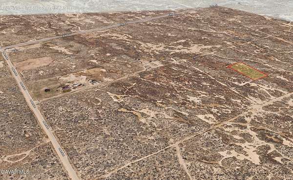
Est $191/moAPN: 3152-015-012 Coordinates: 34.728590, -118.088903 1.34 acre parcel for sale in LA County. The property is located off of 20th ST E and Avenue G, in Lancaster, CA. Nearby are other homes with utilities. Zoned for agricultural use per county records.
Location
- Street address
- 20th St E
- County
- Los Angeles County
- Zip code
- 93535
- Community
- Lanc Div to 90th E
- Elevation
- 2,343 feet
Directions
The property is located off of 20th ST E and Avenue G, in Lancaster, CA. For directions use the provided coordinates Coordinates: 34.728590, -118.088903
Property details
- Acreage
- 1.34 acres58,370 sq ft
- Zoning
- LCA2
- MLS #
- GAVAR 26008110
- Posted
Parcels
- 3152-015-012
Details and features
Listing
- Type
- Land
Structure
- Sewer
- None
Listing history
| Date | Event | Price | Change | Source |
|---|---|---|---|---|
| Oct 23, 2026 | New listing | $19,950 | — | GAVAR |
Payment calculator

Contact listing agent
By submitting, I agree to the terms of use and to be contacted by . Message and data rates may apply.