Land for Sale in Peyton, Colorado
2605 Antelope Hill Vw, Peyton, CO 80831
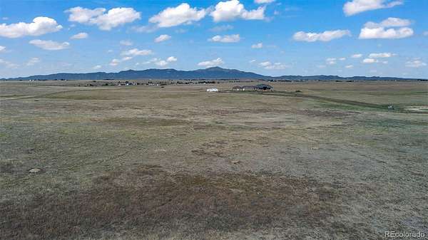
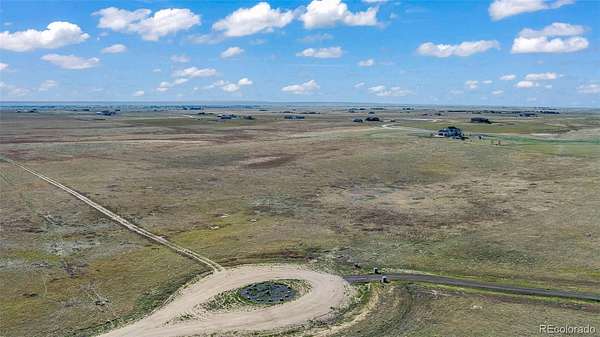
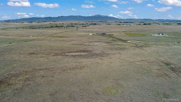
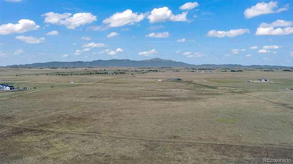
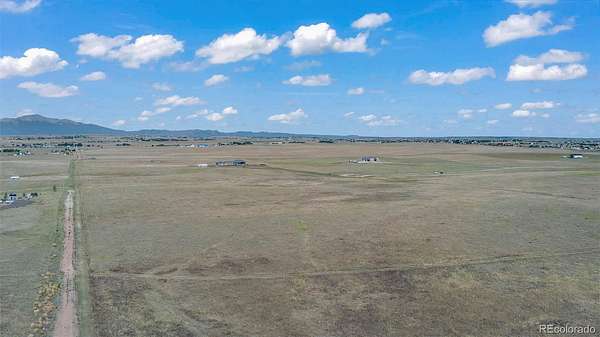
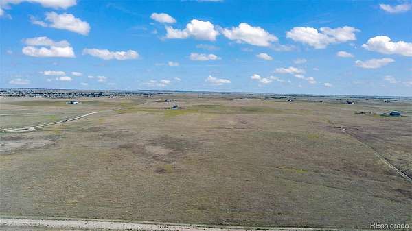
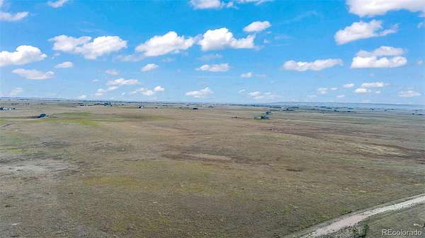
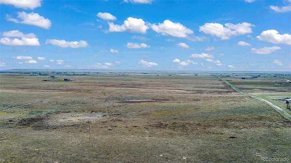
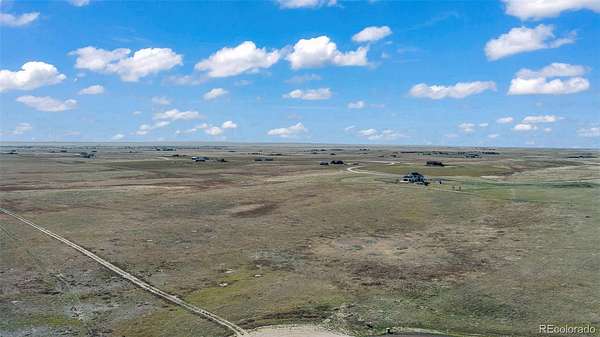
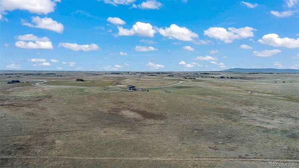
Welcome to your Colorado Ranch Dream! Own, 35 beautiful acres in the prestigious Trails End Ranch community which comes with 1 acre-foot of water rights! This lot is the end of the cul-de-sac for minimum traffic and the unobstructed views are absolutely stunning!! Enjoy the breathtaking views of Pikes Peak, the Front Range, Sangre de Cristo Mountains, the Spanish Peaks, sunrises/sunsets, and abundant wildlife! There is no HOA or HOA fee; instead, there are well thought out and reasonable Recorded Covenants designed to keep the community in a quality manner all awhile being able to enjoy the freedom of owning 35 acres. Build on your timeline or hold if you prefer. Trails End Ranch is a highly coveted and one-of-a-kind community completely sold out for years except for rare opportunities like this where the owners had to change plans. The community has a stunning entrance with a rustic log entryway, covered stone mail kiosk with bench. There are dedicated riding trails throughout for the exclusive use of the owners for you to ride horseback, bike, jog, or walk your dog. Underground electric was installed along the parcel front boundary so no unsightly power poles blocking your views. Plus, you are in the path of growth and only 15 minutes to Falcon, less than 10 minutes to Schriever SFB, 20 - 25 minutes to the Powers Corridor and Peterson SFB. Major stores and services are close by.
- Listed by Mike Jacobson, (719) 886-4800, Engel & Voelkers Pikes Peak
Location
- Street address
- 2605 Antelope Hill Vw
- County
- El Paso County
- Zip code
- 80831
- Community
- Trails End Ranch
- School district
- Ellicott 22
- Elevation
- 6,357 feet
Directions
East on Jones Road, turn right on Murr Rd, left on Kevin's View, Right on Antelope Hill View.Go south to end of cul-de-sac, the parcel is southwest corner of cul-de-sac.
Property details
- Acreage
- 35.1 acres
- Zoning
- RR-5
- MLS #
- REcolorado 4697199
- Posted
Property taxes
- 2024
- $2,816
Parcels
- 33000-00-664
Legal description
A TR OF LAND BEING IN SEC 31-13-63 DESC AS FOLS: COM AT THE NW COR OF SD SEC 31, TH N88-56-04E 1463.25 FT, TH S00-05-42E 4197.59 FT TO POB, TH S00-05-42E 1045.05 FT, TH N89-36-55E 1191.75 FT, TH N89-37-15E 271.31 FT, TH N00-05-42E 1045.08 FT, TH S89- 36-55W 1463.06 FT TO POB AKA PARCEL 16 ON TRAILS END RANCH LAND SURVEY PLAT AS DESC BY REC #220900215.
Details and features
Listing
- Type
- Land
- Subtype
- Unimproved Land
- Terms
- Cash, Conventional, VA Loan
- Possession
- Closing/DOD
Lot
- Vegetation
- Grassed
- Road Frontage
- Public
- Road Surface
- Gravel
- Road Responsibility
- Road Maintenance Agreement
- View
- Mountain(s)
- Well Type
- Not Drilled
- Well Usage
- Domestic
- Features
- Cul-De-Sac, Meadow
Exterior
- Horses Allowed
- Yes
- Equestrian
- Well Allows For
Structure
- Electric
- 220 Volts
- Water
- Well
- Sewer
- Septic Tank
Property utilities
| Category | Type | Status |
|---|---|---|
| Power | Grid | Available |
| Gas | Natural Gas | Available |
| Sewage | Septic System | Available |
| Water | Private Well | Available |
Listing history
| Date | Event | Price | Change | Source |
|---|---|---|---|---|
| Mar 7, 2026 | Price drop | $295,000 | $30,000 -9.2% | EV |
| July 21, 2025 | Price drop | $325,000 | $24,898 -7.1% | EV |
| May 2, 2025 | New listing | $349,898 | — | EV |
Payment calculator
Based on information submitted to the MLS GRID as of July 19, 2026 1:00 pm MT. All data is obtained from various sources and may not have been verified by broker or MLS GRID. Supplied Open House Information is subject to change without notice. All information should be independently reviewed and verified for accuracy. Properties may or may not be listed by the office/agent presenting the information. Some IDX listings have been excluded from this website. View more