
Land with Home for Sale in Burns, Oregon
Harney County, Burns, OR 97720
Silver Sage FarmOff Weaver Springs Ln, Burns, OR 97720
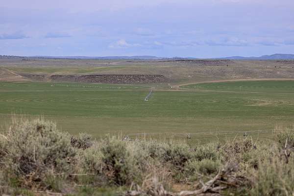
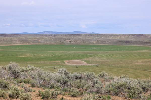
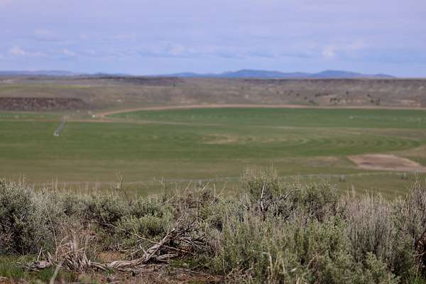
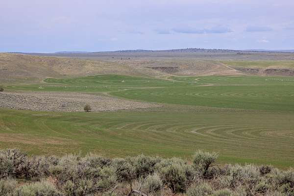
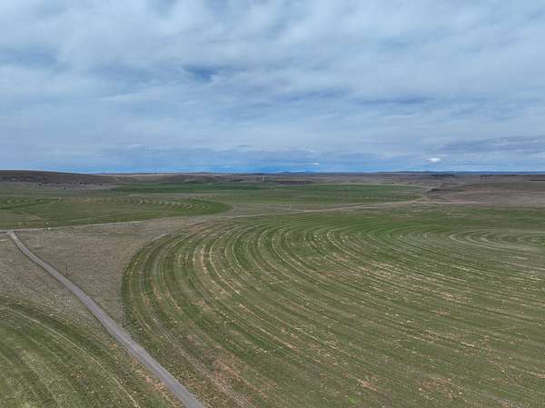
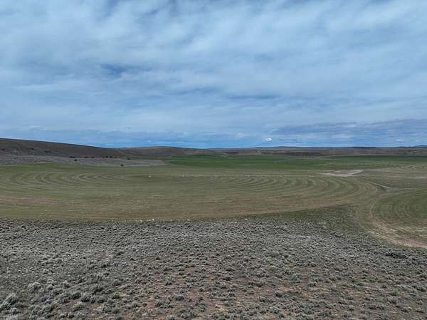
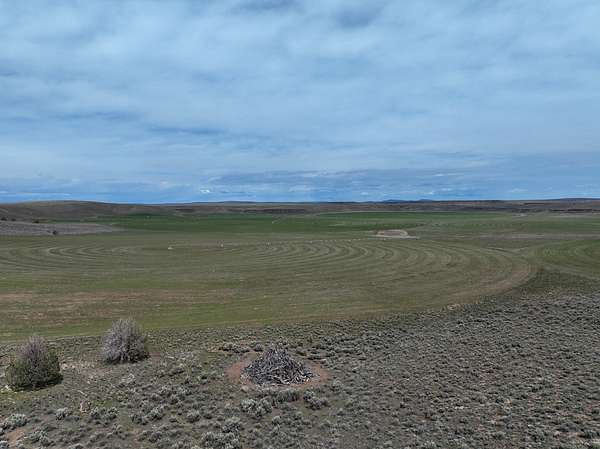
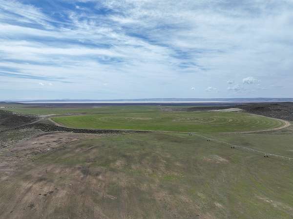
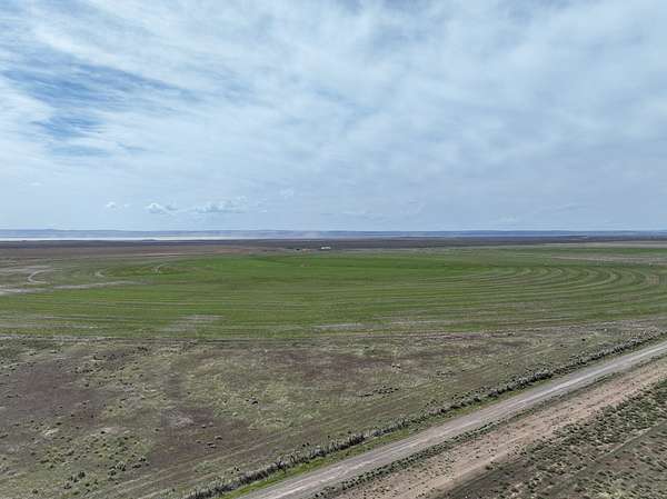
Silver Sage Farm is an eastern Oregon outfit nestled in the high desert of Harney County approximately 25 miles south of Burns Oregon. Rolling hills with sandy loam make up the terrain for this large operation as it is located in some of the highest yields for hay production per acre in the region.
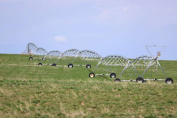
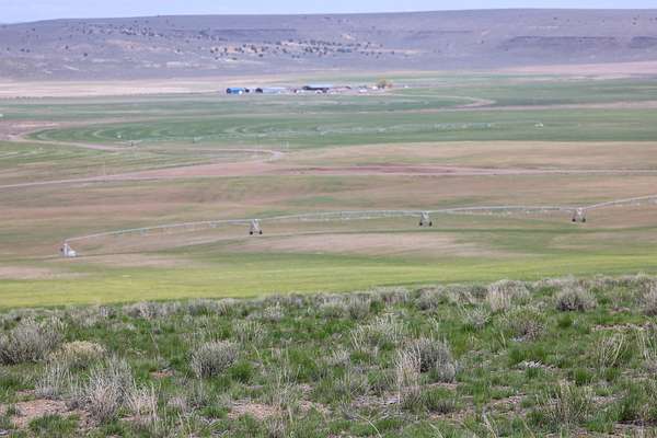
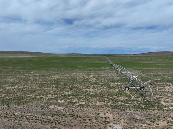
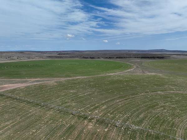
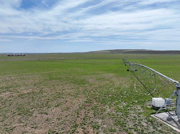
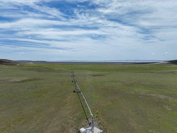
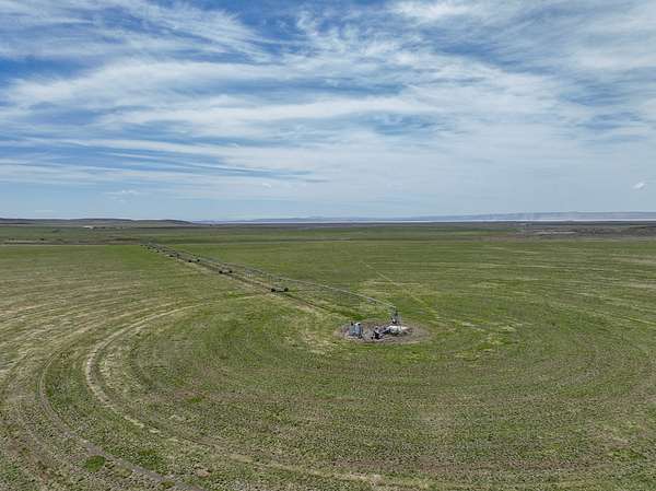
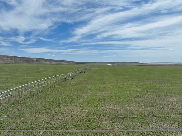
The farm consists of almost 5,000 continuously deeded acres. Of that acreage, 2,743+/- acres are irrigated under 35 pivots that currently are certified organic. The Seller is willing to consider purchasing back 10,000 tons of Organic hay annually.
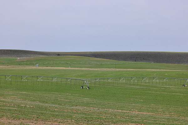
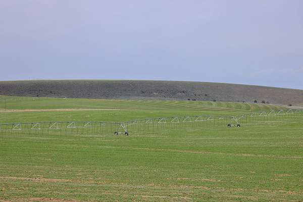
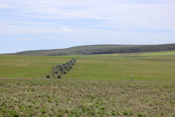
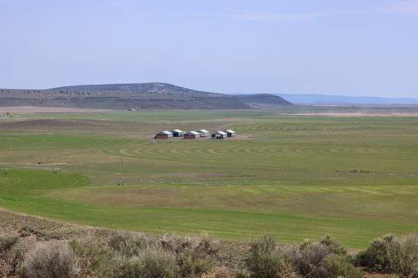
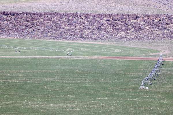
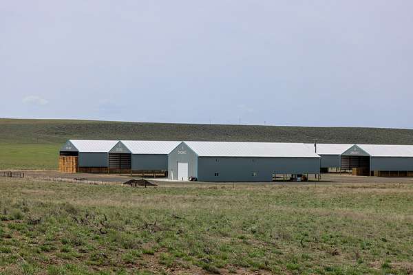
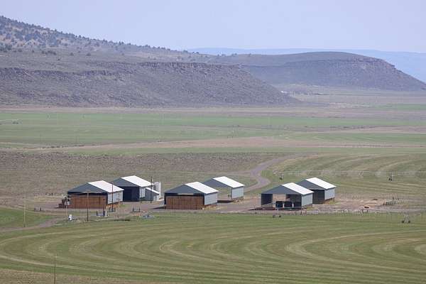
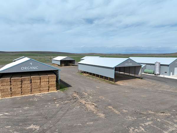
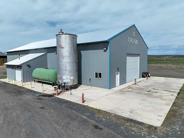
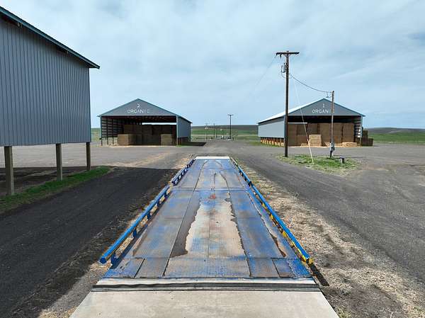
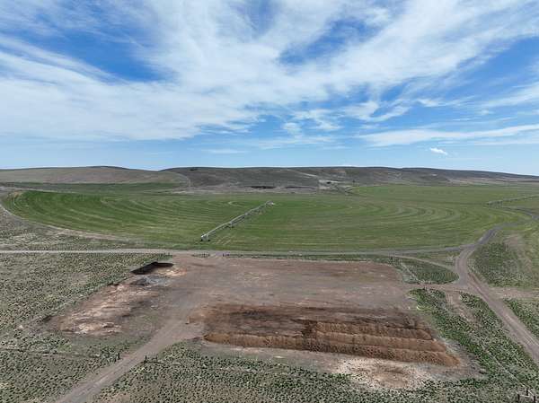
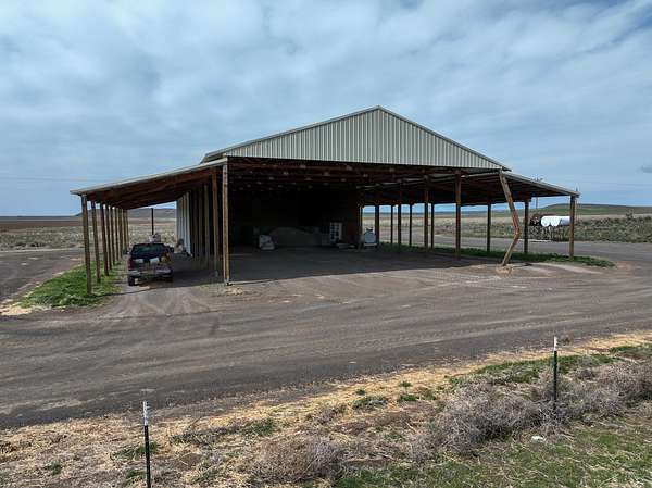
Most of the irrigation system is interconnected with mainlines making it easy to push water around to different pivots. This farm has 5 newer large hay sheds, 60-ton truck scales, shop/commodity, and fuel located in the central part of the farm for easy access. Also centrally located is a large cinder pit that is use for roads, hay pads, and pivot tracks.
Located off a paved county-maintained road that dead ends at the property entrance. Within 20 minutes of the farm, one can export in any direction off 4 major highways: Hwy 20, Hwy 78, Hwy 205, & Hwy 395. The farm is also located roughly 5 hours from hay press facilities in Boardman, Junction City, & Aurora to export hay overseas.
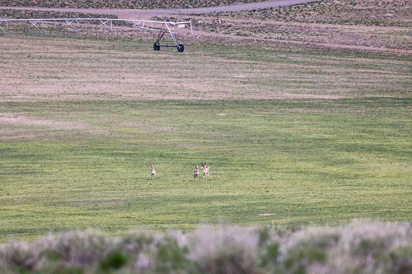
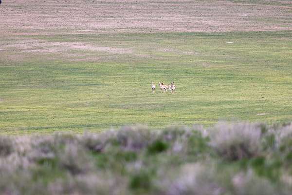
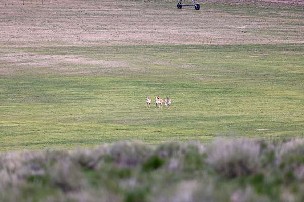
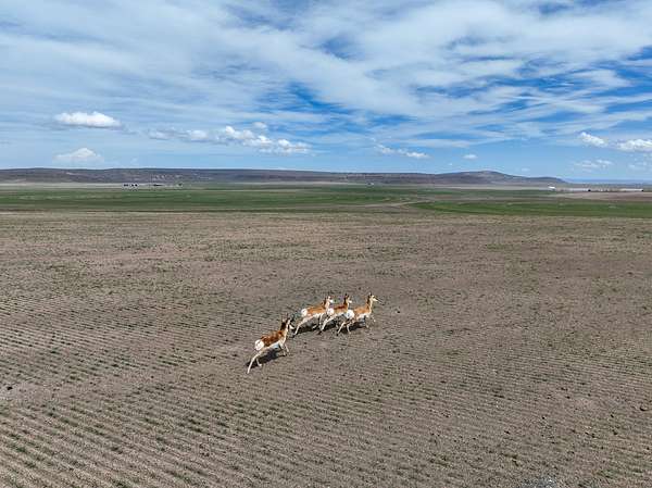
The land is home to all types of wildlife. With the continuous acreage, the land allows landowner preference tags for hunting. Mule deer, antelope, & elk are seen throughout the area grazing pivots as they are highly attracted to the feed. Several other animal species such as bald eagles, hawks, coyotes, & more can be seen throughout the year.
The land is perimeter fenced with cross fencing throughout. Silver Sages location along with the current infrastructure in place creates an extremely large operation for the area.
IMPROVEMENTS
Hay storage facilities which consist of 5 newer large sheds, shop/commodity, fueling station, and 60 Ton truck scales are in the center of the farm. There is one other older shop/storage shed on the south end of the farm. This farm has very nice road infrastructure and gravel hay pads throughout the farm. There is a nice sized cinder pit to save money & maintain roads, pivot tracks, pads, & areas around the improvements.
IRRIGATION
With over 2,743 acres of water rights nearly every acre is under pivots. Of the 35 pivots, a majority are Zimmatic but range in brand, some have LESA systems. A large portion of the pivots are tied into the same mainlines with existing wells & some sections have variable frequency drives making it easy to move water around. The majority of the fields are in alfalfa or triticale.
ACREAGE:
4,958.7+/- Total Deeded Acres consisting of:
- 2,721.72+/- Irrigated under pivots
- 2,219+/- Native pasture, pivot corners, dryland
- 23.08+/- Acres with improvements
IRR. EQUIPMENT: 48 Pivots
WATER RIGHTS:
Acres Permit # Certificate Priority Date
150 G-5287 95739 Oct. 21, 1970
304.6 G-9419 95738 April 10, 1981
393.5 G-12841 95656 July 20, 1995
393.6 G-16165 96174 May 16, 2005
273.8 G-16165 96175 Feb. 21, 2006
400 G-17987 95740 Dec. 17, 2007
37.6 G-17991 95742 Nov. 24, 2008
434.62 G-17992 95743 March 10, 2011
355.9 G-17990 95741 June 7, 2012
IMPROVEMENTS:
- 1973 Shop/storage building - 3,200 sq ft
- (5) Hay Sheds 2016/2017 - 6,480 sq ft
- Shop/Commodity Building - 6,864 sq ft
- Cinder Pits
- 60 Ton Truck Scales
UTILITIES:
Power - Harney Electric Coop
Water/Sewer - Wells & private septic
Internet - Starlink
TAXES: $48,076
Location
- County
- Harney County
- Elevation
- 4,137 feet
Property details
- Acreage
- 4,959 acres
- Posted
Listing history
| Date | Event | Price | Change | Source |
|---|---|---|---|---|
| Dec 10, 2025 | New listing | $9,750,000 | — | Listing agent |
| Oct 30, 2025 | Listing removed | $9,750,000 | — | Listing agent |
| Aug 14, 2025 | Price drop | $9,750,000 | $2,250,000 -18.8% | Listing agent |
| May 5, 2025 | Price drop | $12,000,000 | $1,000,000 -7.7% | Listing agent |
| Apr 28, 2025 | Price drop | $13,000,000 | $1,000,000 -7.1% | Listing agent |
| Apr 8, 2025 | Price drop | $14,000,000 | $1,000,000 -6.7% | Listing agent |
| Dec 4, 2024 | Price drop | $15,000,000 | $500,000 -3.2% | Listing agent |
| Nov 20, 2024 | Price drop | $15,500,000 | $1,000,000 -6.1% | Listing agent |
| Nov 6, 2024 | Price drop | $16,500,000 | $1,000,000 -5.7% | Listing agent |
| Oct 23, 2024 | Price drop | $17,500,000 | $1,000,000 -5.4% | Listing agent |
| Oct 2, 2024 | Price drop | $18,500,000 | $5,300,000 -22.3% | Listing agent |
| July 7, 2024 | Price drop | $23,800,000 | $10,200,000 -30% | Listing agent |
| Apr 18, 2024 | New listing | $34,000,000 | — | Listing agent |