
Recreational Land for Sale in Lyons, Colorado
3600 Blue Mountain Trl, Lyons, CO 80540
RARE MOUNTAIN OPPORTUNITY OVERLOOKING CARTER LAKE — NEW PRICE $699,000
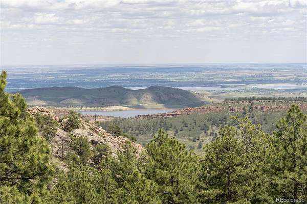
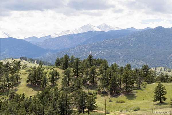
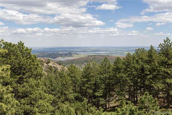
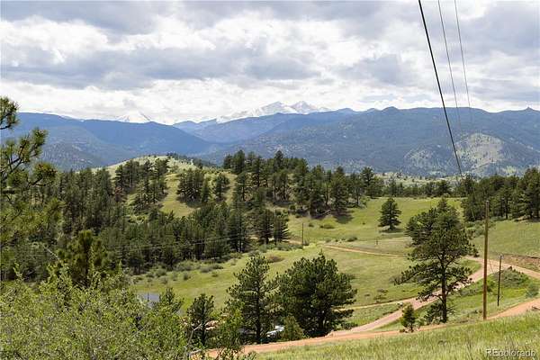
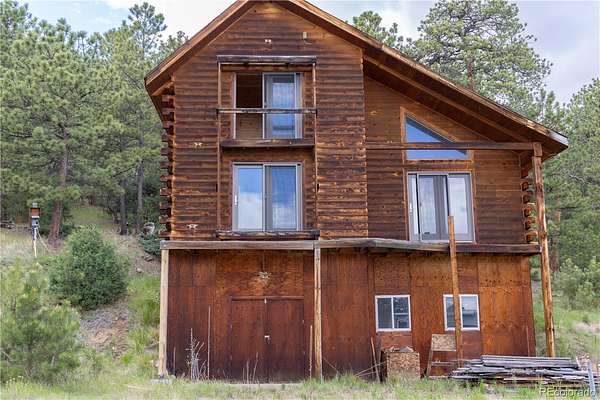
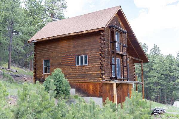
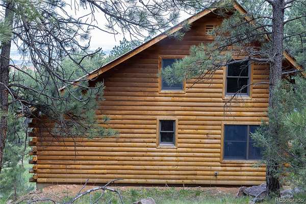
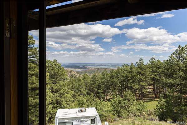
Rare Northern Colorado mountain land — now at $699,000. An extraordinary improved land opportunity on the Colorado Front Range: 84.83 acres overlooking Carter Lake, offered as two adjoining parcels in Lyons, Colorado.
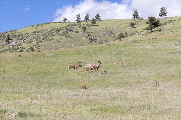
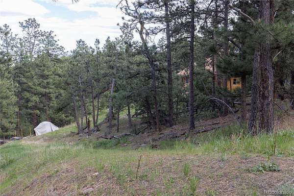
Parcel #0417000004 (60 acres) and Parcel #0417000010 (24.83 acres) deliver panoramic views of Carter Lake, the new dam project lake, rolling meadows, a seasonal pond, and historic 1800s homestead ruins. Envision a legacy mountain estate, family compound, private hunting retreat, or long-term land investment — the scale, infrastructure, and setting are all here.
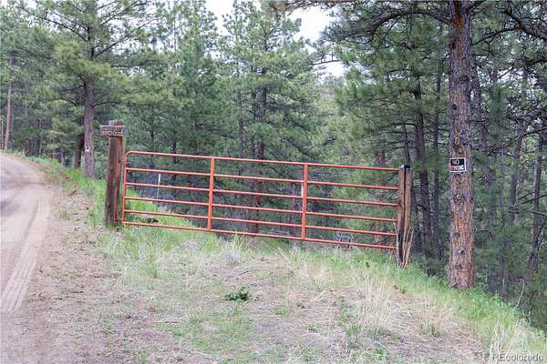
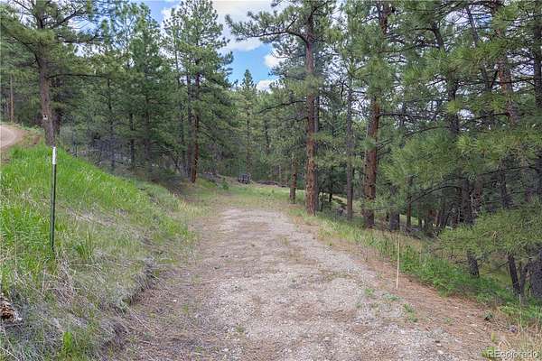
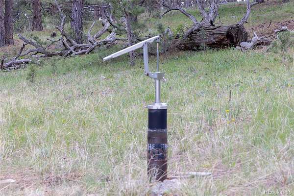
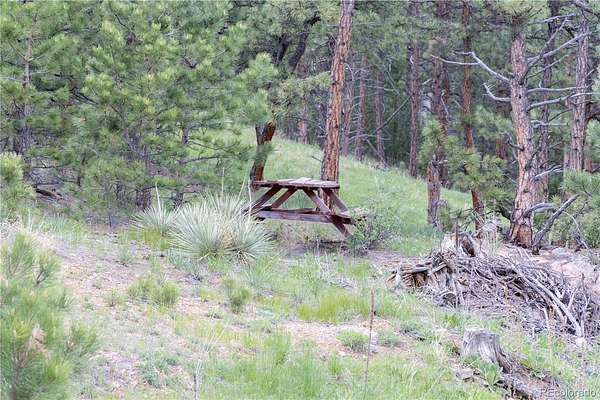
Fully improved and build-ready: connected electricity on-site, permitted & approved well, septic tank and leach field installed (not connected), direct BLM border, and only two private neighbors for true seclusion. As private land, enjoy hunting, hiking, horseback riding, and recreational vehicle use.
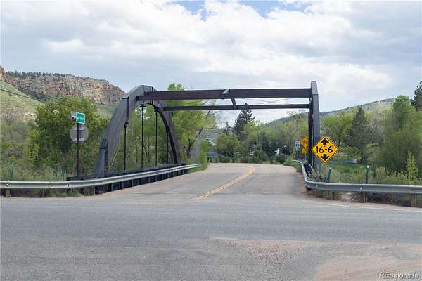
Minutes from Lyons, short drive to Loveland and Estes Park, easy access to Rocky Mountain National Park. Carter Lake — premier Northern Colorado boating, fishing, and camping — is your front-yard view.
Seller financing available to qualified buyers. Cash offers also welcome. Contact listing agent for terms.
- Listed by Dawn Rowell, (720) 301-1476, Real Broker
Location
- Street address
- 3600 Blue Mountain Trl
- County
- Larimer County
- Zip code
- 80540
- Community
- Blue Mountain Estates
- School district
- Thompson R2-J
- Elevation
- 6,526 feet
Property details
- Acreage
- 84.83 acres
- Zoning
- O
- Access
- Private road
- MLS #
- REcolorado 2551061
- Posted
Property taxes
- 2025
- $4,455
Parcels
- 95009495
Legal description
Parcel A:
The NE1/4 NW1/4 of Section 17, Township 4 North, Range 70 West of the 6th P.M. and the S1/2 of the
NW1/4 except a tract of land located in the S1/2 of the NW1/4, Section 17, Township 4 North, Range 70
West of the 6th P.M., said tract being more particularly described as follows:
Beginning at the W 1/4 Corner of said Section 17 from whence the Northwest Corner of said Section
bears N00°32'15"W, 2766.36 Feet and with all other bearings contained herein relative thereto; thence
N00°32'15"W, 680.06 Feet; thence S85°24'04"E, 2567.42 Feet to a Point on the East line of the NW1/4,
Section 17; thence S01°22'58"E, 681.04 Feet along said East line to the Southeast Corner of said S1/2
of the NW1/4, Section 17; thence N85°24'04"W, 2577.50 Feet along the South line of said S1/2 of the
NW1/4 to the Point of Beginning as evidenced by Warranty Deed recorded February 17, 1995 at
Reception No. 95009495.Parcel B:Together with the right to use and subject to a non-exclusive Easement as Recorded May 28, 1991
Details and features
Listing
- Type
- Land
- Subtype
- Improved Land
- Ownership
- Individual
- Terms
- Cash, Owner Will Carry
- Exclusions
- None
- Possession
- Immediate
Lot
- Road Frontage
- Private Road
- Road Surface
- Gravel
- Road Responsibility
- Private Maintained Road
- View
- Lake, Mountain(s)
- Well Type
- Operational
- Well Usage
- Domestic
- Well Permits
- 243716
- Features
- Borders National Forest, Mountainous, Rock Outcropping
Exterior
- Parking
- Unpaved
Structure
- Water
- Well
- Sewer
- Septic Tank
Property utilities
| Category | Type | Status |
|---|---|---|
| Power | Grid | Available |
| Sewage | Septic System | Available |
| Water | Private Well | Available |
Listing history
| Date | Event | Price | Change | Source |
|---|---|---|---|---|
| June 25, 2026 | Under contract | $699,000 | — | REcolorado |
| Apr 19, 2026 | New listing | $699,000 | — | REcolorado |
Payment calculator
Based on information submitted to the MLS GRID as of July 18, 2026 7:00 am MT. All data is obtained from various sources and may not have been verified by broker or MLS GRID. Supplied Open House Information is subject to change without notice. All information should be independently reviewed and verified for accuracy. Properties may or may not be listed by the office/agent presenting the information. Some IDX listings have been excluded from this website. View more