Residential Land for Sale in Horseshoe Beach, Florida
4 Main St, Horseshoe Beach, FL 32648
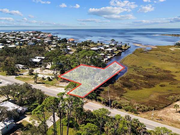
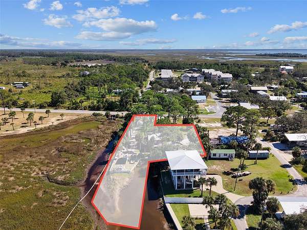
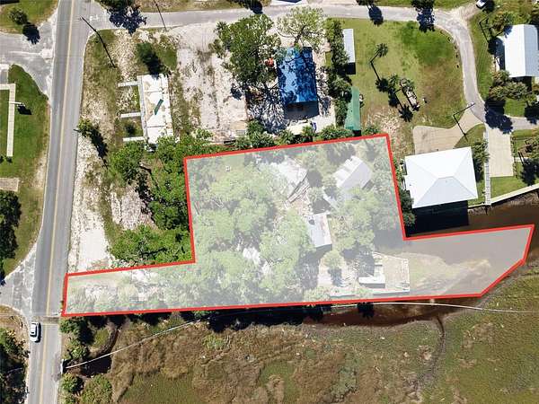
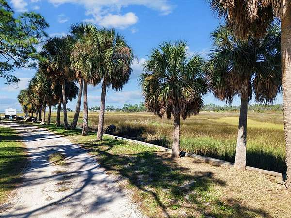
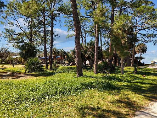
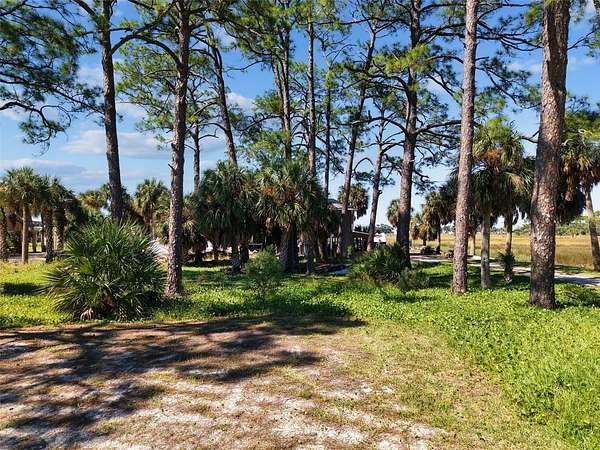
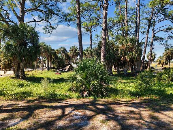
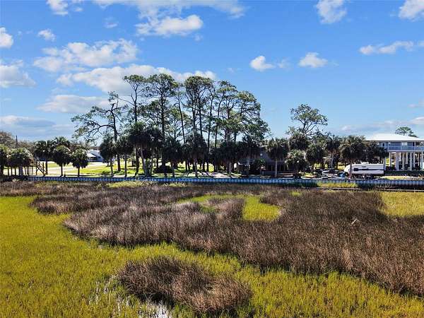
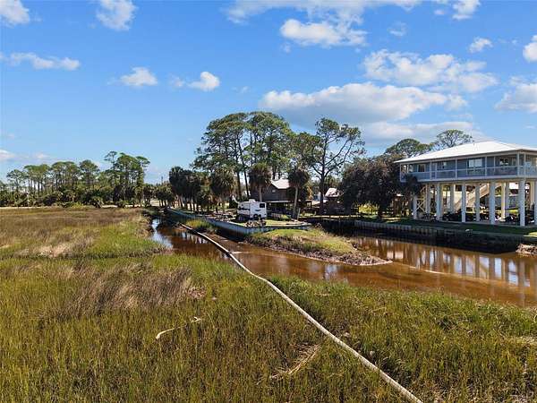
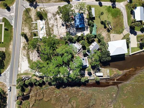
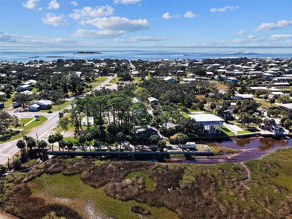
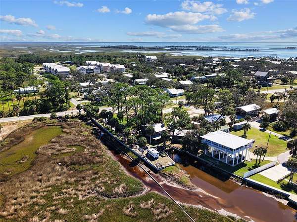
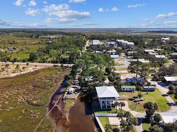
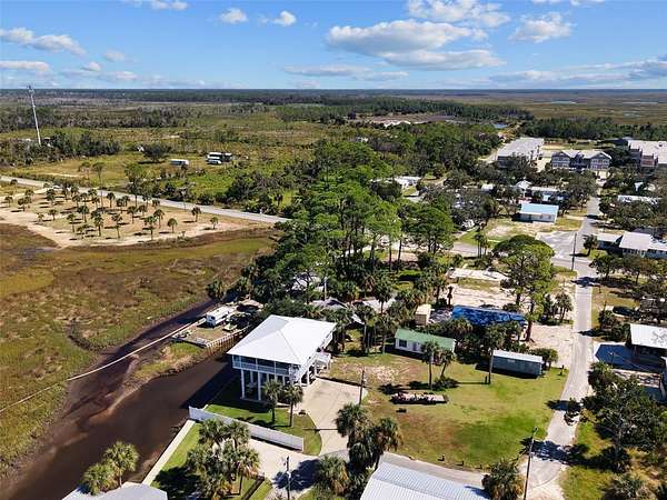
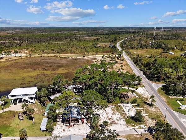
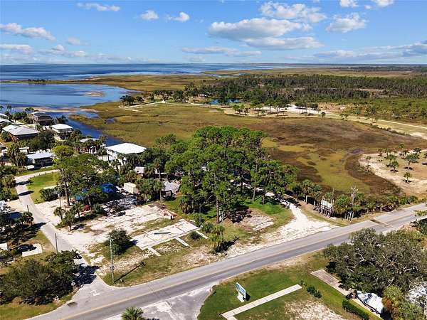
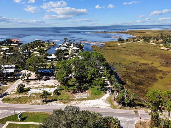
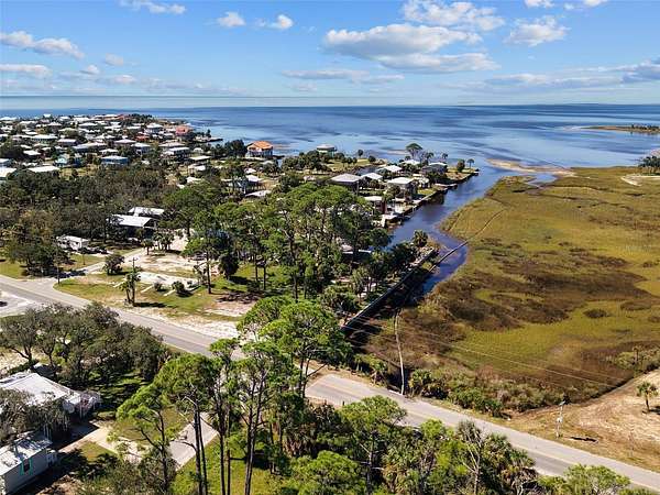
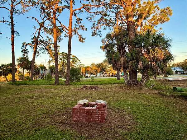
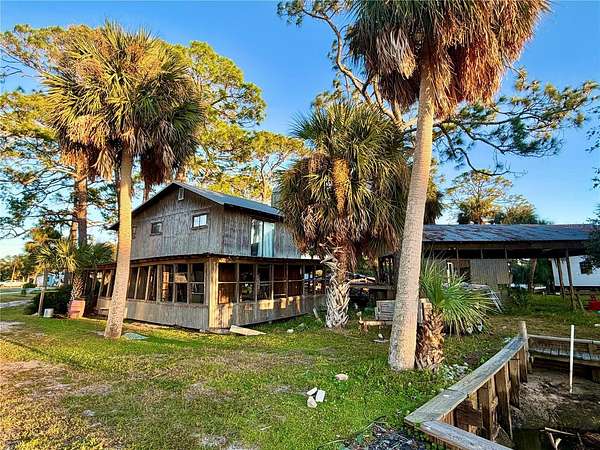
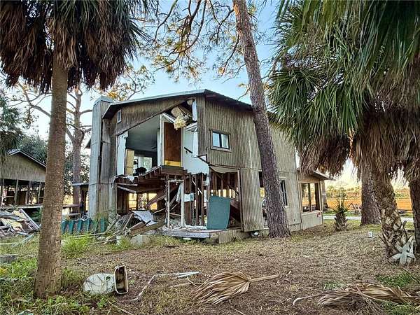
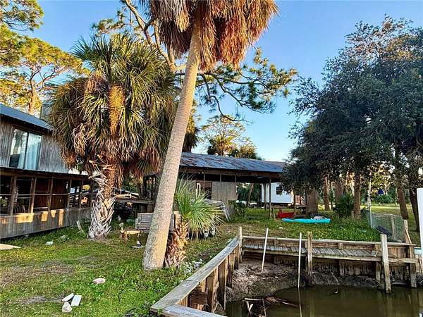
INCREDIBLE GULF-ACCESS WATERFRONT OPPORTUNITY IN HORSESHOE BEACH, FLORIDA with the absolute BEST VIEW in HORESHOE! Discover the possibilities with this unique 0.654-acre waterfront property featuring approximately 400 feet of canal frontage with direct access to the Gulf of Mexico! With an existing sea wall along the canal, beautiful mature palm trees, and a spacious layout, this property offers tremendous potential for someone looking to create their own piece of coastal paradise. Located in the charming fishing village of Horseshoe Beach, known for its laid-back Old Florida atmosphere, this coastal community is a favorite destination for boating, fishing, scalloping, kayaking, and enjoying breathtaking Gulf sunsets. Situated along Florida's beautiful Nature Coast between the Suwannee and Steinhatchee , Horseshoe Beach offers a peaceful escape from the hustle and bustle while providing access to some of the Gulf Coast's most loved outdoor activities. Whether you're dreaming of a waterfront retreat or exploring an investment opportunity, this property offers an exciting chance to bring your vision to life! Property will require cleanup , there is a home in place that was damaged from the hurricanes and is being sold AS IS. Bring your imagination and discover the possibilities of owning waterfront property in Horseshoe Beach!
Location
- Street address
- 4 Main St
- County
- Dixie County
- Zip code
- 32648
- Community
- Horseshoe Beach 2nd Add
- Elevation
- 3 feet
Directions
Heading north on Hwy 19 traveling though Cross City , turn left onto SW Hwy 351 travel several miles until you end in the little costal town of Horseshoe Beach, as soon as you enter town see property on the right. FOLLOW SIGNAGE.
Property details
- Lot size
- 0.65 acres28,314 sq ft
- Zoning
- Resi
- MLS #
- MFRMLS GC544201
- Posted
Property taxes
- 2025
- $3,916
Parcels
- 11-12-10-0532-000-00130
Legal description
11 12 10 LOTS 12 13 14 HORSESHOE BEACH 2ND ADD AN UNREC PLAT (FURTHER DESC IN ORB 87 PG 374 & ORB 91 PG 361) ALSO A WATERFRONT PARCEL DESC AS FOLLOWS; BG AT A FOUND IRON PIPE MARKING THE SE CNR OF GOV LOT 6 FOR THE POC; THENCE N 02 25 54" W ALNG THE E LN OF GOV LOT 6 A DISTANCE OF 428.15 FT TO A CON MON; THENCE N 89 05 29" W 489.82 FT TO A SET IRON PN ON THE W R/W LN OF SE 351 HWY FOR THE POB; THENCE N 09 18 56" E ALNG THE R/W LN 17.06 FT; THENCE N 08 30 56" E ALNG SAID R/W LN 18.18 FT TO A SET IRON PN; THENCE DEPARTING SAID R/W LN RN N 85 15 36" W ALNG THE CEN LN OF AN EXISTING TIDAL CREEK 169.60 FT; THENCE N 89 15 33" W ALNG CEN LN OF TIDAL CREEK 136.91 FT; THENCE S 74 29 57" W ALNG CEN LN OF TIDAL CREEK 45.50 FT; THENCE S 15 12 43" W
Details and features
Listing
- Type
- Land
Lot
- View
- Ocean
- Waterfront
- Yes
Structure
- Water
- Public
- Sewer
- Septic Tank
Listing history
| Date | Event | Price | Change | Source |
|---|---|---|---|---|
| Oct 29, 2026 | New listing | $299,900 | — | MFRMLS |