Residential Land for Sale in Twin Lakes, Colorado
437 Juniper Dr, Twin Lakes, CO 81251
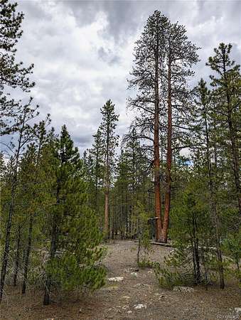
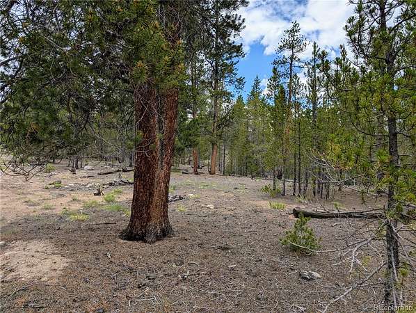
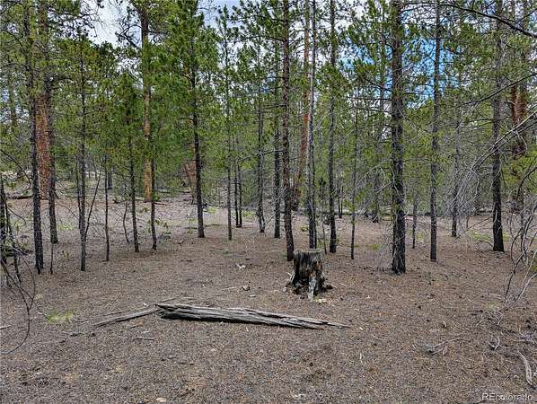
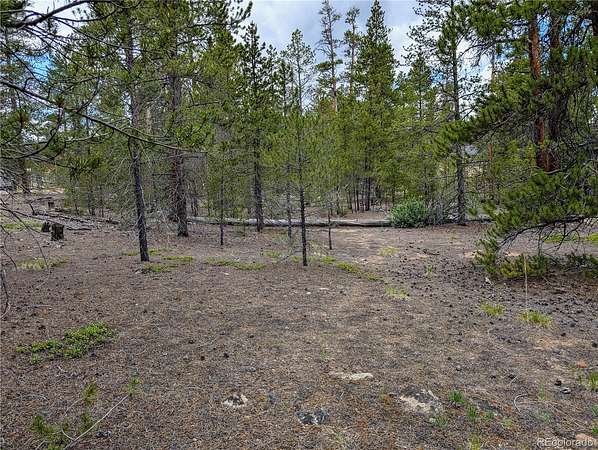
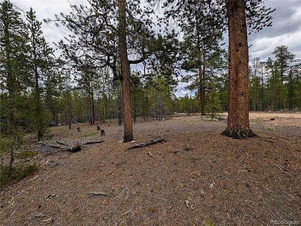
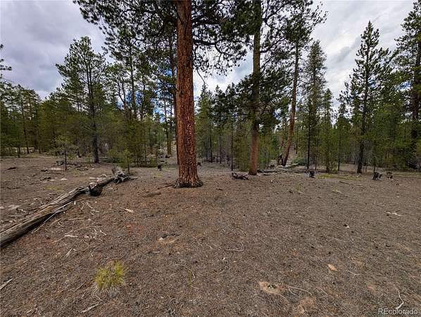
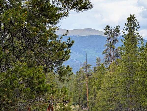
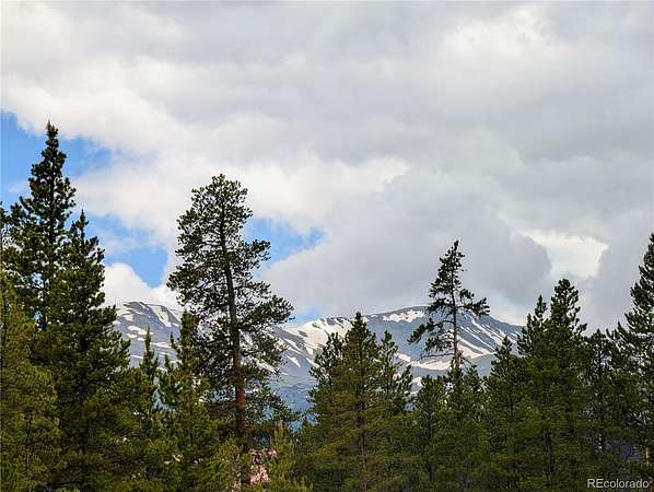
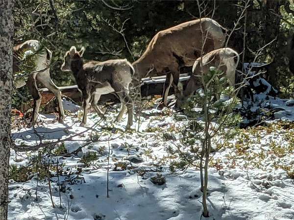
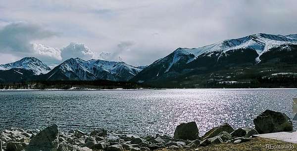
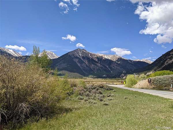
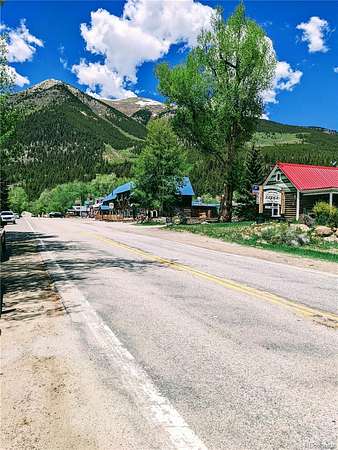
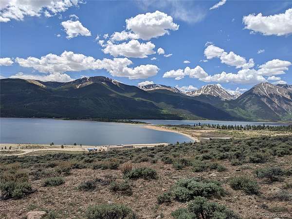
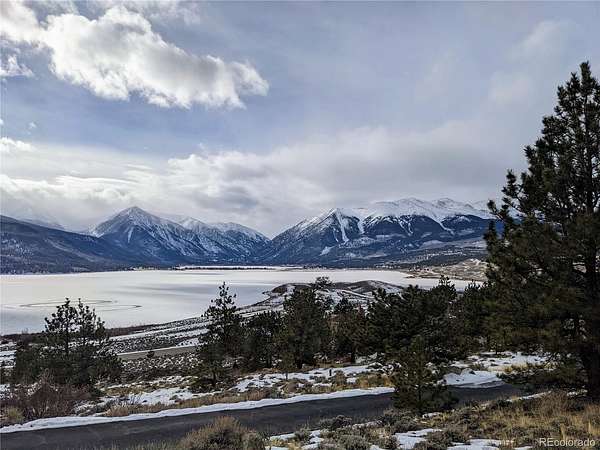
THREE AMAZING SOUTH-FACING LOTS. No HOA! Lots of trees. Secluded, yet easy to access all year.This amazing lot is flat & ready to build your dream home. CLOSE TO SKIING: 8 SKI RESORTS WITHIN 60 MILES: Breckenridge, Keystone, Copper Mt, Monarch, Vail, Beaver Creek, A-Basin, Cooper. Only about a half hour to Ski Cooper or Copper Mountain. Epic Ski Passes give you access to multiple ski resorts. This prime location is surrounded by endless recreational opportunities for hiking, skiing, mountain climbing, whitewater rafting, hunting & much more. For Gold Medal fishing, throw in a line at nearby at Twin Lakes or Mount Elbert Forebay. For additional fishing options, Clear Creek Reservoir or Turquoise Lake are only a few minutes further. Near the historic town of Twin Lakes. To the west, Aspen is on the other side of Independence Pass, on top of The Continental Divide, (which is at 12,095 feet elevation). This is one of the highest paved mountain passes in the country & only open in the summertime. Immerse yourself into a true Wild West lifestyle. Lots of wildlife, including Big Horn Sheep, love to hang out here. Water line is near the corner of this parcel. Tap fee has not been paid. Buyers to verify water accessibility & connection fees with MEWA. Buyers to verify costs for electric connections with the power company. https://www.mountelbertwater.org/ This property is part of a municipal taxing district for road maintenance & snow plowing. https://ccgcolorado.com/Buyers to verify building requirements for Lake County. https://www.lakecountyco.com/188/Community-Planning-Development Only 20 minutes to Leadville, 30 minutes to Buena Vista, 2 hours to Denver.
- Listed by Jo Reese, (719) 966-7711, Full Circle Real Estate Group
Location
- Street address
- 437 Juniper Dr
- County
- Lake County
- Zip code
- 81251
- Community
- Pan Ark
- School district
- Lake County R-1
- Elevation
- 9,632 feet
Directions
GPS Coordinates:
39.10876, -106.33861
From Buena Vista take US-24 W for 25.5 miles. Turn left, (west), on Hwy 82, turn right on Co Rd 10, and go 2.4 miles. Take a slight left to stay on Co Rd 10, and go 1.0 mile. Continue straight on Cedar Dr and go 0.4 miles. Take a right on Birch Dr. Take Birch Drive to Gold Dr. and turn left. Turn left on Juniper and the parcel will be on the left.
From Leadville, take US-24 W for 8.2 miles. Turn right onto Co Rd 10, and go for 2.4 miles. Take a slight left to stay on Co Rd 10 and go for 1.0 miles. Continue straight onto Cedar Dr and go for 0.4 miles. Take a right onto Birch Dr. Take Birch Drive to Gold Dr. and turn left. Turn left on Juniper and the parcel will be on the left.
Property details
- Lot size
- 0.9 acres39,204 sq ft
- Zoning
- Residential
- MLS #
- REcolorado 6310229
- Posted
Property taxes
- 2022
- $821
Parcels
- 290109002170
Legal description
LOTS 362, 363, AND 364, MT ELBERT PLAMOR RANCH 1C, detailed legal description to be verified by title company
Details and features
Listing
- Type
- Land
- Subtype
- Unimproved Land
- Ownership
- Individual
- Terms
- Cash, Conventional, VA Loan
- Exclusions
- Sellers Personal Property
- Possession
- Closing/DOD
Lot
- Vegetation
- Natural State, Wooded
- Road Frontage
- Year Round
- Road Surface
- Dirt
- Road Responsibility
- Private Maintained Road
- Features
- Many Trees, Mountainous
Listing history
| Date | Event | Price | Change | Source |
|---|---|---|---|---|
| July 8, 2026 | Price drop | $129,900 | $10,000 -7.1% | REcolorado |
| Apr 19, 2026 | New listing | $139,900 | — | REcolorado |
Payment calculator
Based on information submitted to the MLS GRID as of July 20, 2026 11:00 pm MT. All data is obtained from various sources and may not have been verified by broker or MLS GRID. Supplied Open House Information is subject to change without notice. All information should be independently reviewed and verified for accuracy. Properties may or may not be listed by the office/agent presenting the information. Some IDX listings have been excluded from this website. View more