
Land for Sale in Montrose, Colorado
61067 Hwy-50, Montrose, CO 81401
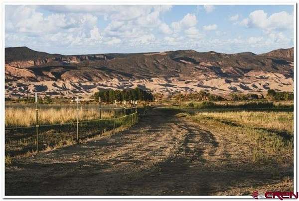
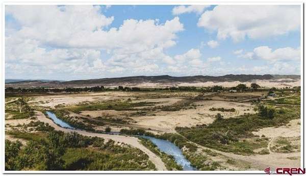
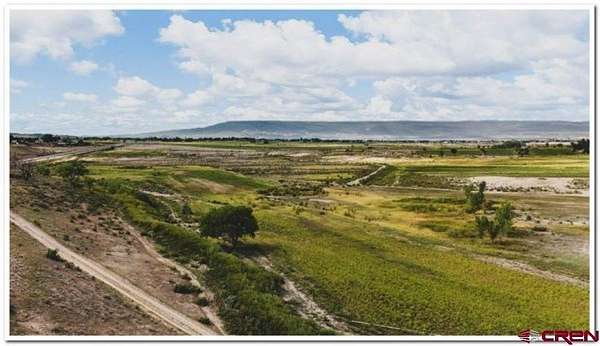
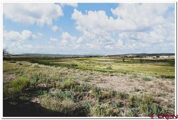
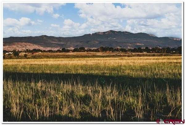
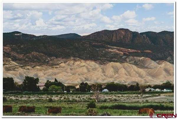
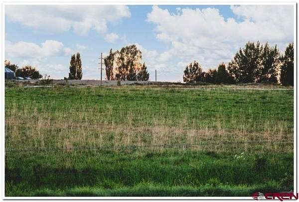
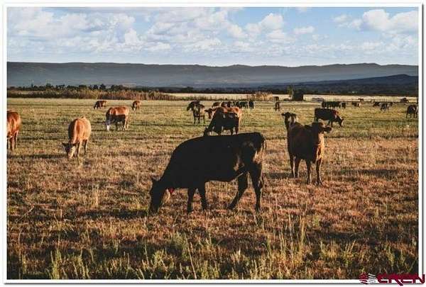
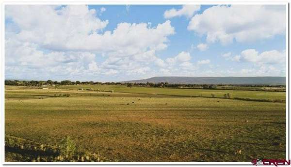
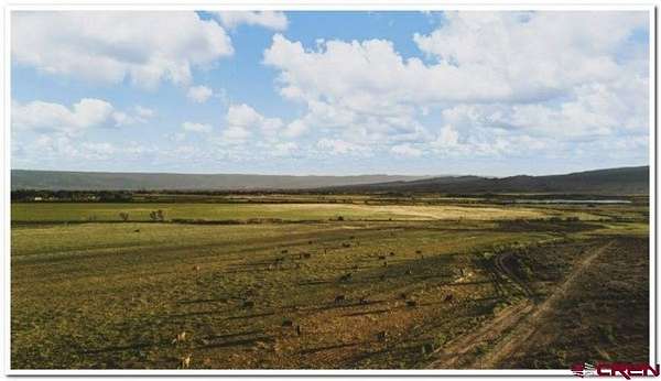
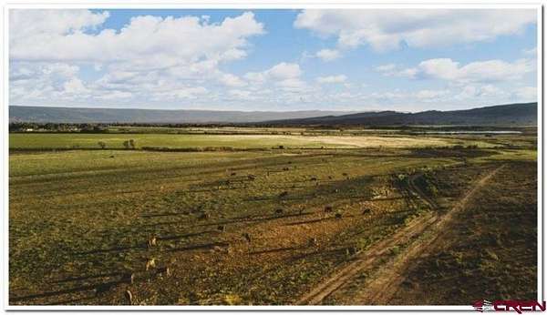
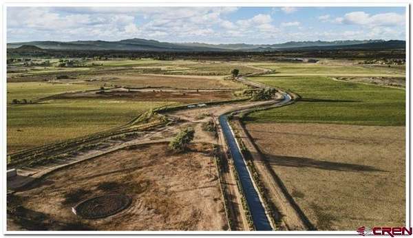
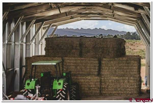
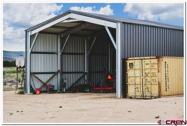
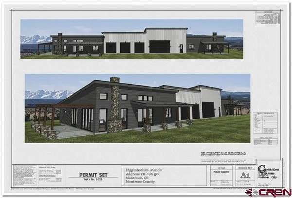
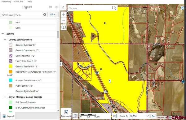
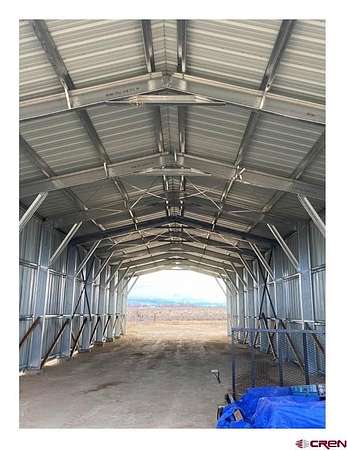
Colleen Aller, Keller Williams Realty Southwest Associates, LLC - Montrose, C:,,: Discover an unparalleled opportunity to own a 465+-acre Wagyu cattle ranch in the heart of Montrose, Colorado. This exceptional property combines top-tier agricultural infrastructure with stunning natural beauty, making it an ideal investment for ranching enthusiasts and those looking to build their dream home. Key Features:465+- Acres of Prime Ranch Land: This expansive property offers 200 irrigated acres, with 220 shares of water rights ensuring ample irrigation. The irrigation system has been fully upgraded to gated pipe for maximum efficiency.Permitted House Plans & Home Site: The property comes with permitted house plans and in-ground utilities, ready for the construction of a state-of-the-art duplex "Barndominium". The home site boasts unobstructed views of the San Juan Mountains to the south and Grand Mesa to the north.Fencing: The entire property is fenced and cross-fenced with four-strand fencing, all of which has been meticulously tuned up, ensuring the security and management of your livestock.Brand New Hay Barn: A newly constructed hay barn provides ample storage space, conveniently located near the home site with breathtaking mountain views.Utilities: The property is equipped with five City of Montrose water taps, and electricity and internet are provided by DMEA, offering modern conveniences in a rural setting.Zoning: Zoned for residential use, with a small commercial island that historically operated as a dairy, this property offers a unique blend of agricultural and residential potential.Prime Location: Situated just five miles north of the newly expanded Montrose Regional Airport, this ranch provides easy access to transportation while maintaining the tranquility of a rural lifestyle.This Wagyu cattle ranch is a rare gem in Montrose, offering a perfect blend of functionality, modern amenities, and breathtaking scenery. Whether you're looking to expand your ranching operations or build a luxury home in one of Colorado's most beautiful regions, this property is ready to exceed your expectations.Don't miss this unique opportunity-contact us today to schedule a private tour and explore the endless possibilities this ranch has to offer.
Location
- Street address
- 61067 Hwy-50
- County
- Montrose County
- Zip code
- 81401
- Elevation
- 5,623 feet
Directions
From Main and Townsend, travel North on Hwy 50 for 5.2 miles. Turn right on the frontage road. Go approx .5 miles past the Rainmaker and turn right at the road with no signs. I know these are horrible directions. Go another .5 miles until you cross the cement canal. Primary access is just past the canal on the right. This is the northern most boundary. There are other access points on the Jay Jay and 6200 rd. DO NOT ACCESS THIS PROPERTY WHEN IT IS WET. YOU WILL GET STUCK.
Property details
- Acreage
- 465 acres
- MLS #
- CREN 817117
- Posted
Details and features
Listing
- Type
- Farm
- Franchise
- Keller Williams Realty
Nearby schools
| Name | Type |
|---|---|
| Olathe 6-8 | Middle |
Listing history
| Date | Event | Price | Change | Source |
|---|---|---|---|---|
| Apr 29, 2026 | Price drop | $2,495,000 | $295,000 -10.6% | CREN |
| Oct 11, 2025 | Price drop | $2,790,000 | $100,000 -3.5% | CREN |
| July 10, 2025 | Price drop | $2,890,000 | $541,000 -15.8% | CREN |
| Feb 11, 2025 | Price drop | $3,431,000 | $544,000 -13.7% | CREN |
| Aug 16, 2024 | New listing | $3,975,000 | — | CREN |