Land for Sale in Cedarpines Park, California
787 Burnt Cedarpines Park, CA 92322
Images
Map
Street


$13,700
0.08 acres
Active sale$800 dropEst $134/mo
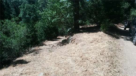
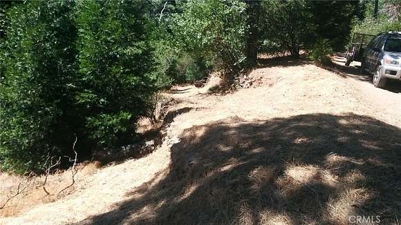
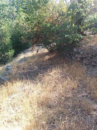
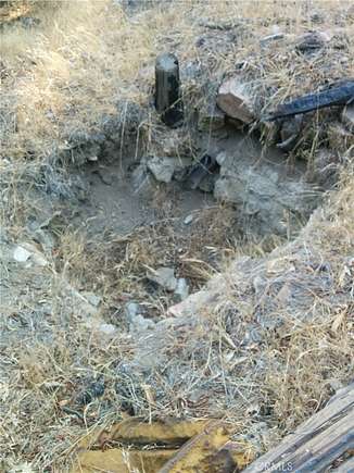
THIS IS A LAND LISTING LOT SIZE IS 3,480 SQ. PROPERTY IS ZONED CF/RS-1 THIS WAS THE SITE OF A CABIN BUILT IN THE 1920'S WITH LOTS OF STONE WALLS AND REMEANTS REMAINING. THERE IS MATURE TALL SHADE TREES FROM THE PROPERTY, YOU CAN HEAR THE FLOWING WATER OF THE NEARBY YEAR-ROUND CREEK. THERE IS CELL RECEPTION IN THE AREA. PROPERTY IS VERY CLOSE TO THE NATIONAL FOREST BOUNDARY WITH MILES OF DIRT ROADS TO EXPL0RE WITH OFF ROAD VEHICLES OR USE OF HORSES, AREA IS A VERY QUIET AND PRIVATE.
Directions
FROM SAN BERNARDINO FREEWAY TAKE 18 FREEWAY TO BURNT MILL ROAD STRAIGHT NORTH TO 787 BURNT MILL, CEDARPINES PARK 92322
Location
- Street Address
- 787 Burnt
- County
- San Bernardino County
- Community
- Cedar Pines Park (CEPP)
- Elevation
- 4,488 feet
Property details
- Zoning
- CF/RS-1
- MLS Number
- MRMLS EV23021099
- Date Posted
Parcels
- 0343013140000
Detailed attributes
Listing
- Type
- Land
- Franchise
- Realty ONE Group
Lot
- Views
- Mountain
Exterior
- Features
- Valley Community Features Included
Listing history
| Date | Event | Price | Change | Source |
|---|---|---|---|---|
| Aug 8, 2023 | Price drop | $13,700 | $800 -5.5% | MRMLS |
| Feb 10, 2023 | New listing | $14,500 | — | MRMLS |
Payment calculator
Contact listing agent
By submitting, you agree to the terms of use, privacy policy, and to receive communications.