


Improved Recreational Land for Sale in Gulnare, Colorado
Las Animas County, Gulnare, CO 81020
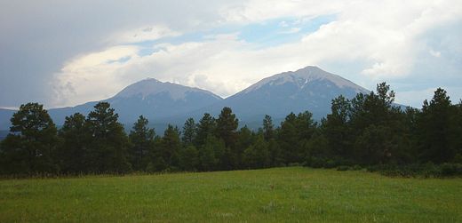
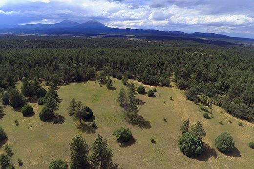
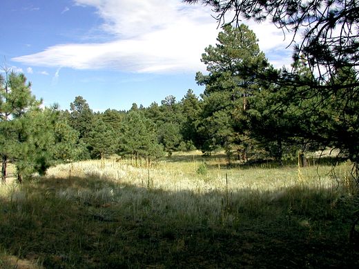
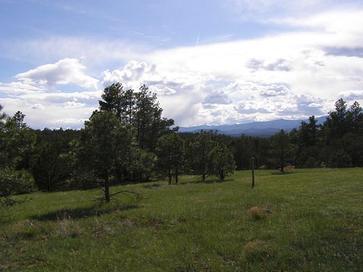
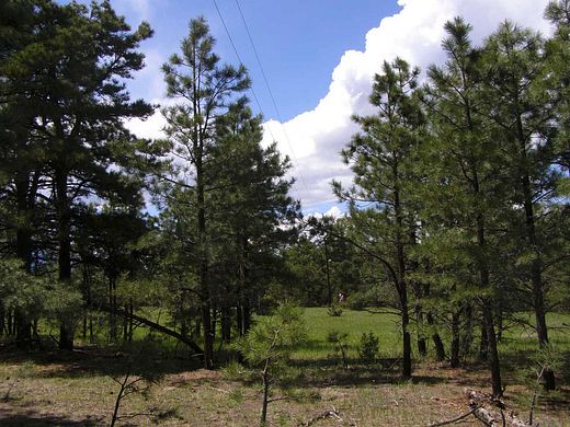
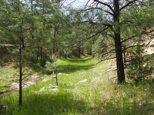
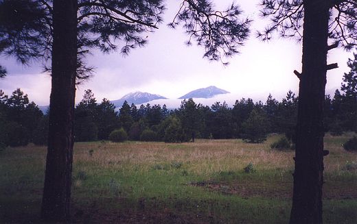
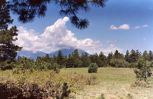
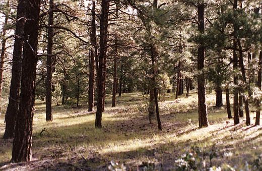
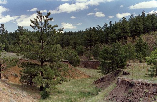
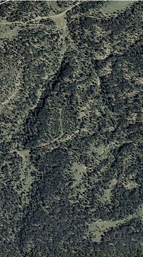
This 264+ acres is composed of five contiguous tracts in the southeastern quadrant of the Apishapa River Ranch, which is just two miles east of Gulnare, Colorado on County Road 44.0. Total combined acres is 264.346 (specifically) of very attractive native Colorado Ponderosa pine forest & scattered meadows & valleys, with an occasional spring fed flow in one canyon/valley in wetter times (late Spring & in the early Fall). This is very high quality forested land. I have been all over Las Animas county in years past and this is a very small section of the best land in that county, i.e. just a few miles tall by about four miles or so wide. Elevations are roughly between 7000' and 7200'. Southern Colorado has noticeably milder winters than further north and road access is generally 365 days a year with very few short exceptions. Typically, this area gets about 60" of snow a year with most of that being heavier/wet Spring snows. Once about every 23-24 years roughly, they may have a heavy snow year and get near twice that much snow, but that is very rare.
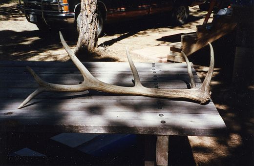
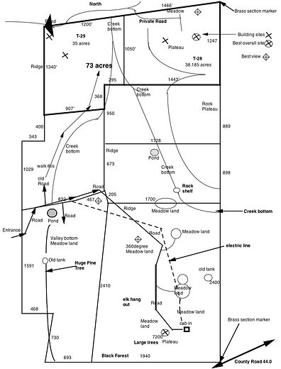
The three northern tracts are roughly 35+ acres each, one is 57.86 (southwest) and one is just over 100 acres (southeast & the highest in elevation, 7200'). My land is about 3/4 mile tall by a 1/2 mile wide in size. Generally, you can not see more than about 100 yards due to the Ponderosa Pine, with a few exceptions (larger valleys & meadows). So it feels quite a bit larger on foot, which is the best way to get around in it. I have intentionally kept the roads to a minimum to keep it in it's native state. I personally have never owned/used an ATV on this land. Some hunters may have occasionally use them get out game over the last couple of years.
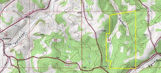
See both the Topo map and my computer drawing map of the details of this land to get an idea of it's layout. The land within the yellow lines on the Topo map is 338 acres. This is the bottom 78+% of the original 338 acres. The north two tracts (73+ acres, tracts 28 & 29) sale has been completed.
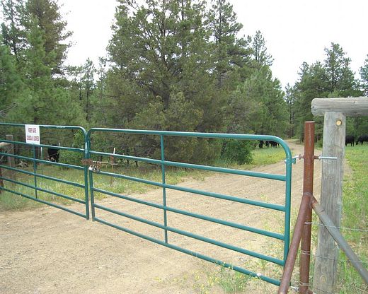
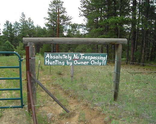
I've installed about 2/3rd of a mile of electric lines that go up to my cabin in the southeast corner from the entrance on the western boundary (Bear Claw Pass). I've also installed about 1000' of wire fencing along the entrance on the west side to keep honest people out. I also have double locked gates there also, shown in 2 pics.
Recently the County paved the road from Gulnare into/through the Apishapa River Ranch, so a paved road (C.R. 44.0) comes to within 3/4 mile of my front gates.
My intent is to Sell all of this land in one transaction for it's entirety, which is accessed by one single entry point (Bear Claw Pass, on western boundary) that provides access to all five of these tracts comprising the 264+ acres.
The current price listed is as of August of 2022. But as the real inflation rate was at least 15% for 2021 and is now 16% for early 2022, (see: John Williams' Shadowstats.com for the REAL US economic data), these prices will continue to rise as the value of the currency continues to decline in value (called inflation). 16% of $1,085,000 is over $173K, which is why all cost are going to appear to rise, but it's really the Foreign/Private Bank's (FED) Fiat currency's value that is rapidly going down (by intent, engineered) that's really causing most ALL of these rising costs. The private/foreign owners of the FED also control all the Western Oil companies & always have.
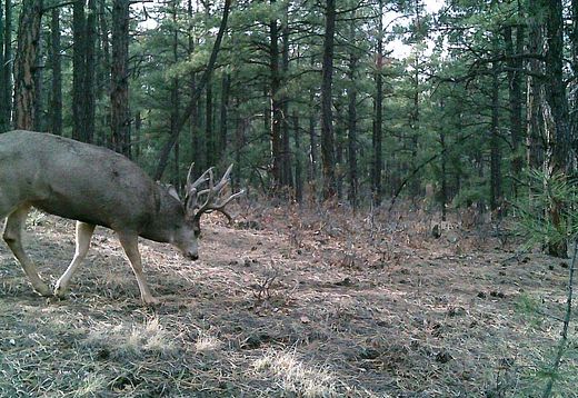
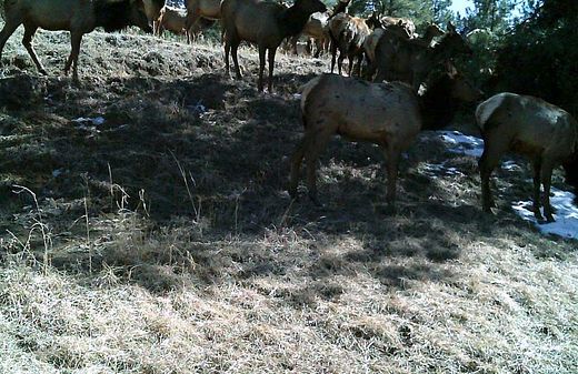
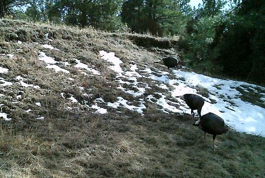
The entire Apishapa River Ranch is leased out for cattle grazing to keep the property Taxes low, which it does. Taxes on the raw land is on the order of $1/acre per year. Improvements are taxed separately. You can fence off any portion of your land that you so choose to (around your house). While there are a few paddocks/small-pastures around, no one to date has fenced off their entire tract. In fact, most owners do not use most of their land, preferring to just leave it in it's "natural state" for the wildlife.
This land has very good panoramic views of the Spanish Peaks & "Sangre de Cristos" (Rocky Mountains). There is also a two Natural Gas wells on my land with one being with an Electric motor & the other could also be electrified, as the electric line is close by. I only own the surface rights. It's eastern & southern boundaries have old livestock barbed wire fence. Some of which may get replaced soon by the eastern neighbor (has about 500 acres) that runs cattle. There is much more info on that issue (NG) & more on my website, linked to on this page as "listing source".
Cash prices only, as we are not a bank, nor willing to act like one. The current US currency, "Federal Reserve Debt Notes" of a completely Private/Foreign Rothschilds' Bank (the FED) will have a very short life before they & it FAILS completely, which is coming. Once the entire Global Financial Systems crashes, payment must be made in US Gold American Eagles. Don't knew when that'll happen, but the time is getting shorter & will probably occur this year. It's been planned for at least 50 years.
Location
- County
- Las Animas County
Directions
Off Interstate 25, there are two exits to Aguilar (west of IH-25) that tie into First Street, which runs north/south on the east side of Aguilar. At the intersection of First Street & Main Street, go west on Main St for four blocks, then turn south/left on San Antonio Ave, which becomes County Road 43.7 as it exits Aguilar heading southwest. Go 9 miles to Gulnare, and turn left just past the Spanish Peaks Inn (restaurant) going east on County Road 44.0. After 2 miles on C.R. 44.0, you'll cross a cattle guard, having entered the Apishapa River Ranch. Continue another 0.7 miles until you come to a road that goes only North off of C.R. 44.0. This is Apishapa Lane. Go north just about half a mile and there is a dog leg in the road to the right. In the middle of that dog leg, before the road straightens back up, there is road that goes east off Apishapa Lane, called Bear Claw Pass, which goes about 450 yards until it dead ends at my western locked double gates. (37.314549,-104.714754).
Property details
- Acreage
- 264.4 acres
- Posted
Listing history
| Date | Event | Price | Change | Source |
|---|---|---|---|---|
| May 19, 2025 | Price drop | $1,000,000 | $200,000 -16.7% | Property seller |
| Oct 1, 2024 | Price drop | $1,200,000 | $200,000 -14.3% | Property seller |
| Sept 13, 2024 | Price drop | $1,400,000 | $50,000 -3.4% | Property seller |
| May 21, 2024 | Price increase | $1,450,000 | $50,000 3.6% | Property seller |
| Mar 28, 2024 | Price increase | $1,400,000 | $25,000 1.8% | Property seller |
| Mar 13, 2024 | Price increase | $1,375,000 | $25,000 1.9% | Property seller |
| Dec 28, 2023 | Price drop | $1,350,000 | $50,000 -3.6% | Property seller |
| Nov 14, 2023 | Price drop | $1,400,000 | $50,000 -3.4% | Property seller |
| Sept 1, 2023 | Price increase | $1,450,000 | $125,000 9.4% | Property seller |
| Aug 15, 2023 | Price drop | $1,325,000 | $50,000 -3.6% | Property seller |
| July 27, 2023 | Price drop | $1,375,000 | $100,000 -6.8% | Property seller |
| Mar 27, 2023 | Price increase | $1,475,000 | $350,000 31.1% | Property seller |
| Aug 12, 2022 | Price increase | $1,125,000 | $40,000 3.7% | Property seller |
| May 27, 2022 | Price drop | $1,085,000 | $227,000 -17.3% | Property seller |
| Mar 10, 2022 | Price increase | $1,312,000 | $30,000 2.3% | Property seller |