Recreational & Residential Land for Sale in Salyersville, Kentucky
Alsept Fork Road Map, Salyersville, KY 41465
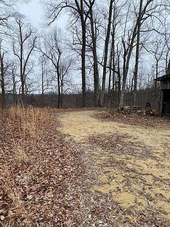
This property offers an opportunity to spend hours and hours of fun hunting, hiking, camping or 4-wheeling. Property is located a good distance from any other residences. Coordinates: 37.704, -83.21454. The property is totally undeveloped: no sewer, water or electricity. There is no water nor electricity nearby; therefore, you would have to look at solar panels or generator for electric or drilled well for water. Mineral rights are unknown; however, you will get whatever the seller owns.
Location
- Street address
- Alsept Fork Road Map, # 009-00-00-006.01
- County
- Magoffin County
- Elevation
- 1,291 feet
Directions
From the intersection of RT 460/114, travel 460 W for 2 miles. At Traffic Light 1 continue straight through on Mt. Parkway for 6.9 miles to Exit 68. At the bottom of the ramp, turn left onto Kernie-Ova-Seitz Road. Go 1.9 miles and turn left by "tiny house" to continue on Kernie-Ova-Seitz Road. Go .9 miles and turn right onto CR 1259. Travel past the Patrick Cemetery on the right to where the road forks. You can take either road to the property. It is at the end of the hollow. Property can also be accessed on at the very end of Puncheon Ck Rd.
Property details
- Acreage
- 52 acres
- MLS #
- EKTAR 128215
- Posted
Resources
Details and features
Listing
- Type
- Land
Exterior
- Features
- Hillside Acreage Included
Nearby schools
| Name | Type |
|---|---|
| North Magoffin | Elementary |
| Herald Whitaker | Middle |
| Magoffin County | High |
Listing history
| Date | Event | Price | Change | Source |
|---|---|---|---|---|
| Mar 20, 2026 | Under contract | $65,000 | — | EKTAR |
| Feb 27, 2026 | New listing | $65,000 | — | EKTAR |