Residential Land for Sale in Mayer, Arizona
Arcosanti Rd Mayer, AZ 86333

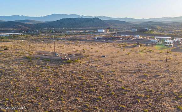

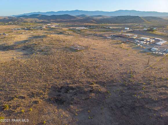

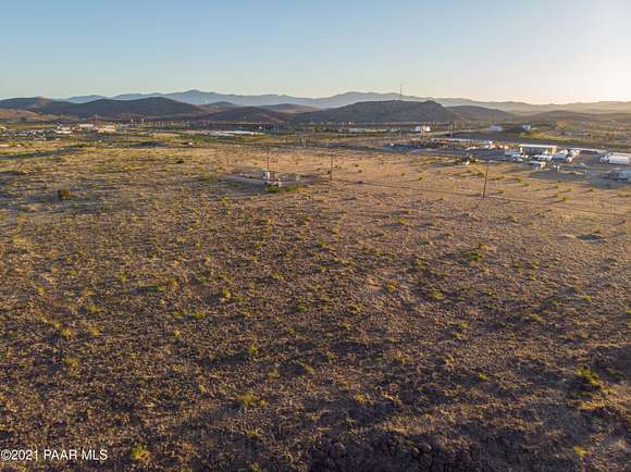


5 aces bordering State land, this lot is currently zoned residential as RCU-2A. Although commercial opportunities exist with nearby parcels including the recent addition of Loves Travel Stop Station, all information should be verified with Yavapai County regarding future plans or zoning changes, variances, etc. Traffic counts are high as I-17 is the main route between Phoenix and Flagstaff and Hwy 69 intersects for the main route to Prescott.
Directions
Highway 69 to Cordes Lakes/Arcosanti Road Exit. Or if on I-17, take exit 263. Once on Arcosanti heading East, continue through stop sign straight onto gravel road. Go toward APS transfer station. Park. To right and north of Transfer station, look for Simon Fort commercial sign designating the Southwest corner of the lot.
Location
- Street Address
- Arcosanti Rd
- County
- Yavapai County
- Elevation
- 3,802 feet
Property details
- Zoning
- RCU-2A
- MLS Number
- PAAR 1062996
- Date Posted
Property taxes
- 2023
- $533
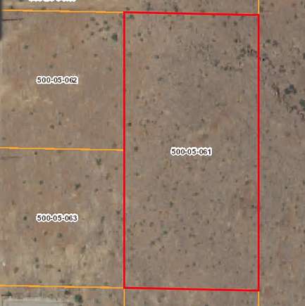
Parcels
- 500-05-061
Legal description
E2 NE4 SE4 NE4 SEC 14 11 2E TOT5AC AP66
Detailed attributes
Listing
- Type
- Land
- Franchise
- Berkshire Hathaway HomeServices
Lot
- Views
- Mountain, Panorama
Exterior
- Fencing
- Fenced
- Features
- Fencing
Listing history
| Date | Event | Price | Change | Source |
|---|---|---|---|---|
| Dec 1, 2024 | Under contract | $169,999 | — | PAAR |
| Oct 1, 2024 | Price drop | $169,999 | $10,000 -5.6% | PAAR |
| Aug 2, 2024 | Price drop | $179,999 | $10,000 -5.3% | PAAR |
| June 1, 2024 | Price drop | $189,999 | $10,000 -5% | PAAR |
| Apr 1, 2024 | New listing | $199,999 | — | PAAR |