Land for Sale in Wikieup, Arizona
Back Rd Wikieup, AZ 85360
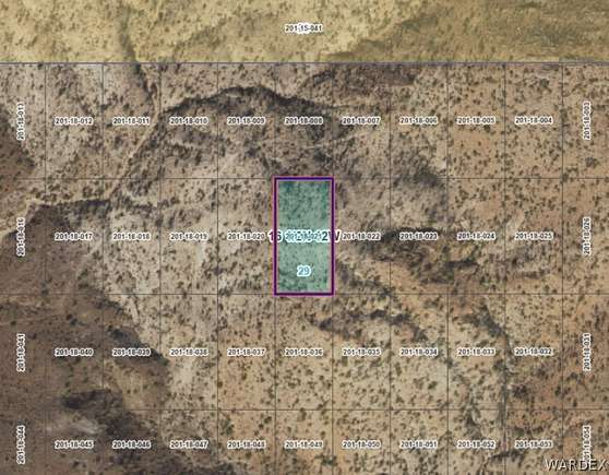
This beautiful piece of land is an amazing piece of nature. If you like hiking, trail riding and just being outside this is the place for you. Bring a tent and camp under the stars plus you can own your a little piece of Arizona. There are no roads directly to the property but trails in all directions. No HOA, No Time frame for building. Use GPS Coordinates - Lat: 34.791852? N - Lon: 113.533976? W Seller is Owner Agent
Directions
Highway 93 S just south of Mile Marker 121, Exit East on Pump Station Road, Take Lower Trout Rd/Lower Trout Creek Rd which is also know as Back Rd just North of Mile Marker 6, take trail to the right (NE) to section. Walk to the final destination or off road vehicle. No Cut in Roads. In Google Maps enter 34.791852, -113.533976
Property details
- County
- Mohave County
- Elevation
- 3,307 feet
- MLS Number
- WARDEX 013239
- Date Listed
Legal description
T 16 1/2 N R12W SEC 29 STAR LIGHT HILLS BLK 1 LOT 21
Parcels
- 201-18-021
Resources
Listing history
| Date | Event | Price | Change | Source |
|---|---|---|---|---|
| May 3, 2024 | New listing | $2,950 | — | WARDEX |