Skip to main content
Skip to navigation
Properties
Find agent
Post property
Log in
•
Sign up
Search here
List
Rifle, CO land for sale
Price
Size
Tags
Save
79 properties
For you
Newest
Price: high to low
Price: low to high
Size: large to small
Size: small to large
Updated
28 days
$40k drop • Mar 25
$839,900
8 acres
Garfield County
2 bd, 2 ba
•
1,692 sq ft
Parachute, CO 81635
6 days
$1,550,000
35.2 acres
Garfield County
3 bd, 2 ba
•
2,692 sq ft
Silt, CO 81652
2 months ago
$552,000
160 acres
Garfield County
Rifle, CO 81650
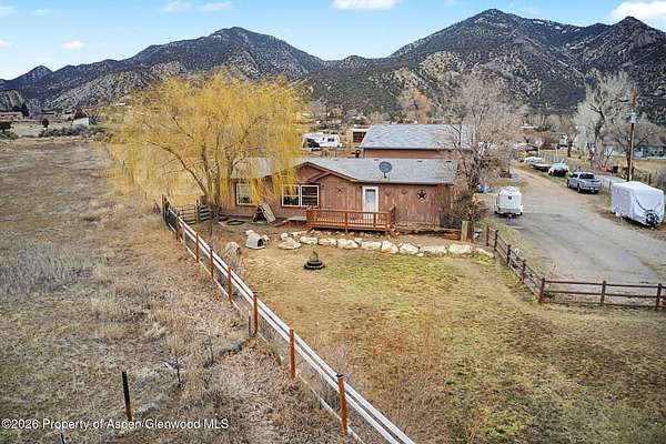
4 days
$630,000
5 acres
Garfield County
3 bd, 2 ba
•
1,344 sq ft
Rifle, CO 81650
56 days ago
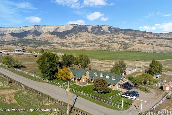
$2,195,000
7.44 acres
Garfield County
3 bd, 4.5 ba
•
5,094 sq ft
Rifle, CO 81650
1 day
$395,000
62.9 acres
Garfield County
Silt, CO 81652
12 days
$925,000
13.9 acres
Garfield County
3 bd, 2 ba
•
1,616 sq ft
Rifle, CO 81650
4 months ago
$1,995,000
38.2 acres
Garfield County
3 bd, 2.5 ba
•
2,974 sq ft
Silt, CO 81652
10 months ago
$799,000
95 acres
Garfield County
Silt, CO 81652
28 days
$525,000
8.12 acres
Garfield County
Silt, CO 81652
4 days
$545,000
40 acres
Garfield County
3 bd, 2 ba
•
1,512 sq ft
Rifle, CO 81650
$200k drop • Mar 11
$4,750,000
217 acres
Garfield County
5 bd, 5 ba
•
4,592 sq ft
Silt, CO 81652
4 days
$2,800,000
67.8 acres
Garfield County
3 bd, 2 ba
•
1,568 sq ft
Silt, CO 81652
6 months ago
$1,826,334
19.6 acres
Garfield County
5 bd, 3 ba
•
3,480 sq ft
Silt, CO 81652
18 months ago
$3,480,000
20.5 acres
Garfield County
New Castle, CO 81647
2 months ago
$715,000
10.1 acres
Garfield County
3 bd, 2 ba
•
1,782 sq ft
Silt, CO 81652
2 months ago
$395,000
14.2 acres
Garfield County
Silt, CO 81652
9 months ago
$400,000
79 acres
Garfield County
Silt, CO 81652
2 years ago
$1,750,000
122 acres
Garfield County
Rifle, CO 81650
19 days
$2,745,000
64.6 acres
Garfield County
Rifle, CO 81650
5 months ago
$840,000
4.88 acres
Garfield County
4 bd, 2 ba
•
2,342 sq ft
Silt, CO 81652
2 months ago
$2,200,000
3.14 acres
Garfield County
Rifle, CO 81650
14 days
$130,000
0.14 acres
Garfield County
Silt, CO 81652
$45k drop • Feb 21
$280,000
0.3 acres
Garfield County
Silt, CO 81652
6 months ago
$767,000
1.46 acres
Garfield County
Silt, CO 81652
21 months ago
$5,000,000
677 acres
Garfield County
Silt, CO 81652
5 months ago
$765,000
36 acres
Garfield County
3 bd, 2 ba
•
1,188 sq ft
Rifle, CO 81650
8 months ago
$4,890,000
331 acres
Garfield County
4 bd, 3.5 ba
•
4,201 sq ft
Rifle, CO 81650
$24k drop • Mar 31
$675,000
2 acres
Garfield County
3 bd, 2 ba
•
1,377 sq ft
Silt, CO 81652
19 months ago
$10,585,000
723 acres
Garfield County
5 bd, 3 ba
•
2,700 sq ft
Rifle, CO 81650
6 months ago
$383,500
0.73 acres
Garfield County
Silt, CO 81652
$450k drop • Feb 25
$1,200,000
50 acres
Garfield County
1 bd, 1 ba
•
825 sq ft
New Castle, CO 81647
$80k drop • Mar 16
$1,395,000
2 acres
Garfield County
5 bd, 3.5 ba
•
4,600 sq ft
Rifle, CO 81650
6 months ago
$2,850,000
40.6 acres
Garfield County
Silt, CO 81652
6 months ago
$600,000
6.53 acres
Garfield County
Rifle, CO 81650
6 months ago
$2,600,000
4.28 acres
Garfield County
Rifle, CO 81650
2 months ago
$1,000,000
40 acres
Garfield County
Silt, CO 81652
2 years ago
$639,000
94 acres
Garfield County
1 bd, 1 ba
•
— sq ft
Silt, CO 81652
6 months ago
$1,480,000
9.28 acres
Garfield County
Rifle, CO 81650
$81k drop • Mar 26
$200,000
35.1 acres
Garfield County
Rifle, CO 81650
14 months ago
$349,000
3.62 acres
Garfield County
Rifle, CO 81650
2 years ago
$109,900
0.75 acres
Garfield County
Rifle, CO 81650
3 years ago
$625,000
30 acres
Garfield County
Rifle, CO 81650
Pending
Under contract
$1,123,500
321 acres
Garfield County
Rifle, CO 81650
Pending
Under contract
$2,249,660
643 acres
Garfield County
Rifle, CO 81650
Pending
Under contract
$999,000
88 acres
Garfield County
3 bd, 1 ba
•
2,800 sq ft
Silt, CO 81652
Pending
Under contract
$750,000
8 acres
Garfield County
4 bd, 3.5 ba
•
3,160 sq ft
Parachute, CO 81635
Pending
Under contract
$1,999,999
574 acres
Garfield County
Rifle, CO 81650
Pending
Under contract
$835,000
5.86 acres
Garfield County
4 bd, 2.5 ba
•
1,863 sq ft
Silt, CO 81652
Pending
Under contract
$1,345,000
7.1 acres
Garfield County
5 bd, 4 ba
•
4,072 sq ft
Silt, CO 81652
1
2
1-50 of 79 properties
Map