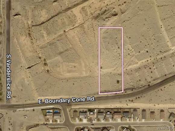
3 Acres of Land for Sale in Fort Mohave, Arizona
Boundary Cone Rd, Fort Mohave, AZ 86426
Image
Map
Street
$89,000
3 acres
Active sale agoEst $884/mo
This is a new split per Parcel Plat 40/85-85A. You can see the property on the Mohave County Website but no tax information is available yet. Imagine what you could do with 3 acres! Zoned AR. Buyer to verify all utilities.
Directions
Boundary Cone Rd. east of S Vanderslice Rd.
Property details
- County
- Mohave County
- Elevation
- 663 feet
- MLS Number
- WARDEX 012837
- Date Listed
Parcels
- 225-52-053
Listing history
| Date | Event | Price | Change | Source |
|---|---|---|---|---|
| Apr 20, 2024 | New listing | $89,000 | — | WARDEX |
Payment calculator

Contact listing agent
By submitting, you agree to the terms of use, privacy policy, and to receive communications.