
Land for Sale in Burns, Oregon
Harney County, Burns, OR 97720
Prime Eastern Oregon Acreage
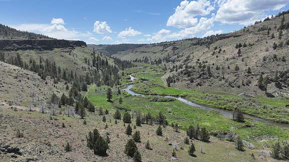
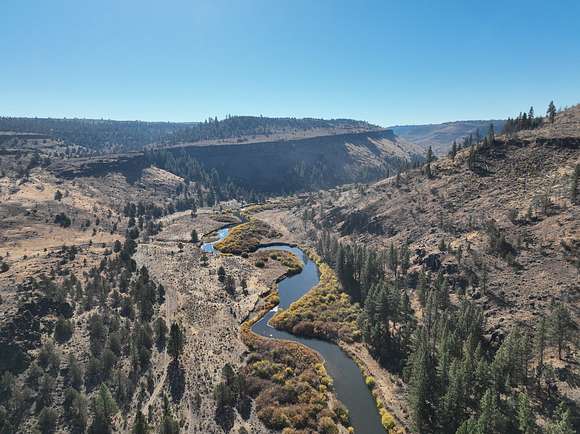
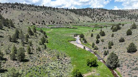
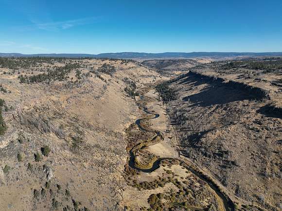
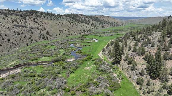
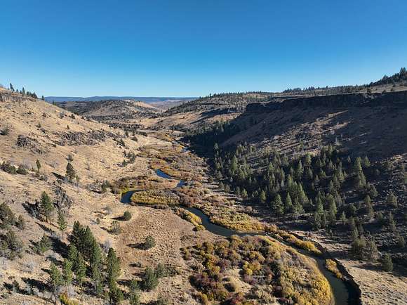
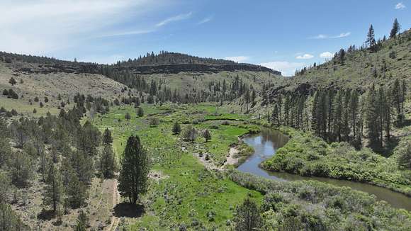
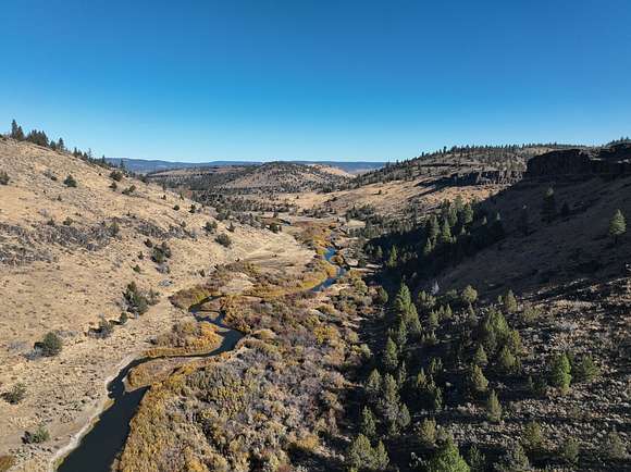
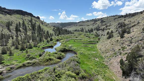
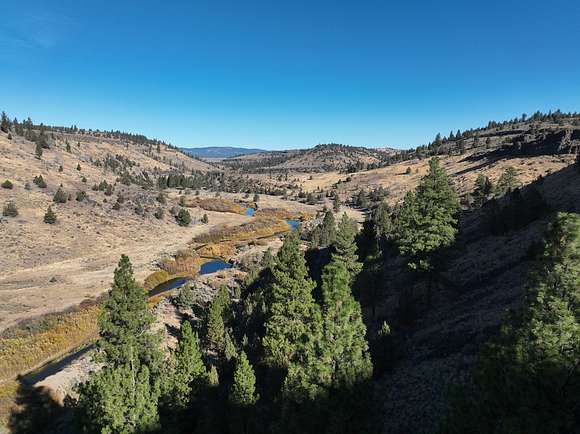
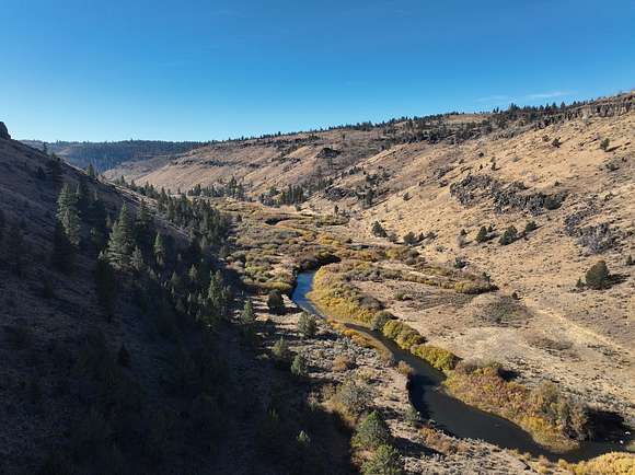
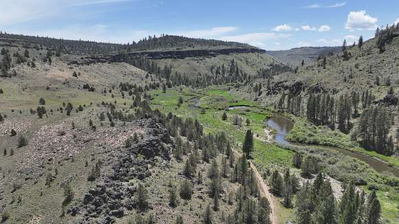
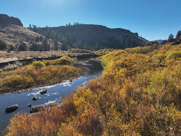
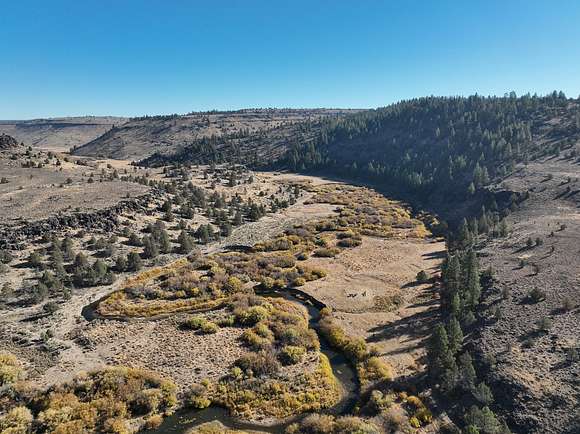
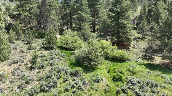
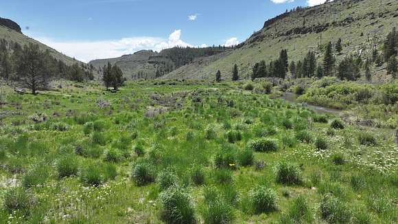
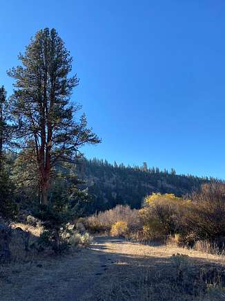
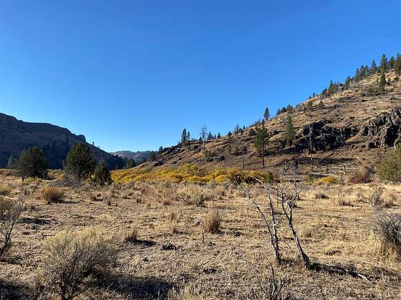
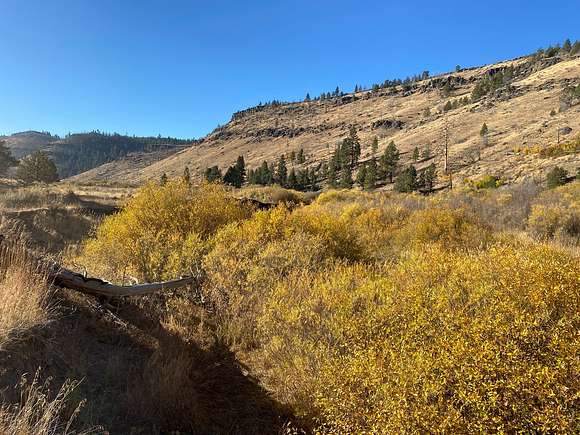
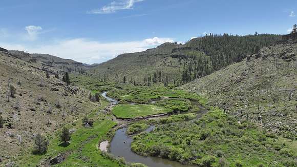
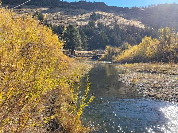
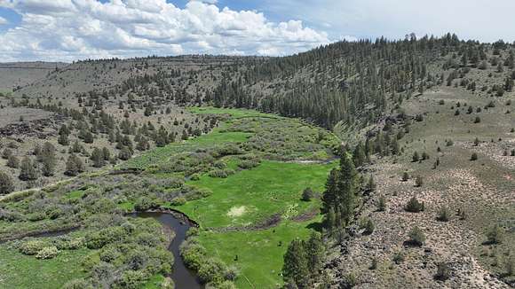
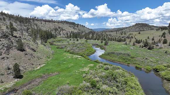
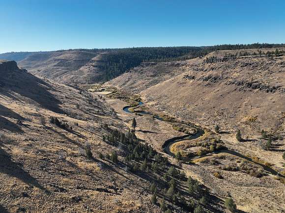
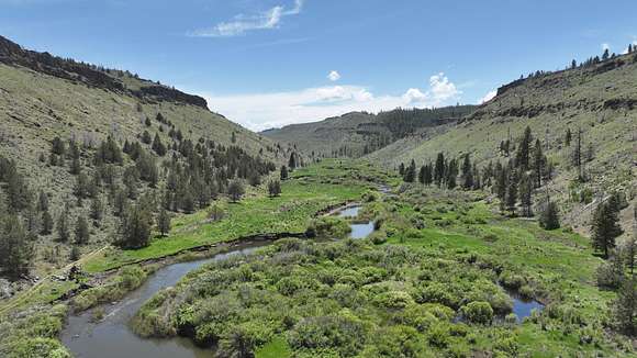
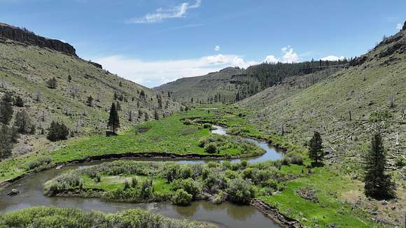
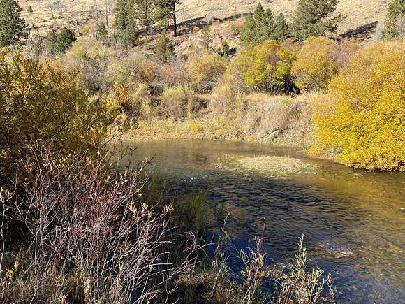
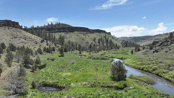
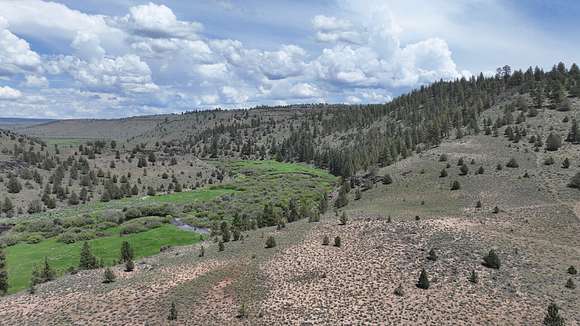
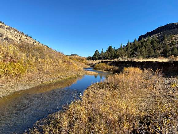
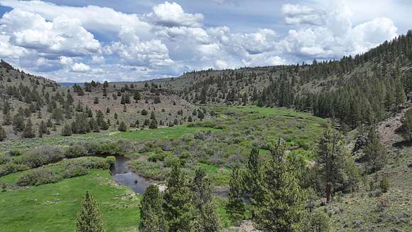
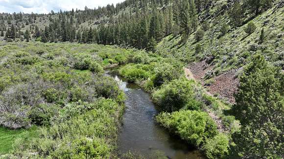
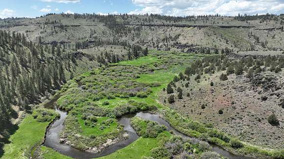
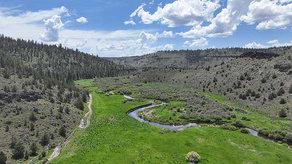
Nestled where Emigrant Creek converges with the Silvies River, this expansive 512.95-acre property offers a rare and captivating escape just 20 miles north of Burns, Oregon. The land presents a striking blend of rimrock formations, lush willows, stately pine trees, and open meadows, creating a diverse and picturesque landscape. This varied terrain supports a thriving population of elk and deer, making it an exceptional haven for wildlife enthusiasts and hunters alike. With approximately 2.5 miles of Silvies River frontage, the property also offers excellent trout fishing opportunities, enhancing its appeal as a recreational retreat.
Outdoor Lifestyle and Hunting Advantages
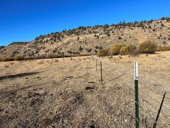
This remote ranch is fenced throughout and cross-fenced to accommodate cattle grazing, blending agricultural use with outdoor adventure. The property qualifies for two Limited Oregon Permit (LOP) elk and deer tags, a significant benefit for hunters seeking exclusive access. Surrounded by thousands of acres of public lands within the Silvies Hunting Unit, it provides unparalleled access to some of Oregon’s finest hunting grounds. The four separate tax lots included in the sale open possibilities for multiple dwellings, allowing for family retreats or guest accommodations amid the tranquil wilderness.
Location and Legal Details
Situated just 20 minutes north of Burns, this property is legally described as T21S R29E WM Section 02 Tax Lot 300, along with Tax Lots 200, 600, and 1200. It carries 68.9± acres of flood irrigation water rights from the Silvies River, with a priority date dating back to December 31, 1889, providing valuable water access for agricultural or landscaping needs. With annual taxes of $517.35, this unique parcel combines natural beauty, recreational opportunity, and practical resources in a remote yet accessible location, inviting those seeking a distinctive slice of Eastern Oregon’s wilderness to call it their own.
Location
- County
- Harney County
- Zip code
- 97720
- Elevation
- 4,232 feet
Property details
- Acreage
- 512.95 acres
- Posted
Resources
Listing history
| Date | Event | Price | Change | Source |
|---|---|---|---|---|
| Oct 9, 2024 | Relisted | $1,000,000 | — | Listing agent |
| Oct 5, 2024 | Listing removed | $1,000,000 | — | Listing agent |
| Oct 18, 2023 | Relisted | $1,000,000 | — | Listing agent |
| Oct 6, 2023 | Listing removed | $1,000,000 | — | Listing agent |
| Jan 6, 2023 | New listing | $1,000,000 | — | Listing agent |