274 Acres of Recreational Land & Farm for Sale in Burr Oak, Kansas
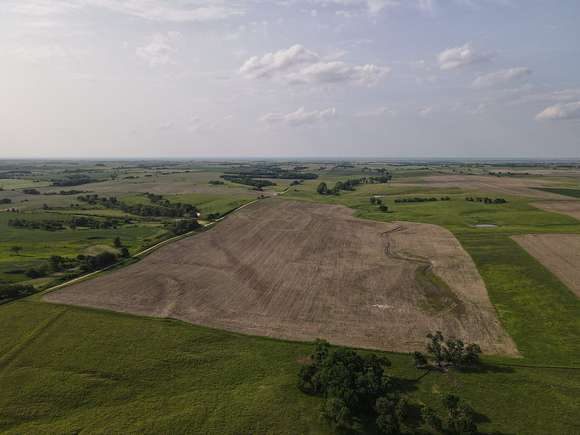
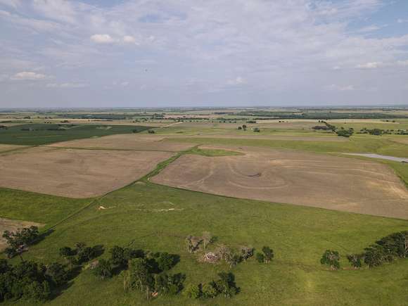

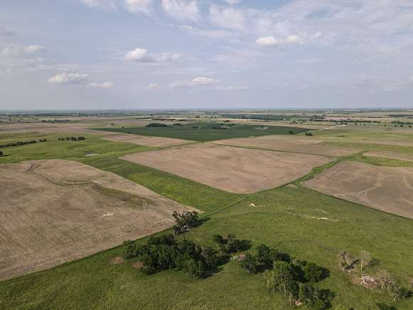
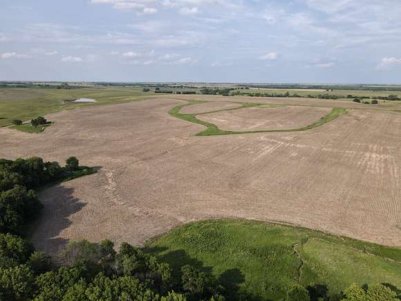


This roughly 274 acres is ready for it's new owner. It contains a little over 6 acres of creek bottom and 6 acres of grass waterways.
Land
Consisting of mainly Harney Silt Loam soils at 0-3% and Geary Silt Loam at 3-7%, and with roughly 40 acres being of a larger slope, this farm offers good production. The South set of farms offers a rough 10 year average of 46 bu/A on Soybeans and 140 bu/A on Corn. Over the years the owner has maintained the terraces and re-cooped acres that were otherwise considered waste.
Recreation
This tract offers the Southern portion of Long Branch Creek with grass waterways that the deer like to travel and bed in. This, coupled with grains being major food sources and the possibility to add food plots means plenty of opportunities for deer.
Water/Mineral Rights & Natural Resources
Any and all mineral rights owned by the seller will convey to the buyer.
Region & Climate
Jewell, KS County has a climate that is characterized as humid continental. Summers in the county tend to be hot and humid with average temperatures between 70-80?F. Winters in the area are generally cold and dry, with temperatures averaging between 20-30?F. Precipitation in the area is relatively balanced year-round, with about 3-4 inches of average rainfall each month. Jewell County experiences all four distinct seasons, making it an ideal place to live in for those who enjoy experiencing changing weather patterns throughout the year.
Summer High: the July high is around 90 degrees Winter Low: the January low is 15
Rain: averages 28 inches of rain a year Snow: averages 21 inches of snow a year
- **Information according to bestplaces.net
Location
Directions to the NE corner of the property via HWY & gravel road:
From Burr Oak, KS - 7 miles N on HWY 128 to Cedar RD and 3 miles E to 140 RD, then 2 miles S From Guide Rock, NE - 6.8 miles S on HWY 78/128 to Cedar RD and 3 miles E to Cedar RD, then 2 mile S From Superior, NE - S on HWY 14 to Diamond RD, then W 5 miles to 160 RD, then S 1 mile to Cedar RD, then W 2 miles to 140 RD, and S 2 miles.
Mankato, KS and Superior, NE are both roughly 10 - 15 minutes away via country roads for supplies and dining needs.
- **To view this property, please contact the listing agent to schedule your showing.
*Please note: A survey is being done to establish the boundary between sections 19 and 30. All acreage references in this description are estimated and should not be taken as exact values.*
Property details
- County
- Jewell County
- Elevation
- 1,801 feet
- Date Listed
Resources
Listing history
| Date | Event | Price | Change | Source |
|---|---|---|---|---|
| Mar 10, 2024 | Price decrease | $1,041,200 | $953,800 -47.8% | — |
| Dec 5, 2023 | New listing | $1,995,000 | — | — |