Land for Sale in Taos, New Mexico
Camino Lovato Taos Valley Rd, Taos, NM 87571
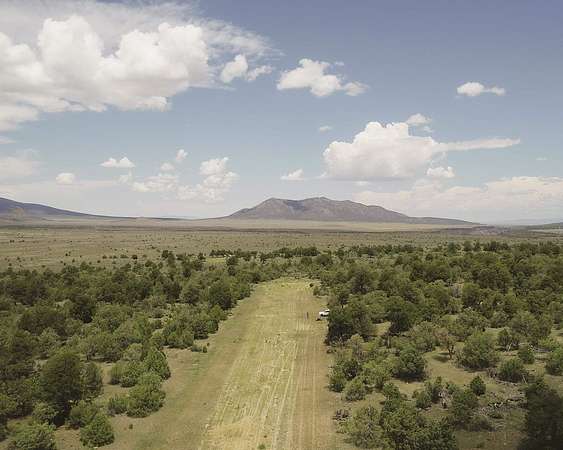
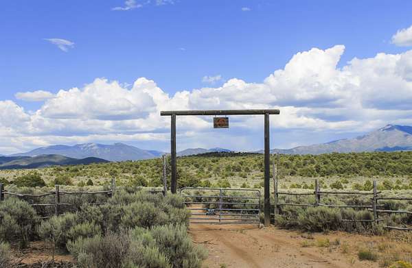
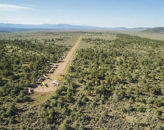
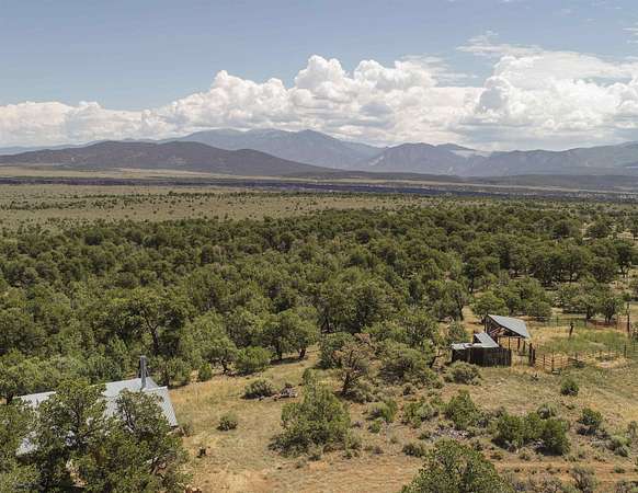
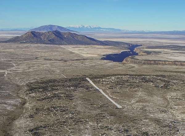
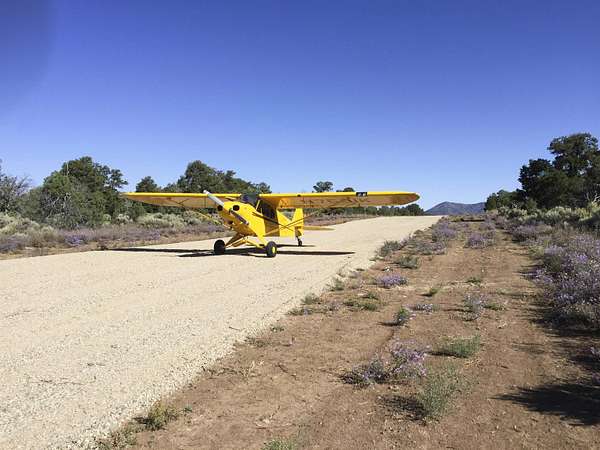
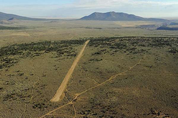
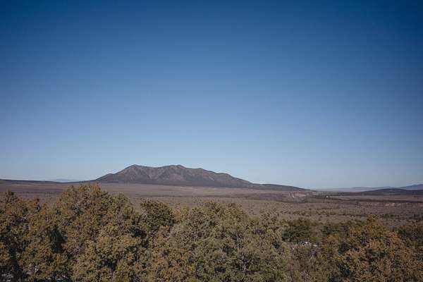
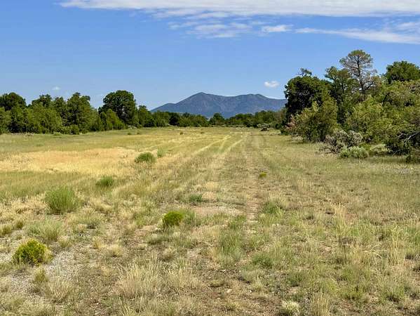
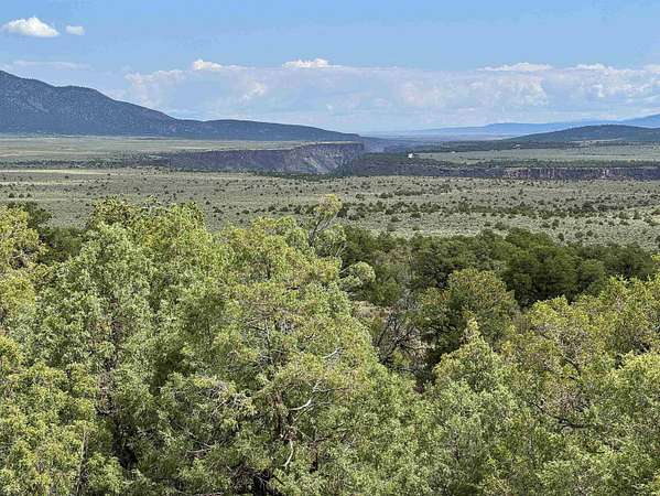
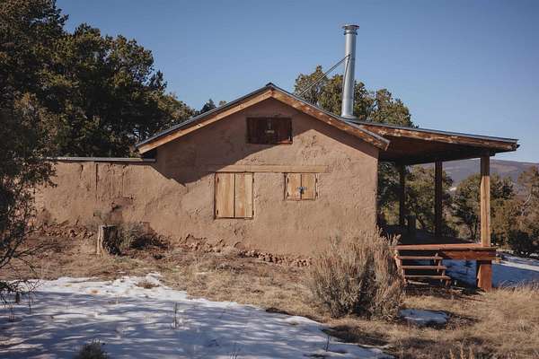
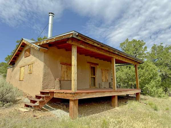
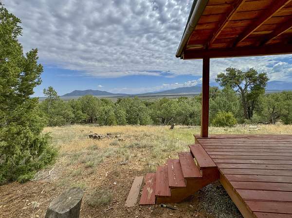
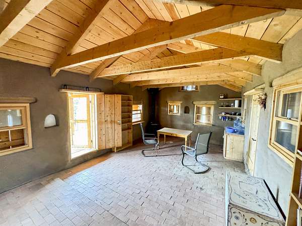
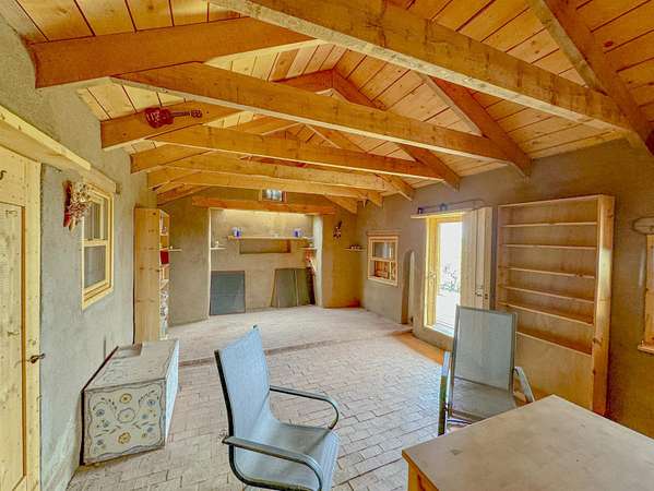
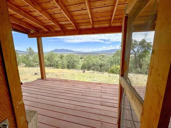
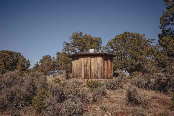
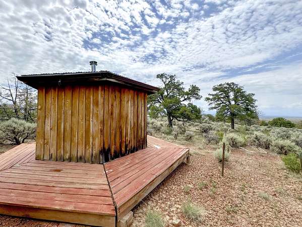
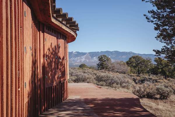
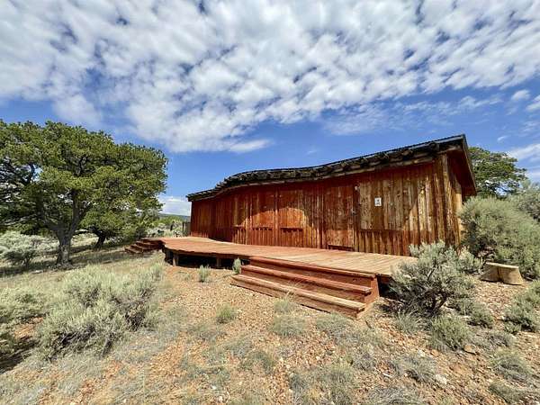
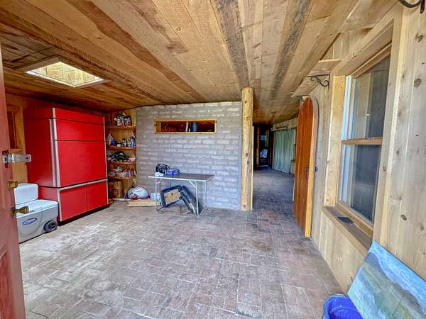
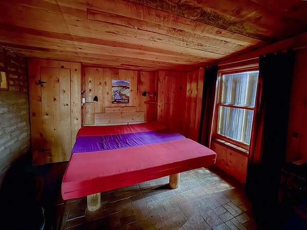
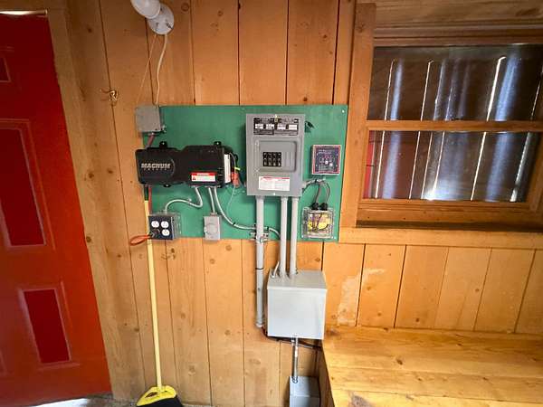
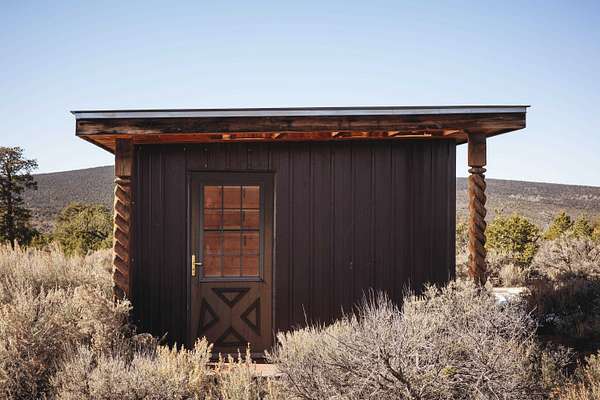
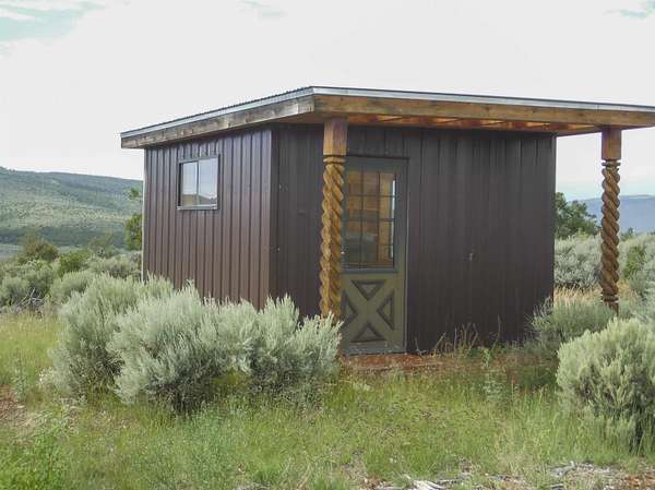
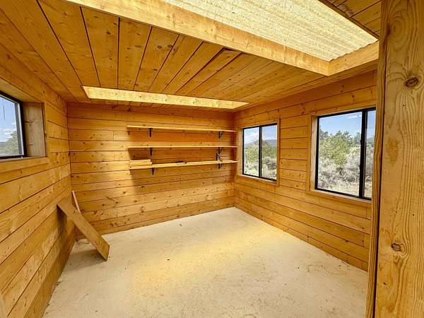
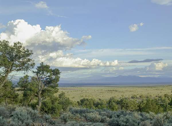
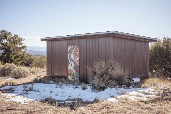
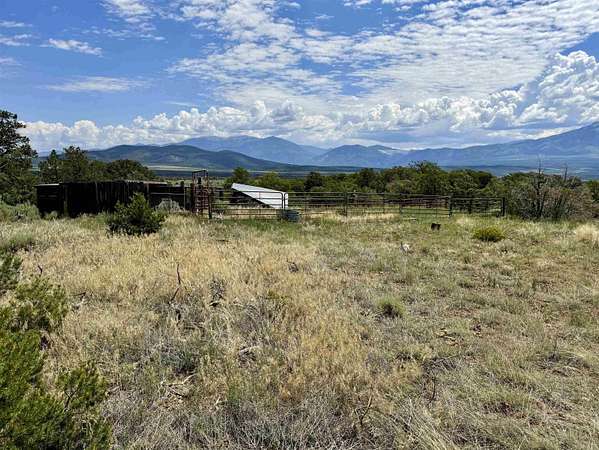
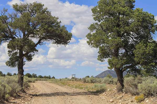
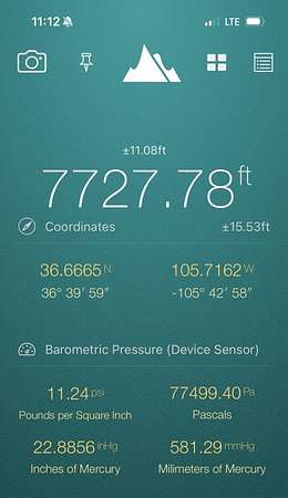
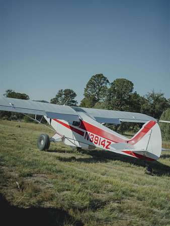
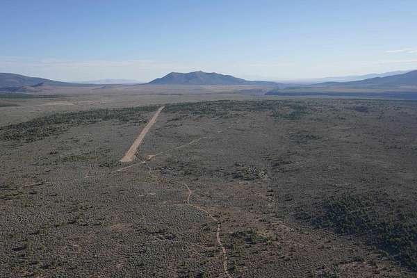
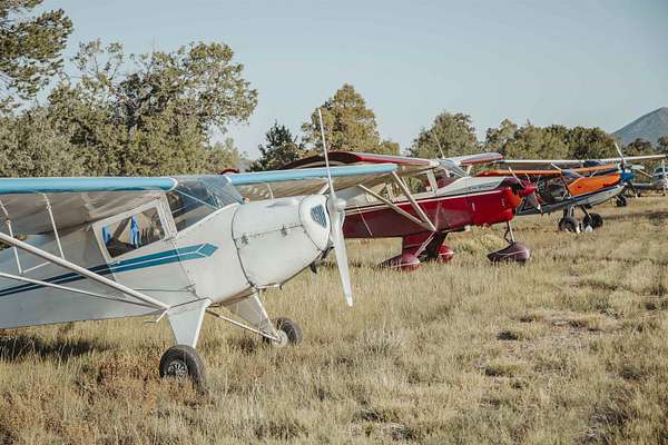
FLYING W RANCH A 640-ACRE NATIONAL MONUMENT PARCEL | FAA-REGISTERED AIRSTRIP Fly or drive to a kingdom of high-desert freedom. The Flying W Ranch is a rare and prestigious private inholding nestled within the heart of the Rio Grande del Norte National Monument. Bordered on three sides by protected public lands, this 640-acre sanctuary offers a 360-degree theater of views, from the rugged "Wild and Scenic" Rio Grande Gorge to the snow-capped majesty of the Sangre de Cristo Range. The crown jewel for the modern adventurer is the FAA-registered 4,500-foot airstrip, meticulously engineered from compressed stone to accommodate high-performance aircraft. At an elevation of 7,700 feet, the ranch's improvements are a masterclass in off-grid charm and functionality, featuring: A quintessential one-room adobe home with a deep, north-facing portal. A spacious secondary residence featuring a chef's kitchen and solar refrigeration. A light-filled writer's studio and a signature octagon-shaped sauna house. Extensive infrastructure, including barn outbuildings, horse corrals, and a sophisticated 3,600-gallon rainwater collection system. With countless pristine sites to build a grand legacy estate, the Flying W Ranch is a haven for those who demand absolute privacy, unparalleled natural beauty, and the thrill of the open sky. Located just 45 minutes from the vibrant culture of Downtown Taos and the world-class slopes of the Ski Valley.
Location
- Street address
- Camino Lovato Taos Valley Rd
- County
- Taos County
- Zip code
- 87571
- Community
- West Gorge BRDG (53B)
- Elevation
- 7,473 feet
Directions
Drive west from the Old blinking light, over gorge bridge to Cerro Montoso Rd on right (Also ref to as B-007 on some maps). Turn and Drive east on Montoso Rd.towards gorge ~3.5 miles. Then left (north) on Camino de Lovato (no sign but last turn before you go down hill towards John Dunn Bridge). Follow this road which is maintained for almost exactly 8 miles. You will see the Ranch entrance (in pictures) on right. After first gate you are on property. Follow narrow road to the airstrip. Cross airstrip and continue through second gate up hill to improvements. Views overlook RG Gorge, north to south.
Property details
- Acreage
- 640 acres
- Zoning
- County
- MLS #
- TAOSMLS 113785
- Posted
Property taxes
- Recent
- $800
Legal description
Section 13, Township 28N, Range 11E. NMPM
Details and features
Listing
- Type
- Farm
Lot
- Features
- Borders State Land, Ranch, Views
Exterior
- Structures
- Corral(s)
- Features
- Horse Facilities
Structure
- Water
- Well Needed
Nearby schools
| Name | Type |
|---|---|
| Taos Elementary | Elementary |
| Taos | Middle |
| Taos | High |
Listing history
| Date | Event | Price | Change | Source |
|---|---|---|---|---|
| Aug 7, 2025 | New listing | $1,250,000 | — | TAOSMLS |