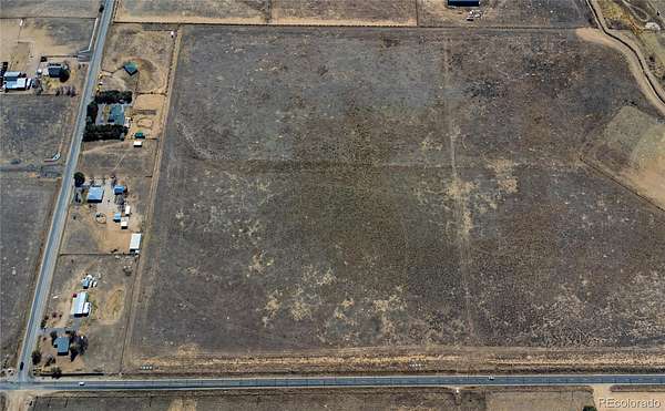
Agricultural Land for Sale in Brighton, Colorado
County Road 4, Brighton, CO 80603
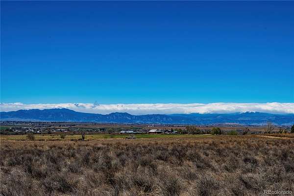
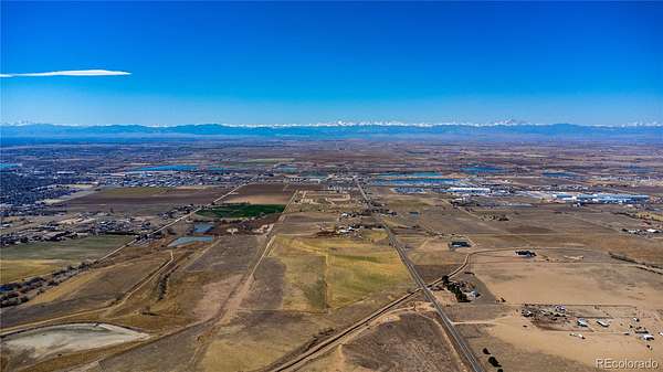
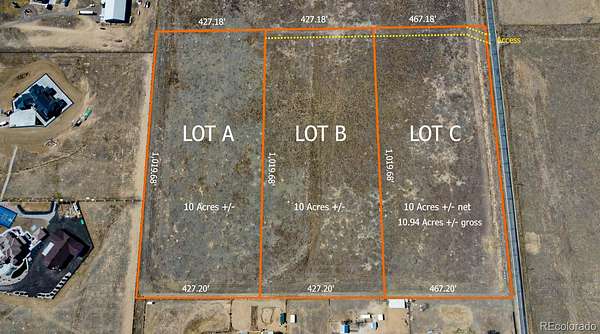
Well permit in supplements! Well allows for 4 large animals, poultry, an ADU, and 39,000 square feet of yard/garden irrigation. Here’s your chance to claim one of three incredible 10-acre properties in Brighton—where wide-open space meets breathtaking Front Range views and no HOA.
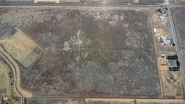
Each lot is flat, build-ready, and free from HOA restrictions, giving you the freedom to create the lifestyle you actually want—horses, outbuildings, room to breathe… all of it.
With easy access to Road 4, you get that peaceful, rural feel without sacrificing convenience.
Only three of these parcels are available—so if you’ve been waiting for the right land, this is the moment to grab it.
Approximate GPS location for center of lot:
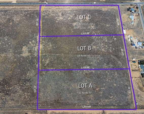
Lot B - 40.013254, -104.775768
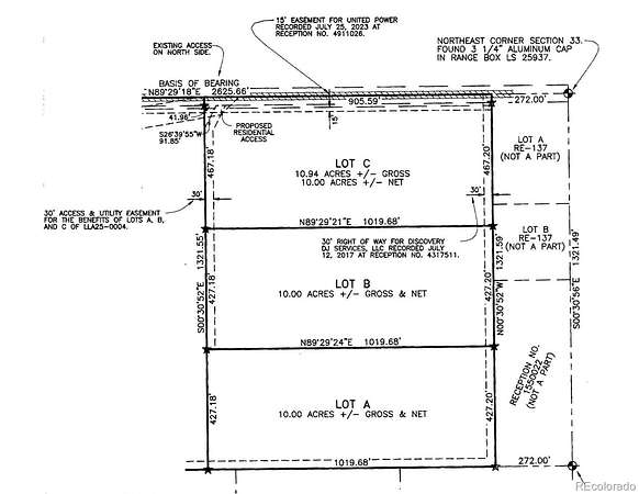
There are three lots for sale. Lot A – is MLS # 3633676. Lot B – is MLS # 5294567. Lot C – is MLS # 8402861.
Google Map Location: https://maps.app.goo.gl/hL9tiAAEdoL3p73F6
- Listed by Roberta Sue Stewardson, (303) 523-4380, You 1st Realty
Location
- Street address
- County Road 4
- County
- Weld County
- Zip code
- 80603
- School district
- School District 27-J
- Elevation
- 5,102 feet
Property details
- Acreage
- 10 acres
- Zoning
- Ag
- Access
- Easement
- MLS #
- REcolorado 5294567
- Posted
Legal description
LOT B, LOT LINE ADJUSTMENT LLA25-0004, BEING A PART OF THE NORTH 1/2 OF THE NORTHEAST 1/4 OF SECTION 33, TOWNSHIP 1 NORTH, RANGE 66 WEST OF THE 6TH PRINCIPAL MERIDIAN, MORE PARTICULARLY DESCRIBED AS FOLLOWS:
COMMENCING AT THE NORTHEAST CORNER OF SAID NORTH 1/2; THENCE COINCIDENT WITH THE NORTH LINE OF SAID NORTH 1/2 SOUTH 89°29'18" WEST, A DISTANCE OF 272.00 FEET; THENCE COINCIDENT WITH THE WEST LINE OF LOTS A AND B OF RECORDED EXEMPTION NO. 1471-33-1 RE-137 RECORDED MAY 16, 1974 AT RECEPTION NO. 1636706 SOUTH 00°30'52" EAST, A DISTANCE OF 467.20 FEET TO THE POINT OF BEGINNING; THENCE CONTINUING COINCIDENENT WITH THE WEST LINE OF SAID LOT B AND THE WEST LINE OF THAT PARCEL DESCRIBED IN DEED RECORDED JUNE 26, 1970 AT RECEPTION NO. 1550022 SOUTH 00°30'52" EAST, A DISTANCE OF 427.20 FEET; THENCE SOUTH 89°29'24" WEST, A DISTANCE OF 1019.68 FEET; THENCE NORTH 00°30'52" WEST, A DISTANCE OF 427.18 FEET; THENCE NORTH 89°29'21" EAST, A DISTANCE OF 1019.68 FEET TO THE POINT OF BEGINNING FULL LEGAL IN SUPPLEMENTS
Details and features
Listing
- Type
- Land
- Subtype
- Unimproved Land
- Current Use
- Agricultural, Livestock, Vacant
- Possible Use
- Residential
- Ownership
- Individual
- Terms
- 1031 Exchange, Cash, Conventional
- Exclusions
- None
- Possession
- Closing/DOD
Lot
- Vegetation
- Mixed, Natural State, Sagebrush
- Road Frontage
- Easement
- Road Surface
- Paved
- Road Responsibility
- Private Maintained Road
- View
- Mountain(s)
- Well Type
- Not Drilled
- Well Permits
- 343613
- Survey
- Pin Survey
- Features
- Level
Exterior
- Fencing
- None
- Horses Allowed
- Yes
Structure
- Water
- Well
Property utilities
| Category | Type | Status |
|---|---|---|
| Power | Grid | Available |
| Water | Private Well | Available |
| Gas | Propane | Available |
Listing history
| Date | Event | Price | Change | Source |
|---|---|---|---|---|
| Apr 19, 2026 | New listing | $550,000 | — | REcolorado |
Payment calculator
Based on information submitted to the MLS GRID as of July 18, 2026 1:00 pm MT. All data is obtained from various sources and may not have been verified by broker or MLS GRID. Supplied Open House Information is subject to change without notice. All information should be independently reviewed and verified for accuracy. Properties may or may not be listed by the office/agent presenting the information. Some IDX listings have been excluded from this website. View more