Skip to main content
Skip to navigation
Properties
Find agent
Post property
Log in
•
Sign up
Search here
List
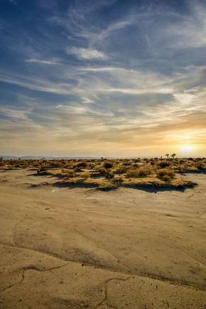
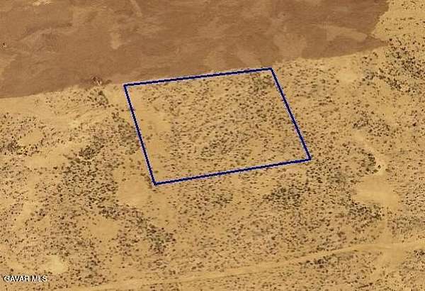
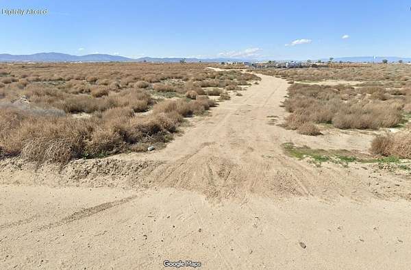
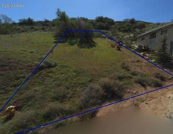
Lancaster, CA land for sale
Price
Size
Tags
Save
1,733 properties
For you
Newest
Price: high to low
Price: low to high
Size: large to small
Size: small to large
Updated
Featured
14 months ago
$29,995
7.5 acres
Los Angeles County
Pearblossom, CA 93553
Featured
46 days ago
$11,000
2.5 acres
Kern County
Rosamond, CA 93560
Featured
32 days ago
$9,500
1.9 acres
Kern County
Rosamond, CA 93560
Featured
28 days ago
$12,000
2.5 acres
Kern County
Rosamond, CA 93560
Featured
60 days ago
$9,500
2.49 acres
Kern County
Rosamond, CA 93560
Featured
2 months ago
$95,000
0.86 acres
Los Angeles County
Pearblossom, CA 93553
Featured
$2.5k drop • Mar 12
$22,497
10.2 acres
Los Angeles County
Lancaster, CA 93535
Featured
9 months ago
$11,000
2.49 acres
Kern County
Rosamond, CA 93560
Featured
$4k drop • Jan 15
$7,995
1.36 acres
Los Angeles County
Lancaster, CA 93536
Featured
21 months ago
$14,899
2.56 acres
Los Angeles County
Lancaster, CA 93535
Featured
14 months ago
$7,500
2.49 acres
Los Angeles County
Lancaster, CA 93535
Featured
50 days ago
$35,000
10.3 acres
Los Angeles County
Palmdale, CA 93552
Featured
2 months ago
$12,500
2.5 acres
Los Angeles County
Palmdale, CA 93591
Featured
18 months ago
$20,000
0.28 acres
Los Angeles County
Elizabeth Lake, CA 93532
Featured
50 days ago
$22,500
1.21 acres
Los Angeles County
Lancaster, CA 93536
Featured
4 months ago
$45,000
2.27 acres
Los Angeles County
Roosevelt, CA 93535
Featured
29 days ago
$120,000
5 acres
Los Angeles County
— sq ft
Palmdale, CA 93591
Featured
2 months ago
$22,000
5 acres
Los Angeles County
Pearblossom, CA 93553
Featured
4 months ago
$55,000
2.3 acres
Los Angeles County
Lancaster, CA 93536
Featured
18 months ago
$120,000
20.4 acres
Los Angeles County
Lancaster, CA 93536
Featured
16 months ago
$30,000
1.32 acres
Los Angeles County
Lancaster, CA 93534
Featured
16 months ago
$17,500
5 acres
Los Angeles County
Lancaster, CA 93536
Featured
2 months ago
$15,000
2.52 acres
Los Angeles County
Lancaster, CA 93536
Featured
10 months ago
$16,000
2.49 acres
Los Angeles County
Lancaster, CA 93536
Featured
2 months ago
$15,000
0.17 acres
Los Angeles County
Lake Hughes, CA 93532
Featured
4 months ago
$30,000
1.32 acres
Los Angeles County
Lancaster, CA 93534
Featured
$1.5k drop • Mar 9
$22,000
10.3 acres
Los Angeles County
Palmdale, CA 93591
Featured
10 months ago
$55,000
20.6 acres
Los Angeles County
Lancaster, CA 93535
Featured
15 months ago
$8,000
0.15 acres
Los Angeles County
Elizabeth Lake, CA 93532
Featured
2 months ago
$15,000
2.5 acres
Los Angeles County
Lancaster, CA 93536
Featured
4 months ago
$22,500
2.53 acres
Los Angeles County
Antelope Acres, CA 93536
Featured
$1.5k drop • Mar 9
$22,000
10.2 acres
Los Angeles County
Palmdale, CA 93591
Featured
2 months ago
$14,000
2.5 acres
Los Angeles County
Lancaster, CA 93536
Featured
2 months ago
$9,500
2.58 acres
Los Angeles County
Lancaster, CA 93535
Featured
9 months ago
$7,500
0.17 acres
Los Angeles County
Elizabeth Lake, CA 93532
Featured
11 months ago
$11,500
0.18 acres
Los Angeles County
Elizabeth Lake, CA 93532
Featured
$2.5k drop • Mar 29
$30,000
5 acres
Los Angeles County
Lancaster, CA 93536
Featured
24 days ago
$45,000
4.27 acres
Los Angeles County
Lancaster, CA 93535
Featured
18 months ago
$11,000
5.13 acres
Los Angeles County
Lancaster, CA 93535
Featured
46 days ago
$9,000
2.46 acres
Los Angeles County
Palmdale, CA 93551
Featured
46 days ago
$27,000
2.5 acres
Los Angeles County
Palmdale, CA 93551
Featured
$35k drop • Mar 18
$45,000
13.4 acres
Los Angeles County
Palmdale, CA 93551
Featured
46 days ago
$6,000
1.24 acres
Los Angeles County
Lancaster, CA 93535
Featured
46 days ago
$13,000
2.7 acres
Los Angeles County
Lancaster, CA 93535
Featured
46 days ago
$10,000
1.29 acres
Los Angeles County
Palmdale, CA 93552
Featured
$35k drop • Mar 18
$45,000
16 acres
Los Angeles County
Palmdale, CA 93551
Featured
2 months ago
$30,000
10.2 acres
Los Angeles County
Lancaster, CA 93535
Featured
18 months ago
$11,000
5.13 acres
Los Angeles County
Lancaster, CA 93535
Featured
2 months ago
$20,000
0.12 acres
Los Angeles County
Green Valley, CA 91350
Featured
$1.5k drop • Mar 9
$22,000
Los Angeles County
Palmdale, CA 93591
1
2
3
4
…
35
1-50 of 1,733 properties
Map