Land for Sale in Walnut Hill, Florida
Highway 97, Walnut Hill, FL 32568
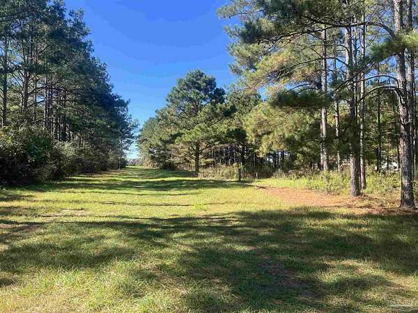
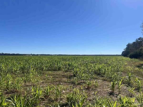
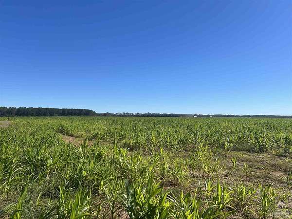
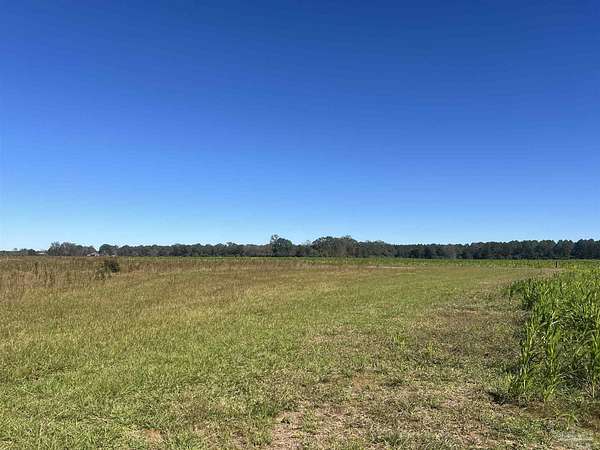
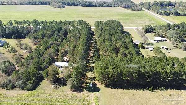
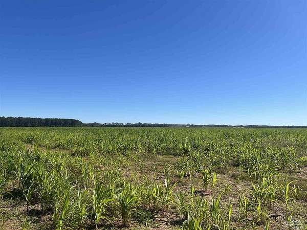
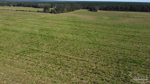
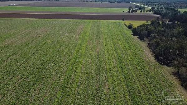
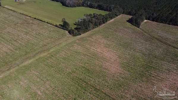
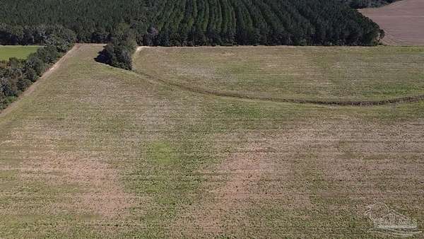
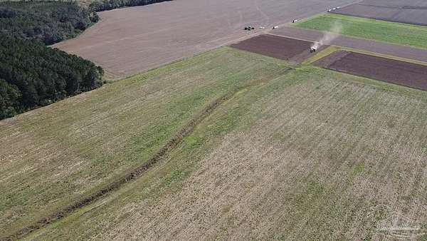
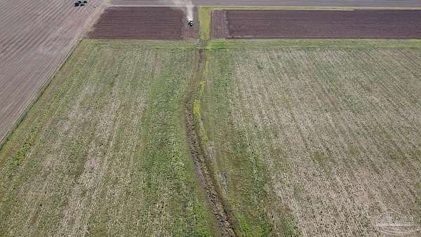
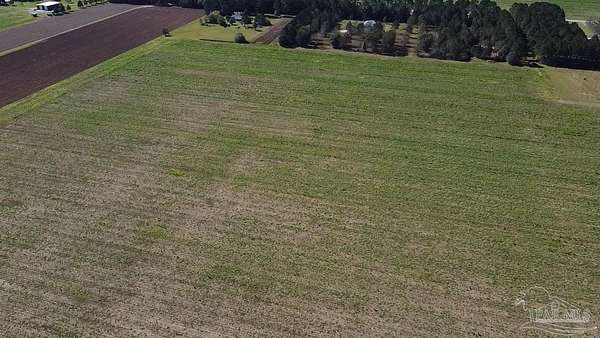
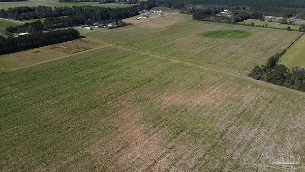
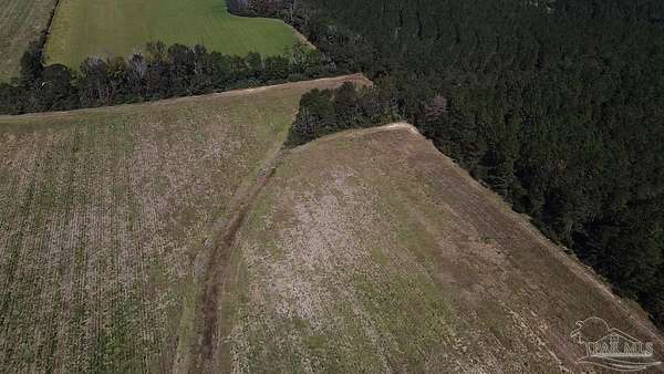
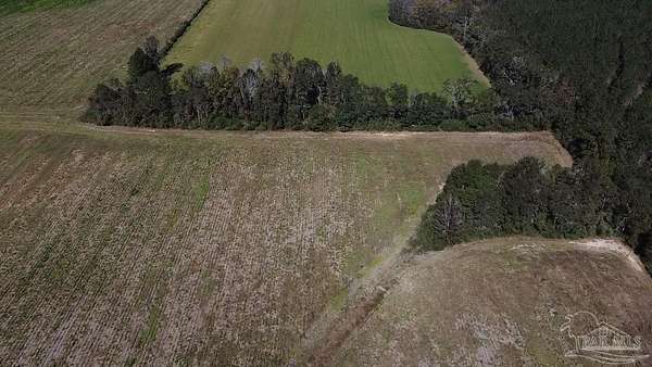
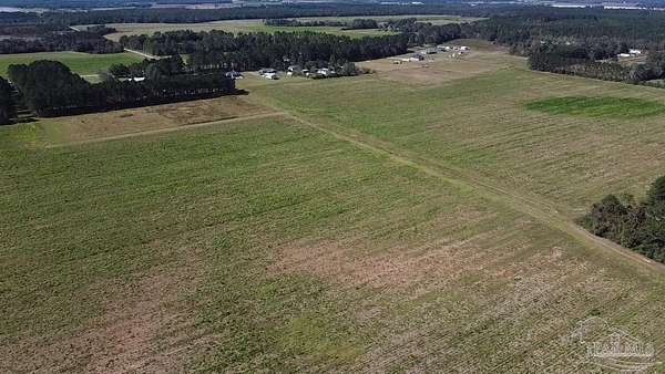
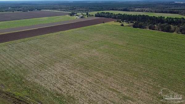
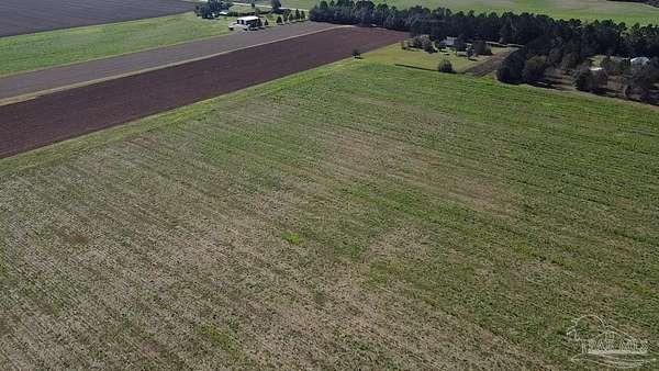
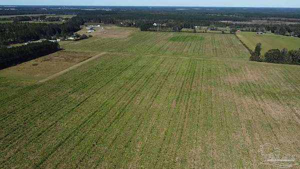
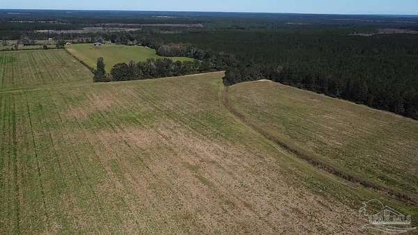
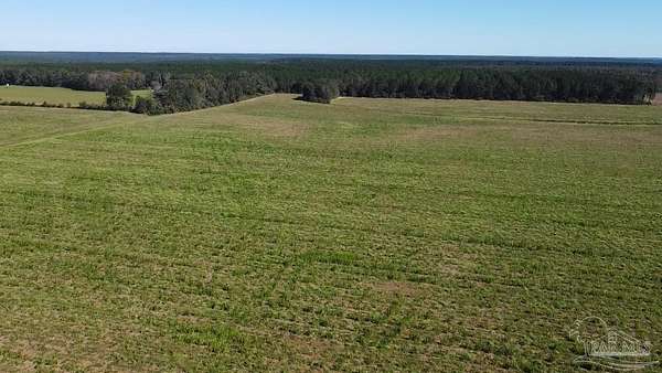
Come See this gorgeous 85-acre tract of prime crop land located in the highly sought-after Walnut Hill community. Featuring level, fertile soil, this property is perfect for farming, off-grid living, or enjoying peaceful recreational activities. Enjoy the best of both worlds with a rural setting that offers tranquility and plenty of open space, yet remains conveniently close to all essential amenities. With endless possibilities, this versatile parcel invites you to let your imagination guide your next great venture. Land is currently under a Crop Lease through 12/31/2025. Call for More Details!! ALL DIMENSIONS ARE APPROXIMATE AND IS THE BUYER'S RESPONSIBILITY TO VERIFY.
Location
- Street address
- Highway 97
- County
- Escambia County
- Zip code
- 32568
- Elevation
- 236 feet
Directions
From downtown Atmore take Hwy 21, (aka S. Main St) At the AL/Fl Stateline Hwy 21 changes to Hwy 97. Continue approx 14.5 miles and property will be on your left. 60" ROW into the acreage. Look for the SOUTHERN REAL ESTATE POINTER SIGN
Property details
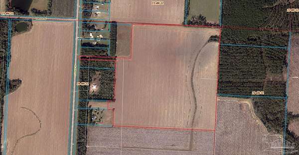
- Acreage
- 84.07 acres
- Zoning
- Agricultural
- MLS #
- PAR 673474
- Posted
Parcels
- 394N321201016003
Legal description
Legal Description COMMENCE AT THE NORTHEAST CORNER OF SECTION 39, ALSO BEING THE SOUTHEAST CORNER OF THE SOUTHWEST QUARTER OF THE SOUTHEAST QUARTER OF SECTION 22, TOWNSHIP 4 NORTH, RANGE 32 WEST, ESCAMBIA COUNTY, FLORIDA; THENCE GO SOUTH 89 DEGREES 20 MINUTES 11 SECONDS WEST ALONG THE SOUTH LINE OF SAID SECTION 22 FOR A DISTANCE OF 660.98 FEET; THENCE DEPARTING SAID SECTION LINE GO SOUTH 87 DEGREES 47 MINUTES 33 SECONDS WEST FOR A DISTANCE OF 1008.73 FEET; THENCE GO SOUTH 01 DEGREES 03 MINUTES 52 SECONDS EAST FOR A DISTANCE OF 628.00 FEET; THENCE GO SOUTH 89 DEGREES 11 MINUTES 20 SECONDS WEST FOR A DISTANCE OF 983.00 FEET TO THE WESTERLY RIGHT OF WAY LINE OF HIGHWAY 97 (STATE ROAD #97, 100 FOOT RIGHT OF WAY); THENCE GO SOUTH 01 DEGREES 2() MINUTES 16 SECONDS EAST ALONG SAID WESTERLY RIGHT OF WAY LINE FOR A DISTANCE OF 60.00 FEET; THENCE DEPARTING SAID WESTERLY RIGHT OF WAY LINE GO NORTH 89 DEGREES 20 MINUTES 11 SECONDS EAST FOR A DISTANCE OF 705.67 FEET; THENCE GO SOUTH 01 DEGREES 03 MINUTES 52 SECONDS EAST FOR A DISTANCE OF 598.17 FEET; THENCE GO SOUTH 00 DEGREES 38 MINUTES 45 SECONDS EAST FOR A DISTANCE OF 192.80 FEET; THENCE GO SOUTH 89 DEGREES 20 MINUTES 11 SECONDS WEST FOR A DISTANCE OF 137.50 FEET; THENCE GO SOUTH 00 DEGREES 38 MINUTES 45 SECONDS EAST FOR A DISTANCE OF 160.50 FEET; THENCE GO NORTH 89 DEGREES 20 MINUTES 11 SECONDS EAST FOR A DISTANCE OF 135.48 FEET; THENCE GO SOUTH 00 DEGREES 38 MINUTES 45 SECONDS EAST FOR A DISTANCE OF 321.00 FEET; THENCE GO NORTH 89 DEGREES 20 MINUTES 11 SECONDS EAST FOR A DISTANCE OF 1929.57 FEET; THENCE GO NORTH 00 DEGREES 20 MINUTES 16 SECONDS WEST FOR A DISTANCE OF 1990.65 FEET TO THE POINT OF BEGINNING. OR 8529 P 1362
Details and features
Listing
- Type
- Land
- Address
- 4900 Block Hwy 97
Lot
- Waterfront
- Waterfront
- Features
- Central Access, Cleared
Structure
- Water
- Public
Nearby schools
| Name | Type |
|---|---|
| Bratt | Elementary |
| Ernest Ward | Middle |
| Northview | High |
Listing history
| Date | Event | Price | Change | Source |
|---|---|---|---|---|
| July 2, 2026 | Price drop | $650,000 | $30,000 -4.4% | PAR |
| Nov 8, 2025 | New listing | $680,000 | — | PAR |