Images
Map
Street
Land for Sale in Laurel Fork, Virginia
Keno Rd Lot: 102, Laurel Fork, VA 24352
$215,000
10.7 acres
Active
ago
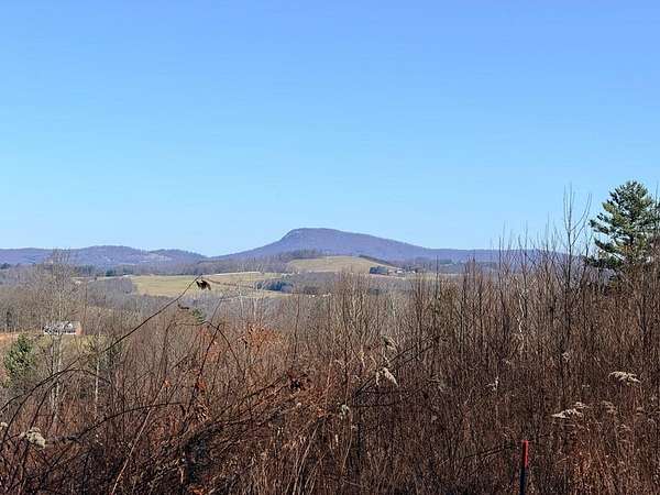
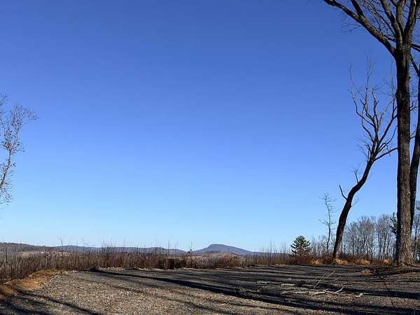
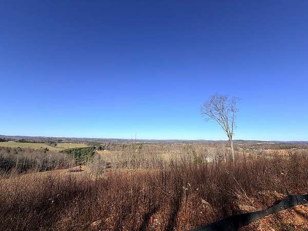
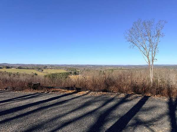
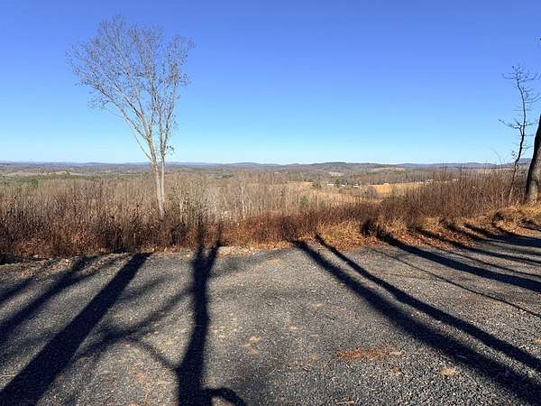
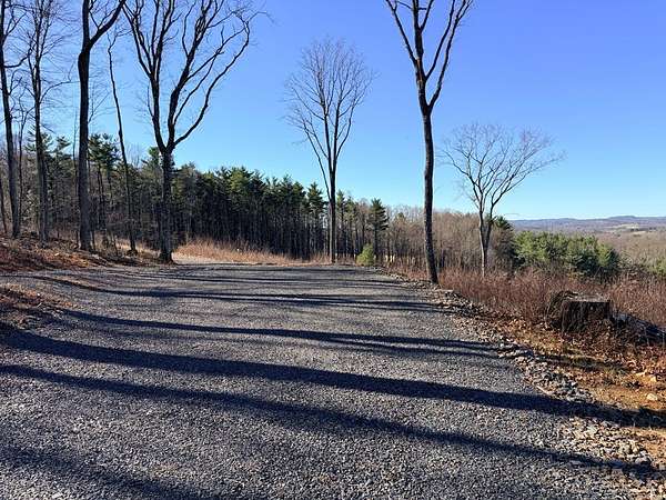
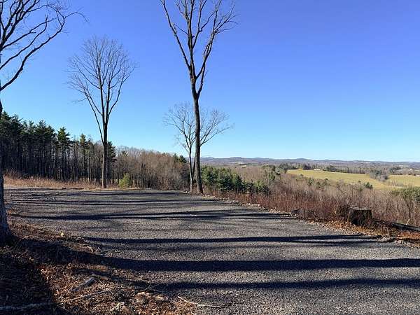
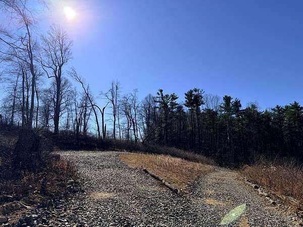
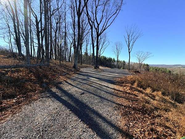
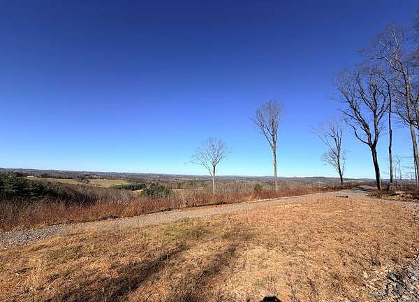
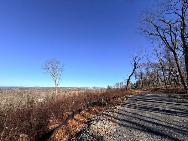
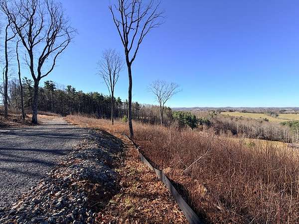
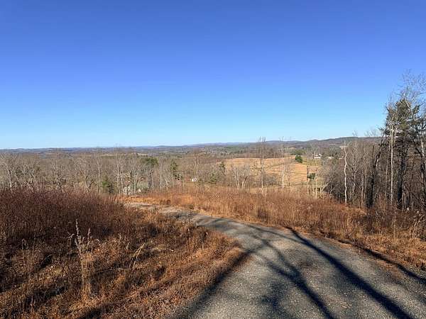
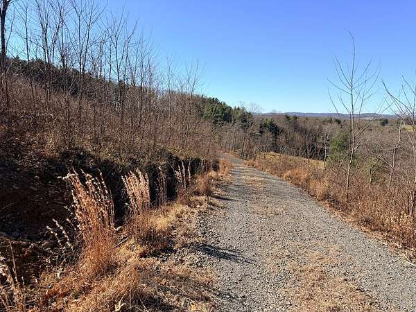
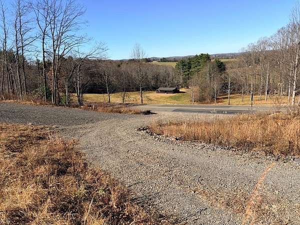
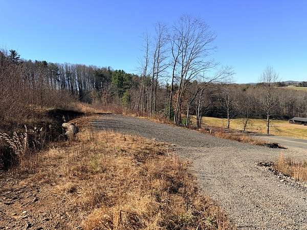
Est $1,498/mo180-degree spectacular view of Buffalo Mtn and the surrounding mountains in Laurel Fork! Land has already been cleared and has the perfect spot for your home. Land was perked for a 4-bedroom septic system in 2023. Land is rolling to slopping and has a level spot on top to build on. Enjoy the sunsets. Located on a paved road about 3 miles off the Blue Ridge Parkway.
Location
- Street address
- Keno Rd Lot: 102
- County
- Carroll County
- Elevation
- 2,648 feet
Directions
From the intersection of Hwy 52 and the Blue Ridge Parkway in Fancy Gap, go north on the Parkway for 5.7 miles and turn left onto Keno Rd. Go 3.4 miles to the land on the right at sign. If you have gone past Worrell Memorial Road on the left, you have gone too far.
Property details
- Acreage
- 10.67 acres
- MLS #
- SWVAR 104231
- Posted
Property taxes
- 2025
- $366
Details and features
Listing
- Type
- Land
Lot
- Features
- Can Be Divided, Cleared, Wooded
Nearby schools
| Name | Level | District | Description |
|---|---|---|---|
| Gladesboro | Elementary | — | — |
| Carroll County Intermediate | Middle | — | — |
| Carroll County | High | — | — |
Listing history
| Date | Event | Price | Change | Source |
|---|---|---|---|---|
| Dec 1, 2025 | New listing | $215,000 | — | SWVAR |
Payment calculator
Kaye Burnett
Fancy Gap Mountain Realty
Contact listing agent
By submitting, I agree to the terms of use and to be contacted by real estate professionals. Message and data rates may apply.