Images
Map
Agricultural Land for Sale in Humboldt, Iowa
Kentucky Ave, Humboldt, IA 50548
$1,708,438
124 acres
Active sale
ago
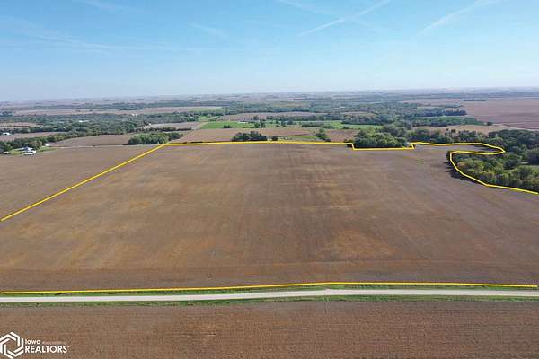
Est $12,442/mo124.25 acres, m/l, located approximately 2 1/2 miles southwest of Humboldt, Iowa on the east side of Kentucky Ave. This gently sloping farm has 120.31 FSA/Eff. crop acres with a CSR2 of 80.00. This is productive Humboldt County farm located southwest of Humboldt. The north 100 acres, m/l, of this farm carries an 85.00 CSR2.
Location
- Street address
- Kentucky Ave
- County
- Humboldt County
- Zip code
- 50548
- Elevation
- 1,138 feet
Directions
From Humboldt: Head south on Hwy. 169 for 2 miles. Turn west on Co. Hwy. C46 / 250th Street. In 1 mile turn south on Kentucky Ave. In 1 mile the property will be on the east side of the road
Property details
- Acreage
- 124.25 acres
- Zoning
- Agriculture
- MLS #
- NCMLS 6343872
- Posted
Property taxes
- 2025
- $5,018
Parcels
- 1023300001
Legal description
N 1/2 SW 1/4, and Tax Parcel 1023300006, all in Section 23, Township 91 North, Range 29 West of the 5th P.M., Humboldt County, IA. Final abstract/title documents to govern legal description.
Listing history
| Date | Event | Price | Change | Source |
|---|---|---|---|---|
| Oct 21, 2026 | New listing | $1,708,438 | — | NCMLS |
Payment calculator
Contact listing agent
By submitting, I agree to the terms of use and to be contacted by . Message and data rates may apply.