Land for Sale in Murphy, North Carolina
Liberty Rd, Murphy, NC 28906
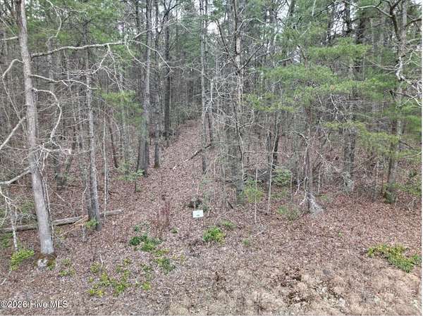
Murphy NC - Vacant Land 1.62+/-Acres. Located West of Town - Private Wooded Setting with few Restrictions. See attached Deed Restrictions allowing Recreational Vehicles. Property is conveniently located close to Tennessee Line & Blue Ridge Georgia, For Easy Access for Shopping and Medical Facilities, Also Only a Short Distance to Lake Hiwassee & Lake Apalacia for Fishing and Boating, and Cherokee County has 92,000 + Acres of US Forest Service for Outdoor Enthusiast to enjoy. The Seller is asking only $19,900. Make Offer! Just a little history: Murphy is a small town in the county seat of Cherokee County, North Carolina, It is situated at the confluence of the Hiwassee and Valley rivers. It is the westernmost county seat in the state of NC approximately 360 miles from the state capital. Cherokee County had long been part of the homelands of the Cherokee people. They knew this site along the Hiwassee River as Tlanusi-yi (the Leech Place). They had a legend about a giant leech named Tlanusi, that lived in the river here.[7] The Trading Path (later called the "Unicoi Turnpike") passed by the future site of Murphy, connecting the Cherokee lands east of the mountains with what were known to European colonists as the "Overhill Towns" of Tennessee. In 1836, during the Cherokee removal known as the Trail of Tears, the United States army built Fort Butler in what is today Murphy. Fort Butler was used as the main collection point by the government for Cherokee east of the mountains. From Fort Butler, the Cherokee were taken over the mountains on the Unicoi Turnpike to the main internment camps at Fort Cass (today Charleston, Tennessee), prior to their forcible removal to territory west of the Mississippi River, in what became known as Indian Territory (today's Oklahoma). I hope you enjoyed a little history of the area per Wikipedia Agent Remarks: Vacant Land Show Anytime, Buyers responsible for their own well/water
Location
- Street address
- Liberty Rd, Lot 29
- County
- Cherokee County
- Zip code
- 28906
- Community
- Headwaters At Meadowbrook Estates
- Elevation
- 1,742 feet
Directions
From the intersection of US Hwy 64 West and NC Hwy 294, turn RIGHT onto Hwy 294. Travel approximately 12.6 miles, then turn LEFT onto Candy Mountain Road. Go approximately 400 feet and turn RIGHT onto Liberty Road. Continue on Liberty Road Lot 29 will be on the LEFT. See sign.
Property details
- Acreage
- 1.62 acres70,567 sq ft
- MLS #
- HMLS 100615945
- Posted
Parcels
- 451300786422000
Legal description
LT 29 HEADWATERS @ MEADOWBROOK ESTATES 1731/648
Details and features
Listing
- Type
- Land
Lot
- Features
- Level, Rural, Wooded
Property utilities
| Category | Type | Status |
|---|---|---|
| Power | Grid | Available |
Listing history
| Date | Event | Price | Change | Source |
|---|---|---|---|---|
| Nov 12, 2026 | New listing | $19,900 | — | HMLS |