
Recreational Land for Sale in Livermore, Colorado
Larimer County, Livermore, CO 80536
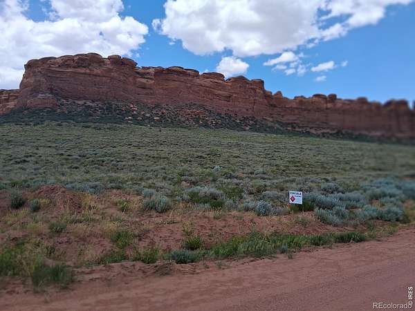
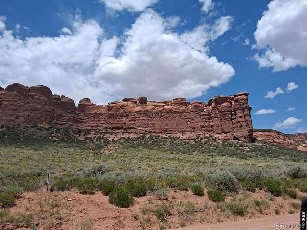
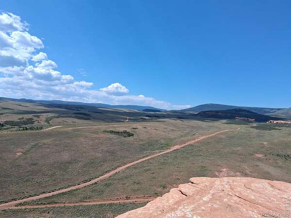
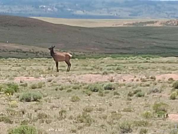
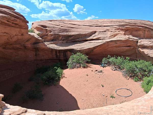
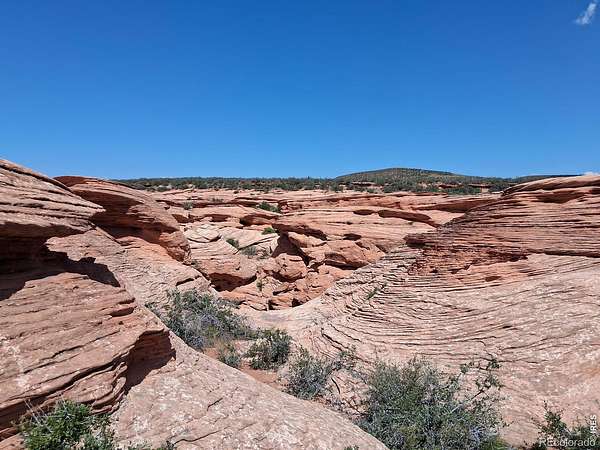
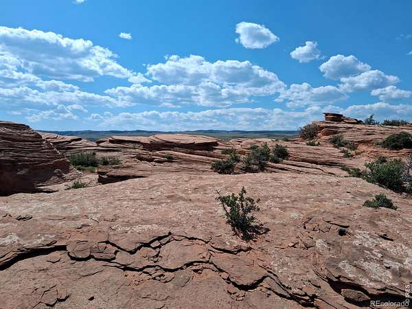
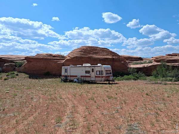
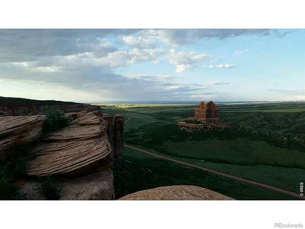
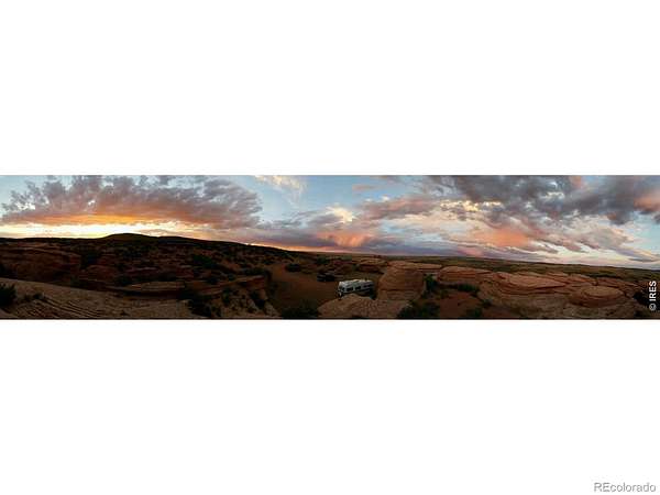
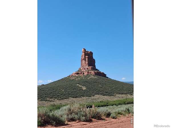
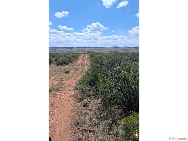
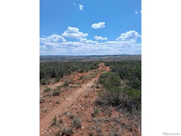
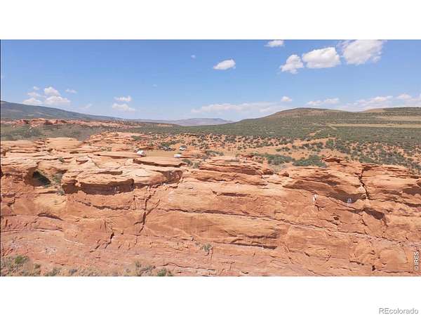
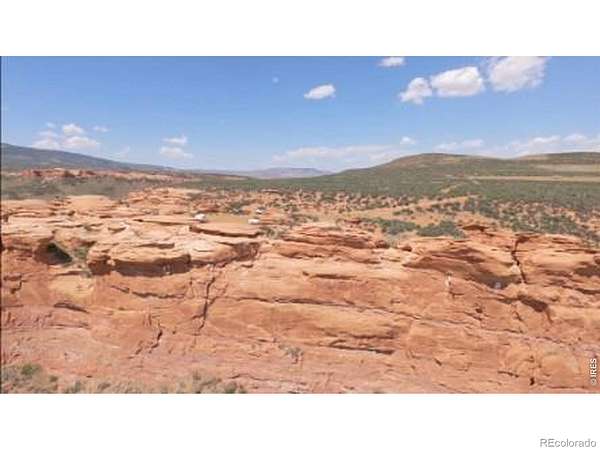
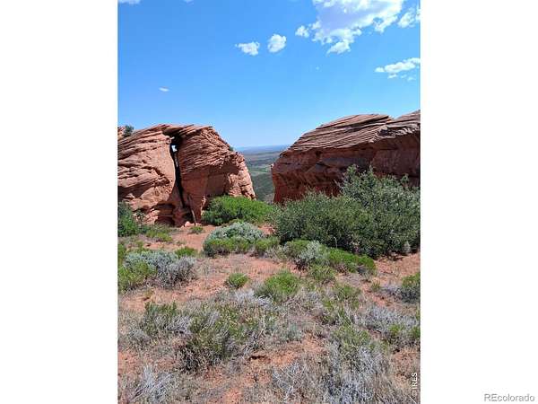
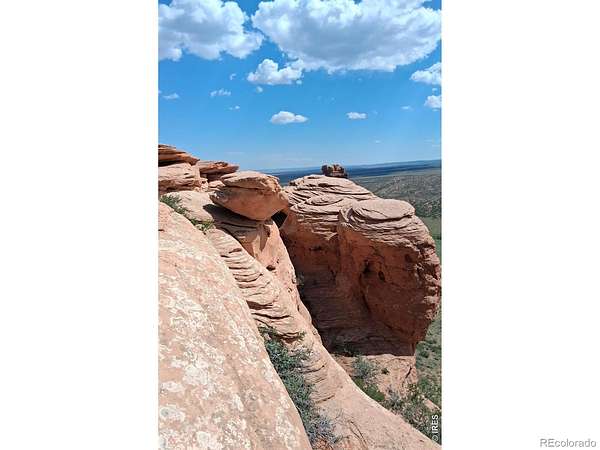
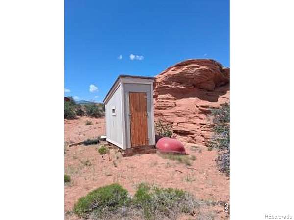
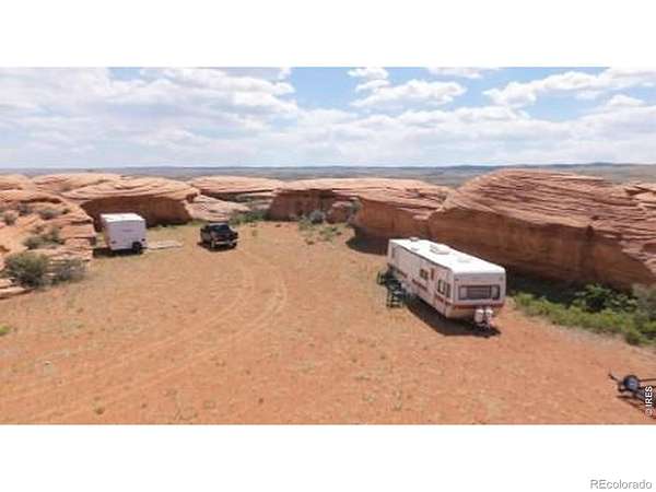
Discover a truly rare opportunity to own a piece of Colorado's natural and historical heritage in the heart of Sand Creek, offering a setting rich in history, open landscapes, and unmatched serenity. Enjoy breathtaking, unobstructed views of Chimney Rock rising prominently from the plains-an iconic natural feature that adds to the property's one-of-a-kind character. The surrounding scenery captures the essence of Colorado's high prairie, with expansive skies, native grasses, and peaceful surroundings that feel worlds away from the hustle of city life. Enjoy access to nearby private fishing opportunities, adding to the property's appeal as a quiet, nature-focused recreational getaway. Opportunities like this are few and far between-own a slice of Colorado history with views that truly inspire. Sand Creek is recognized as a National Natural Landmark. Campers are no longer on the property.
- Listed by Jo Klimecki, (720) 249-7453, HomeSmart Realty
Location
- County
- Larimer County
- Zip code
- 80536
- Community
- Sand Creek Park
- School district
- Poudre R-1
- Elevation
- 7,767 feet
Directions
From Tie Siding WY head west on Sportsman Lake Road, left on Sand Creek Road (CR 34), becomes N. County Road 89 once in Colorado, veer right on Ferret Circle, veer right on Ridge Rock Lane, right on Ringtail Drive. Last road at the top of the cliffs. Alternatively, from the Cement Plant south of Laramie take Cement Plant Rd, left onto Sand Creek Road (CR 34) becomes N. County Road 89 once in Colorado, turn right as it meets Sportsman Lake Road, veer right on Ferret Circle, veer right on Ridge Rock Lane, right on Ringtail Drive, Last road at the top of the cliffs.40.993768, - 105.776690
Property details
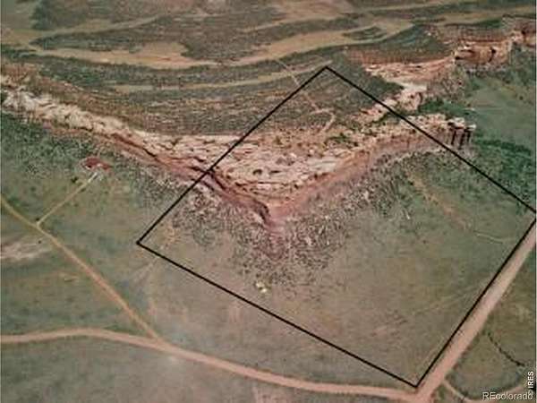
- Acreage
- 35 acres
- Zoning
- O
- MLS #
- REcolorado IR1054327
- Posted
Property taxes
- 2025
- $1,778
Expenses
- Homeowner Association Fee
- $105 annually
Parcels
- R1289594
Legal description
"POR IN 23-12-75 BEG AT NE COR, S 89 17' 26"""" W 5272.24 FT TO NW COR, S 0 7' 33"""" E 1156.53 FT, E 1235.73 FT TPOB, S 0 7' 33"""" E 1233.77 FT, E 1145.26 FT TO C/L CO RD, TH ALG SD C/L N 8 29' E 766.48 FT TO BEG CUR CONC W, C/A 3 11' 32"""", RAD 4665.42 FT, L/C N 6"
Resources
Details and features
Listing
- Type
- Land
- Subtype
- Unimproved Land
- Ownership
- Individual
- Exclusions
- All Seller's Personal Property. Campers Are No Longer On the Property.
- Possession
- Closing/DOD
Lot
- Road Surface
- Dirt
- View
- Mountain(s)
- Features
- Rock Outcropping
Nearby schools
| Name | Type | District |
|---|---|---|
| Livermore | Elementary | Poudre R-1 |
| Poudre | High | Poudre R-1 |
Listing history
| Date | Event | Price | Change | Source |
|---|---|---|---|---|
| Apr 19, 2026 | New listing | $180,000 | — | REcolorado |
Payment calculator
Based on information submitted to the MLS GRID as of July 20, 2026 11:00 pm MT. All data is obtained from various sources and may not have been verified by broker or MLS GRID. Supplied Open House Information is subject to change without notice. All information should be independently reviewed and verified for accuracy. Properties may or may not be listed by the office/agent presenting the information. Some IDX listings have been excluded from this website. View more