Commercial Land for Sale in Byers, Colorado
Peoria Rd, Byers, CO 80103
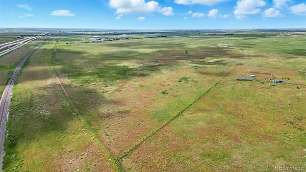
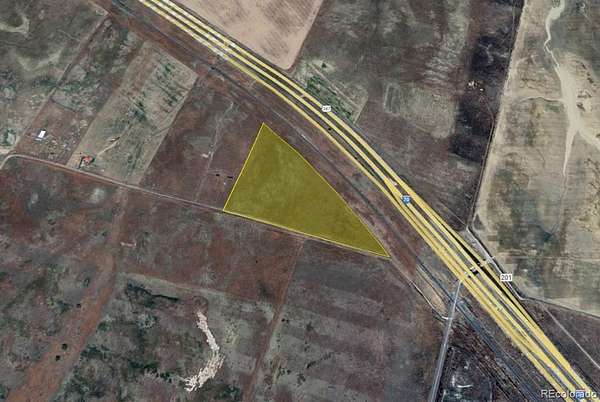
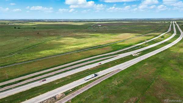
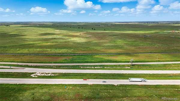
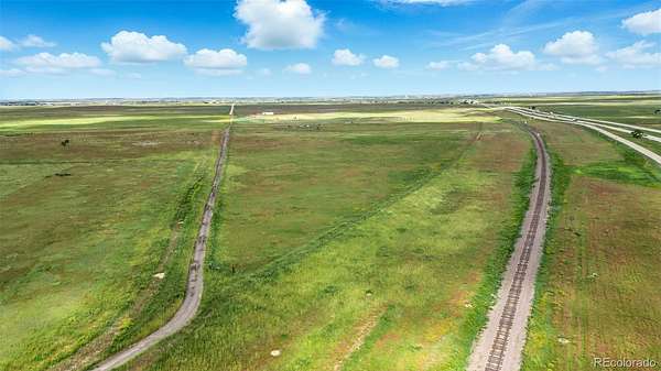
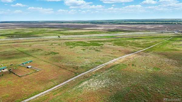
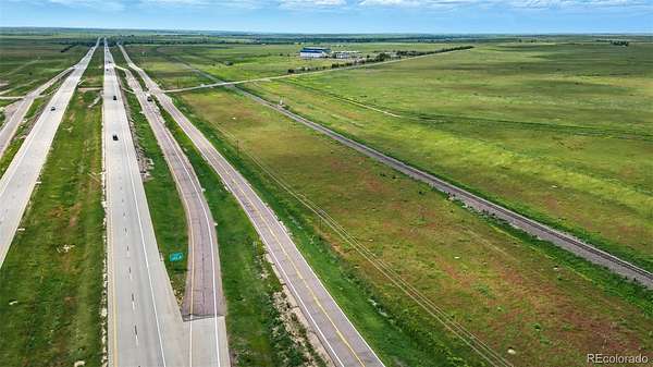
Located just off the I-70 Peoria Street exit (exit 322), this 30.25-acre parcel offers an exceptional opportunity for developers, investors, and end-users alike. Positioned within Arapahoe County’s Urban Area Corridor per the Comprehensive Plan, the site is designated for future urban development—making it ideal for industrial, commercial/retail, or residential uses.
The Urban Area Corridor is defined as a zone where growth is either already present or anticipated, supporting higher-density development with supporting infrastructure. This property features two established points of access and nearby utilities, ensuring a smoother path toward future uses.
With proximity to major transportation routes and growing economic activity in the area, this site offers both immediate and long-term potential.
- Listed by Cooper Raines, (720) 470-8585, Compass - Denver
Location
- Street address
- Peoria Rd
- County
- Arapahoe County
- Zip code
- 80103
- Community
- Ag - TWN 1987 and 2061
- School district
- Byers 32-J
- Elevation
- 5,192 feet
Directions
If heading East on I-70, take exit 322. At the stop sign take a right and cross the rail road tracks. Take your first right and property will be on your right.
Property details
- Acreage
- 30.25 acres
- Zoning
- A-1
- Access
- Easement
- MLS #
- REcolorado 1735930
- Posted
Property taxes
- 2024
- $138
Parcels
- 0000023
Legal description
A PARCEL OF LAND SITUATE IN THE SOUTHEAST QUARTER OF SECTION 20,
TOWNSHIP 4 SOUTH, RANGE 60 WEST OF THE SIXTH PRINCIPAL MERIDIAN,
COUNTY OF ARAPAHOE, STATE OF COLORADO BEING MORE PARTICULARLY
DESCRIBED AS FOLLOWS;
BEGINNING AT THE SOUTH ONE-QUARTER CORNER OF SAID SECTION 20,
AND HAVING ALL BEARINGS HEREIN RELATIVE TO THE SOUTH LINE OF THE
SOUTHEAST QUARTER OF SECTION 20, AS SHOWN ON THE DEPOSITED LAND
SURVEY PLAT RECORDED UNDER RECEPTION NO. E2097006 OF SAID COUNTY,
WHICH BEARS S88°27'41"W AND IS MONUMENTED AT THE SOUTH ONE-QUARTER
BEING A 2-1/2 INCH ALUMINUM CAP LS 36070 AND AT THE SOUTHEAST CORNER
BEING A 1 INCH IRON ROD WITH A 2-1/2 INCH ALUMINUM CAP PLS 29766.
THENCE N00°03'32"W ALONG THE WEST LINE OF SAID SOUTHEAST QUARTER,
DISTANCE OF 1,285.65 FEET TO A POINT ON THE SOUTHERLY RIGHT-OF-WAY
LINE OF THE UNION PACIFIC RAILROAD, BEING A NON-TANGENT CURVATURE;
THENCE ALONG SAID SOUTHERLY RIGHT-OF-WAY THE FOLLOWING TWO (2)
COURSES...
See Supplements for full legal description.
Details and features
Listing
- Type
- Land
- Subtype
- Unimproved Land
- Terms
- Cash, Conventional, Farm Service Agency
- Possession
- Closing/DOD
Location
- Incorporated
- No
Lot
- Road Frontage
- Easement, Public
- View
- Plains
- Well Type
- Not Drilled
- Survey
- Boundaries Surveyed
Exterior
- Fencing
- Partial
- Horses Allowed
- Yes
Property utilities
| Category | Type | Status |
|---|---|---|
| Power | Grid | Available |
Listing history
| Date | Event | Price | Change | Source |
|---|---|---|---|---|
| Apr 19, 2026 | New listing | $200,000 | — | REcolorado |
Payment calculator
Based on information submitted to the MLS GRID as of July 18, 2026 5:00 am MT. All data is obtained from various sources and may not have been verified by broker or MLS GRID. Supplied Open House Information is subject to change without notice. All information should be independently reviewed and verified for accuracy. Properties may or may not be listed by the office/agent presenting the information. Some IDX listings have been excluded from this website. View more