Land for Sale in Quemado, New Mexico
Catron County Quemado, NM 87829
Images
Map


$30,000
16.71 acres
Active sale agoEst $247/mo
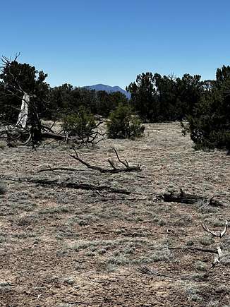
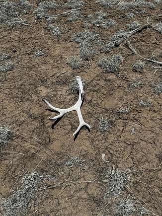
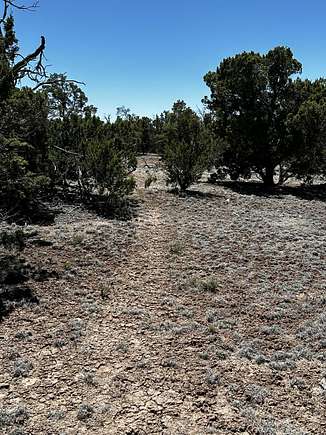
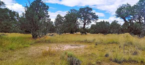
Beautiful, heavily treed, private lot in the Indian Springs subdivison. Many older, Large Cedar, and tall pinons throughout property. There are several private flat building sites. Stunning mountain views to the north and south. Evidence of elk, deer and other wildlife scattered throughout. Electricty is close by. Close to popular hunting units and public lands. Come enjoy the unobstructed night skies and beautiful sunsets this area of New Mexico has to offer.
Directions
Fom Hwy 60 in Quemado: Take Hwy 60 east to Omega Rd turn North, follow to Cocheise turn west, follow to Warpath, turn right then left onto Tomahawk, follow around to sign.
Location
- County
- Catron County
- Community
- Indian Spirngs
- Elevation
- 7,569 feet
Property details
- Zoning
- RR-1
- MLS Number
- SWMLS 1061571
- Date Posted
Property taxes
- Recent
- $217
Expenses
- Home Owner Assessments Fee
- $132 annually
Parcels
- 2084010473233
Listing history
| Date | Event | Price | Change | Source |
|---|---|---|---|---|
| Apr 29, 2024 | New listing | $30,000 | — | SWMLS |
Payment calculator

Contact listing agent
By submitting, you agree to the terms of use, privacy policy, and to receive communications.