Skip to main content
Skip to navigation
Properties
Find agent
Post listing
Log in
•
Sign up
Search here
List
Alliance, OH land for sale
Price
Size
Tags
Save
62 properties
Updated
For you
Newest
Price: high to low
Price: low to high
Size: large to small
Size: small to large
Updated
Pending
Under contract
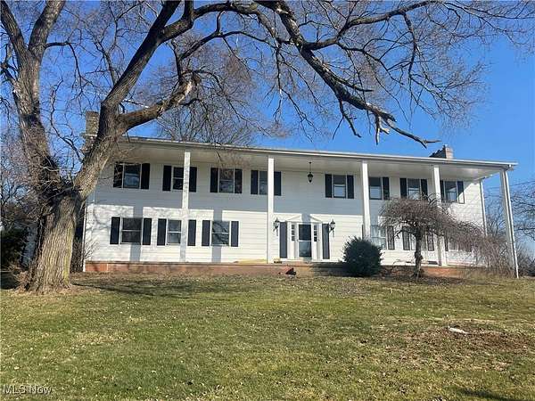
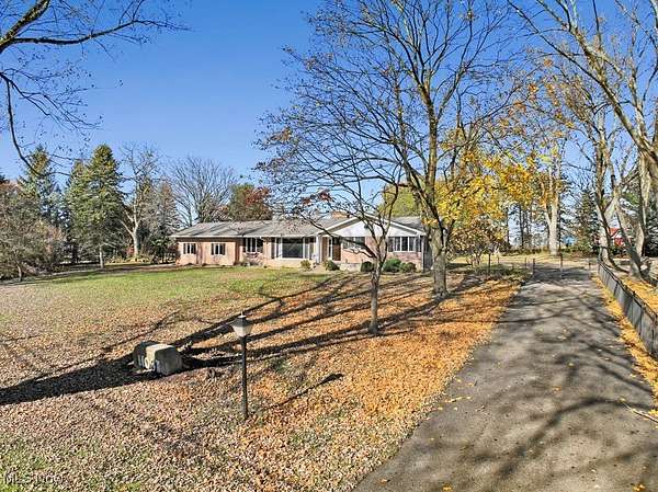
$500,000
6 acres
Stark County
7 bd, 4 ba
•
— sq ft
Louisville, OH 44641
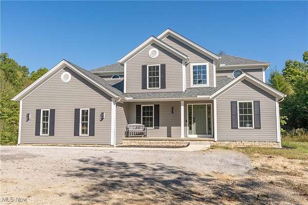
Pending
Under contract
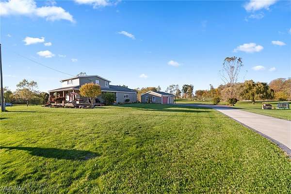
$439,900
5.69 acres
Stark County
4 bd, 3 ba
•
2,150 sq ft
Alliance, OH 44601
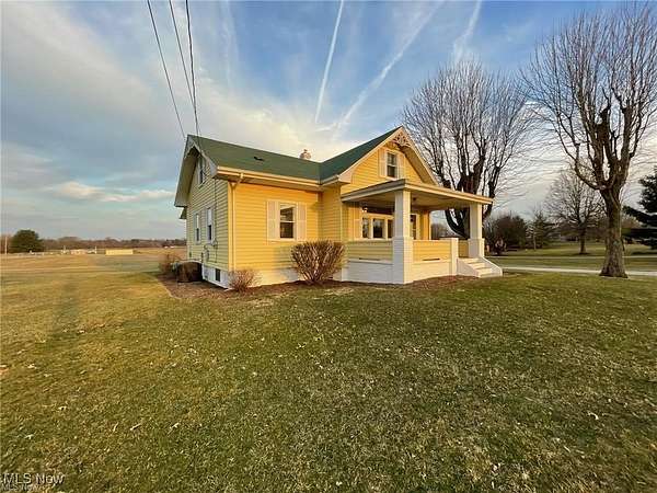
21 hours
$274,900
4.84 acres
Columbiana County
3 bd, 1 ba
•
1,752 sq ft
Alliance, OH 44601
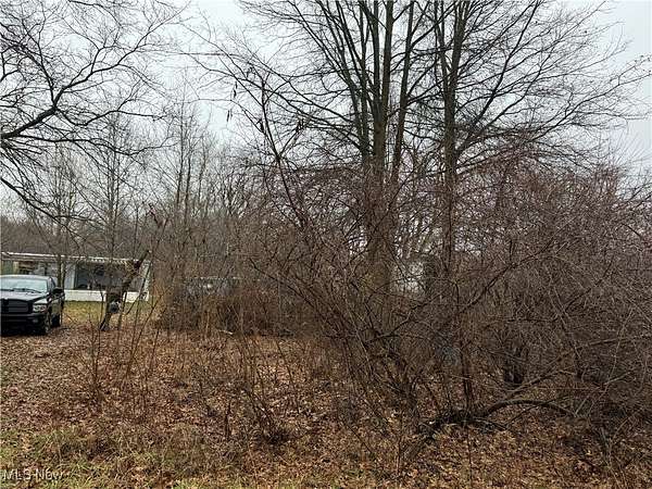
1 day
$18,000
0.6 acres
Mahoning County
Sebring, OH 44601
Pending
Under contract
$239,900
3.57 acres
Stark County
3 bd, 2 ba
•
1,528 sq ft
Alliance, OH 44601
Pending
Under contract
$7,500
0.12 acres
Mahoning County
Sebring, OH 44672
Pending
Under contract
$7,500
0.17 acres
Stark County
Alliance, OH 44601
Pending
Under contract
$369,900
5 acres
Stark County
3 bd, 3 ba
•
2,000 sq ft
Alliance, OH 44601
Upcoming auction
$— min
6.5 acres
Stark County
Louisville, OH 44641
11 days
$269,900
2 acres
Stark County
4 bd, 2 ba
•
2,446 sq ft
Alliance, OH 44601
21 days
$259,000
7 acres
Stark County
3 bd, 1 ba
•
1,541 sq ft
Paris, OH 44669
$5.1k drop • Nov 18
$259,900
1.8 acres
Stark County
4 bd, 3 ba
•
1,936 sq ft
Louisville, OH 44641
7 months ago
$1,245,000
19.7 acres
Stark County
3 bd, 5 ba
•
4,586 sq ft
Louisville, OH 44641
$10k drop • Oct 22
$309,000
6.49 acres
Stark County
3 bd, 2 ba
•
1,964 sq ft
Alliance, OH 44601
4 months ago
$379,900
8.18 acres
Columbiana County
3 bd, 2 ba
•
2,157 sq ft
Minerva, OH 44657
$14k drop • Nov 6
$325,000
3.5 acres
Portage County
3 bd, 1 ba
•
2,084 sq ft
Deerfield, OH 44411
7 months ago
$735,500
26.8 acres
Portage County
4 bd, 1 ba
•
1,960 sq ft
Deerfield, OH 44411
$10k drop • Dec 1
$345,900
5.2 acres
Stark County
3 bd, 2 ba
•
1,664 sq ft
Paris, OH 44669
Pending
Under contract
$259,900
6 acres
Stark County
4 bd, 1 ba
•
1,632 sq ft
Paris, OH 44669
3 years ago
$269,900
6 acres
Stark County
4 bd, 3 ba
•
1,976 sq ft
East Canton, OH 44730
50 days ago
$725,000
7.26 acres
Stark County
3 bd, 4 ba
•
3,672 sq ft
Louisville, OH 44641
$20.1k drop • Dec 4
$129,900
0.22 acres
Stark County
Alliance, OH 44601
Pending
Under contract
$425,000
4.73 acres
Portage County
5 bd, 3 ba
•
2,395 sq ft
Atwater, OH 44201
13 days
$525,000
18.8 acres
Stark County
4 bd, 3 ba
•
2,754 sq ft
Alliance, OH 44601
14 days
$290,000
5.6 acres
Portage County
3 bd, 2 ba
•
1,092 sq ft
Atwater, OH 44201
2 months ago
$549,900
1.59 acres
Portage County
3 bd, 3 ba
•
2,034 sq ft
Deerfield, OH 44411
57 days ago
$239,900
1.63 acres
Stark County
3 bd, 3 ba
•
1,670 sq ft
Minerva, OH 44657
$10k drop • Dec 18
$165,000
3 acres
Columbiana County
3 bd, 2 ba
•
1,470 sq ft
Beloit, OH 44609
9 months ago
$225,000
2.64 acres
Mahoning County
— sq ft
Alliance, OH 44601
$35k drop • Nov 26
$275,000
2.87 acres
Stark County
— sq ft
Minerva, OH 44657
Pending
Under contract
$445,000
3 acres
Stark County
5 bd, 4 ba
•
4,728 sq ft
Louisville, OH 44641
52 days ago
$650,000
9 acres
Columbiana County
4 bd, 4 ba
•
3,075 sq ft
East Rochester, OH 44625
$2k drop • Nov 11
$5,000
0.066 acres
Stark County
Alliance, OH 44601
6 months ago
$14,000
0.14 acres
Stark County
Alliance, OH 44601
3 months ago
$393,600
39.4 acres
Stark County
East Canton, OH 44730
13 months ago
$29,900
0.59 acres
Stark County
Alliance, OH 44601
2 years ago
$71,500
0.28 acres
Stark County
Alliance, OH 44601
Pending
Under contract
$5,000
0.27 acres
Stark County
Alliance, OH 44601
6 years ago
$49,900
1.6 acres
Portage County
Atwater, OH 44201
26 days
$50,000
2.25 acres
Mahoning County
Alliance, OH 44601
$3k drop • Dec 8
$27,000
1.5 acres
Stark County
Alliance, OH 44601
3 months ago
$18,900
0.83 acres
Mahoning County
Sebring, OH 44672
4 months ago
$89,000
2.82 acres
Stark County
Alliance, OH 44601
3 months ago
$18,900
0.84 acres
Mahoning County
Sebring, OH 44672
55 days ago
$19,900
0.93 acres
Stark County
Alliance, OH 44601
3 months ago
$40,000
0.33 acres
Stark County
Alliance, OH 44601
3 months ago
$45,000
0.33 acres
Stark County
Alliance, OH 44601
3 months ago
$40,000
0.33 acres
Stark County
Alliance, OH 44601
2 months ago
$11,900
0.14 acres
Stark County
Alliance, OH 44601
6 months ago
$22,000
0.3 acres
Stark County
Alliance, OH 44601
1
2
1-50 of 62 properties
Map