Images
Map
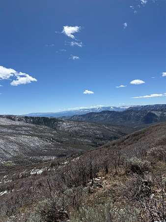
Residential Land for Sale in Rifle, Colorado
S Fork R Rd, Rifle, CO 81650
$225,000
Active sale
Est $1,645/moLocation
- Street address
- S Fork R Rd
- County
- Garfield County
- Zip code
- 81650
- Community
- Rifle
- Elevation
- 7,682 feet
Directions
From downtown Rifle take Railroad Ave North out of town. Right on Hwy 325 (at the bowling alley) continue up the valley towards Rifle Gap at the for take a left on 252 continue North 9.2 miles to Wild Acre Ranch Rd. See picture of gate in pictures. Continue up this road to the For Sale sign.
Property details
- Zoning
- Rural
- MLS #
- GJARA 20262094
- Posted
Property taxes
- 2025
- $1,540
Parcels
- 1921-072-01-005
Details and features
Listing
- Type
- Land
- Subtype
- Single Family Residence
Lot
- Features
- Adjacent to Public Land, Flat, Pond On Lot, Rock Outcropping, Stream Creek, Wooded
Nearby schools
| Name | Type |
|---|---|
| Wamsley Elementary | Elementary |
| Rifle Middle School | Middle |
| Rifle High School | High |
Listing history
| Date | Event | Price | Change | Source |
|---|---|---|---|---|
| May 6, 2026 | New listing | $225,000 | — | GJARA |
Payment calculator
Contact listing agent
By submitting, I agree to the terms of use and to be contacted by . Message and data rates may apply.