537 Acres of Recreational Land for Sale in Rail Road Flat, California
Summit Level Rd, Rail Road Flat, CA 95248
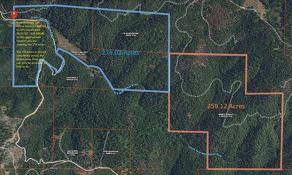
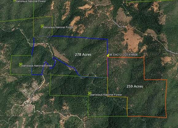

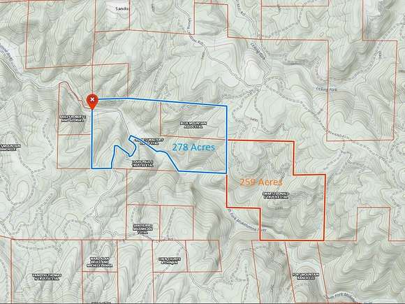

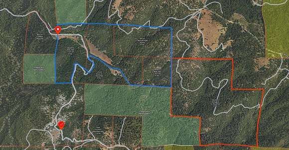


Looking for REALLY remote acreage? This 537 acre listing is made up of 14 separate parcels that the South Fork of the Mokelumne River winds through. The 68 acre parcel on Summit Level county road is located in the Northwest section of this group of parcels and is zoned A1 (General Agricultural). All other parcels are zoned GF (General Forestry). Access to the 13 GF parcels is by fording the river or walking in from the forestry road to the north. Bring your GPS and explore. It is strongly suggested that you review the attached maps and do your research online to confirm location. The coordinates for the Northwest corner of the parcels is 38.33722,-120.43468 at the point where you enter the property on Summit Level Rd coming from Railroad Flat. Over 500 acres of solitude and security are waiting for you to make it yours. Sale may require court approval, depending on timing.
Property details
- County
- Calaveras County
- Elevation
- 3,310 feet
- MLS Number
- CCAR 202300706
- Date Listed
Parcels
- 006014050
Detailed attributes
Listing
- Type
- Lots And Land
Lot
- Views
- Canyon, Forest, Hills, Mountain, River, Water
Listing history
| Date | Event | Price | Change | Source |
|---|---|---|---|---|
| Mar 27, 2024 | New listing | $1,090,000 | — | CCAR |
| Sept 18, 2023 | Listing removed | $1,090,000 | — | CCAR |
| June 1, 2023 | New listing | $1,090,000 | — | CCAR |