300 Acres of Recreational Land & Farm for Sale in Burns, Oregon
T21S R33E Wm Sec. 18: S 1/2, Burns, OR 97720


Timber Retreat
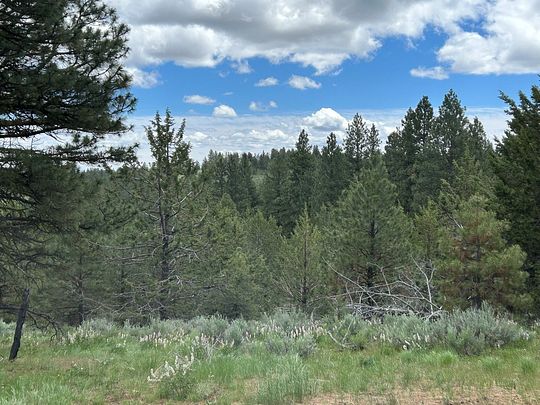
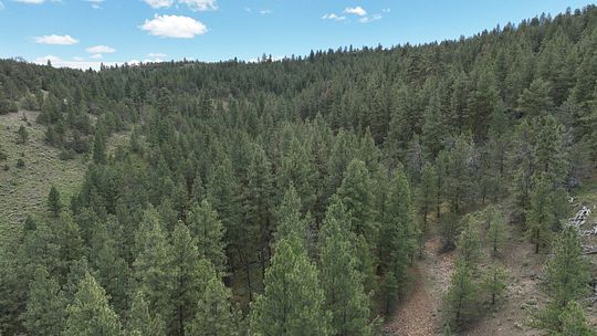
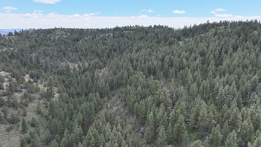
This Eastern Oregon Timbered property boarders BLM land on two sides and is 1/2 mile from the Malheur National Forest. The Eastern Oregon Retreat is characterized by its dense forest cover composed of Ponderosa Pine and Juniper trees. The property's landscape is fairly rugged and hilly with a couple of great cabin sites locations.
The forested area offers a rich and vibrant ecosystem, supporting a wide range of wildlife species; Mule Deer, Rocky Mountain Elk, black bears, mountain lions and various bird species are among the common inhabitants. This property is in the Malheur River Hunting Unit and qualifies for 2 Landowner Preference tags for deer & elk.
There is a nice water drainage going through the property providing a water source for wildlife.
This is a great place to build a cabin and enjoy your recreational activities such as hiking, camping, watching wildlife, photography or retreat from the hustle and bustle of urban life.
LOCATION: Approx. 30 miles Northeast of Burns OR LEGAL DESC.: T21S R33E WM Sec. 18: S 1/2
ACREAGE: 299.93 +/- acres TAXES: 2021/2022 $456.46 (Farm Deferral)
PRICE: $395,000.00
Property details
- County
- Harney County
- Elevation
- 5,410 feet
- Date Listed
Parcels
- 1321.00S33.00E0000--000000700
Listing history
| Date | Event | Price | Change | Source |
|---|---|---|---|---|
| Apr 25, 2024 | Under contract | $395,000 | — | — |
| June 27, 2023 | New listing | $395,000 | — | — |