0.38 Acres of Residential Land for Sale in Ashland, Oregon
Thornton Way, Ashland, OR 97520
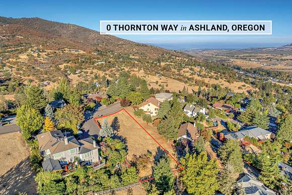
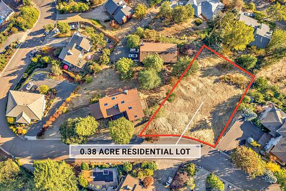

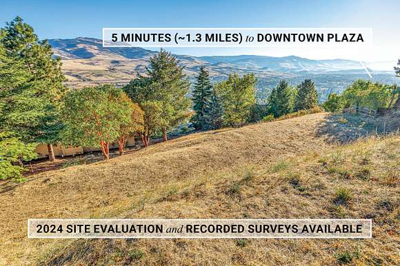
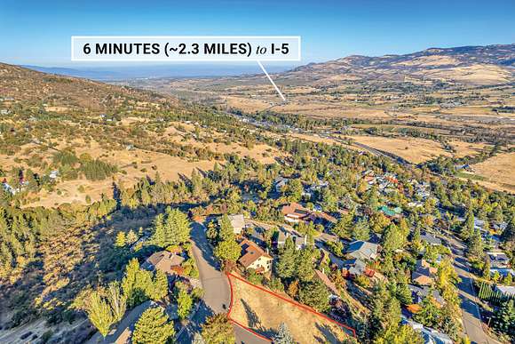


Complete building due diligence package including new 2024 site evaluation by Amy Gunter of Rogue Planning & Development Services available! Spacious residential lot with stunning panoramic views in a desirable neighborhood with underground utilities located above the boulevard near Asante Ashland Community Hospital -- just five minutes from Ashland's downtown plaza and Lithia Park! The property features a clear building site, mature trees, and views across the Rogue Valley to Table Rocks, Grizzly Peak, and Greensprings Mountain. Parcel is 0.38 acres or 16,552 SqFt per county assessor. Inquire with agents for access to site evaluation, surveys, maps, addenda, and Vacant Land Disclosure Addendum.
Directions
From N Main St to Wimer St, right on Thornton Way; lot is on right side of street -- adjacent to 598 Thornton Way.
Property details
- County
- Jackson County
- Community
- Franeva Heights Subdivision
- Zoning
- R-1-7.5
- Elevation
- 2,224 feet
- MLS Number
- SORMLS 220170279
- Date Listed
Parcels
- 10055164
Property taxes
- 2022
- $1,850
Detailed attributes
Listing
- Type
- Lots And Land
- Franchise
- John L. Scott
Lot
- Views
- City, Mountain, Panorama, Valley
Nearby schools
| Name | Level | District | Description |
|---|---|---|---|
| Helman Elem | Elementary | — | — |
| Ashland Middle | Middle | — | — |
| Ashland High | High | — | — |
Listing history
| Date | Event | Price | Change | Source |
|---|---|---|---|---|
| Mar 8, 2024 | Back on market | $100,000 | — | SORMLS |
| Jan 19, 2024 | Under contract | $100,000 | — | SORMLS |
| Oct 14, 2023 | Back on market | $100,000 | — | SORMLS |
| Oct 10, 2023 | Under contract | $100,000 | — | SORMLS |
| Sept 8, 2023 | Back on market | $100,000 | — | SORMLS |
| Aug 29, 2023 | Under contract | $100,000 | — | SORMLS |
| Aug 26, 2023 | New listing | $100,000 | — | SORMLS |