


Recreational & Residential Land for Sale in Livermore, Colorado
W County Road 82E, Livermore, CO 80536
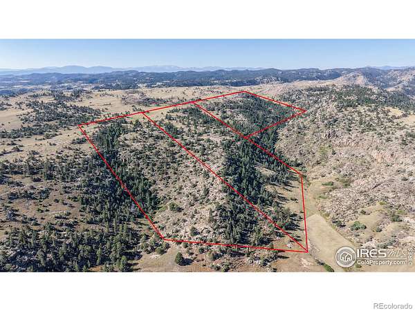
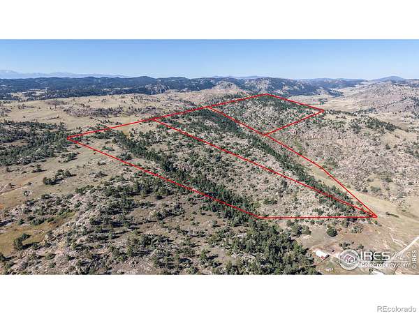
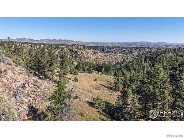
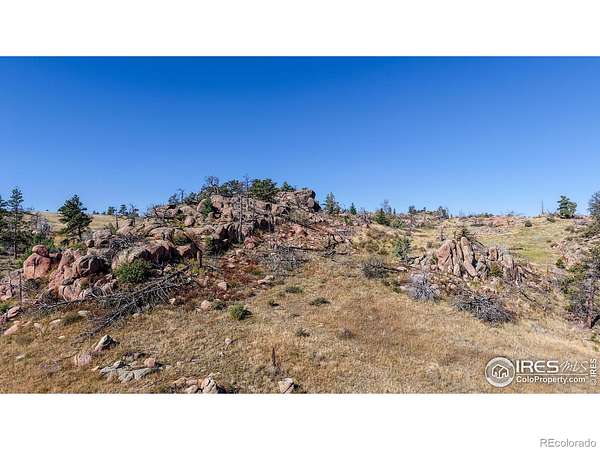
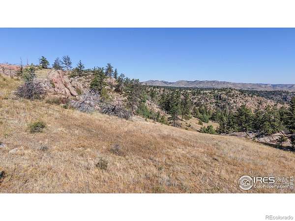
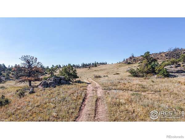
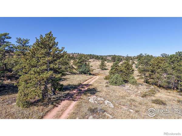
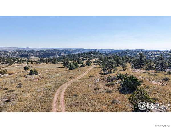
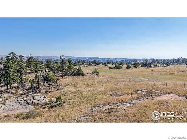
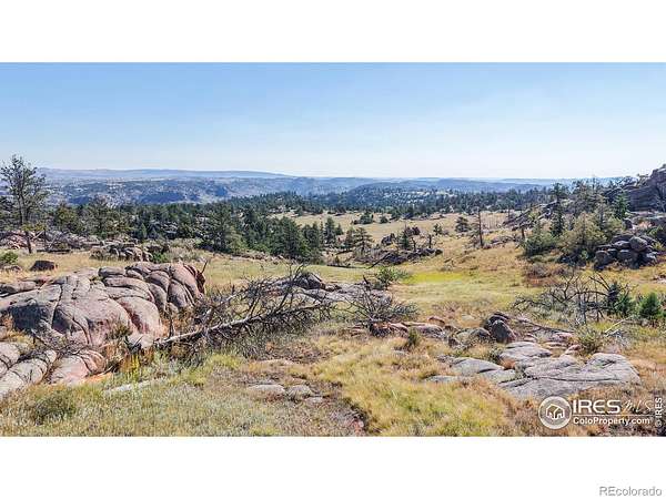
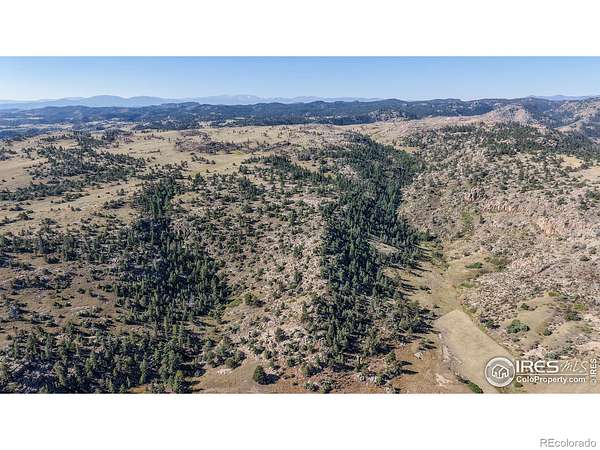
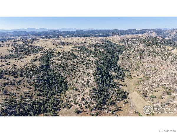
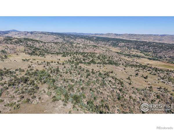
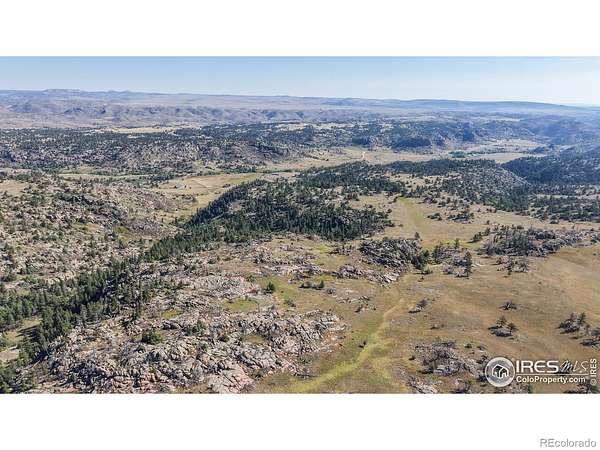
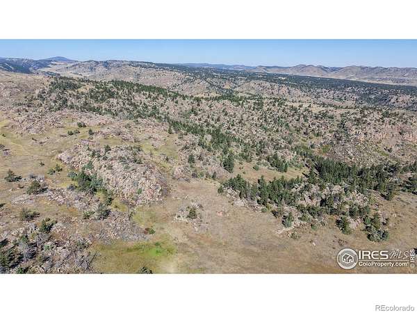
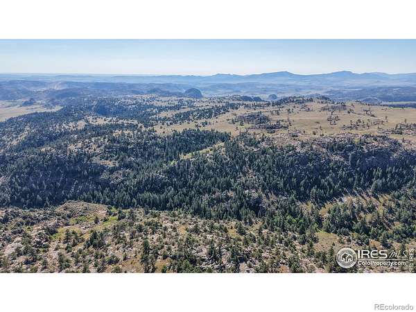
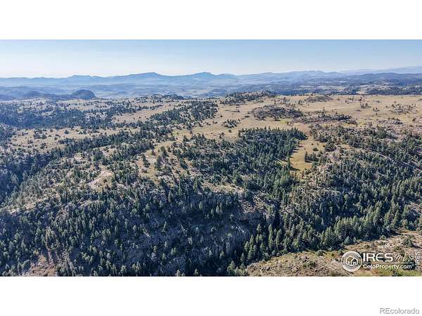
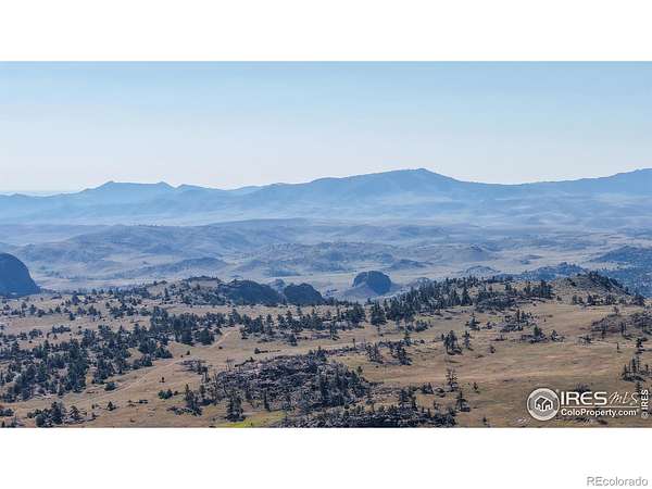
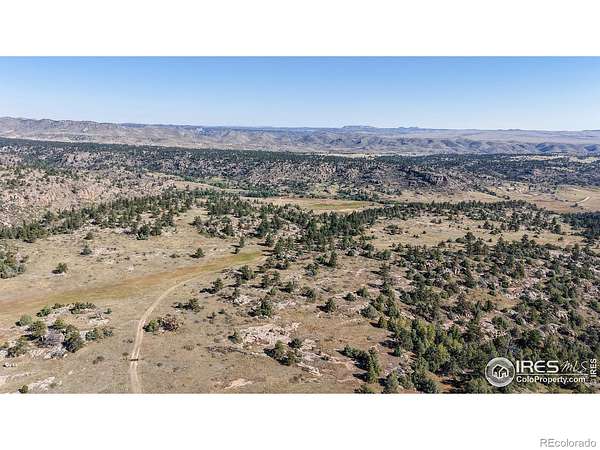
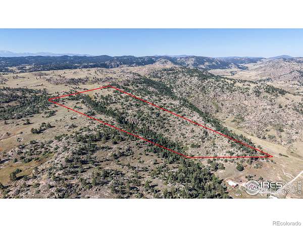
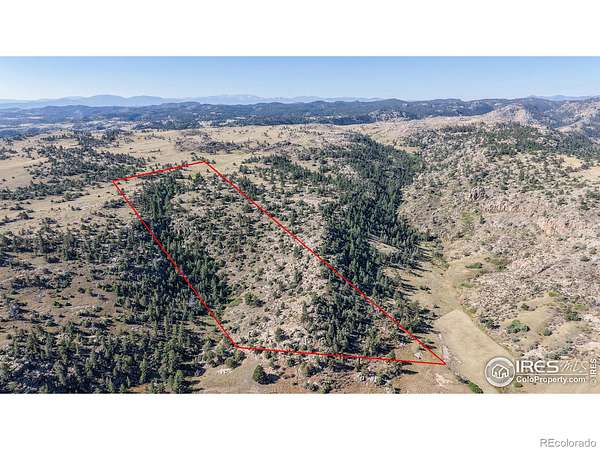
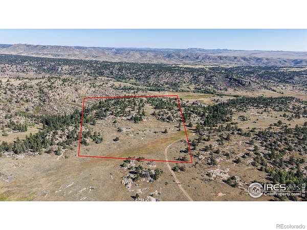
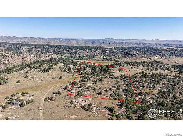
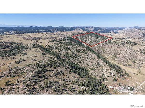
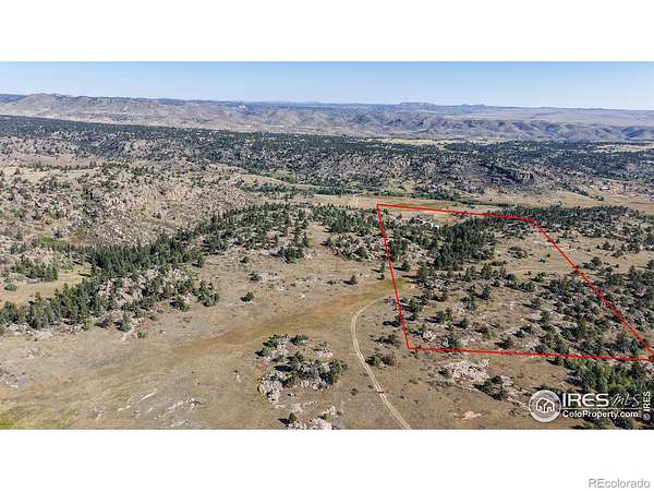
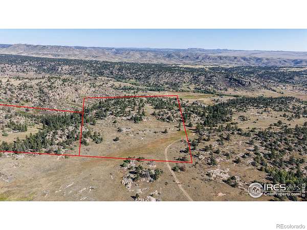
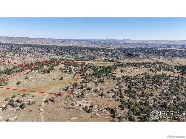
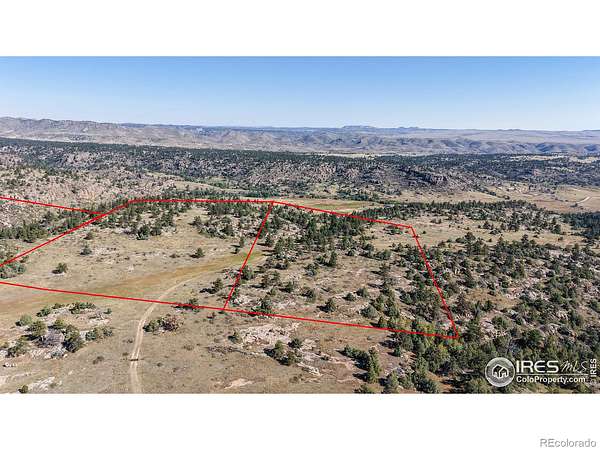
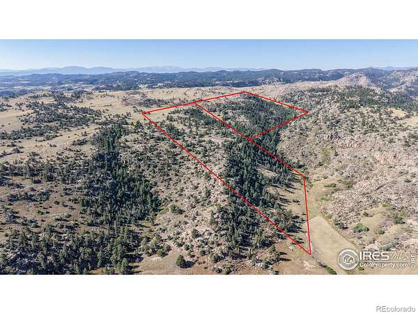
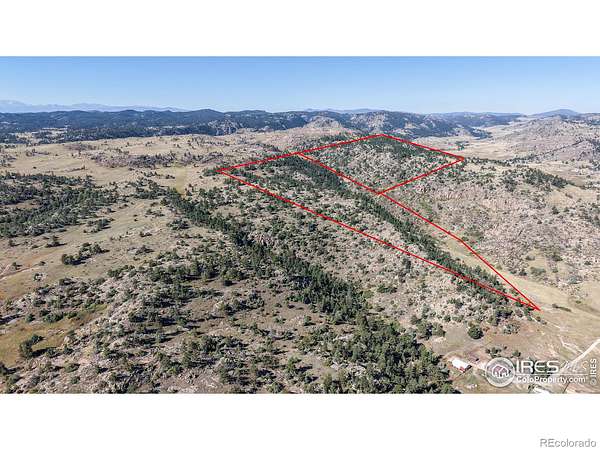
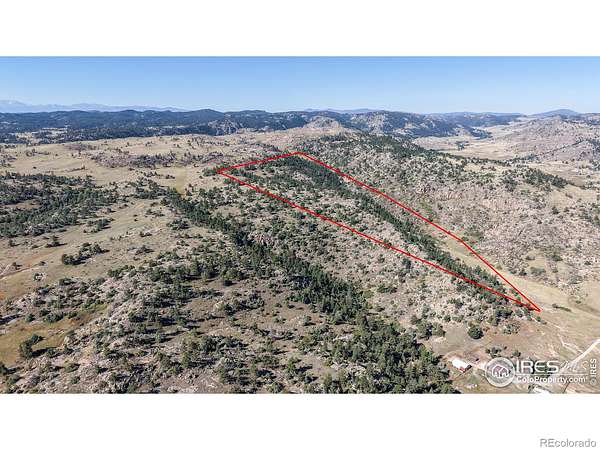
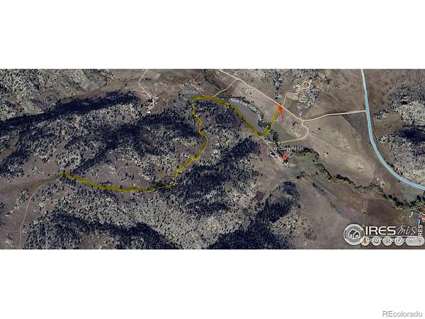
SAVE BIG- buying 3 Parcels all together for a total of 98.78 acres of CO Land - Colorado Living at it's finest! Options for you to make your own. Whether you are looking to build your primary residence, cabin getaway or simply looking for your own plot of paradise, this is it. Hunting season is right around the corner. Lots of wildlife and unbelievable views. Note there are a total of 3 parcels available. This listing includes all 3 parcels; East Parcel features 37 acres and there is an additional Center and West Parcel that can be bought together for 61.78 acres. The West Parcel abuts National Forest perfect for roaming the land and soaking in all that Colorado acreage offers! Gate access. Must schedule with a Realtor. This offering is to purchase all 3 parcels together R0252581 and R1207172 and R1207199 for total of 98.78 acres. Other options include 2 parcels which must be purchased together R0252581 and R1207172 check out MLS#1043101. Buyer to confirm number of dwellings on each parcel. Also an individual parcel is available Check out MLS # 1042980 .
Location
- Street address
- W County Road 82E
- County
- Larimer County
- Zip code
- 80536
- School district
- Poudre R-1
- Elevation
- 6,627 feet
Property details
- Acreage
- 98.78 acres
- Zoning
- O
- MLS #
- REcolorado IR1043103
- Posted
Property taxes
- 2024
- $34
Parcels
- R0252581
Legal description
"BEG AT SE COR 7-10-71, TH ALG E LN N 0 0' 40"""" E 1275.21 FT; TH S 88 40' 45"""" W 1422.70 FT; TH S 08 01' 25"""" E 150 FT; TH S 17 23' 25"""" E 1144.45 FT TO S LN; TH ALG SD S LN S 89 54' 00"""" E 1059.09 FT M/L TPOB (NC17N000040E)"and "BEG AT SW COR 8-10-71, TH ALG W LN N 00 19' 14"""" E 1999.03 FT; TH N 60 00' 00"""" E 800 FT; TH S 2377.95 FT M/L TO S LN; TH ALG S LN S 88 17' 16"""" W 704.32 FT M/L TPOB (SPLIT FROM 10080-00-014) (C43N881716E)" and "BEG AT SW COR 8-10-71, TH ALG W LN N 00 19' 14" E 1999.03 FT; TH N 60 00' 00" E 800 FT; TH S 2377.95 FT M/L TO S LN; TH ALG S LN S 88 17' 16" W 704.32 FT M/L TPOB (SPLIT FROM 10080-00-014) (C43N881716"
Resources
Details and features
Listing
- Type
- Land
- Subtype
- Unimproved Land
- Possible Use
- Agricultural, Residential
- Terms
- Cash, Conventional
- Possession
- Closing/DOD
Lot
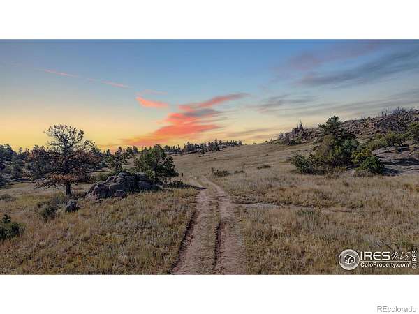
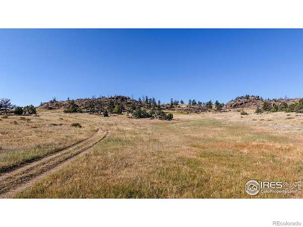
- Vegetation
- Wooded
- Road Frontage
- Public
- Road Surface
- Dirt
- Road Responsibility
- Public Maintained Road
- View
- Mountain(s), Plains
- Features
- Borders National Forest, Level, Rock Outcropping, Rolling Slope
Exterior
- Horses Allowed
- Yes
Nearby schools
| Name | Type | District |
|---|---|---|
| Livermore | Elementary | Poudre R-1 |
| Cache la Poudre | Middle | — |
| Poudre | High | Poudre R-1 |
Listing history
| Date | Event | Price | Change | Source |
|---|---|---|---|---|
| May 12, 2026 | Price drop | $625,000 | $25,000 -3.8% | REcolorado |
| Apr 19, 2026 | New listing | $650,000 | — | REcolorado |
Payment calculator
Based on information submitted to the MLS GRID as of July 20, 2026 11:00 pm MT. All data is obtained from various sources and may not have been verified by broker or MLS GRID. Supplied Open House Information is subject to change without notice. All information should be independently reviewed and verified for accuracy. Properties may or may not be listed by the office/agent presenting the information. Some IDX listings have been excluded from this website. View more