20 Acres of Agricultural Land for Sale in Wikieup, Arizona
Images
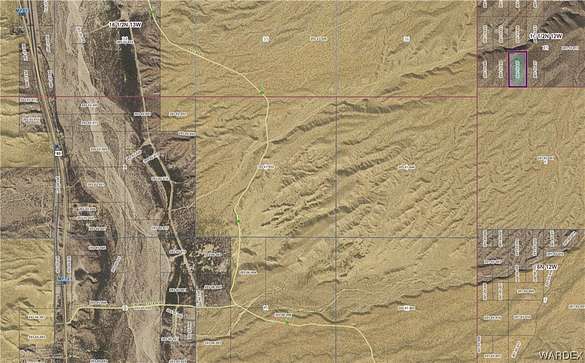
Map
$7,500
20 acres
Active sale agoEst $77/mo
20 acres northeast of Wikieup. Property is adjacent to BLM land. Use GIS Mapping/GPS coordinates.
Directions
Hwy 93 to Pump Station Rd just south of MP 121. North on Back Rd. USE GPS after this. Unknown if there is legal access.
Property details
- County
- Mohave County
- Elevation
- 2,733 feet
- MLS Number
- WARDEX 007619
- Date Listed
Legal description
TWN: 16 1/2N RNG: 12W SEC: 31 TRACT: W2 SE4 SW4 CONT 20 AC M/L
Parcels
- 201-15-025
Property taxes
- 2022
- $82
Resources
Detailed attributes
Listing
- Type
- Lots And Land
- Franchise
- Keller Williams Realty
Lot
- Views
- Mountain, Panorama
Listing history
| Date | Event | Price | Change | Source |
|---|---|---|---|---|
| Oct 27, 2023 | New listing | $7,500 | — | WARDEX |
Payment calculator
Contact listing agent
By submitting, you agree to the terms of use, privacy policy, and to receive communications.