


Land for Sale in Salina, Utah
1200 E Old Hwy 10, Salina, UT 84654
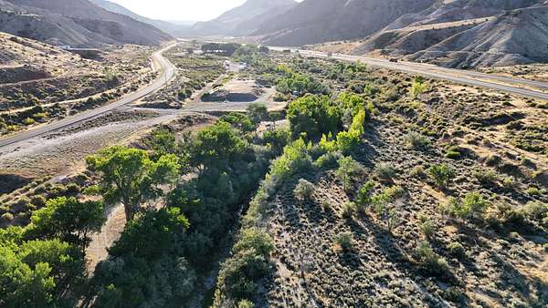
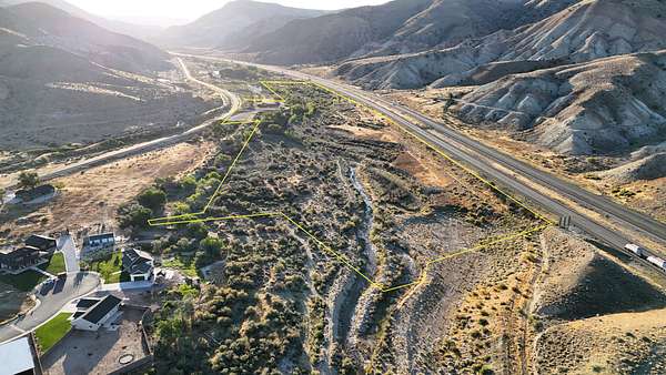
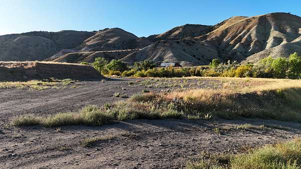
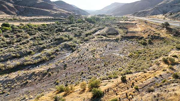
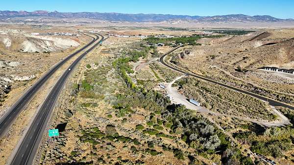
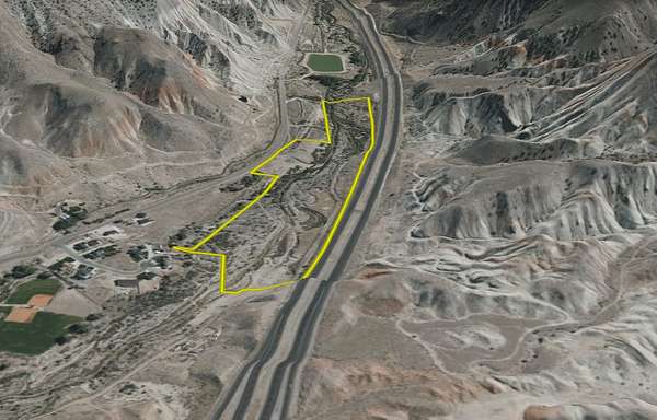
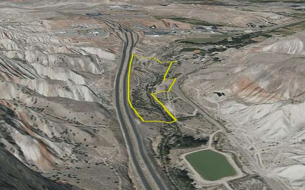
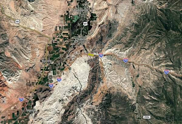
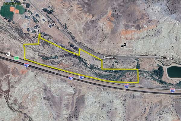
Located just outside the city limits of Salina, Utah, this property combines development potential with natural features and convenient access to both town and recreational opportunities. Positioned between the city park and the city fish pond, the land sits in a location that balances quiet surroundings with quick proximity to community amenities.
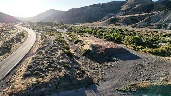
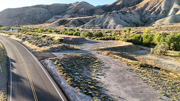
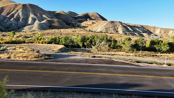
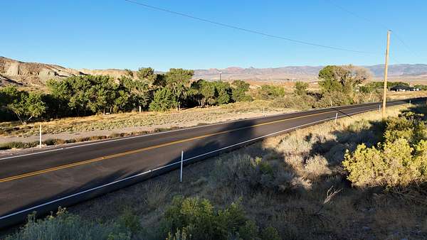
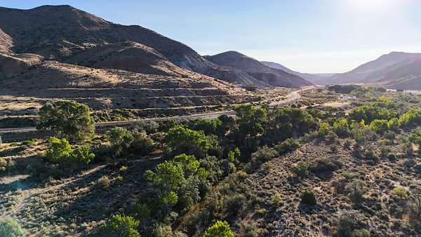
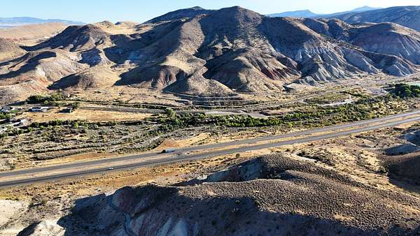
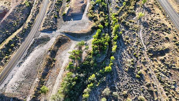
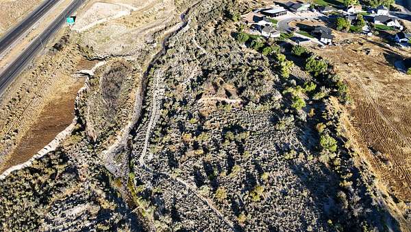
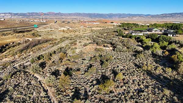
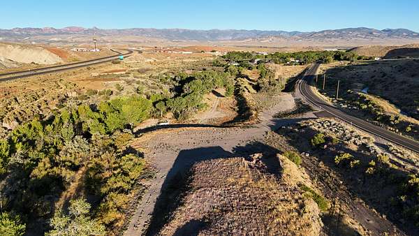
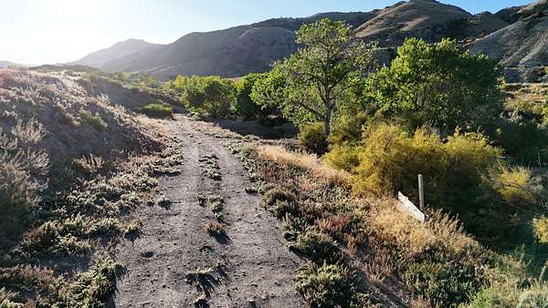
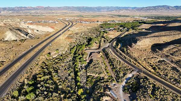
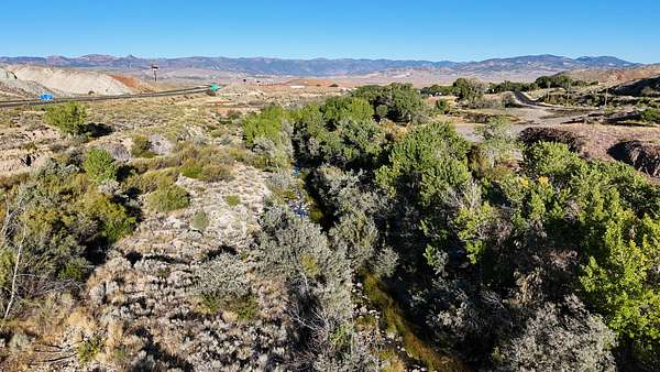
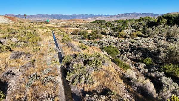
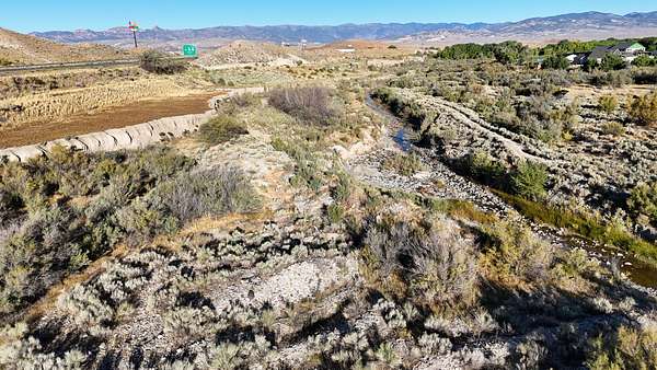
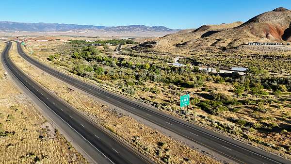
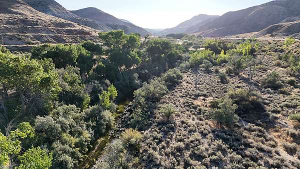
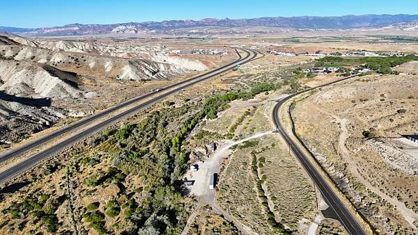
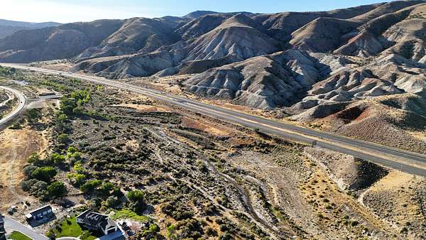
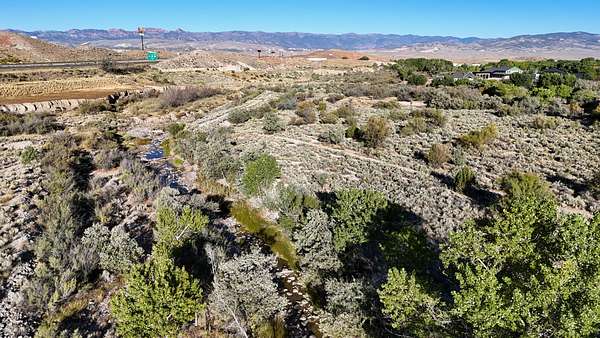
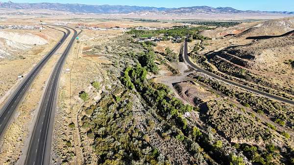
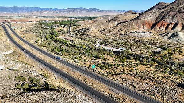
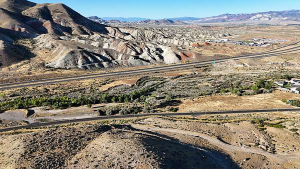
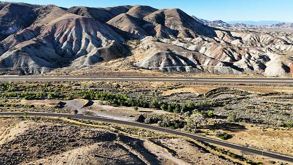
The parcel has frontage along Old Highway 10, providing paved road access and power availability at the property's edge. Interstate 70 forms the southern boundary, enhancing accessibility while keeping the land situated near key routes in central Utah.
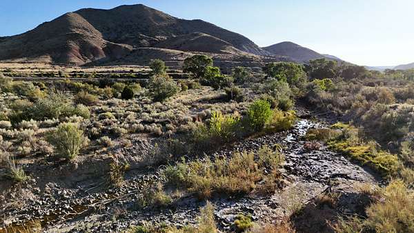
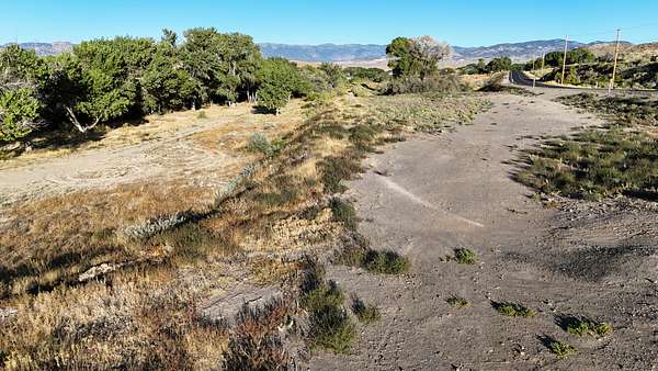
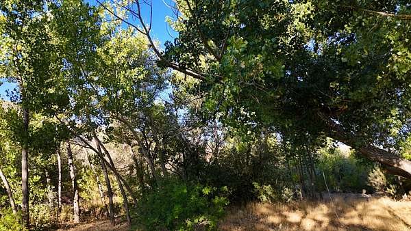
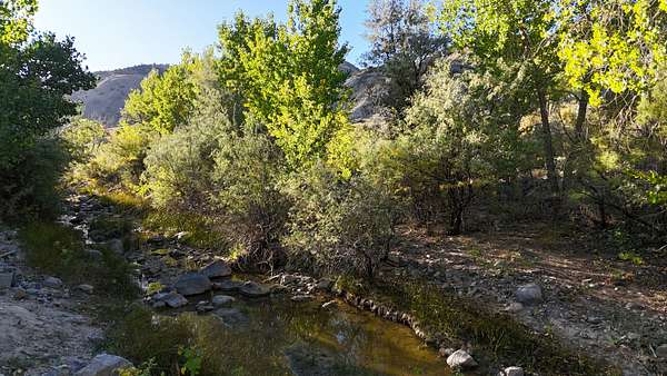
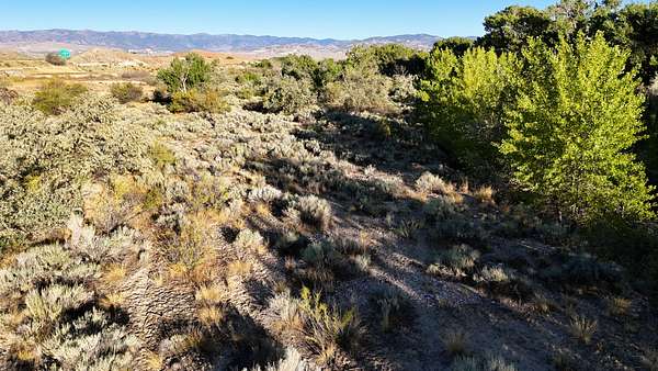
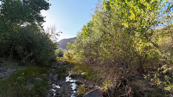
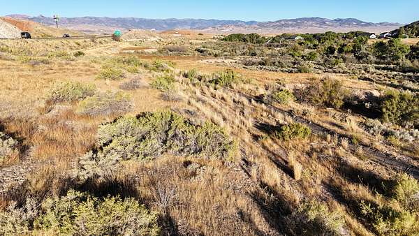
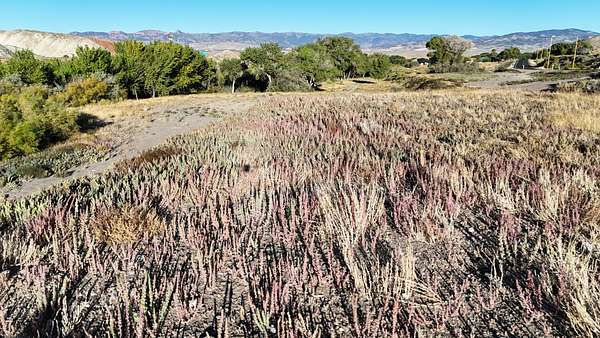
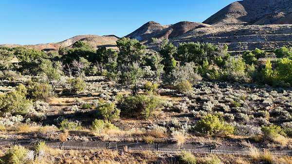
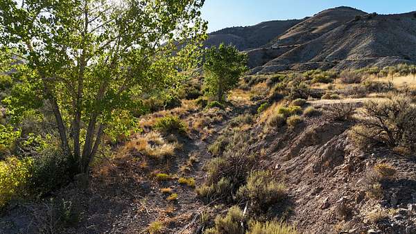
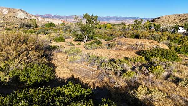
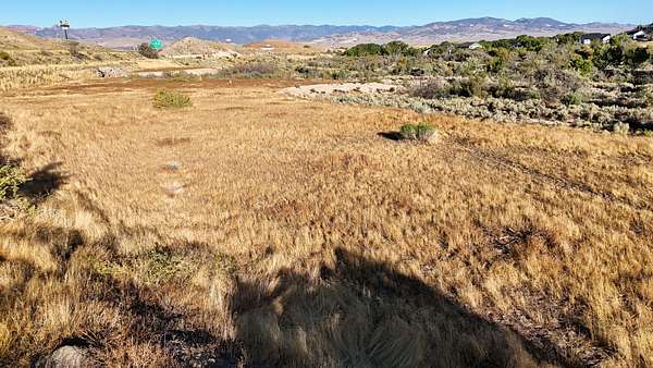
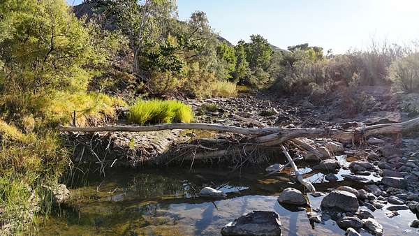
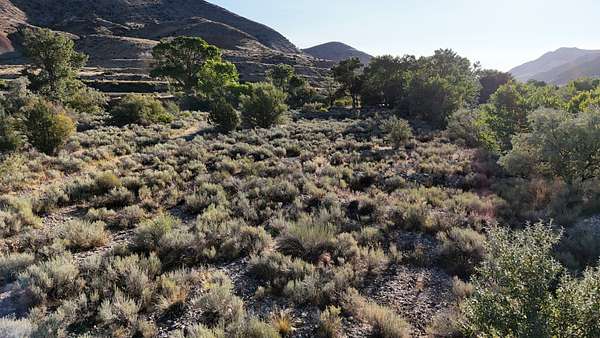
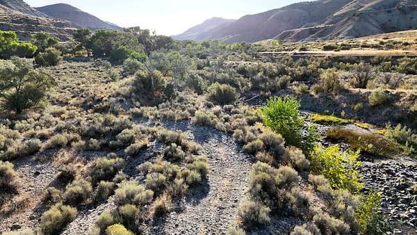
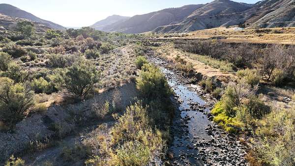
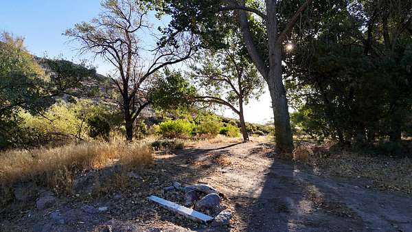
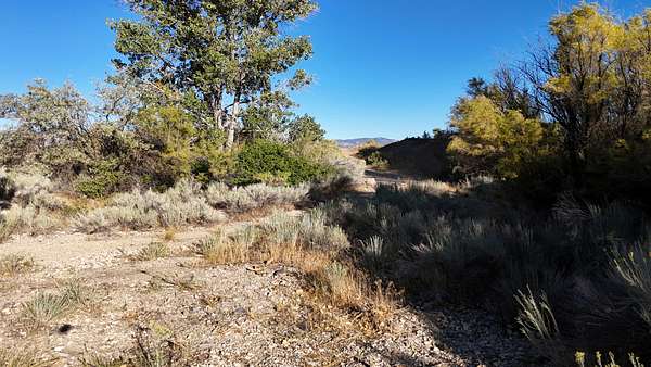
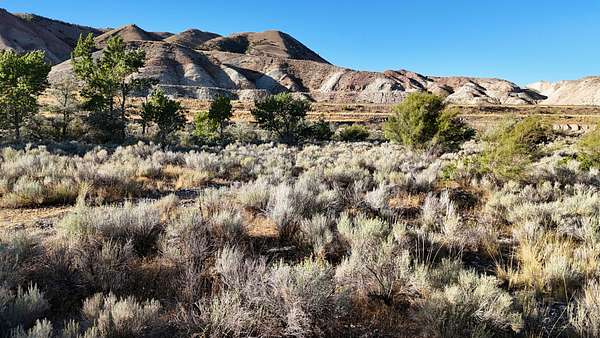
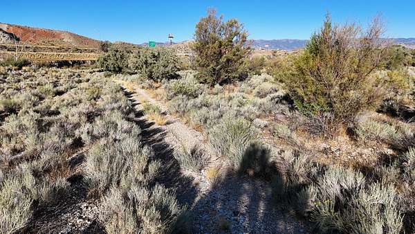
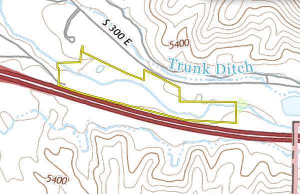
Salina Creek flows through the property for more than half a mile, offering year-round water and supporting a corridor of mature trees. The creek provides a natural landscape feature, with wildlife including deer, turkeys, fish, and the occasional beaver observed in the area. Several acres of the land have already been cleared and leveled, offering building-ready ground for homesites or other uses.
The property includes more than 4 acre-feet of underground water rights, supporting multiple residential possibilities. This water resource enhances the flexibility of the land, whether for a private residence, multiple homesites, or future development.
Within walking distance, the Salina city park complex and fish pond provide convenient recreation. Services, including groceries, fuel, restaurants, and the post office, are only a short drive away. At the same time, the property lies less than two miles from the boundary of Fishlake National Forest. The area offers access to the Piute ATV Trail system, Gooseberry Campground, and the Great Western Trail, making it an ideal location for those who value outdoor recreation alongside town access.
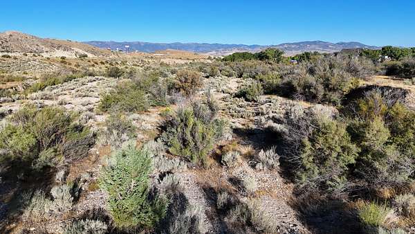
The property's elevation averages 5,270 feet, with a mix of cleared building sites, creekside tree cover, and views of surrounding mountain ranges. The location places it in the center of Utah, with quick connections to both local resources and regional recreation.
Salina is the closest community, offering essential services within minutes. Richfield, approximately 20 miles to the southwest, provides expanded shopping, healthcare, and schools. Provo lies about 90 miles north, while Salt Lake City is about 140 miles from the property.
This parcel presents opportunities for development or personal use, combining natural features like Salina Creek and mature trees with water rights and infrastructure access. Its balance of location, resources, and recreational opportunities makes it a distinctive option for buyers seeking land in central Utah.
Location
- Street address
- 1200 E Old Hwy 10
- County
- Sevier County
- Zip code
- 84654
- Elevation
- 5,270 feet
Property details
- Acreage
- 34.9 acres
- Zoning
- Agricultural
- Access
- Public road
- Posted
Property taxes
- 2026
- $1,214
Parcels
- 4-71-11
Legal description
Legal BEGINNING AT A POINT LOCATED WEST 945.47 FEET AND SOUTH 1384.86 FEET FROM THE CENTER OF SECTION 31, T.21 S., R.1 E., S.L.B. & M., SAID POINT BEING ON THE SOUTH LINE OF PARCEL 1-S98-8 AND THE SOUTH LINE OF THE R.G.W.RY CASTLE VALLEY BRANCH RIGHT-OF-WAY; THENCE ALONG SAID SOUTH LINE AND SOUTH RIGHT-OF-WAY LINE THE FOLLOWING BEARINGS AND DISTANCES; S62°00'02"E 734.27 FEET; AROUND A 5500.00 FOOT RADIUS CURVE TO THE LEFT FOR A DISTANCE OF 372.65 FEET; SAID CURVE HAVING A CHORD BEARING AND DISTANCE OF S63°56'30"E 372.58 FEET TO THE EAST LINE OF
PARCEL 1-S98-8; THENCE N00°21'26"E ALONG SAID EAST LINE 175.74 FEET TO THE SOUTH LINE OF A EXISTING COUNTY ROAD RIGHT-OF-WAY; THENCE ALONG SAID SOUTH LINE OF THE COUNTY ROAD RIGHT-OF-WAY THE FOLLOWING BEARING AND DISTANCE; AROUND A 1483.47 FOOT RADIUS CURVE TO THE LEFT FOR A DISTANCE OF 756.39 FEET; SAID CURVE HAVING A CHORD BEARING AND DISTANCE OF S66°10'49"E 748.22 FEET; THENCE SOUTH 258.09 FEET; THENCE EAST 950.26 FEET; SOUTH 349.75 FEET TO THE SOUTH LINE OF SECTION 31; THENCE S89°40'38"W ALONG SAID SOUTH LINE 628.80 FEET TO THE N
ORTH LINE OF THE EXISTING INTERSTATE 70 RIGHT-OF-WAY; THENCE ALONG SAID RIGHT-OF-WAY THE FOLLOWING BEARINGS AND DISTANCES; N79°32'09"W 471.88 FEET; THENCE N74°40'08"W 891.14 FEET; N73°50'49"W 1102.52 FEET; THENCE N39°22'38"W 9.76 FEET; THENCE N00°13'28"E 411.57 FEET TO THE SOUTH LINE OF PARCEL 1-S98-2; THENCE S89°46'32"E ALONG SAID SOUTH LINE 396.68 FEET; THENCE N00°13'28"E 202.08 FEET TO THE POINT OF BEGINNING. CONTAINING 34.90 ACRES.
Details and features
Lot
- View
- Desert, Mountain, Water, Woods
- Features
- Cleared, Partially Wooded, Trails
Property utilities
| Category | Type | Status |
|---|---|---|
| Power | Grid | Available |
| Water | Private Well | Available |
Listing history
| Date | Event | Price | Change | Source |
|---|---|---|---|---|
| Oct 13, 2025 | Back on market | $445,000 | — | Listing agent |
| Oct 2, 2025 | Under contract | $445,000 | — | Listing agent |
| Sept 18, 2025 | New listing | $445,000 | — | Listing agent |
Payment calculator