22.1 Acres of Mixed-Use Land for Sale in De Soto, Missouri
12796 State Route 21, De Soto, MO 63020
Images
Map


$1,300,000
22.05 acres
Active sale agoEst $12,863/mo
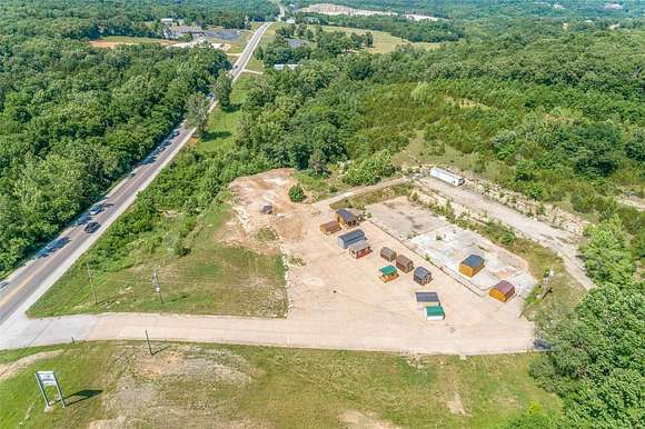
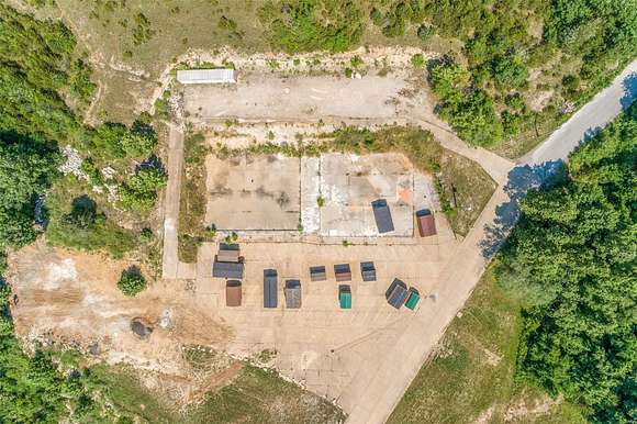
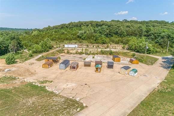
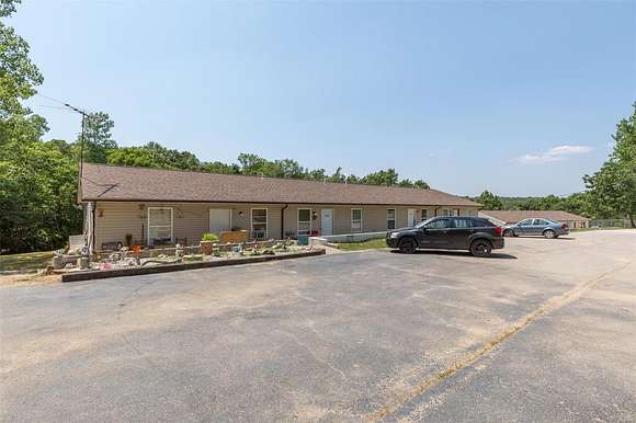
Property 12796 State Route 21 & parcel 17-8.0-34.0-0-000-013.01 are a combined sale. Total acreage 22.05 with 1406 ft. of Hwy21 road frontage just on the north side of Desoto. This property has 9 residential rentals, 4 two bedrooms units, 4 single bedroom units and a 4 bedroom split level home at the top of the hill. Two 4-unit slab apartments and one split level home. This property is a great opportunity for a passive income producing property that has good highway frontage to build a business of your dream.
Directions
HWY 21 SOUTH TO BALL CREEK DR. ON THE EAST SIDE OF THE HWY
Property details
- County
- Jefferson County
- Community
- Ball Creek 03
- Zoning
- CT1
- Elevation
- 564 feet
- MLS Number
- MARIS 24016403
- Date Listed
Legal description
BALL CREEK 3: LOT 1B & ISABELL BRANCH: LOTS 1 (262/14B) & ISABELL BRANCH 2: LOTS2A 2B 2C (2016P-0000
Parcels
- 17-8.0-34.0-0-000-013
Property taxes
- 2020
- $8,037
Detailed attributes
Listing
- Type
- Commercial
- Franchise
- RE/MAX International
Structure
- Stories
- 1
- Roof
- Asphalt
Listing history
| Date | Event | Price | Change | Source |
|---|---|---|---|---|
| Mar 20, 2024 | New listing | $1,300,000 | — | MARIS |
Payment calculator
Contact listing agent
By submitting, you agree to the terms of use, privacy policy, and to receive communications.