Recreational Land for Sale in Buckner, Missouri
1521 S Buckner Tarsney Rd, Buckner, MO 64016
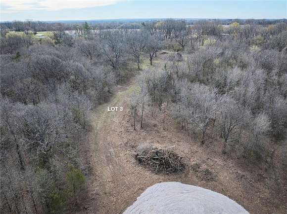
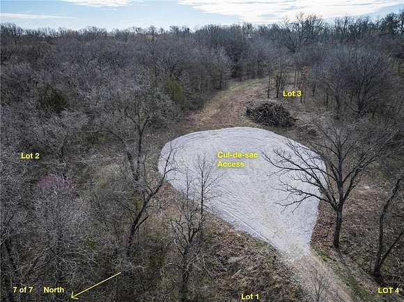
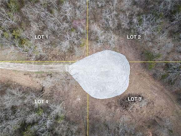
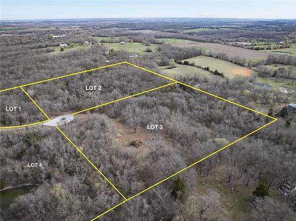
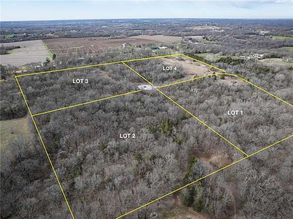
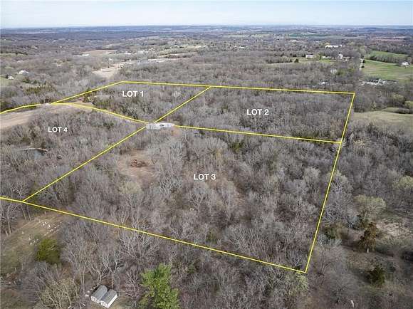
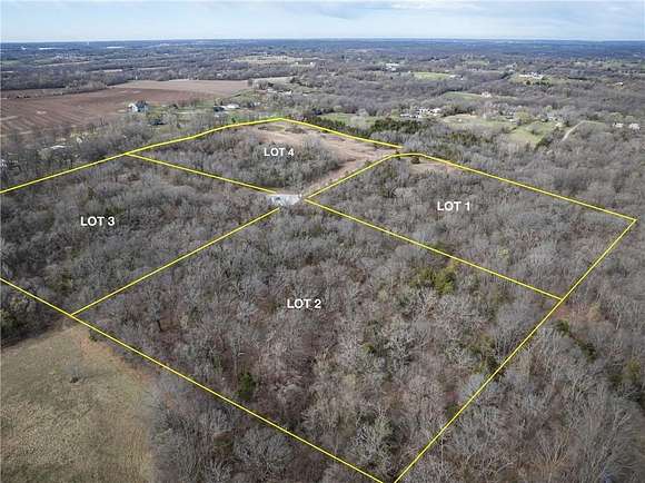
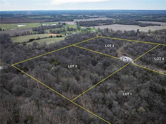
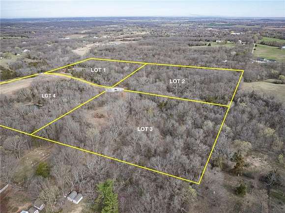
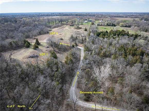
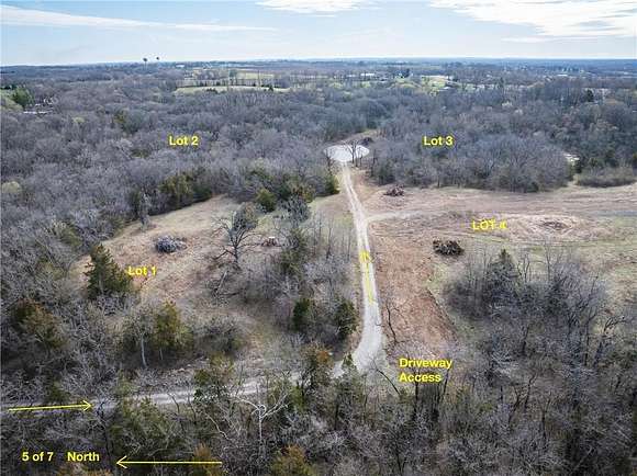
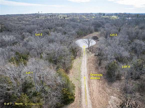
Looking for a slice of country heaven with quick access to city amenities? Look no further!! This gorgeous treed property boasts of endless privacy, nestled in unincorporated Jackson county between Buckner and Grain Valley. This property is just 4 miles North of I-70, and 4 miles South of 24 Hwy, quick easy access to the highway as well as city amenities. The current owner has subdivided this 42+ acre plot into 4 lots, partially cleared build sites on each lot, added a 3/4 mile long shared gravel driveway from the Driveway Easement, to the cul-de-sac that touches each property corner, and added utility easements for electric and water. With the hard work already done, this property is ready for you to make it your own!! With small creeks running throughout, hiking trails ready to be shaped, and tons of wildlife, this property is the perfect spot for recreational use, or for building your home on! *This property can be bought as an individual property, or as part of the 42+ acres that it was subdivided from.
Location
- Street address
- 1521 S Buckner Tarsney Rd
- County
- Jackson County
- Zip code
- 64016
- Community
- Blue Springs
- School district
- Fort Osage
- Elevation
- 928 feet
Directions
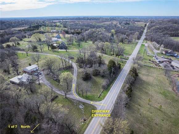
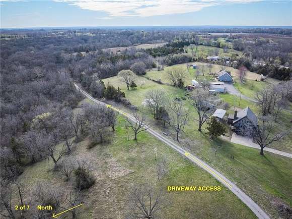
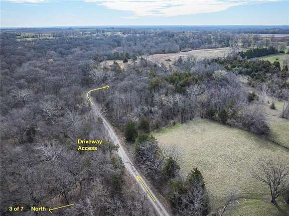
Please note: IF using any form of GPS, you will want to use address: 1501 S. Buckner Tarsney Rd. Buckner, MO. 64016 as the address to end at. This takes you to the driveway/driveway easement to enter the property that is for sale. From I-70 E: Take exit 24 towards Grain Valley. Turn left onto Buckner Tarsney Rd/N Main St. Continue for roughly 4 miles, until you reach the above stated address. Driveway is on the right side of the road. Please do not stop at the house that is seen from the road. Follow the split in the driveway to the right, to access the property.
Property details
- Acreage
- 10.09 acres
- MLS #
- HMLS 2541079
- Posted
Property taxes
- Recent
- $340
Parcels
- 22-200-03-19-00-0-00-000
Legal description
SEC-02 TWP-49 RNG-30---PT SW 1/4 DAF: BE NE COR SE 1/4 SW 1/4 TH S 01 DEG 32 MIN 12 SEC W 664.87' TO TRU POB TH S 01 DEG 32 MIN 12 SEC W 660' TH N 88 DEG 18 MIN 00 SEC W 226.80' TH N 01 DEG 42 MIN 19 SEC E; 210' TH N 88 DEG 18 MIN 00 SEC W 210' TH S 01 DEG 42 MIN 19 SEC W 210' TH N 88 DEG 18 MIN 00 SEC W 188.21' TH N 01 DEG 32 MIN 27 SEC E 640' TH N 88 DEG 18 MIN 00 SEC W 660.62' TH N 01 DEG 32 MIN 41; SEC E 386.90' TH N 88 DEG 23 MIN 24 SEC W 870.59' TH S 01 DEG 40 MIN 08 SEC W 20' TH N 88 DEG 23 MIN 24 SEC W 411.62' TH N 01 DEG 44 MIN 39 SEC E 20' TH S 88 DEG 23 MIN 24 E 391.60' TH N 01 DEG 40 MIN; 08 SEC E 46.72' TH S 88 DEG 23 MIN 24 SEC E 910.40' TH S 01 DEG 32 MIN 41 SEC W 413.65' TH S 88 DEG 18 MIN 00 SEC E 1265.58' TO POB (ALSO KNOWN AS TRACT 3 CERT SURV BK S16 PG 68)
Details and features
Listing
- Type
- Land
Lot
- Features
- Acreage, Many Trees
Listing history
| Date | Event | Price | Change | Source |
|---|---|---|---|---|
| Mar 16, 2026 | Price drop | $220,000 | $28,000 -11.3% | HMLS |
| Apr 4, 2025 | New listing | $248,000 | — | HMLS |