

Land with Home for Sale in Oroville, Washington
1640 Highway 7, Oroville, WA 98844
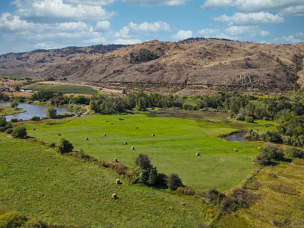
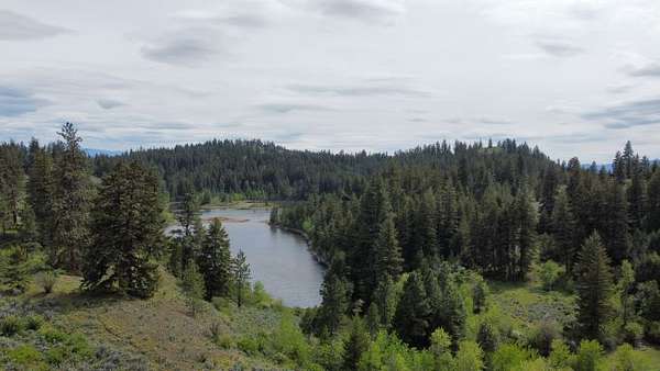
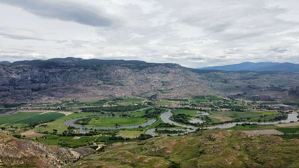
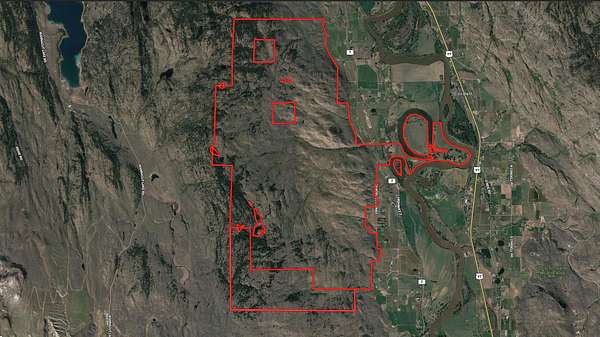
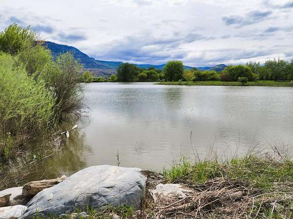
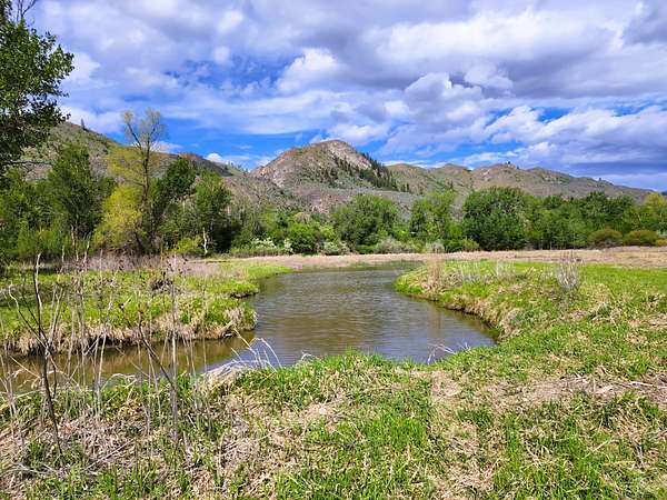
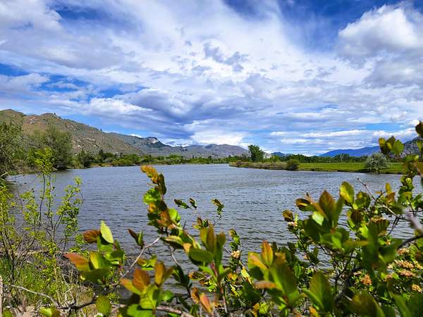
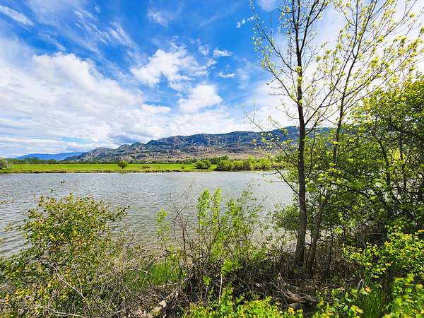
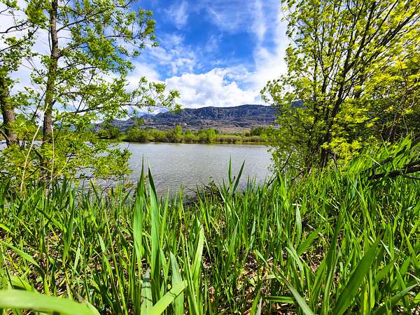
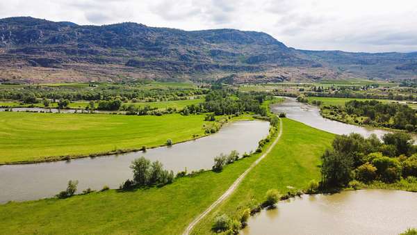
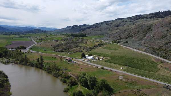
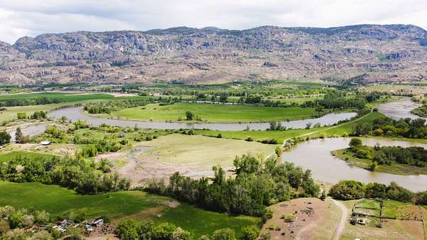
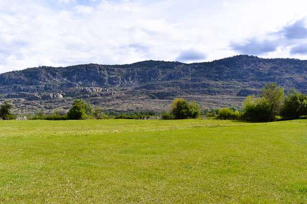
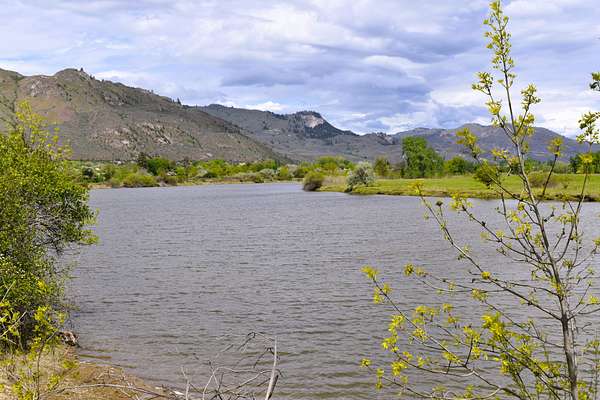
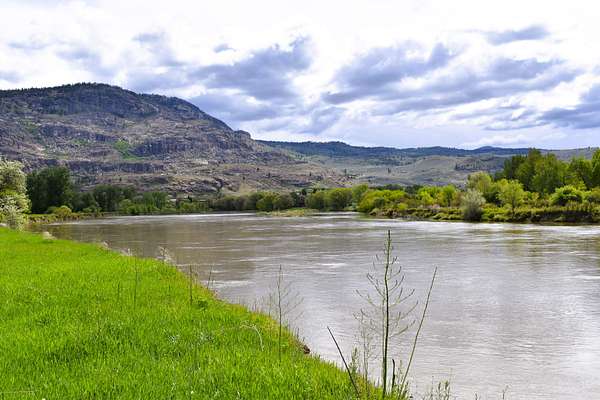
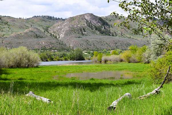
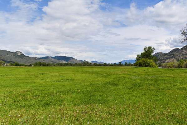
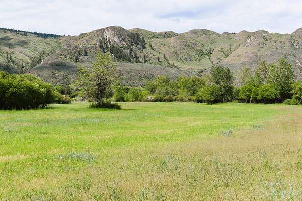
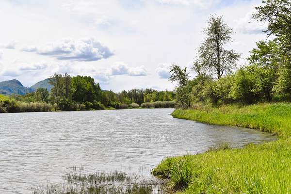
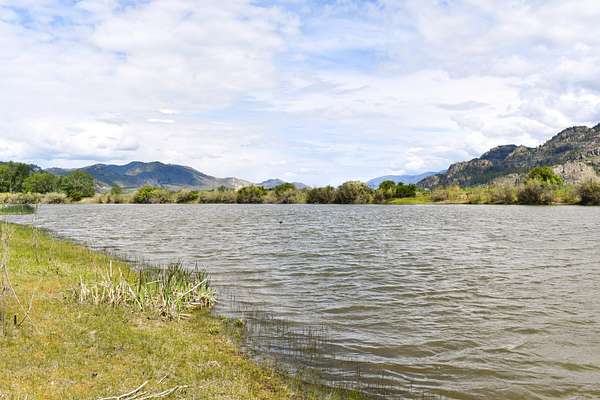
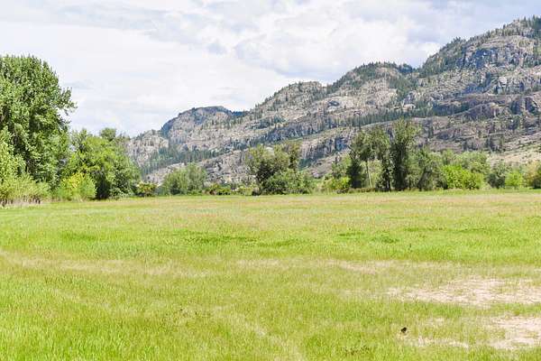
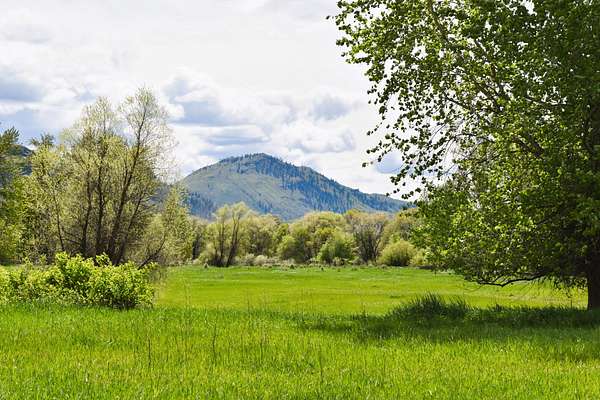
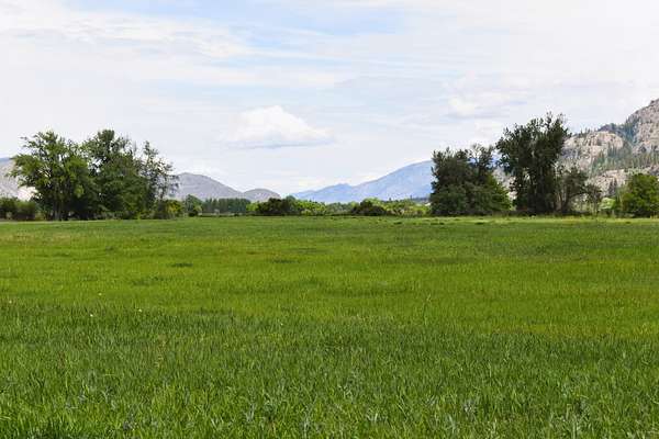
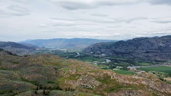
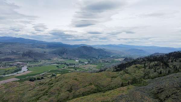
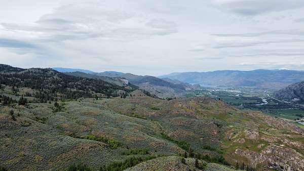
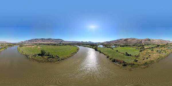
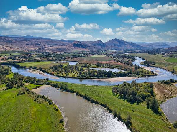
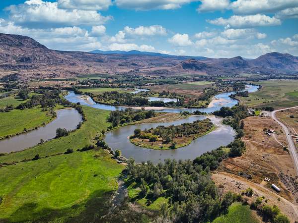
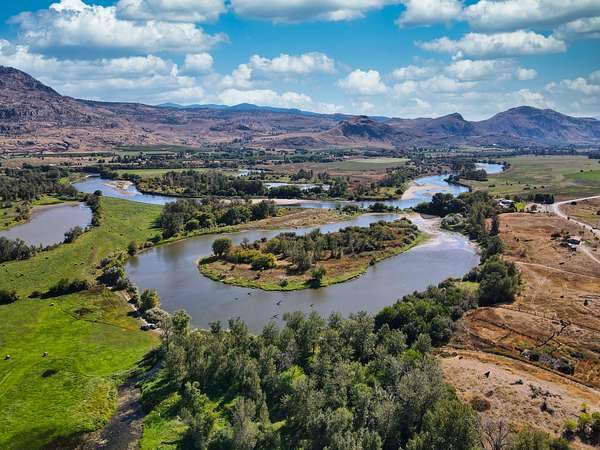
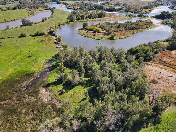
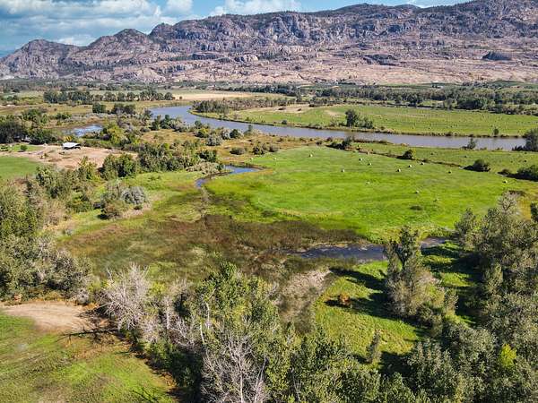
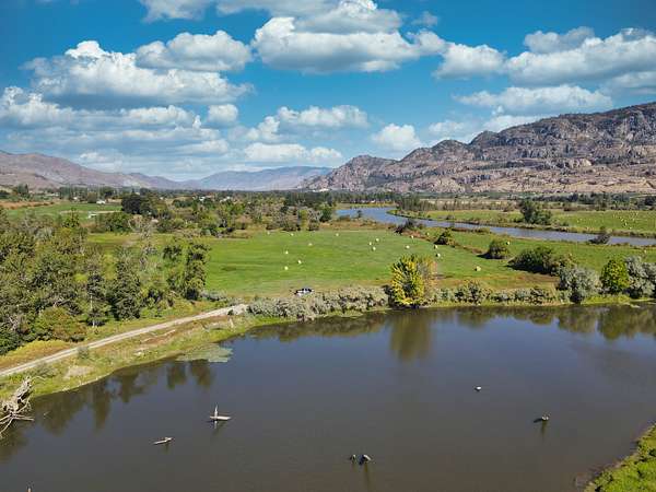
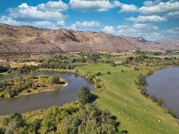
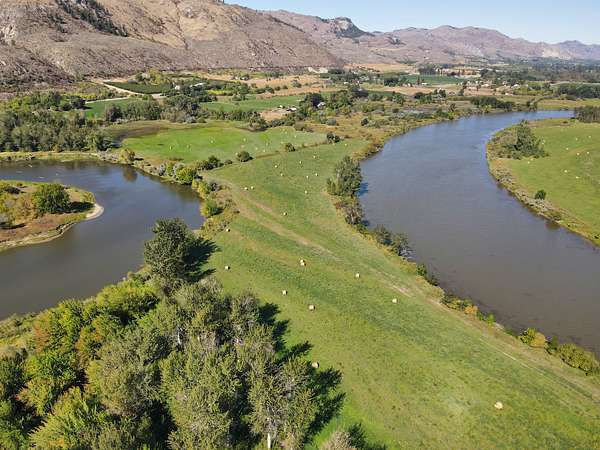
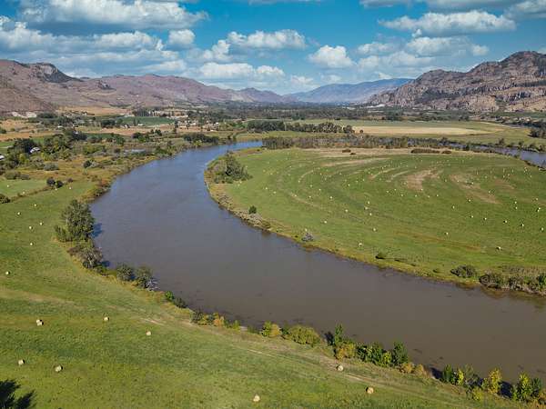
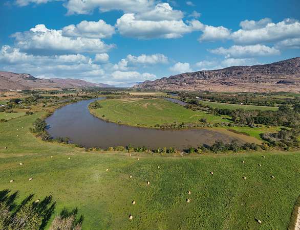
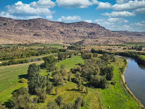
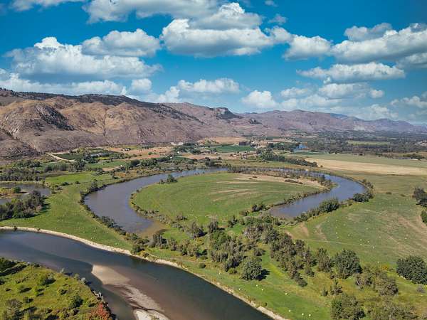
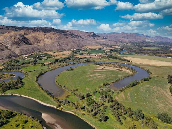
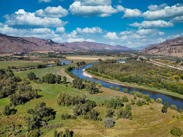
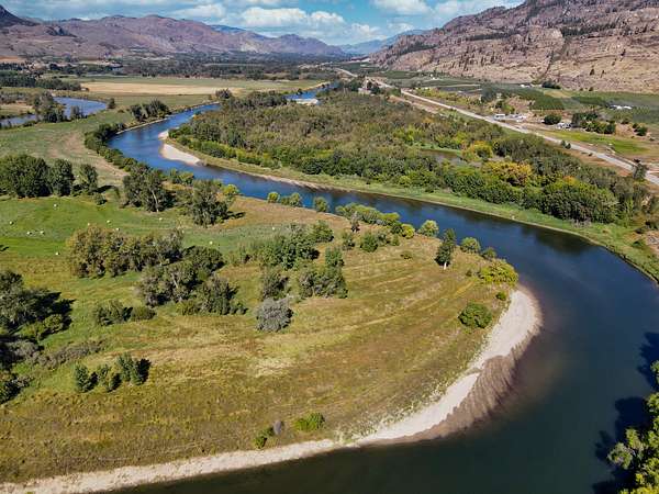
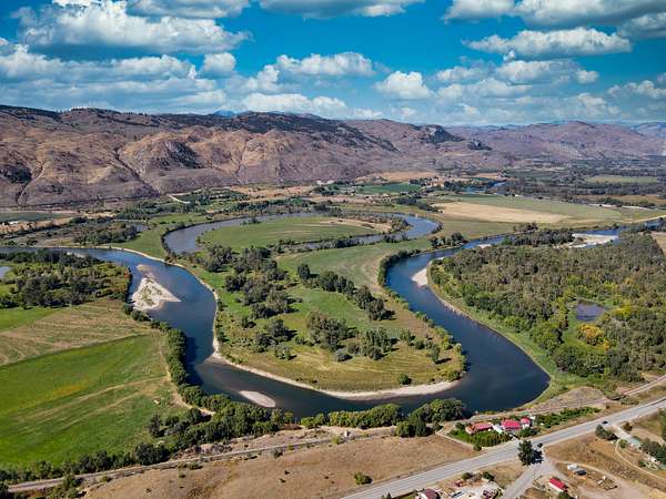
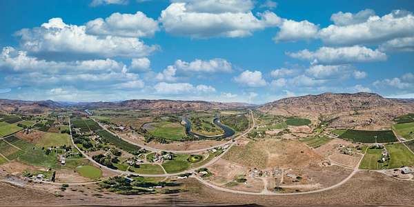
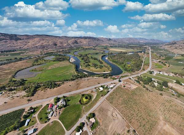
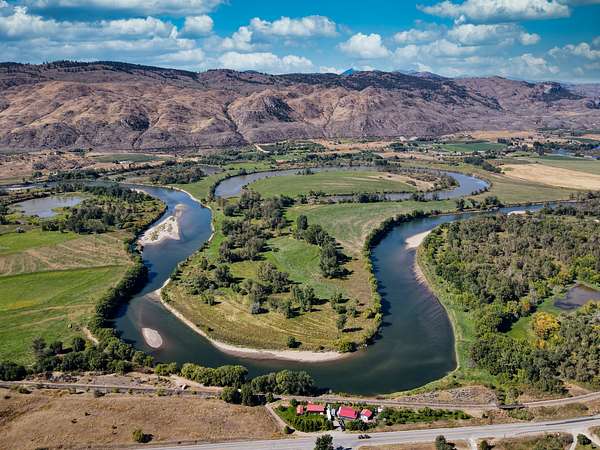
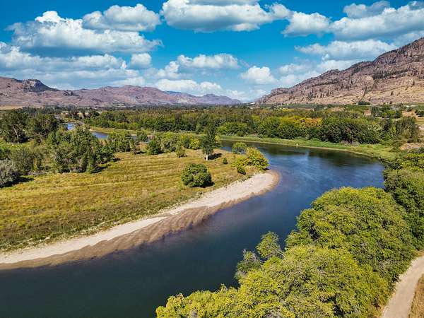
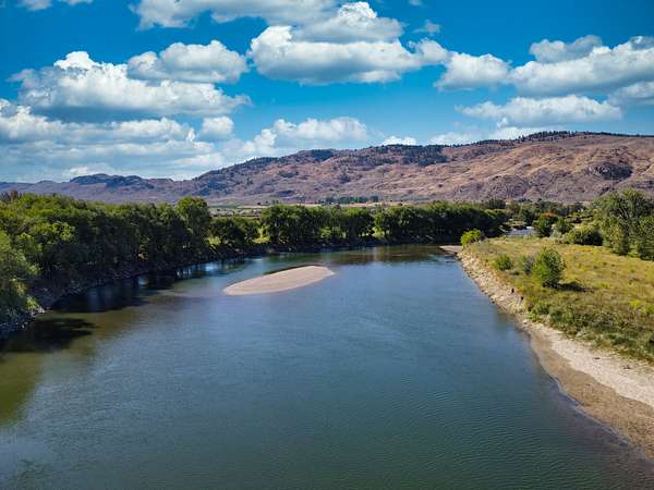
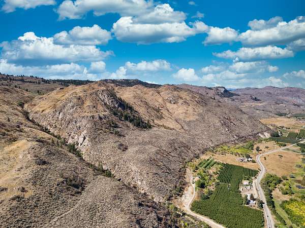
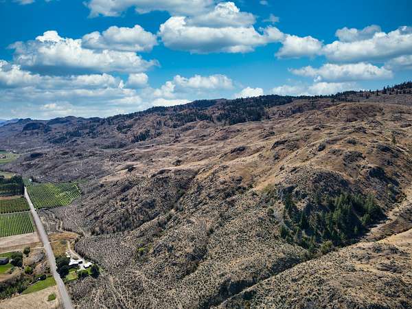
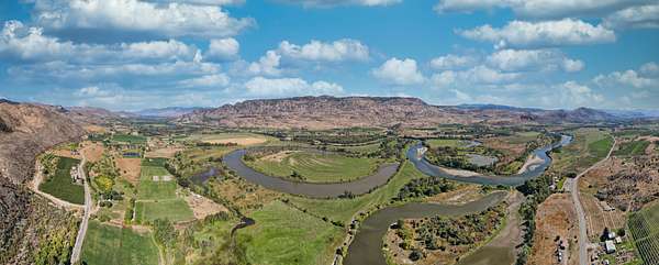
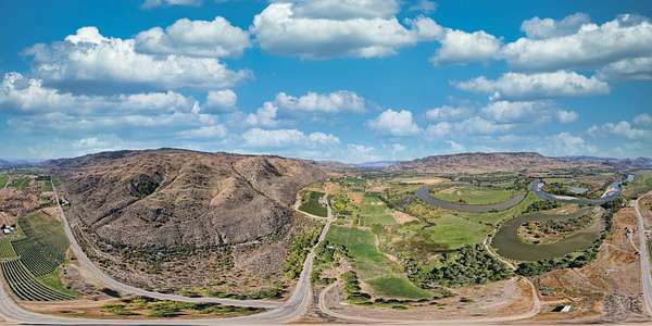
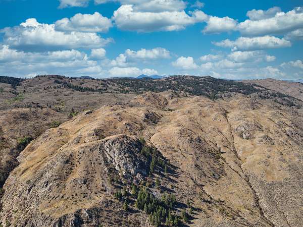
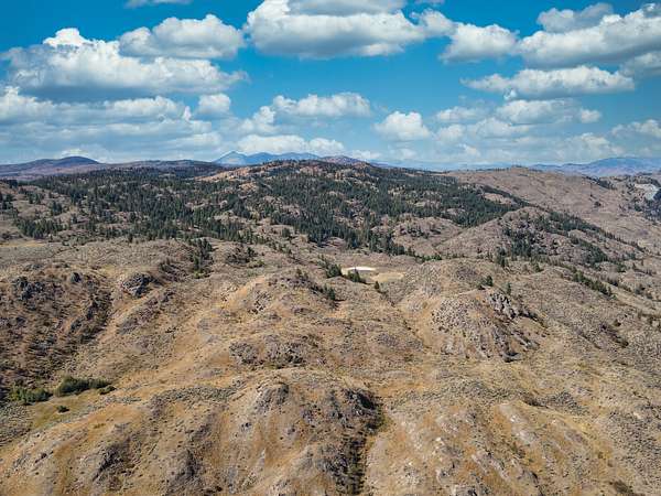
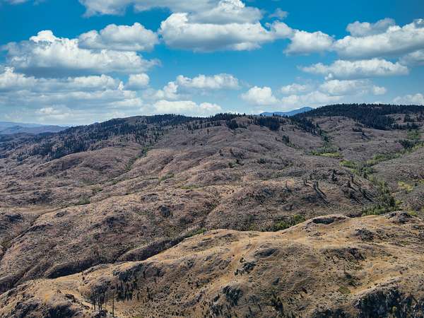
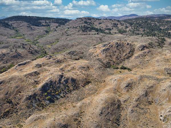
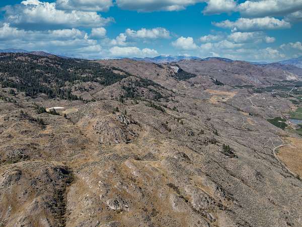
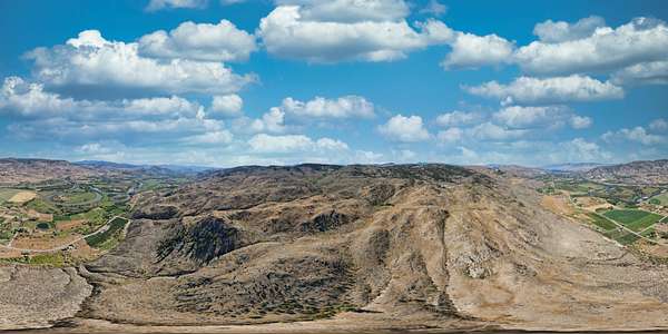
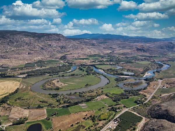
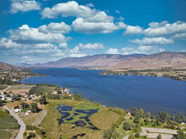
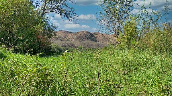
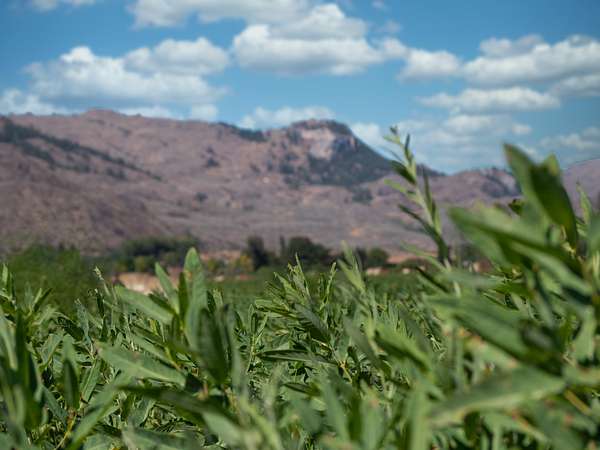
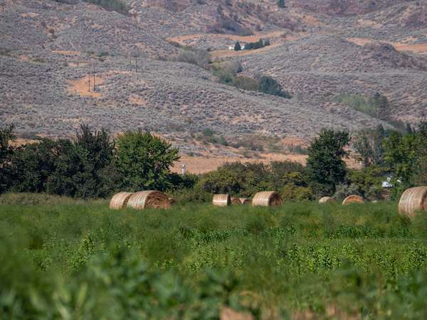
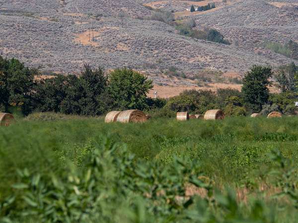
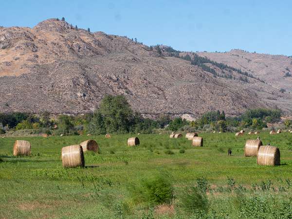
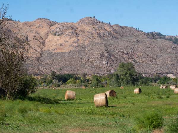
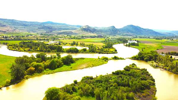
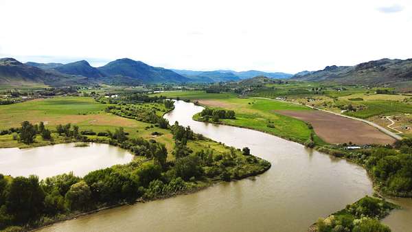
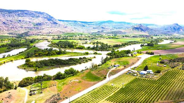
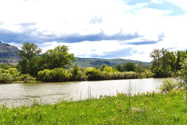
Horseshoe lake River Ranch. .Five named lakes & two miles of river frontage on the Okanogan River . Great fishing Sockeye & Chinook salmon, Small-mouth Bass, and Rainbow Trout, to name a few. A good variety of mature timber, Pine, Red Fir, and Quaking Aspen groves allow for some excellent wildlife habitat. Irrigation water available. Topography is flat with grassy meadows to rolling sage & timber ground with many level benches
Land
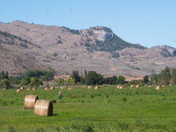
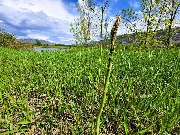
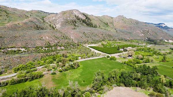
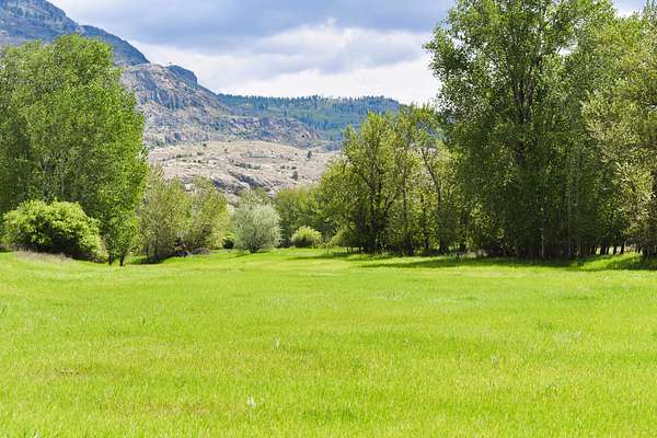
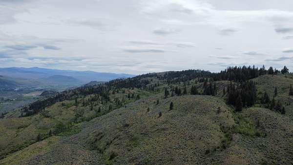
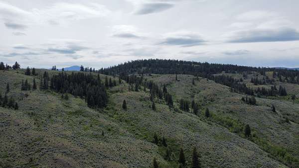
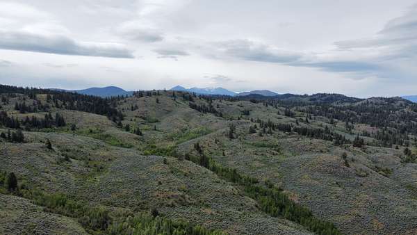
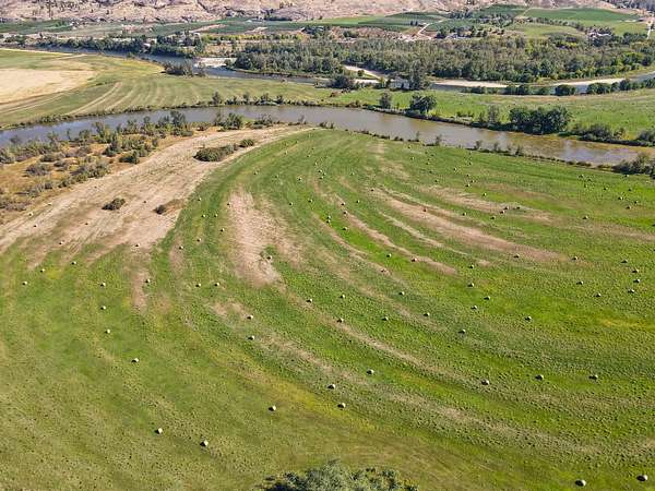
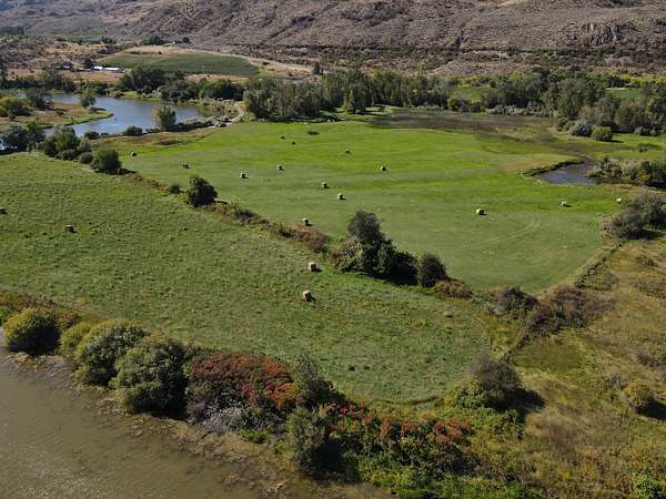
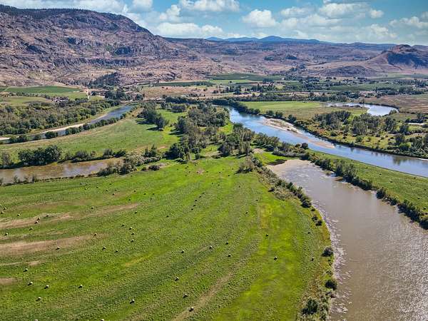
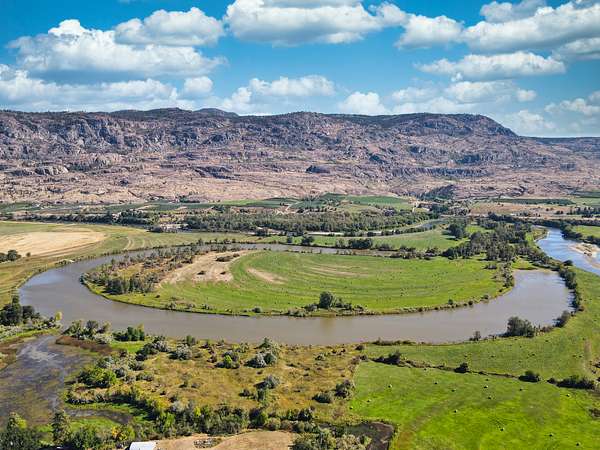
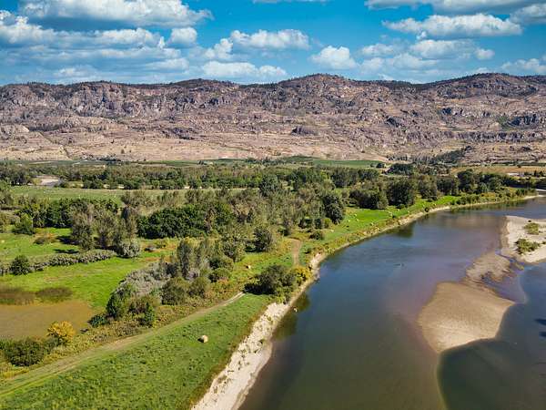
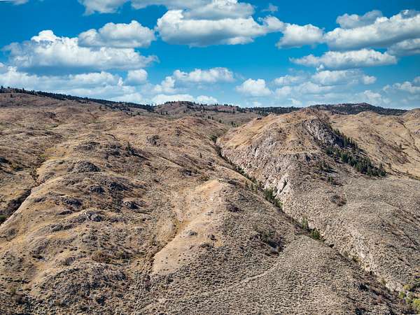
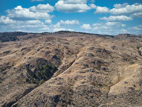
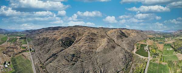
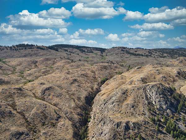
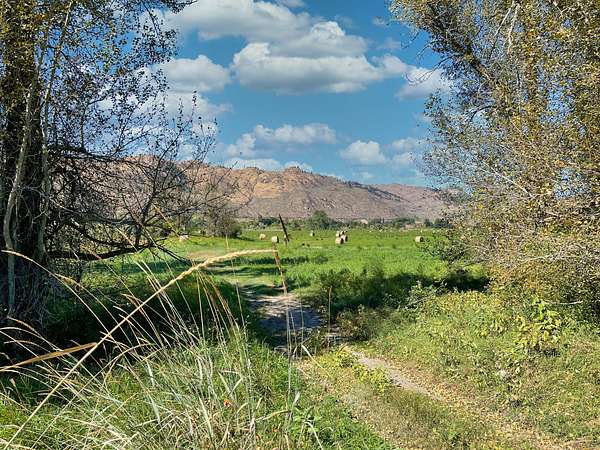
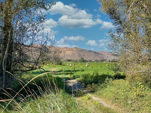
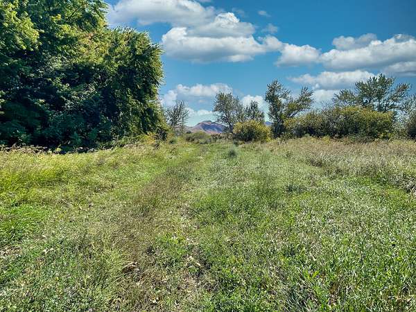
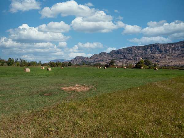
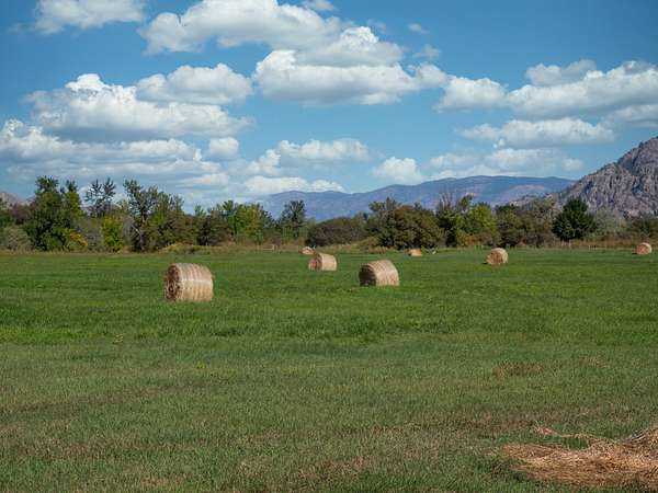
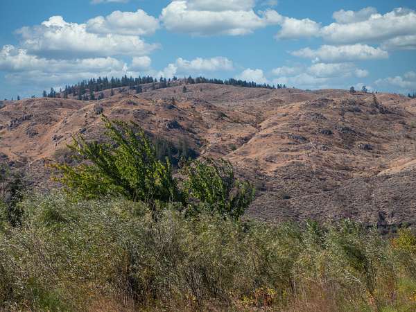
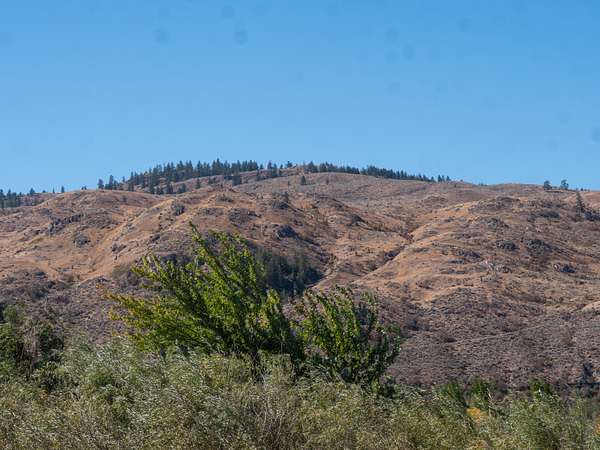
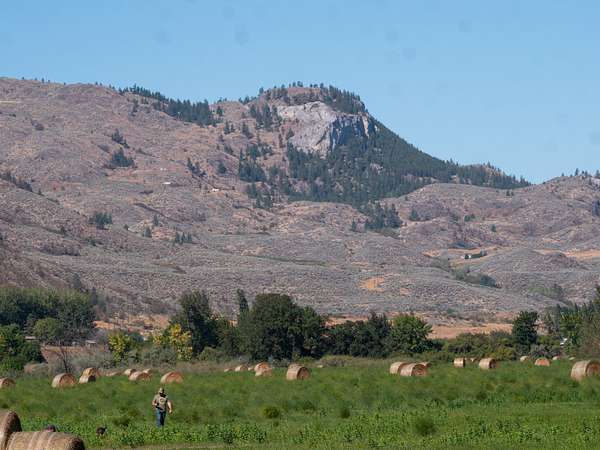
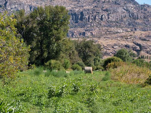
3252 Acres 175 Acres Farmed 60 acres in hay and 6.5 acres with irrigation, Five named lakes on the property, the most significant being Horseshoe Lake. The lower meadows are lush and grassy and border the Okanogan River and Horseshoe Lake with excellent soils for growing. The upper ranch is a variety of rolling hills and numerous flat benches covered in sagebrush and mature Timber; The cattle can graze from May until October, depending on the moisture in the soil
Improvements
There is an older one story home currently occupied by the care taker. Property is all fenced for cattle.
Recreation
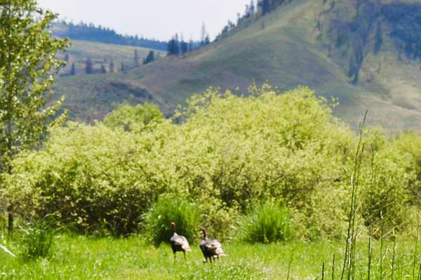
Horseshoe Lake River Ranch, Has many recreation opportunities everything from Fishing for Salmon, and Trout to Hunting Mule Deer, White Tail Deer, Turkeys, Pheasants, Grouse, Black Bear,
Other activities are Snowmobiling, cross-country skiing, canoeing Horseback riding, Hiking, bird watching, and ATV riding.
Agriculture
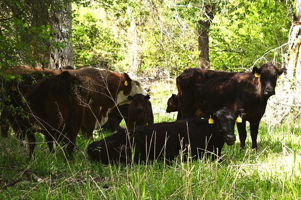
Horseshoe Lake River Ranch is leasing the upper ranch to a cattle farmer who runs up to 250-300 head of cattle during the summer grazing season, lots of rich green grass for them to eat and get fattened up before winter sets in.
The upper Ranch has a substantial amount of large Mature trees from Lodgepole pine, Red Fir, and Quaking Aspen
The Lower Ranch around Horseshoe Lake and the Okanagan River is approximately 175 acres of fertile sandy soils, about 60 acres in non-irrigated hay production. Cattle are often pastured after the hay is cut. There is also a large number of trees in the lowlands. Irrigation water is available through the irrigation district.
Water/Mineral Rights & Natural Resources
One acre foot of domestic and stock watering rights 13 gallons per minute from Well
General Operations
The upper ranch is currently leased for $5800 per grazing season. The Ranch Produces approximant three cuttings per 1.5 to 2.5 Tons of hay per year depending on the weather and moisture
Region & Climate
Oroville Washington gets 14 inches of rain, on average, per year. The US average is 38 inches of rain per year.
Oroville averages 63 inches of snow per year. The US average is 28 inches of snow per year.
On average, there are 187 sunny days per year in Oroville The US average is 205 sunny days.
Oroville WA gets some kind of precipitation, on average, 96 days per year. Precipitation is rain, snow, sleet, or hail that falls to the ground. In order for precipitation to be counted you have to get at least .01 inches on the ground to measure.
Weather Highlights
Summer High: the July high is around 86 degrees
Winter Low: the January low is 21
Rain: averages 14 inches of rain a year
Snow: averages 63 inches of snow a year
History
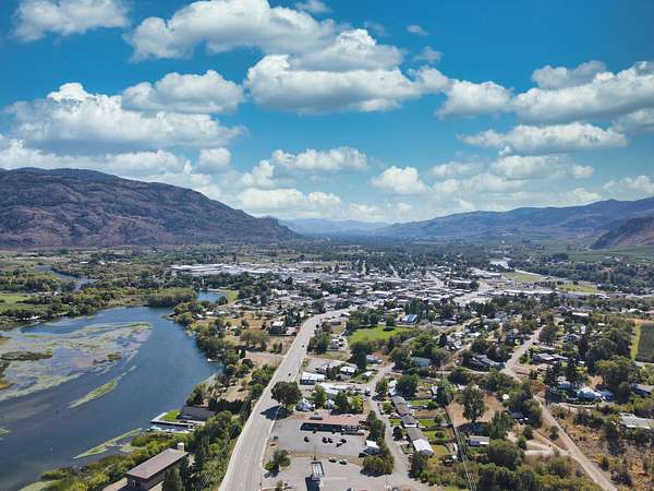
Oroville Established at the west end of the Okanogan Highlands as “Oro” in 1892 and renamed “Oroville” in 1909, this small community owes its name to its gold mining, panning and dredging history. The historic towns of Nighthawk, Molson, and Chesaw are nearby. Some gold is still extracted along the Similkameen River, which flows into Okanogan river; the nearby Buckhorn Mountain gold mine produces 123 thousands ounces of gold annually.
The local economy relies primarily on agriculture (apples, cherries, grapes and other fruit) sustained through irrigation. Farmers’ markets, fruit stands, a brewery and three local wineries offer local home-grown products. The surrounding countryside of hills, mountains, rivers, lakes and forests hosts various fruit orchards, public lands and trails. Oroville is an amazing place to take your kids to swim in Lake Osoyoos.
Location
Located in the North Central Okanogan Highlands of Washington State Just minuets to the Canadian Boarder crossing.
Oroville has a population of 1,842 (2020)
Air Transportation
Private Air Charter from Oroville’s “Dorothy Scott Airport”
CATLIN FLYING SERVICE – – – – – – -(866) 445-2359
Commercial Air Transportation
Kelowna, BC – 2:30 hours north
Penticton, BC – 1 hour north
Wenatchee, WA – Pangborn Field, 2:45 hours south.
Spokane, WA (GEG) – 4 hours east.
Seattle-Tacoma (SEA-TAC) – 5:30 hours west
Location
- Street address
- 1640 Highway 7
- County
- Okanogan County
- Zip code
- 98844
- Elevation
- 938 feet
Directions
From Tonasket head, N on Highway 97 go West at the Ellisforde Bridge Road go N on Highway 7 for about 4.6 miles to property on both sides of Hwy 7 look for sign
Property details
- Acreage
- 3,252 acres
- Posted
Listing history
| Date | Event | Price | Change | Source |
|---|---|---|---|---|
| Mar 26, 2026 | New listing | $3,745,000 | — | Listing agent |
| Jan 2, 2026 | Listing removed | $3,745,000 | — | Listing agent |
| May 17, 2025 | Price drop | $3,745,000 | $250,000 -6.3% | Listing agent |
| Jan 12, 2025 | Relisted | $3,995,000 | — | Listing agent |
| Jan 2, 2025 | Listing removed | $3,995,000 | — | Listing agent |
| Dec 21, 2023 | Relisted | $3,995,000 | — | Listing agent |
| Nov 27, 2023 | Listing removed | $3,995,000 | — | Listing agent |
| May 24, 2022 | New listing | $3,995,000 | — | Listing agent |