Images
Map
Street
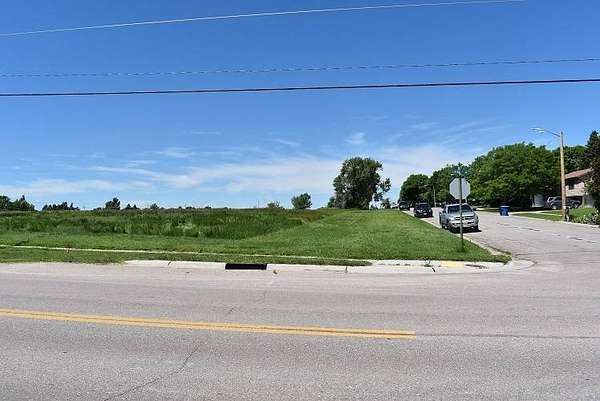
Residential Land for Sale in Alliance, Nebraska
20th St Emerson Ave to Colorado Ave, Alliance, NE 69301
$130,000
Active sale
Est $914/moDEVELOPERS DREAM!! Check this out! 109771 sq. ft. lot that is zoned residential and in the ideal spot to develop more housing in Alliance. Runs along the south side of West 20th Street from Emerson to Colorado and has potential for you to divide into up to 13 lots for development. Right across the street from Laing Lake Park, Sewer runs along West 20th street and water across the street. +- 999.5 ft. long x +- 130 ft. wide.
Location
- Street address
- 20th St Emerson Ave to Colorado Ave
- County
- Box Butte County
- Zip code
- 69301
- School district
- Alliance Public Schools
- Elevation
- 3,981 feet
Property details
- MLS #
- MyStateMLS 11569339
- Posted
Property taxes
- Recent
- $453
Parcels
- 070235864
Details and features
Listing
- Type
- Land
Exterior
- Parking
- Garage
Listing history
| Date | Event | Price | Change | Source |
|---|---|---|---|---|
| Sept 7, 2025 | New listing | $130,000 | — | MyStateMLS |
Payment calculator
Contact listing agent
By submitting, I agree to the terms of use and to be contacted by . Message and data rates may apply.