Skip to main content
Skip to navigation
Properties
Find agent
Post property
Log in
•
Sign up
Search here
List
Canton, MS land for sale
Price
Size
Tags
Save
197 properties
For you
Newest
Price: high to low
Price: low to high
Size: large to small
Size: small to large
Updated
37 days ago
$1,025,750
187 acres
Madison County
Canton, MS 39046
47 days ago
$368,125
38 acres
Madison County
Canton, MS 39046
4 days
$165,000
10.6 acres
Rankin County
Brandon, MS 39047
4 days
$165,000
10 acres
Rankin County
Brandon, MS 39047
38 days ago
$357,000
68 acres
Madison County
Canton, MS 39046
2 months ago
$240,000
50 acres
Madison County
Camden, MS 39045
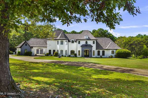
56 days ago
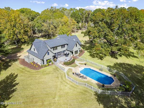
$925,000
5 acres
Madison County
6 bd, 4.5 ba
•
5,068 sq ft
Canton, MS 39046
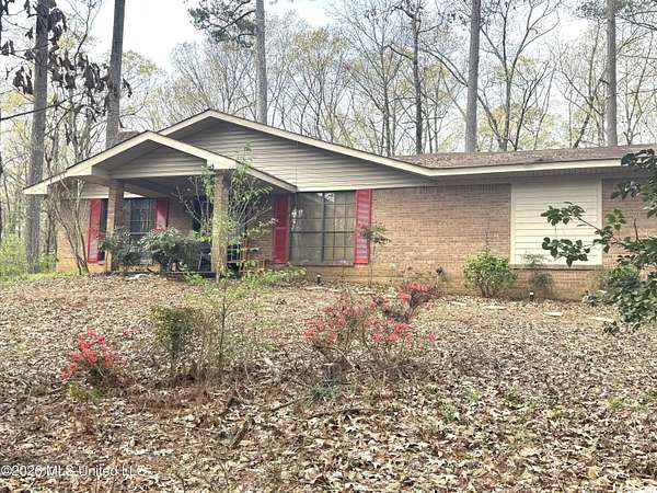
2 months ago
$649,500
15.3 acres
Madison County
3 bd, 2 ba
•
2,845 sq ft
Canton, MS 39046
$20k drop • Mar 16
$705,000
5.8 acres
Madison County
2 bd, 2.5 ba
•
1,989 sq ft
Madison, MS 39110
$24.9k drop • Mar 27
$875,000
5 acres
Madison County
4 bd, 3.5 ba
•
3,551 sq ft
Madison, MS 39110
17 hours
$142,750
9.39 acres
Madison County
Canton, MS 39046
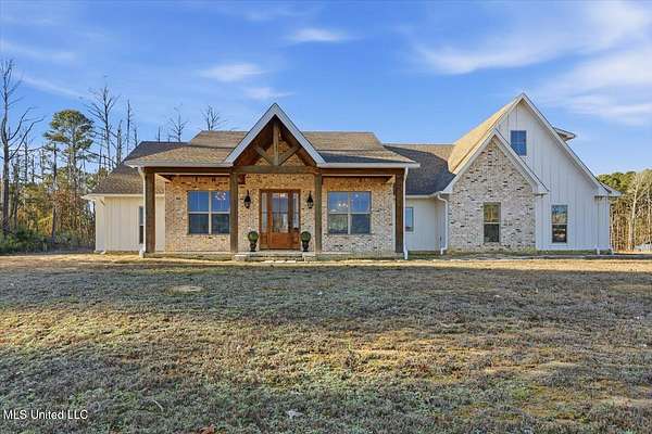
2 months ago
$499,000
5.39 acres
Madison County
4 bd, 2 ba
•
2,099 sq ft
Canton, MS 39046
32 days ago
$10,000,000
19 acres
Madison County
Gluckstadt, MS 39110
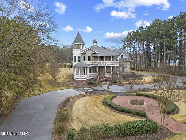
$151k drop • Mar 3
$1,299,000
5.19 acres
Madison County
4 bd, 3.5 ba
•
4,640 sq ft
Canton, MS 39046
4 days
$165,000
12.1 acres
Rankin County
Brandon, MS 39047
5 days
$199,900
16.9 acres
Madison County
Canton, MS 39046
41 days ago
$295,000
1.12 acres
Madison County
Madison, MS 39110
4 months ago
$1,785,000
30 acres
Madison County
4 bd, 4.5 ba
•
4,600 sq ft
Madison, MS 39110
4 months ago
$45,960
3.83 acres
Madison County
Canton, MS 39046
$20k drop • Jan 19
$509,000
3.7 acres
Madison County
3 bd, 2 ba
•
2,840 sq ft
Canton, MS 39046
3 months ago
$162,000
8.2 acres
Madison County
Canton, MS 39046
7 days
$123,000
3 acres
Madison County
Canton, MS 39046
54 days ago
$400,000
4 acres
Madison County
Canton, MS 39046
4 months ago
$44,460
3.72 acres
Madison County
Canton, MS 39046
35 days ago
$2,294,523
15 acres
Madison County
Canton, MS 39046
2 months ago
$224,000
2.8 acres
Madison County
Ridgeland, MS 39157
5 months ago
$725,000
7.88 acres
Madison County
3 bd, 4 ba
•
2,740 sq ft
Madison, MS 39110
$29.1k drop • Mar 1
$844,900
5 acres
Madison County
5 bd, 5 ba
•
4,685 sq ft
Canton, MS 39046
21 days
$245,000
6.4 acres
Madison County
3 bd, 2 ba
•
1,680 sq ft
Canton, MS 39046
$15k drop • Mar 11
$784,900
5.62 acres
Madison County
4 bd, 3.5 ba
•
3,107 sq ft
Madison, MS 39110
2 months ago
$925,000
3.16 acres
Madison County
4 bd, 3.5 ba
•
4,101 sq ft
Madison, MS 39110
$65k drop • Mar 12
$1,016,000
4.9 acres
Madison County
5 bd, 4.5 ba
•
5,419 sq ft
Madison, MS 39110
11 days
$394,900
113 acres
Madison County
Canton, MS 39046
2 months ago
$408,000
102 acres
Madison County
Madison, MS 39110
3 months ago
$10,536,000
439 acres
Madison County
Canton, MS 39046
28 days
$190,000
15 acres
Rankin County
Brandon, MS 39047
4 months ago
$855,000
3 acres
Madison County
5 bd, 4.5 ba
•
4,474 sq ft
Madison, MS 39110
11 days
$1,500,000
17.2 acres
Madison County
Canton, MS 39046
$15.1k drop • Mar 26
$524,900
2 acres
Madison County
4 bd, 3 ba
•
3,069 sq ft
Madison, MS 39110
3 months ago
$1,499,999
3 acres
Madison County
6 bd, 5 ba
•
5,300 sq ft
Madison, MS 39110
3 months ago
$115,950
5 acres
Madison County
Canton, MS 39046
4 months ago
$39,500
2.63 acres
Madison County
Canton, MS 39046
20 hours
$99,535
11.7 acres
Madison County
Canton, MS 39046
7 months ago
$390,000
2.73 acres
Madison County
Gluckstadt, MS 39110
19 hours
$279,500
74.2 acres
Madison County
3 bd, 2 ba
•
1,509 sq ft
Canton, MS 39046
3 months ago
$115,950
5.5 acres
Madison County
Canton, MS 39046
56 days ago
$1,524,600
1 acre
Madison County
Madison, MS 39110
3 months ago
$1,000,000
2.12 acres
Madison County
Madison, MS 39110
7 months ago
$2,711,986
9.55 acres
Madison County
Gluckstadt, MS 39110
12 months ago
$19,900
2 acres
Madison County
Canton, MS 39046
1
2
3
4
1-50 of 197 properties
Map