
Land for Sale in Milton, Florida
7991 Highway 89, Milton, FL 32570
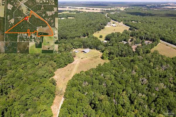
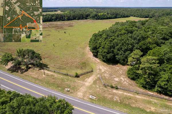
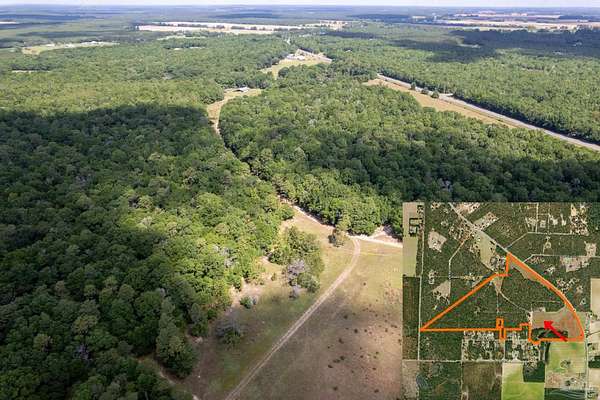
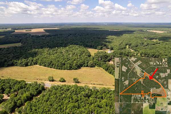
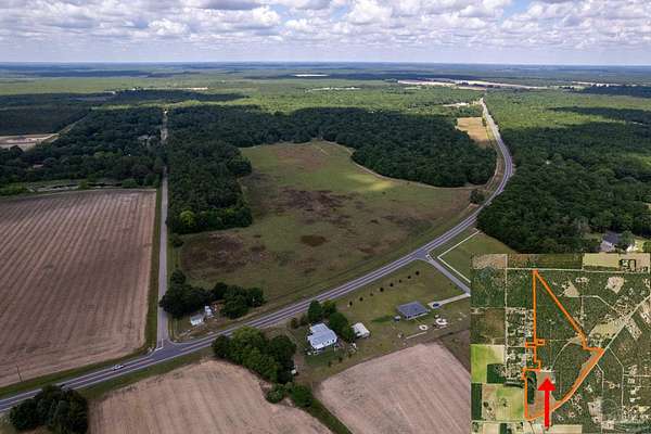
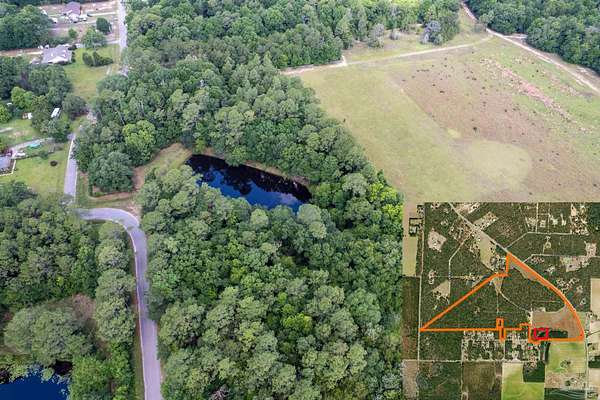
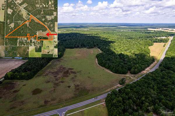
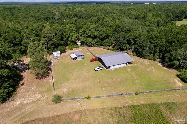
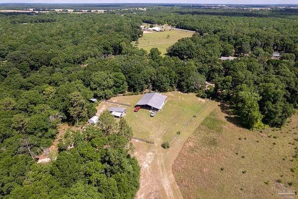
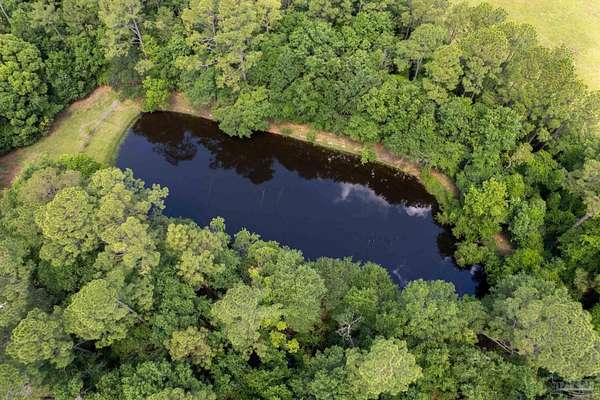
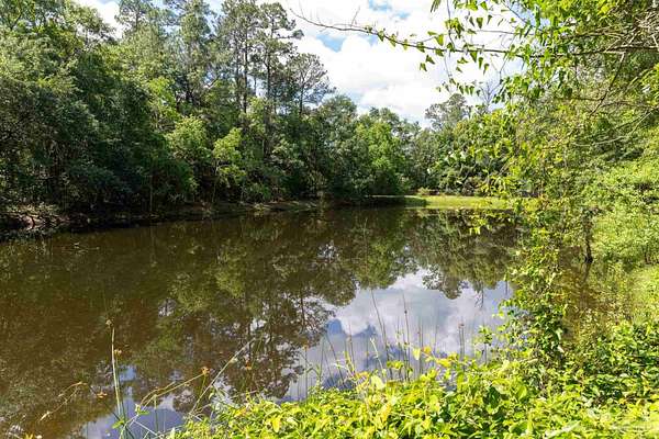
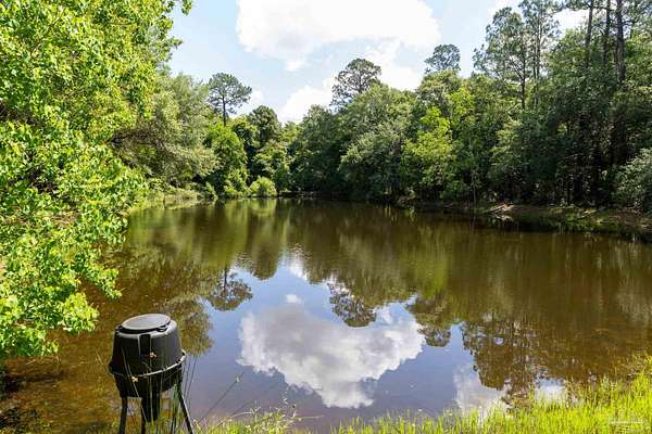
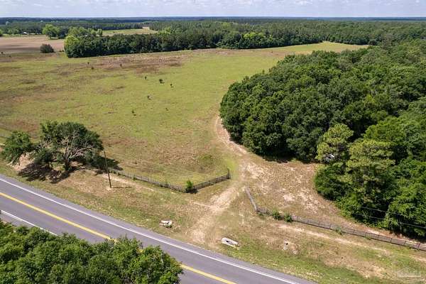
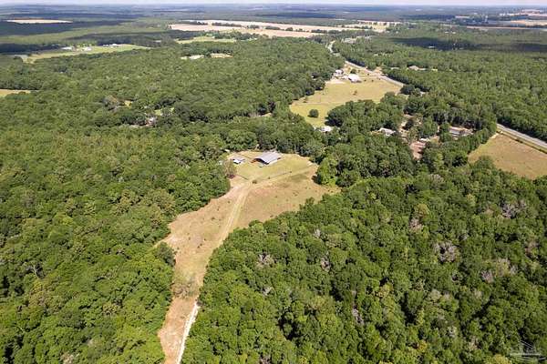
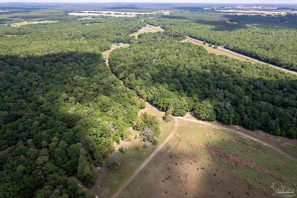
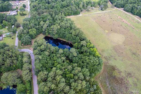
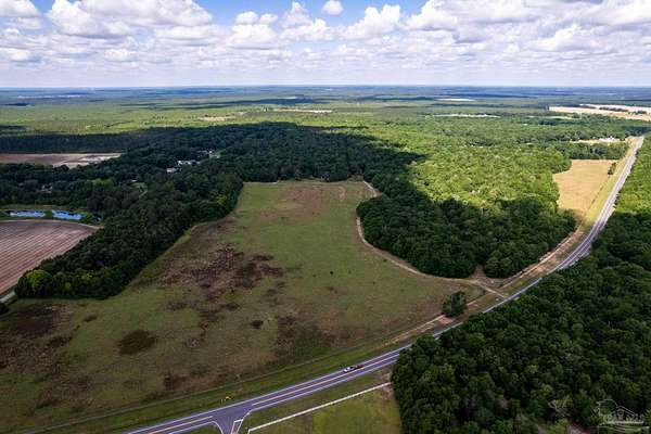
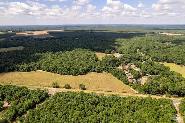
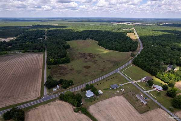
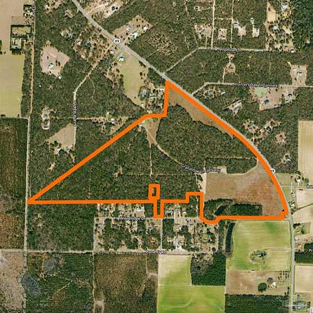
Discover an exceptional opportunity to own 150 pristine acres in the fast-growing Milton area. This expansive property boasts over 3,600 feet of road frontage along Hwy 89, offering unparalleled visibility and accessibility for developers and investors alike. The land features a beautiful mix of open fields and wooded areas, complete with mature pines and hardwoods, providing both scenic value and natural privacy. A picturesque spring-fed pond adds charm and potential for recreational use or community amenities. Surrounded by rapidly expanding residential developments and new infrastructure, this parcel is ideally positioned for a large-scale residential community, equestrian estate, or future commercial use. Utilities are nearby, and zoning allows for a variety of development possibilities. With its strategic location, natural beauty, and development potential, this is a rare chance to secure a generational asset in one of Northwest Florida's hottest markets.
Location
- Street address
- 7991 Highway 89
- County
- Santa Rosa County
- Elevation
- 184 feet
Directions
North on HWY 87, turn left onto HWY 89, property is on the left.
Property details
- Acreage
- 150.41 acres
- MLS #
- PAR 664728
- Posted
Parcels
- 313N280000001360000
Legal description
Enhncd Life Est Resrvd In : Com At Sw Corn Sec Th N01 34 10 E 987.02 Ft Th S89 40'23"E 3482.27 Ft To Ne Corn Unrec Lt 2 Blk 1 Woodridge Acres Sub & Pob Th N01 41'57"E 576.25 Ft Th S89 40'23"E 426.25 Ft Th S01 41'57"W 426.25 Ft Th N89 40'23"W 356.23 Ft Th S01 41'57 W 534.71 Ft To Curv Nr/W Wood- Ridge Dr Th Nwly Alg R/W Of Cur Rad 265.71 Ft Brg N62 04' 14"W 46.82 Ft (Ch) Th Cont Alg Cur L & Nr/W 32.12 Ft=Ch To Sw Corn Lt 1 (Se Corn Lt 2) Rad 361.05 Ft Brg N58 57'58"W Th N01 41'57"E Alg W Li Lt 1 346.60 Ft To Pob As Des In Or 2904 Pg 263 (5 Ac+-) Com Sw Corn Th N01 54'30"E 987.02 Ft To Pob Th N54 18'18" E 2886.74 Ft Th N88 59'E 354. 68 Ft Th N04 56'44"E 672.27 Ft St Rd 89 Th Sely Alg R/W To Sw R/W St Rd 89 Th S53 01'E Alg R/W 1694.45 Ft To Cur Th Sely Alg Cur Rad 2814.93 Ft Brg S33 28'54"E 1882.80 Ft Th N89 49'20"W 76.78 Ft Th S0 10'40"W 100 Ft To Nr/W Pond Crk Rd Th N89 49'20"W Alg Nr/W 1209.95 Ft To Cur Th Swly Alg Cur L Rad 102.55 Ft Brg S45 25'11"W 144.41 Ft (Ch) To Se Corn Lt 1 Blk 1 Unrec Woodridge Acs Th N89 30'24"W 118.13 Ft Alg Nr/W To Cur R Th Nwly Alg Cur Rad 265.71 Ft Brg N78 14'56"W 102.53 Ft Th N01 41'57"E 534. 71 Ft Th S89 40'23"E 356.23 Ft Th N01 41'57"E 4226.25 Ft Th S01 41'57"W 426.25 Ft Th N89 40'23"W 290.63 Ft Th S01 28'40"W 150 Ft Th N89 40'23"W 502.03 Ft To Ne Corn Lt 1 Blk 1 Th S01 29'42"W 305 Ft To Pt On Nr/W Woodridge Dr Th N89 43'24"W Alg Nr/W 154.46 Ft Th N01 46'06"W 70 Ft Th S89 40'23 "E 52.97 Ft Th N01 47'23"W 248 Ft Th N89 40'23"E 103 Ft Th S01 47'23"E 70 Ft To Ne Corn Lt 7 Blk 1 Th N89 40'23"W 2498.35 Ft To Pob As Des In Or 2904 Pg 267 (145.14 Ac+-) & Or 2917 Pgs 564 & 568 & E-L/E Res In Or 4370 Pg 731
Details and features
Listing
- Type
- Land
Structure
- Water
- Public
Nearby schools
| Name | Type |
|---|---|
| Central | Elementary |
| Central | Middle |
| Central | High |
Listing history
| Date | Event | Price | Change | Source |
|---|---|---|---|---|
| May 21, 2025 | New listing | $3,600,000 | — | PAR |