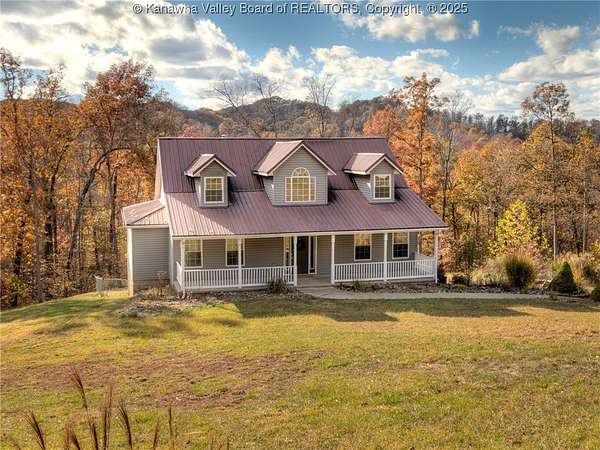
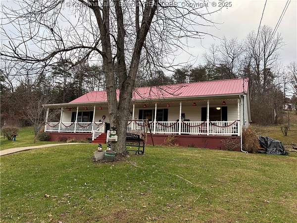
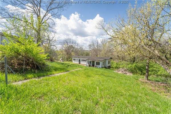
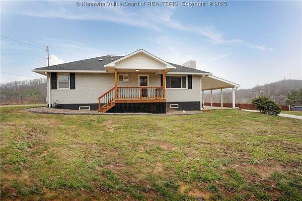
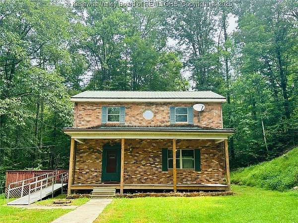
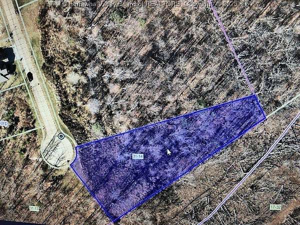
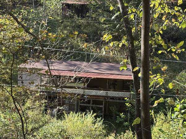
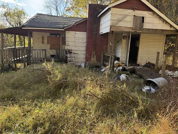
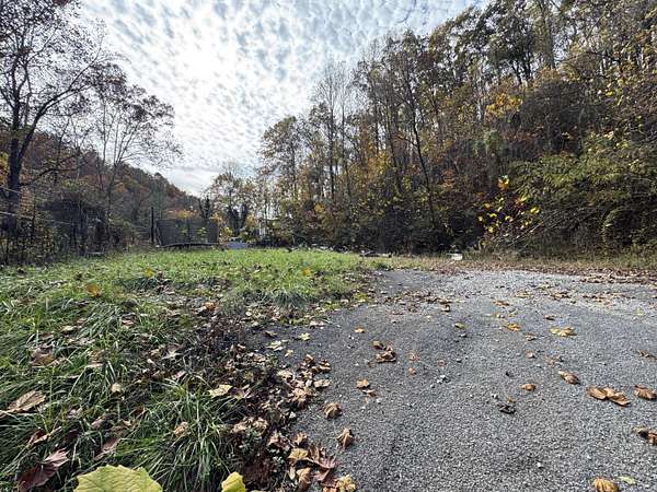
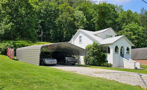
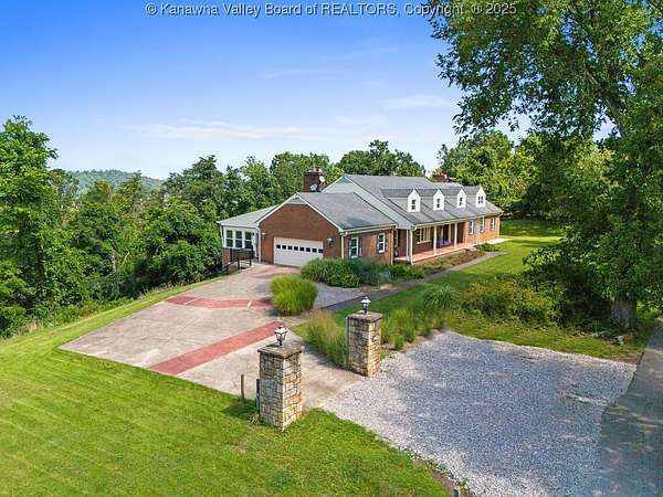
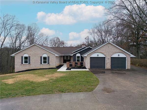
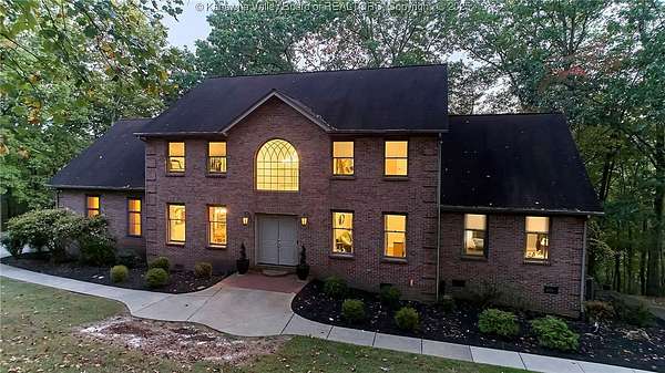
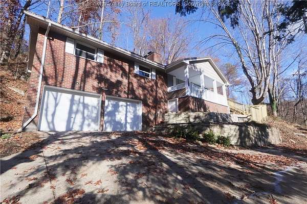
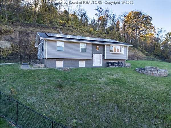
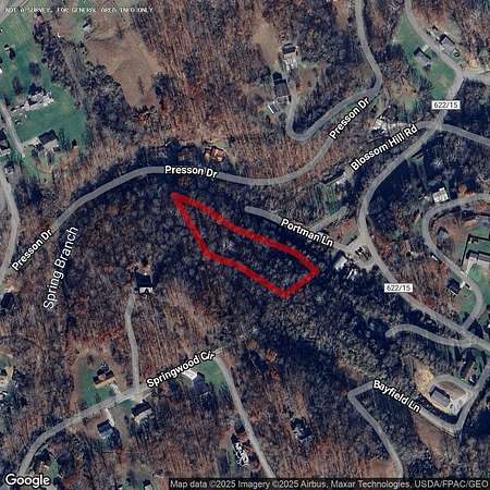
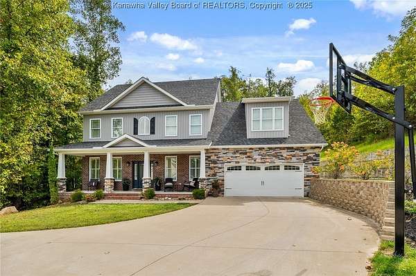
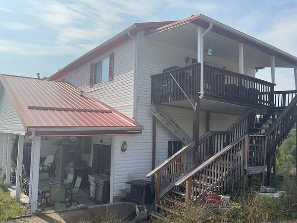
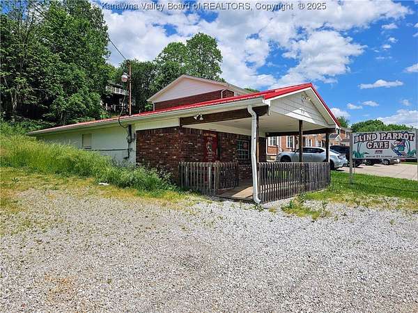
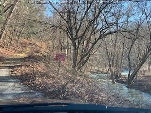
16 Acres of Recreational Land for Sale in Charleston, West Virginia

Alliston Dr, Charleston, WV 25311

Images
Map
1 / 32
$950,000
16 acres
pending saleUnder contract

Fewer than five miles from the state capitol, this 15-acre woodland preserves one of the lesser-known scenic resources in the lower Kanawha Valley-the falls of Mill Creek and its gorge. Near Coonskin Park, the Elk River Trail, and West Virginia International Yeager Airport, the property is ideally suited for tourism or residential development. The state proposed in 1965 that the falls and surrounding gorge be preserved as a park, though the property remains in the care of private owners and has been managed only as a Charleston-area retreat. The acreage includes its namesake waterfalls as well as cliffs and caves, the stone ruins of a millers house, and a two-acre flat that has been developed as a camping area. Other highlights include a tree house and towering oaks, beeches, and hemlocks that shade an understory of fern, mosses, and rhododendron. HISTORY As early as the 1820s, a mill was established at the falls to serve farmers on the lower Elk River. Its 20-foot drop provided a source of water power that served a series of mills into the early 20th century. During the Civil War, when Charleston was occupied by Confederate troops, a band of soldiers attempted to commandeer the miller's horses. According to legend, he was able to hide his string in caves in the surrounding gorge. Even after the demise of milling in the 1920s, the falls remained a favorite hiking and picnicking spot. Yet, the development of new roads in the area circumvented the mill grounds, and the scenic gorge and its falls were forgotten by many. In 1939, Charleston businessman Edward F. Kotch began assembling properties in and around the falls in hopes of creating a retreat, though his plans never came to fruition. The property has since remained in the hands of stewards who have preserved its scenic nature. ABOUT MILL CREEK AND ITS FALLS Mill Creek descends over nine winding miles through the forests that extend southeast of the Elk River. Near its mouth, at the property, the creek enters a wooded canyon some 200 feet deep. Its geology is more typical of the higher mountains east toward the New River Gorge and features sandstone cliffs and tumbled boulders. Unlike many other streams in the region, its bed is smooth and rocky rather than muddy and accommodates wading. Two layers of sandstone outcrop in the gorge. The upper strata form extensive cliffs along the canyon walls. The lower strata form the waterfall and the bed of the stream, which is alternately smooth and pebbly and accommodates wading. At the falls, the creek drops 20 feet over the lower layer of sandstone, plunging into a pool and smooth bed of rock. Three hundred feet downstream, it drops another five feet over a second waterfall on its course to the Elk River. ABOUT THE TREEHOUSE Built in 2005 by Treehouse Masters affiliate Jonathan Farrow of Living Tree, the treehouse is raised on three mature trees 25 feet above the driveway and 60 feet above the falls. Sided in cedar shakes and roofed in metal, the treehouse cabin is secured to a 16-x-20-foot platform and includes a single 10-x-12-foot room with a sleeping loft. Anderson windows provide exceptional views of the property in all directions. The treehouse was designed to take advantage of the view of the falls while preserving the viewshed of the falls from other angles. The cabin is wired for 100 amp service. The treehouse is currently accessible by ladder. ABOUT THE CAMPGROUND A level field of approximately one acre has been maintained as a creekside camping and picnicking area. Above the floodplain, it has been proposed as a homesite area. Once the site of the miller's residence, stone ruins at a corner of the campground area include a cold cellar with a steeply pitched stone roof, notably uncharacteristic of the area. The campground area is accessed directly by the graveled driveway that leads approximately a quarter mile from the entrance. ABOUT THE CLIFFS AND CAVES The south-facing wall of the gorge is lined with cliffs and caves, including an overhanging rock shelter extending more than 200 feet along the gorge wall. This relatively large shelter, also known as a crepuscular or "twilight" cave, may have been used by prehistoric and early historic inhabitants of the region, though no archaeological investigation has been performed. A portion of the cliffs includes areas of honeycomb weathering. These rocky areas are accessible by footpaths that wander up the steep wall of the gorge from the creekside. HISTORY & PREHISTORY Though no study of the property has been performed, archaeologists have identified evidence of several cultures in the region, notably a mound-building culture that may have inhabited the region from about 800 B.C. to 500 A.D. These people raised large ceremonial mounds in valley areas, including large extant mounds at Dunbar and South Charleston and a small mound nearby at Pinch. Various native groups lived and hunted the area until the early 1800s. The Shawnee of the Ohio Country in the late 1700s contested Virginian settlers for control of the land. Indian Creek, which parallels Mill Creek one mile to the northeast, was named for a Native American trail that traversed the area. As early as the 1820s, a grist mill was established at the falls to serve farmers on the lower Elk River and along the nearby Kanawha. Its drop provided a source of water power that served a series of mills that existed here into the early 20th century. During the Civil War, when the Kanawha Valley near Charleston was occupied by Confederate troops, a band of soldiers attempted to commandeer the horses that belonged to the miller. According to legend, he was able to hide his string in caves in the surrounding gorge. After the demise of milling, the falls remained a favorite picnic spot. Yet, the development of new roads in the area circumvented the mill grounds, and the scenic gorge and its falls were forgotten by many. In 1939, Charleston businessman Edward F. Kotch began assembling properties in and around the falls in hopes of creating a retreat, though his plans never came to fruition. The property has since remained in the hands of stewards who have preserved its scenic nature.

Directions

From the West Virginia Capitol, follow Greenbrier Street north 5.1 miles to a right turn onto Old Mill Creek Road. Follow the latter 0.3 miles to a gated property entrance at left.

Property details

Coordinates
38.3863, -81.5513
School District
Kanawha County Schools
Elevation
784 feet
MLS Number
MyStateMLS 11190243
Date Listed

Parcels

  • 1545008000020000

Property taxes

2022
$68

This 16-acre property is located at Alliston Dr in Charleston, WV 25311 with latitude 38.3863 and longitude -81.5513. The property is currently pending sale for $950,000 with a price per acre of $59,375. Listing data is sourced from My State MLS # 11190243.

Verify sale details or contact Foxfire Realty at (304) 645-7674.

Report listing issue

Copyright My State MLS All rights reserved. Information is deemed reliable but not guaranteed.

Listing checked and updated . Parcel data by Regrid.

Contact listing agent Message rules
By submitting, you agree to the terms of use, privacy policy, and to receive communications.